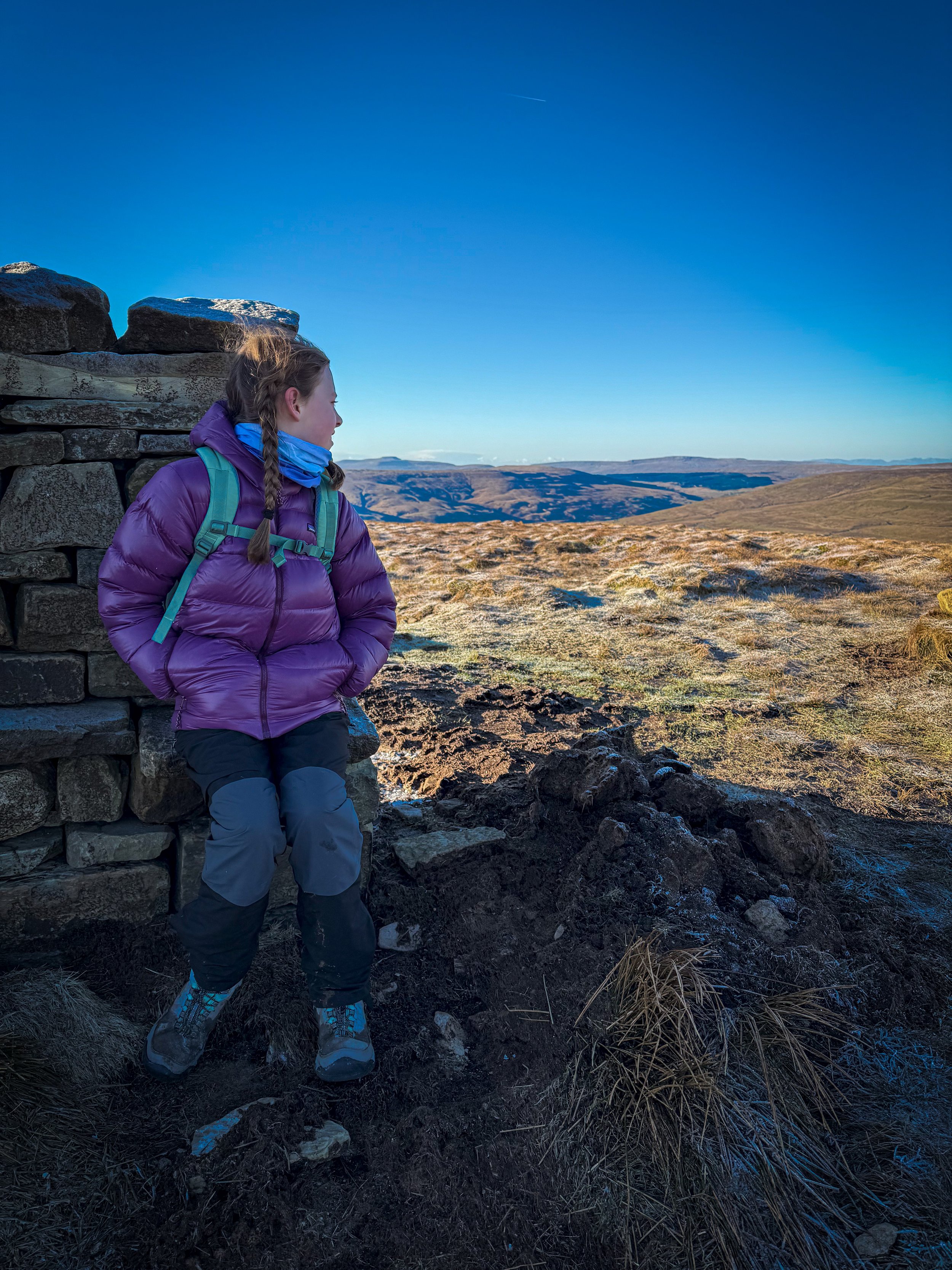
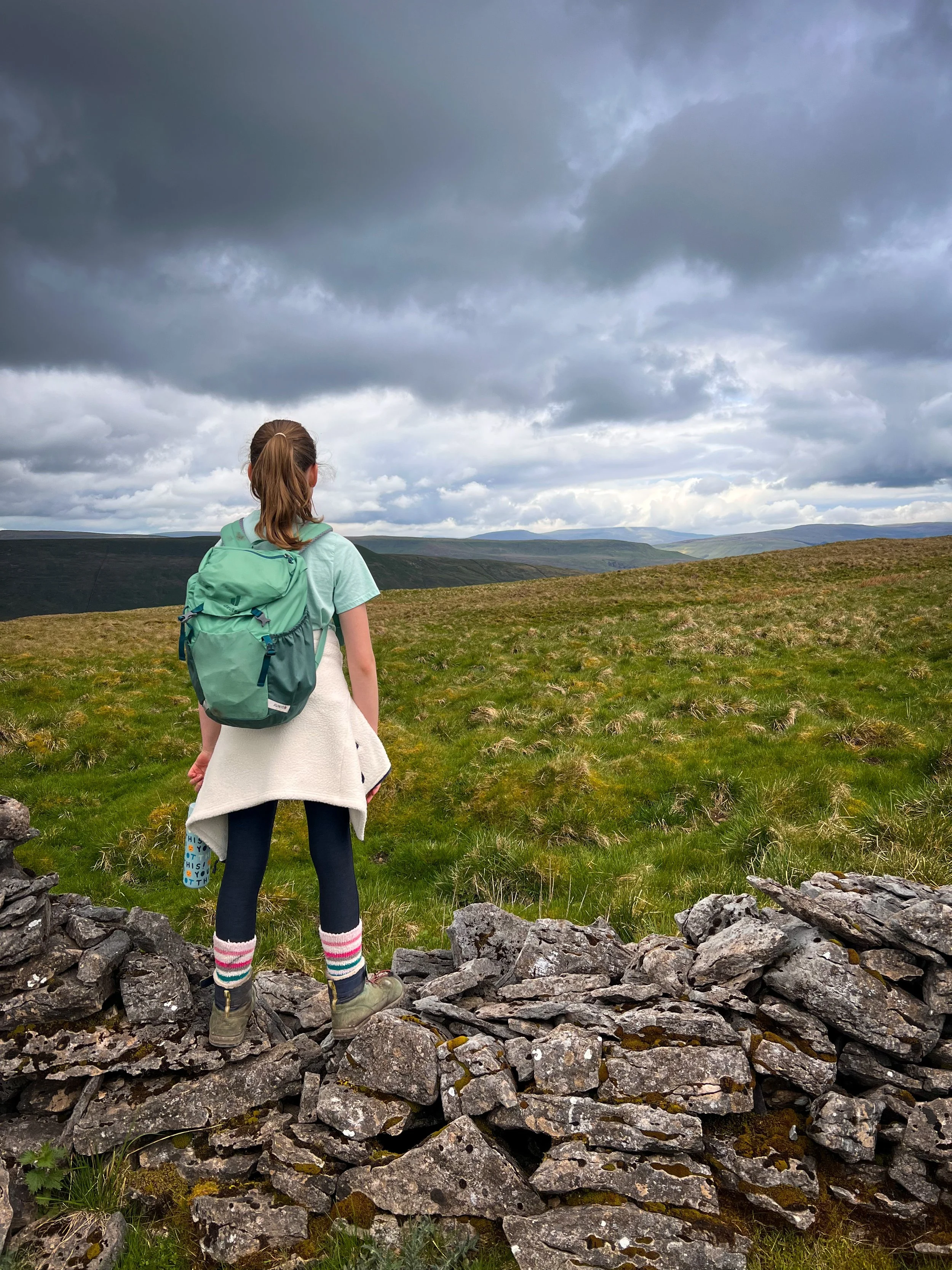
Climb the Yorkshire Dales Mountains with Kids
Would you challenge yourself to climb all the Yorkshire Dales mountains with the kids?
In one year…
Back in 2024 that’s exactly what I decided to do. I do like a challenge, so I not only decided to drag two reluctant explorers up to all the high places in’t Yorkshire Dales, I added a few more on for the sake of completeness (thanks to some dude off the internet) and I formed PLENTY of opinions about what folk class as being a mountain along the way.
(You can read more about the planning process on the Yorkshire Dales Mountain Challenge page)
Did we do it? Well yes, in one year and one day. Which makes it beautifully imperfect, much like the journey we ended up on!
So nearly two years after the decision was made, here are all the gory details. I’ll be sharing everything from a family friendly angle, that’s VERY important to realise because making the Dales mountains family friendly ended up being my greatest challenge!
I’ll take each walk one by one, share our route details and what we learned along the way. I’ll be sharing how tricky they are in terms of navigation and terrain, and I’ll be sharing all our best bits (as well as the worst bits!)
I’ve split them into three instalments
Mountains 1-9 (this one)
Mountains 10 - 21 (Coming soon…)
Mountains 22 - 41 (Coming soon…. but not as soon as 10-21!)
So come and climb the Yorkshire Dales mountains with me and my explorers, aged (at the time) 10 and 8. Every. Single. One of them.
One twice.
Buy Me a Coffee
Make a Donation
Thank you for taking the time to have a look at my website and for reading this now!
I set up the Reluctant Explorers and maintain the website and attached social media accounts in my spare time, around mum-life and two jobs. It was designed to provide access for parents to free resources to help get more families outside and exploring in nature. These walks have all been created by myself and the kids and we have walked each one ourselves (and re-walk them regularly to keep the information as up to date as we can).
If you would like to support us and can afford a few pennies, you can make a donation to our ‘Buy Me a Coffee’ page. Simply tap the button below to head there!
The First 9 Mountains
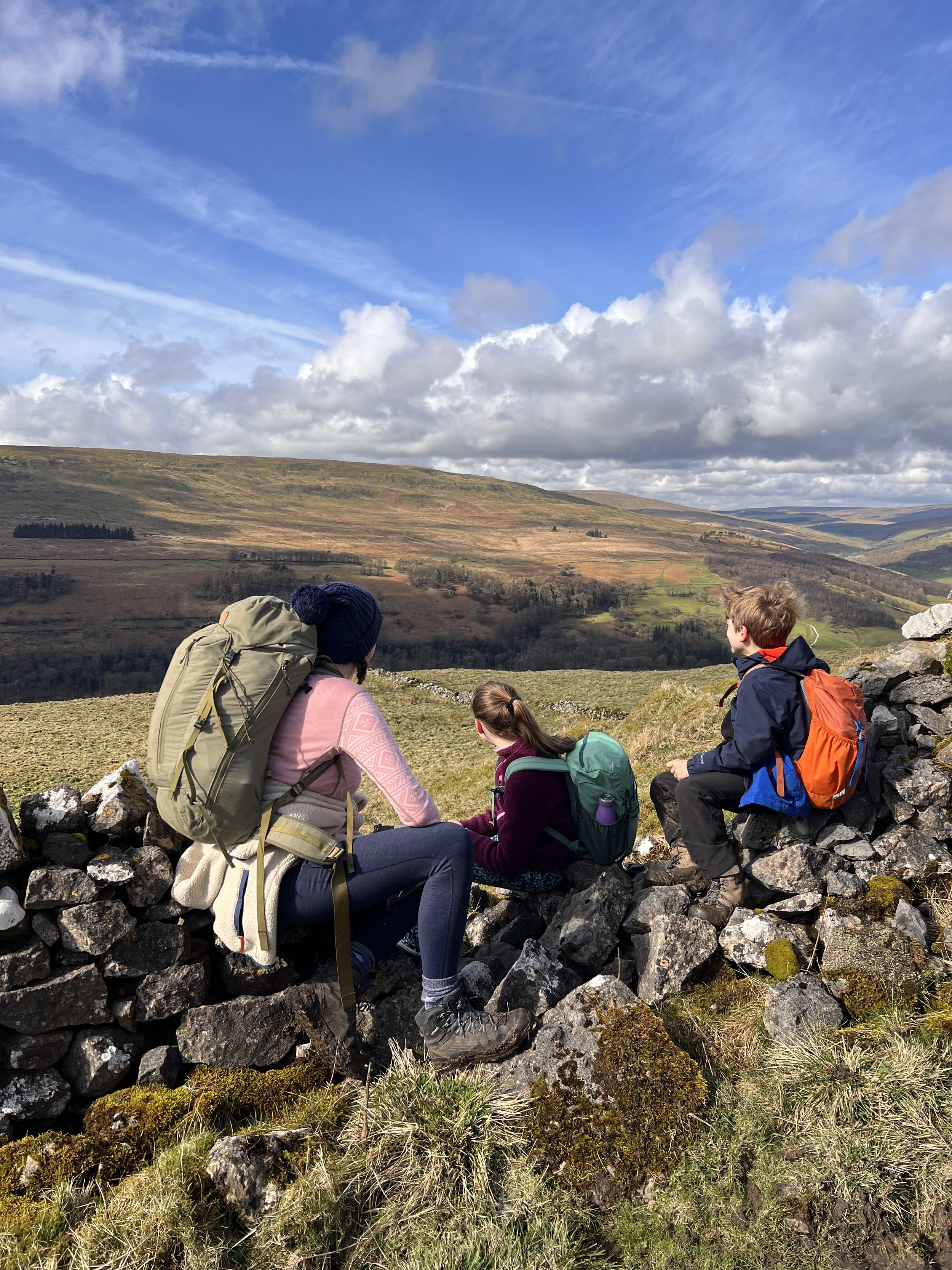
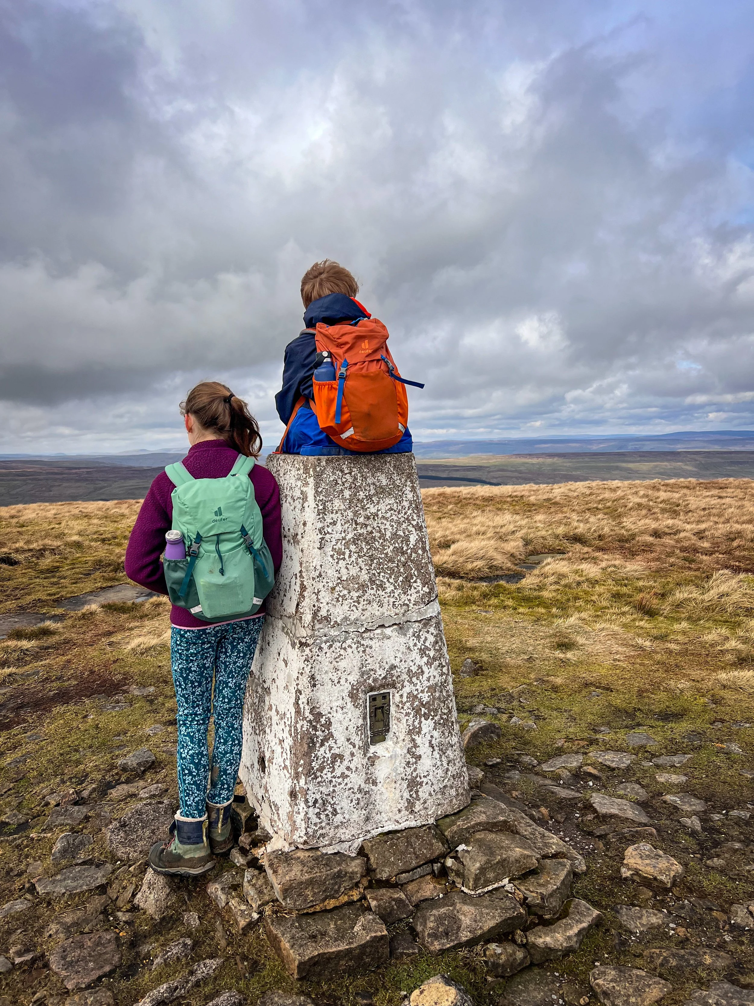
Buckden Pike
16 March 2024 (and 2 January 2025)
‘The one we did twice…’
When you’re climbing all the Yorkshire Dales Nuttalls with the Kids…
You’ve got to start with your favourite and Buckden Pike is up there. But now I’ve called it my favourite, I feel bad for the other mountains…
Nearly two months after deciding we were going to do the challenge, we had climbed approximately no mountains. Not the GREATEST of starts. Believe me, it was not for the want of trying, but the start to 2024 was FAR from great in terms of the weather. I am not adverse to bad weather, we go out in all of it, but February 2024 was not kind.
Buckden Pike was the start of the stopwatch and yes, it was the one we did twice, blame that one on the weather too!
It’s a mountain that we’ve climbed, six or seven times as a family and so planning was not a problem. It’s pretty unique in terms of Dales mountains in that firstly, you can actually get a circular out of it, and secondly, that circular is reasonably short!
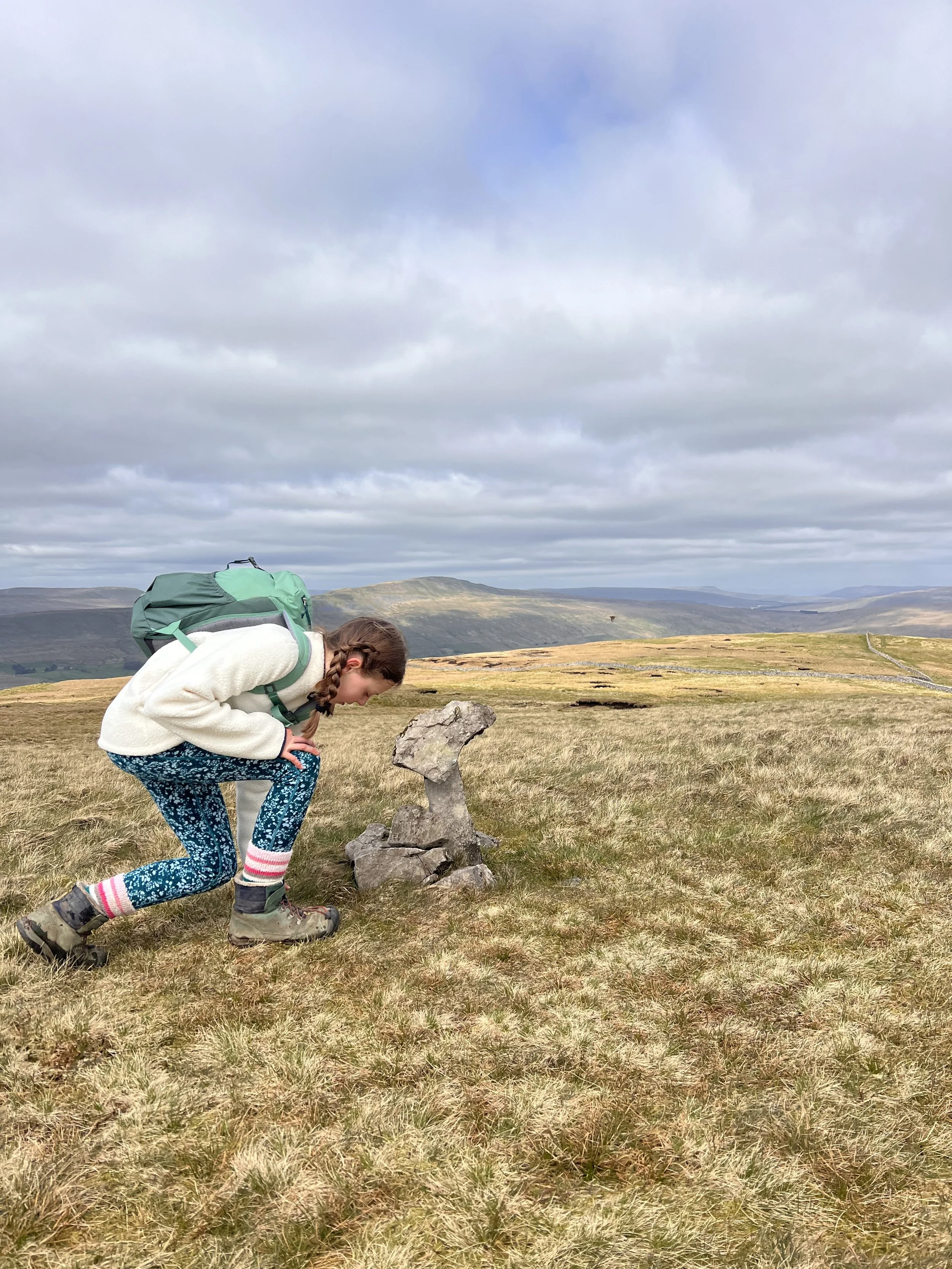
Plus it has mines and waterfalls. So it’s a win all round.
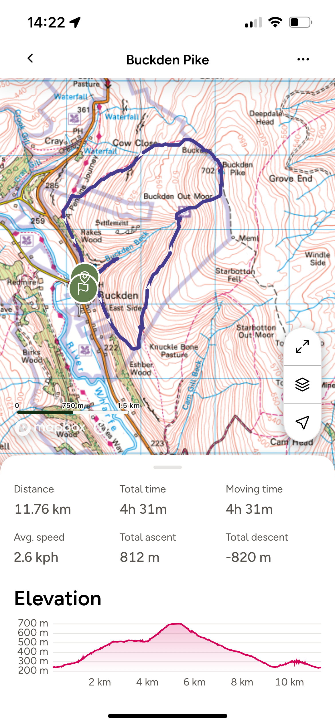
Buckden Pike Route
I first climbed this with the kids back in 2021 and we have done it many times since. It’s a route I love, which is why it’s been on the website for years.
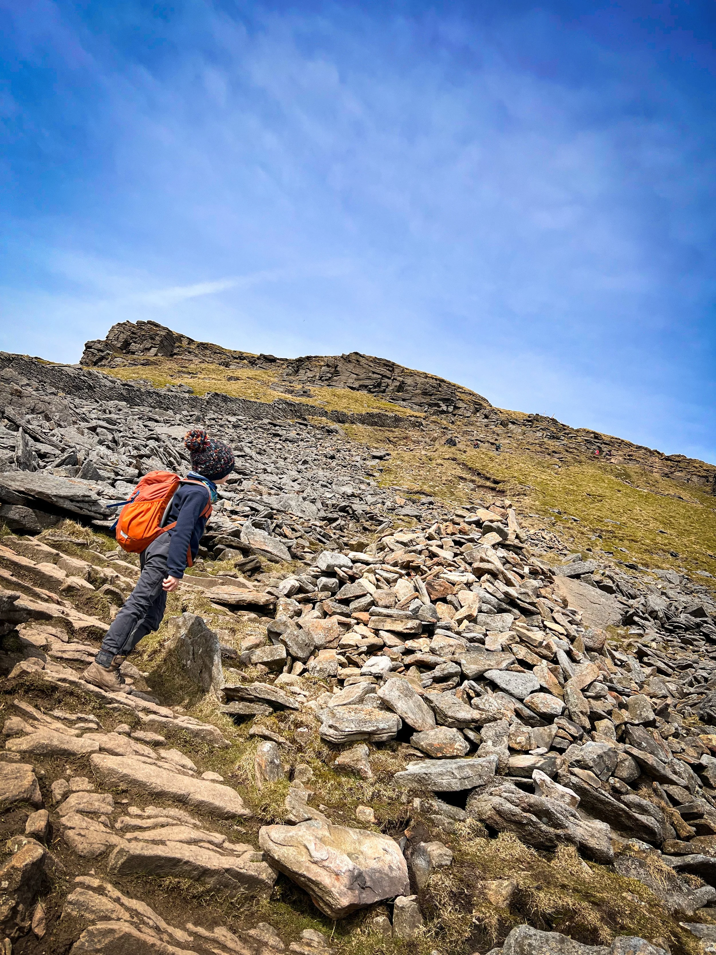
We took our Buckden Pike route (tap the link and it will take you to the page) which heads from the Buckden Pike pay and display car park and then along the lead mine path, passing the Buckden Gavel mines befoe heading upwards to the summit. The paths are clear throughout except for one steep section after the lead mines to the summit path.
We also tend to tag on the waterfalls to the end (because I love them!)
There are regularly grazing cows on the fellside, but they tend to steer clear of the people and we’ve never had any trouble.
Image is copyright of Ordnance Survey
The Buckden Pike Challenge Facts:
Distance Walked: 11.76km
Total time spent walking: 4hours 10 minutes (including a little trip to the waterfalls at the end)
Buckden Pike Summit Height: 702m
Total Actual Ascent: 675m
Ranked: 7th in the Yorkshire Dales.
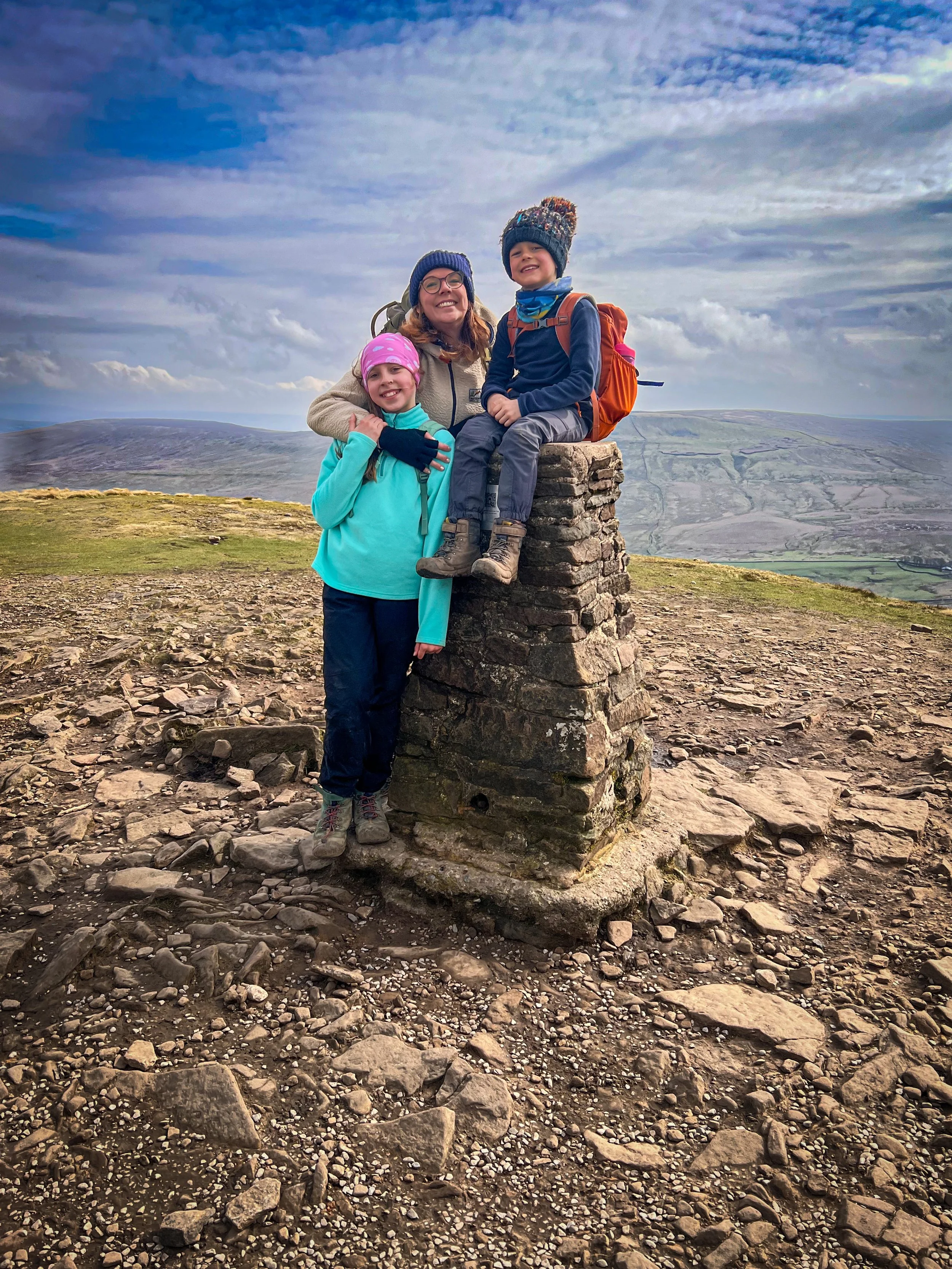
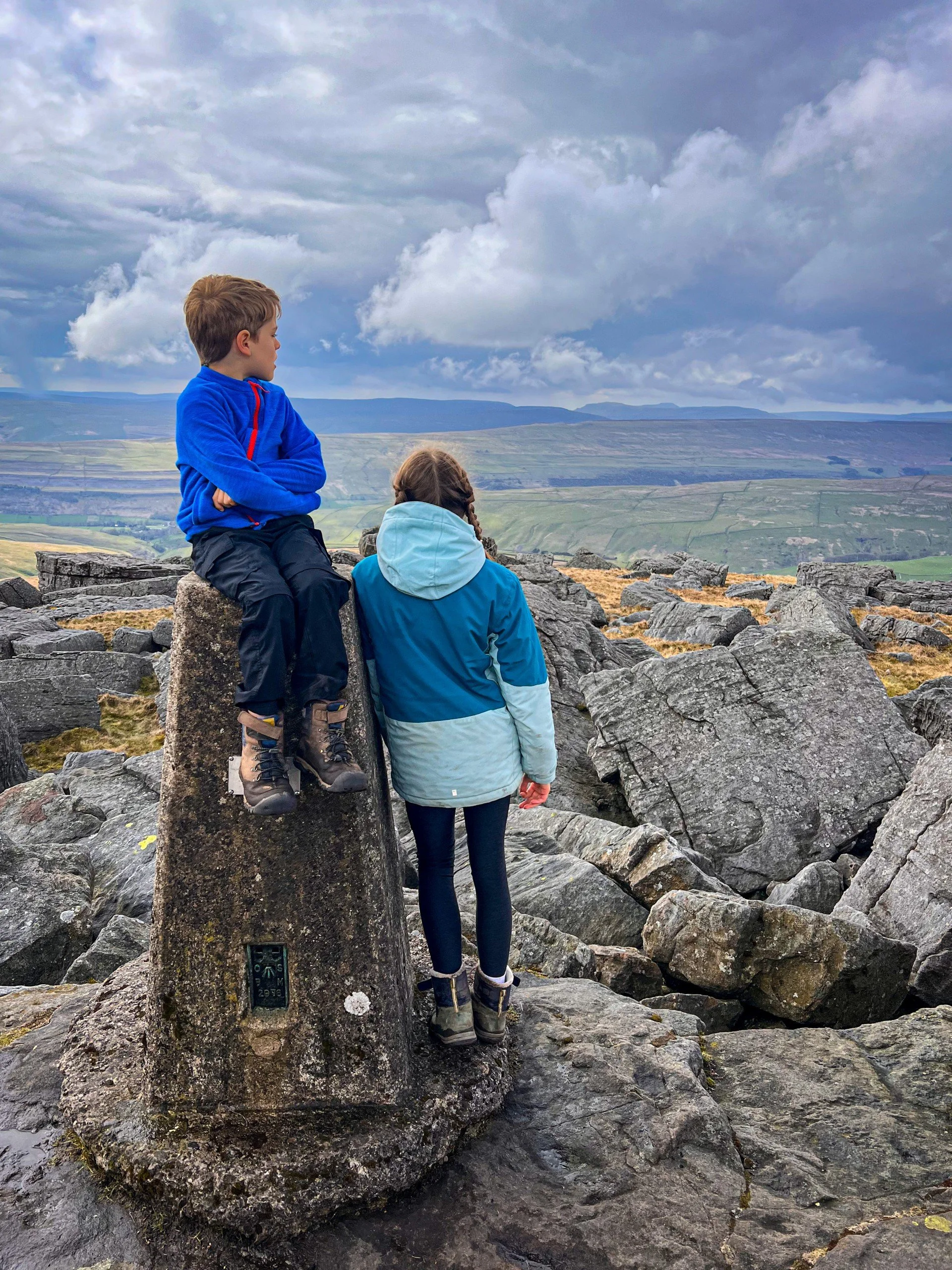
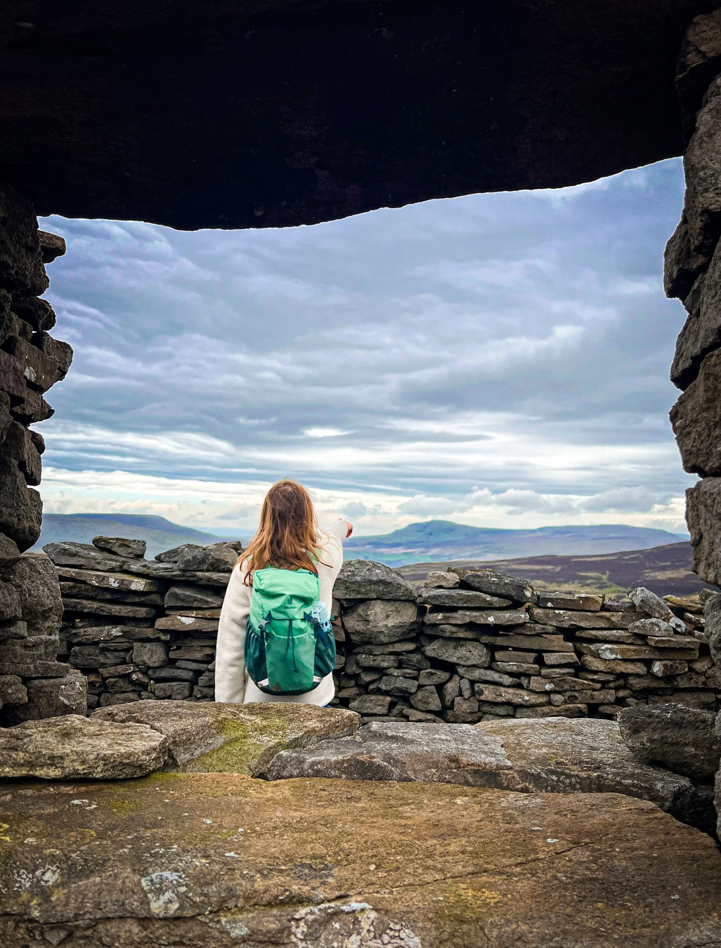
Sitting on top of Buckden Pike in March 2024. Since this point, there has been a summit seat installed.
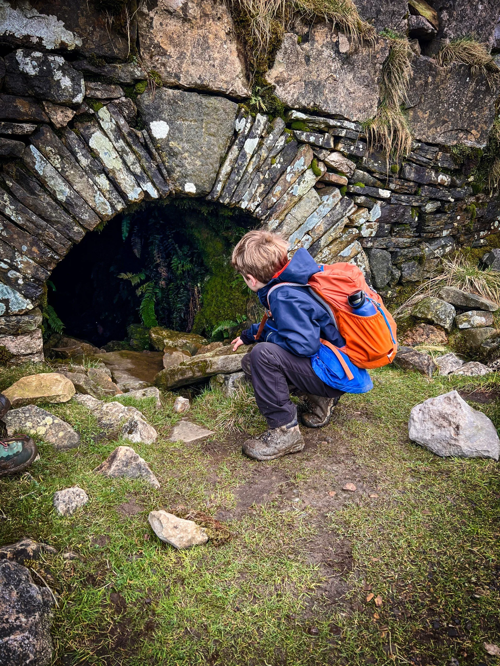
Peeking into the entrance to one of the levels of the Buckden lead mines.
The descent with views across Wharfedale.
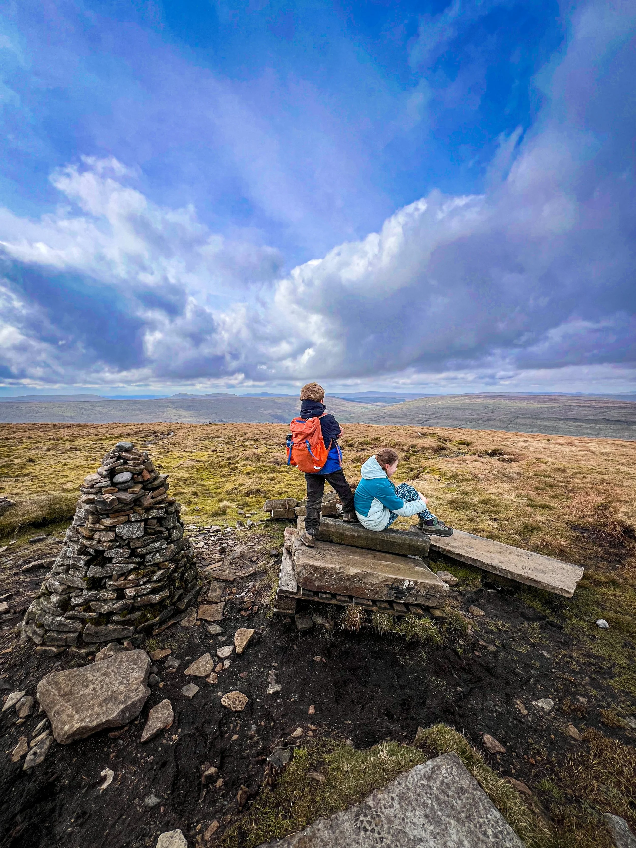
Pen y ghent and Plover Hill
‘The one where we built bridges over bogs’
26 March 2024
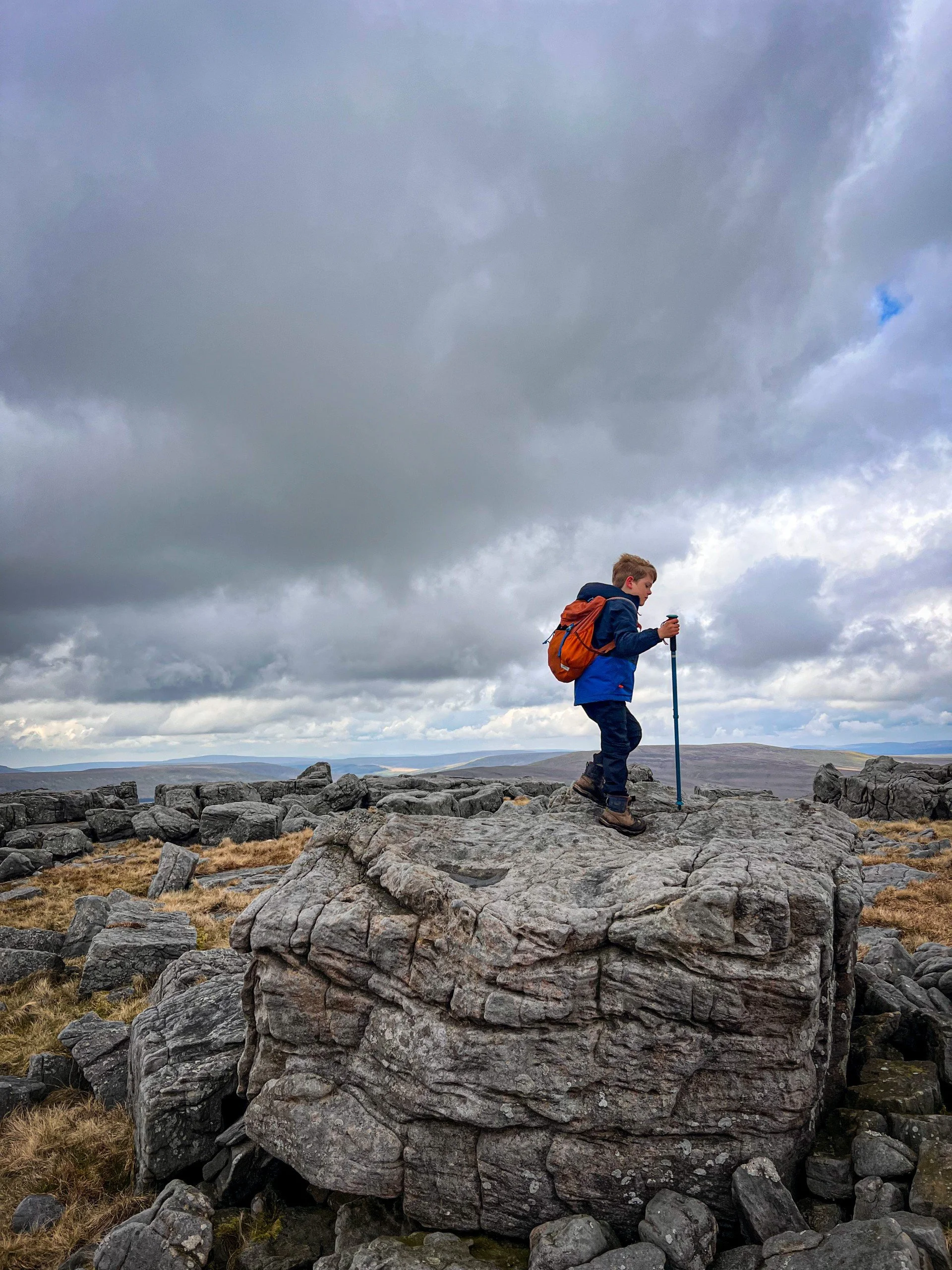
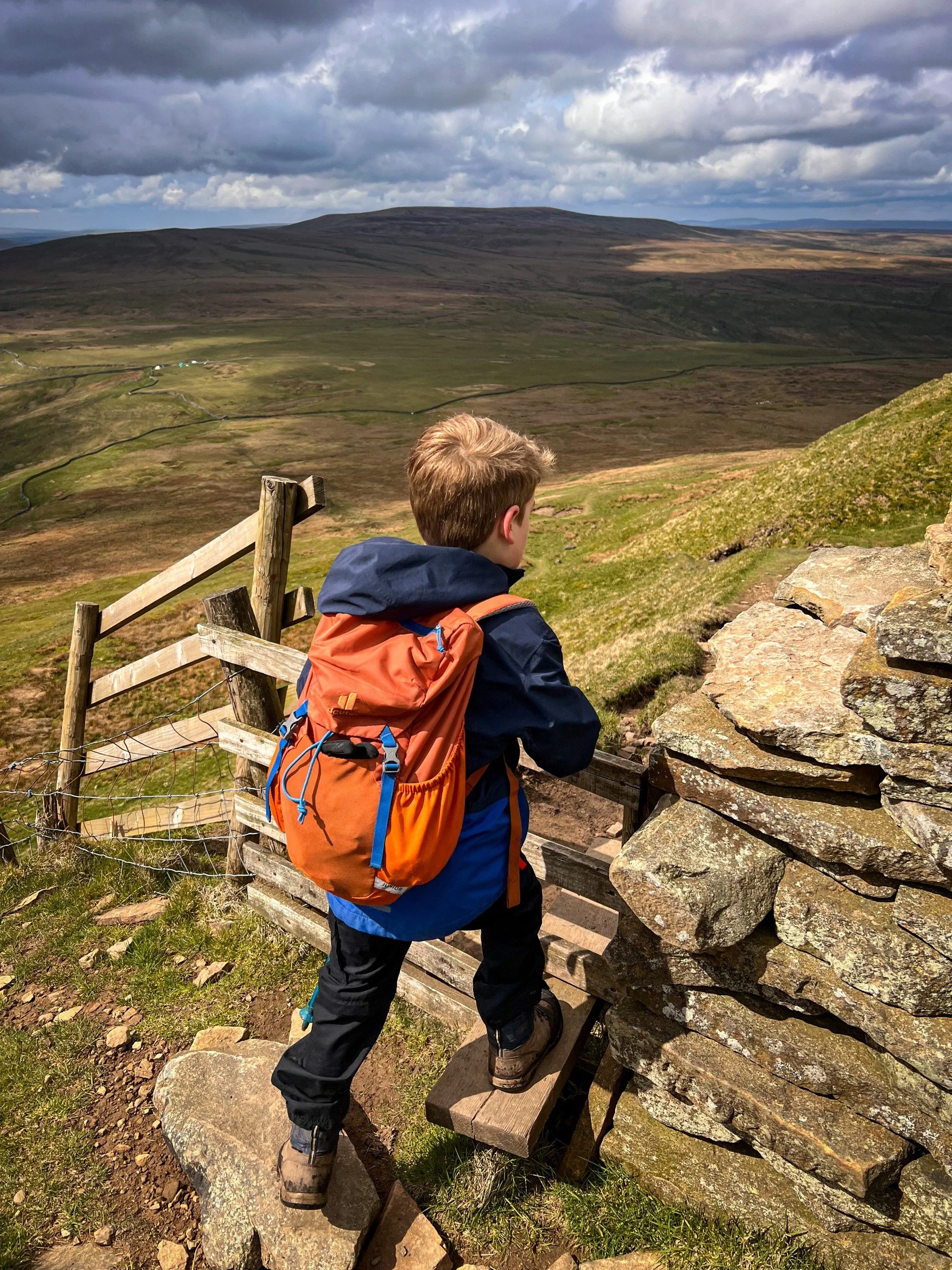
Pen y ghent and Plover Hill are NOT the same.
What do I mean? Well, whilst you’ll see folk piling up to the top of Pen y ghent, tapping the trig and merrily trotting back down the lovely wide well surfaced Yorkshire Three Peaks paths, on Plover you will see nobody, on barely there paths across a saddle of eternal bog.
The character of both mountains could not be more different. Pen y ghent has a fun little scramble up to the top and has a totally rugged rocky profile. Ticking some classic mountain-type boxes. Whereas Plover is made up of 99% bog (1% slightly less boggy bog).
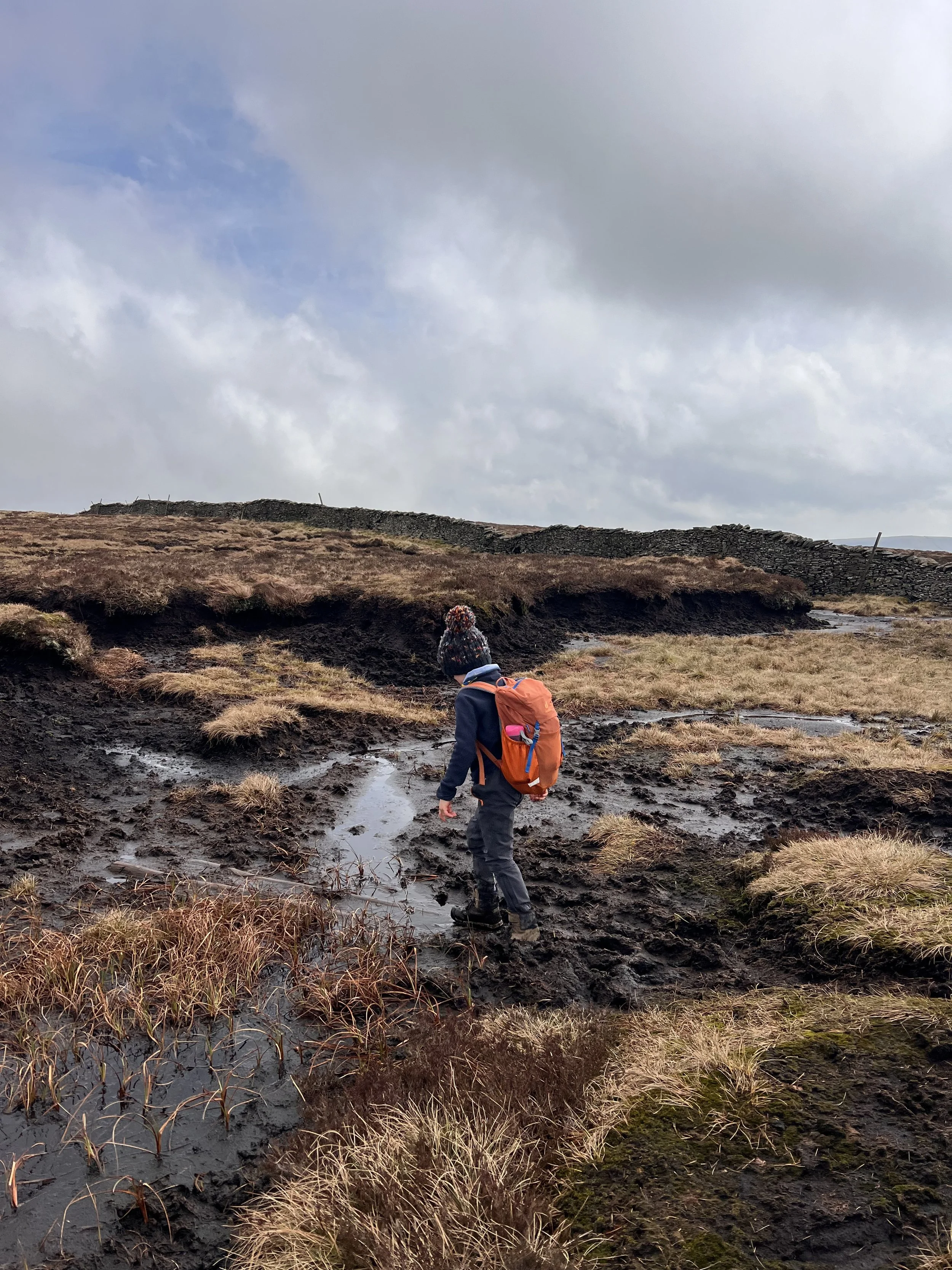
Still, as we merrily traversed the expanse of peaty wonder creating our own bridges out of helpfully discarded planks of wood (presumably placed there by some lovely folk in an attempt to help those attempting to bag Plover) you’d think you’d be rewarded with a big ‘ol satisfying cairn.
Nope. The true top of Plover is actually behind a dry stone wall and is reasonably ambiguous as an actual top. When we arrived, it appears that some previous peak bagging people had steadily knocked down the wall, therefore creating a gap that you can walk through. It is certainly NOT what the landowner intended, and in these situations I do wonder why a stile hadn’t been put in place to avoid the gradual vandalism of what is a costly structure to repair (note: This is on access land and open fell where there is a right to roam, it is not that the summit is on private and is therefore justly fenced off) anyway, I am not condoning the wilful destruction of the wall, but at the time I was grateful that we were able to actually reach the top after all that bog hopping.
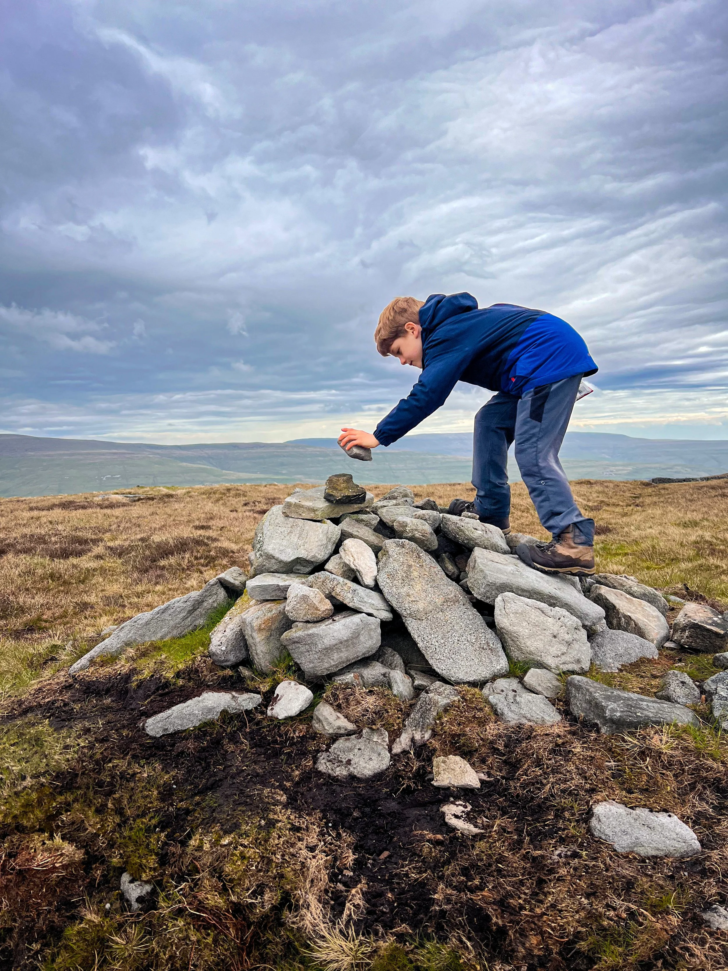
At the top we found a teeny tiny pile of stones. A feature of the Dales mountains that we would become very familiar with!
Plover, I’m not sure we shall meet again. But it was nice to have a brief encounter.
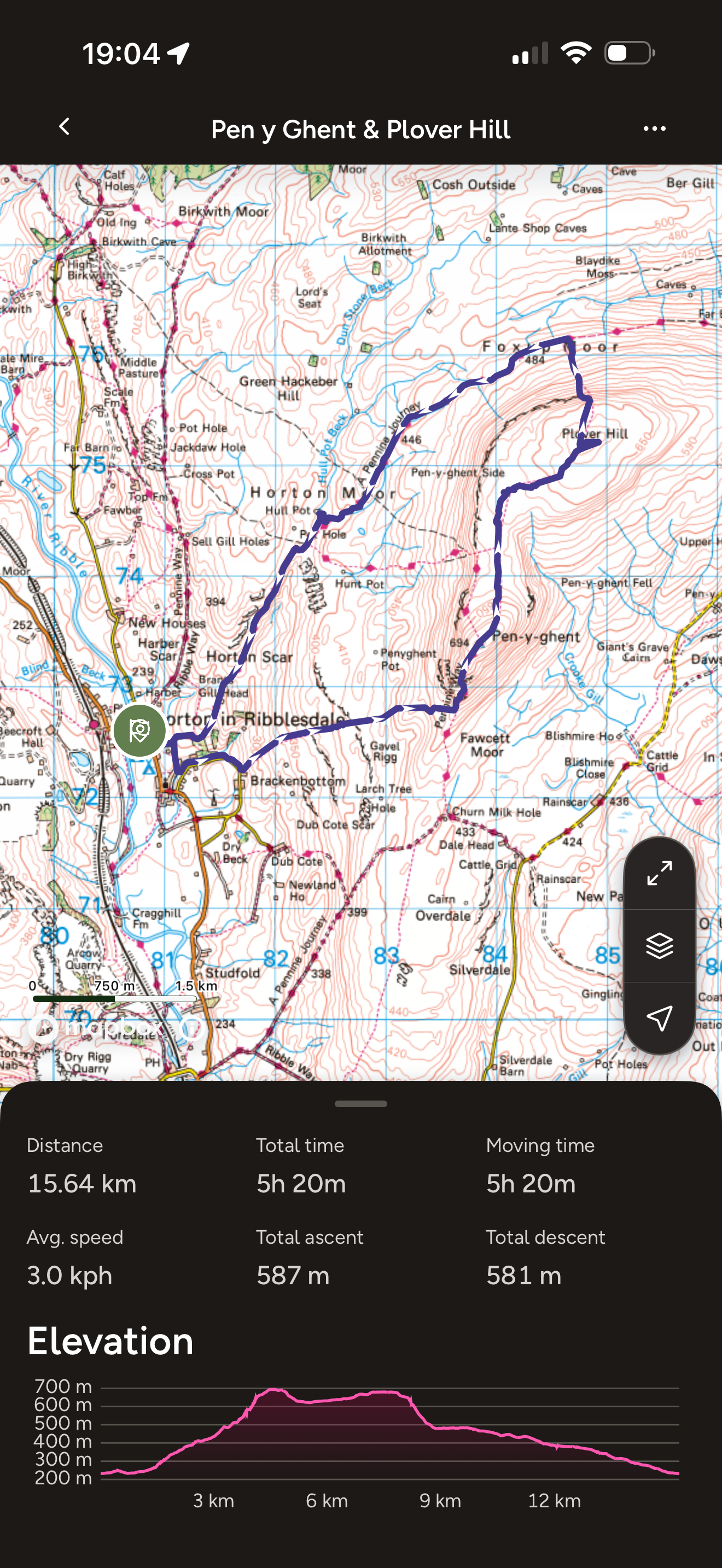
The Pen y ghent and Plover Hill Route
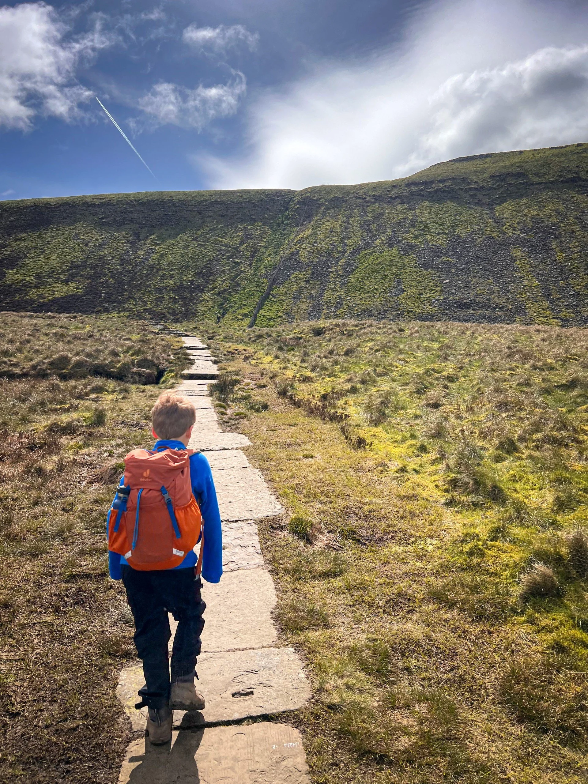
Beginning from Horton in Ribblesdale, we took the Pen y ghent Yorkshire Three Peaks route, which ascends via the scramble (always the best way with the kids). At the trig point and summit seat, you turn off the main path after the gate through the wall, and continue to follow the line of the wall roughly as it traverses the saddle between the two peaks.
We descended onto Foxup Moor. Here there are some steep exposed sections, so care should be taken with kids. The return to Horton was via Hull Pot.
Image is copyright of Ordnance Survey
Pen y ghent and Plover Hill Facts:
Distance Walked: 15.64km
Total time spent walking: 5 hours 20 minutes
Pen y ghent Summit Height: 694m
Plover Summit Height: 680m
Total Actual Ascent: 587m
Ranking: 9th and 14th in the Yorkshire Dales.
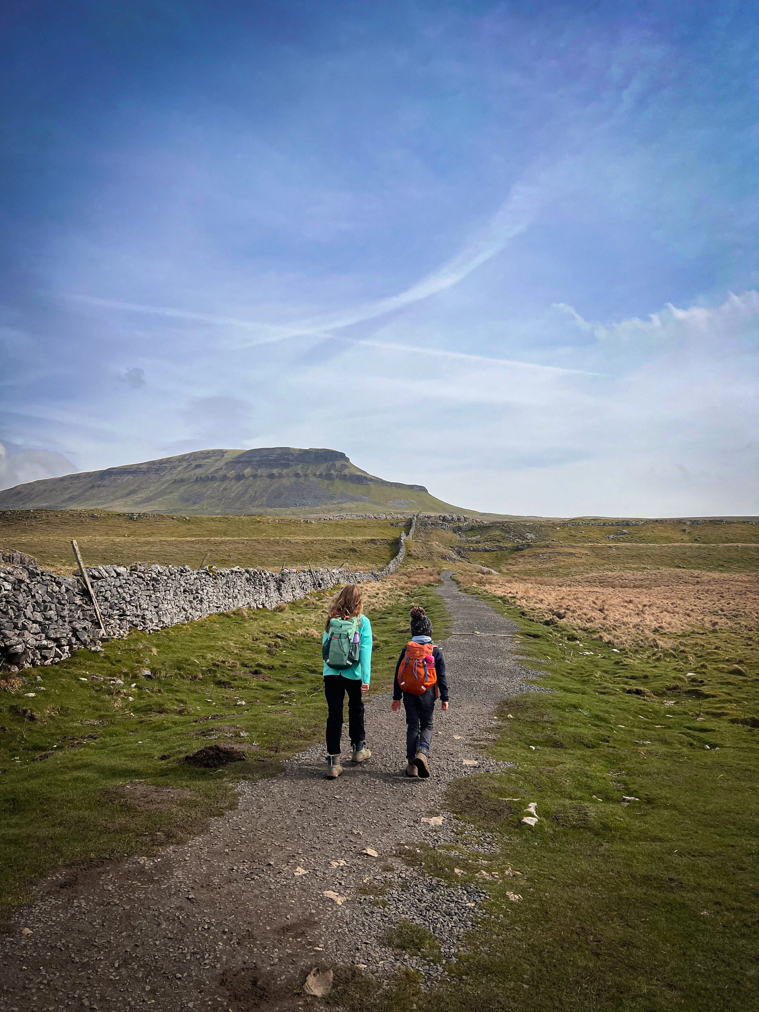
The trig point of Pen y ghent.
Part of the epic bog traverse between Pen y ghent and Plover Hill.
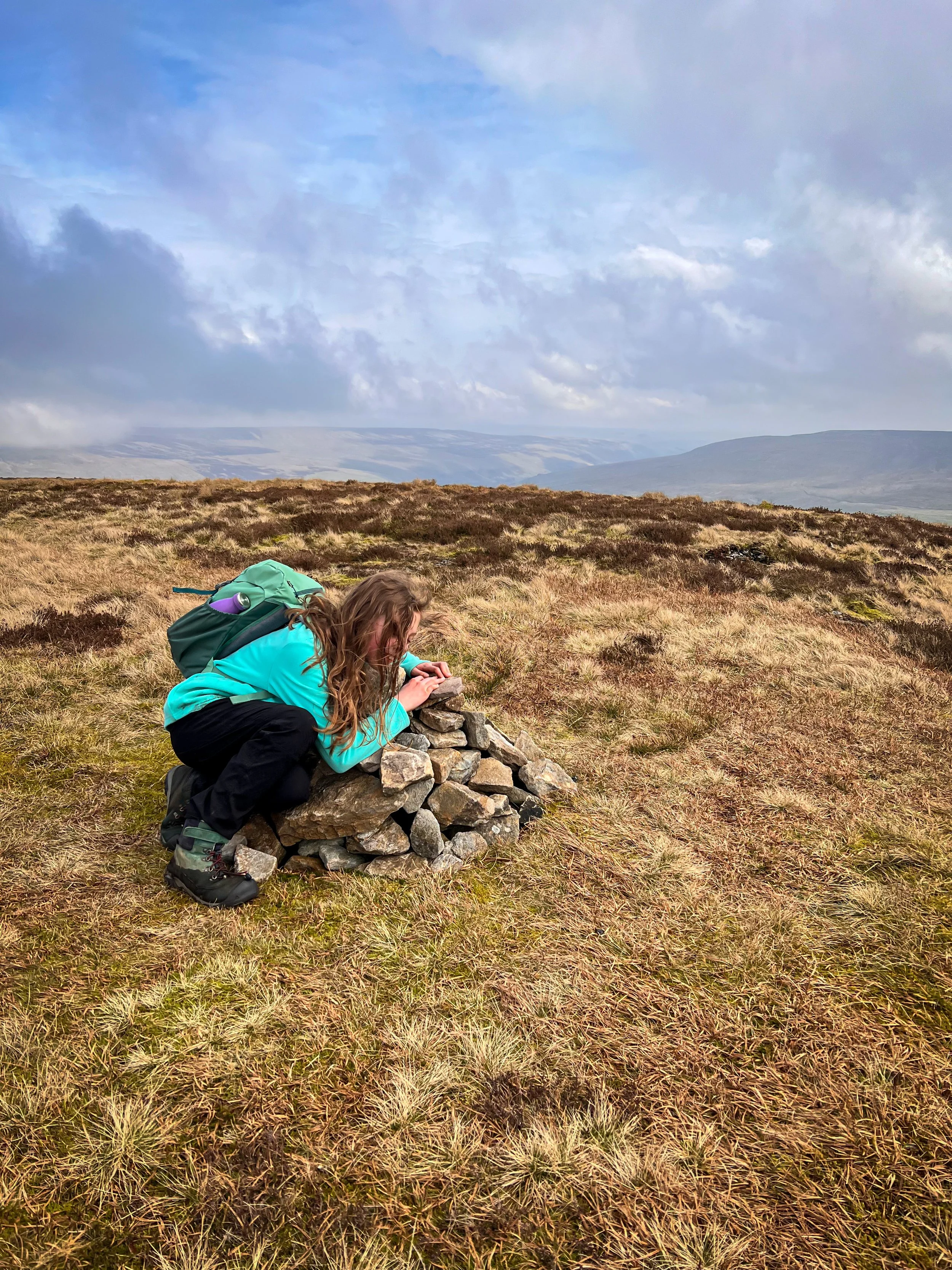
The tiny cairn on the summit of Plover Hill.
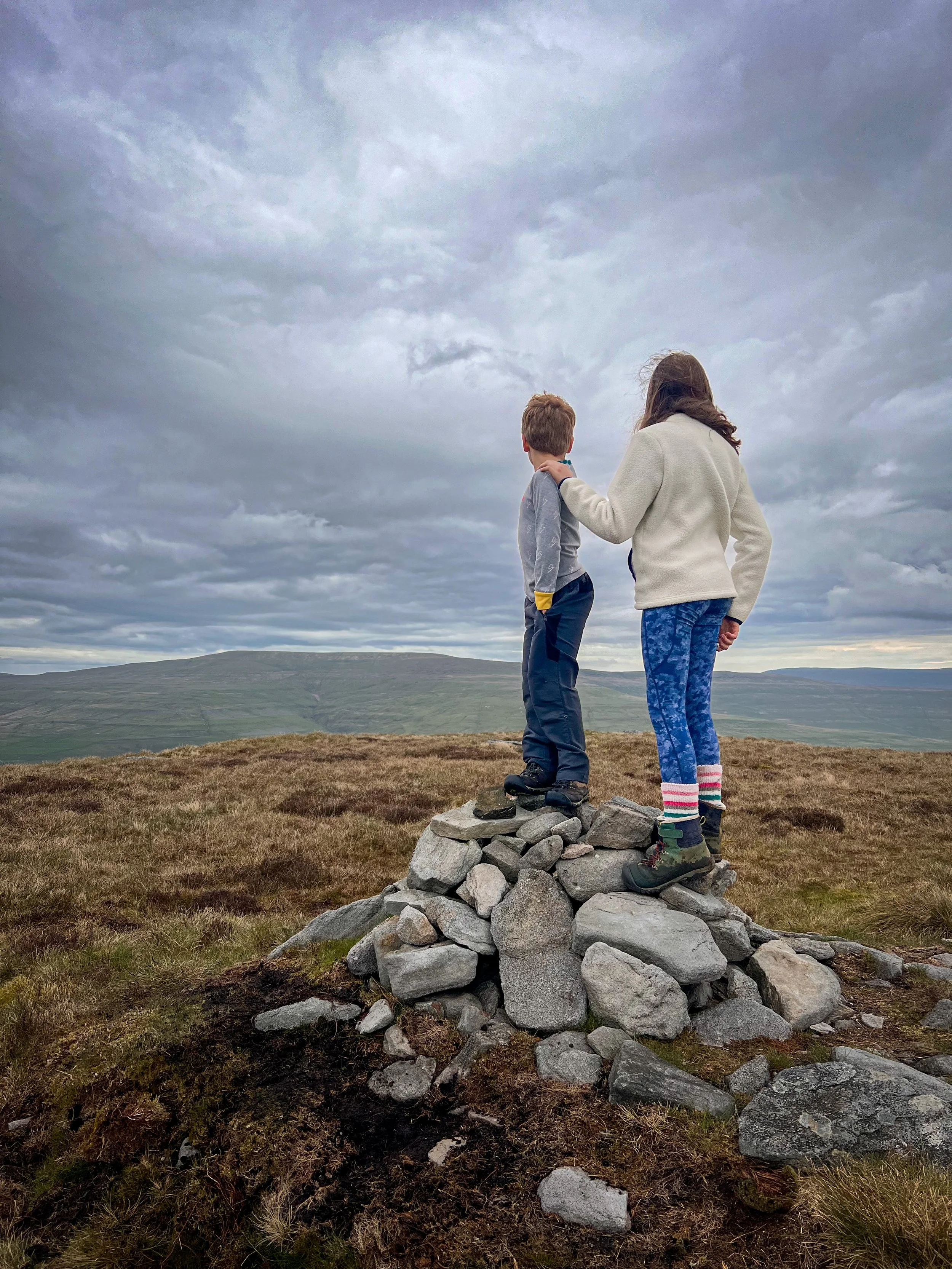
Nine Standards Rigg
2 April 2024
The one that’s not actually in the Yorkshire Dales National Park, but is included anyway because it’s cool (maybe… I don’t actually know why!)
Nine Standards Rigg is cool. We liked this one.
Technically, the summit of Nine Standards lies within touching distance of the Yorkshire Dales National Park, but it’s included in the Nuttalls despite in fact being just within the boundary of Cumbria. Purists, will probably find that REALLY annoying.
However, we didn’t. Because life is too short.
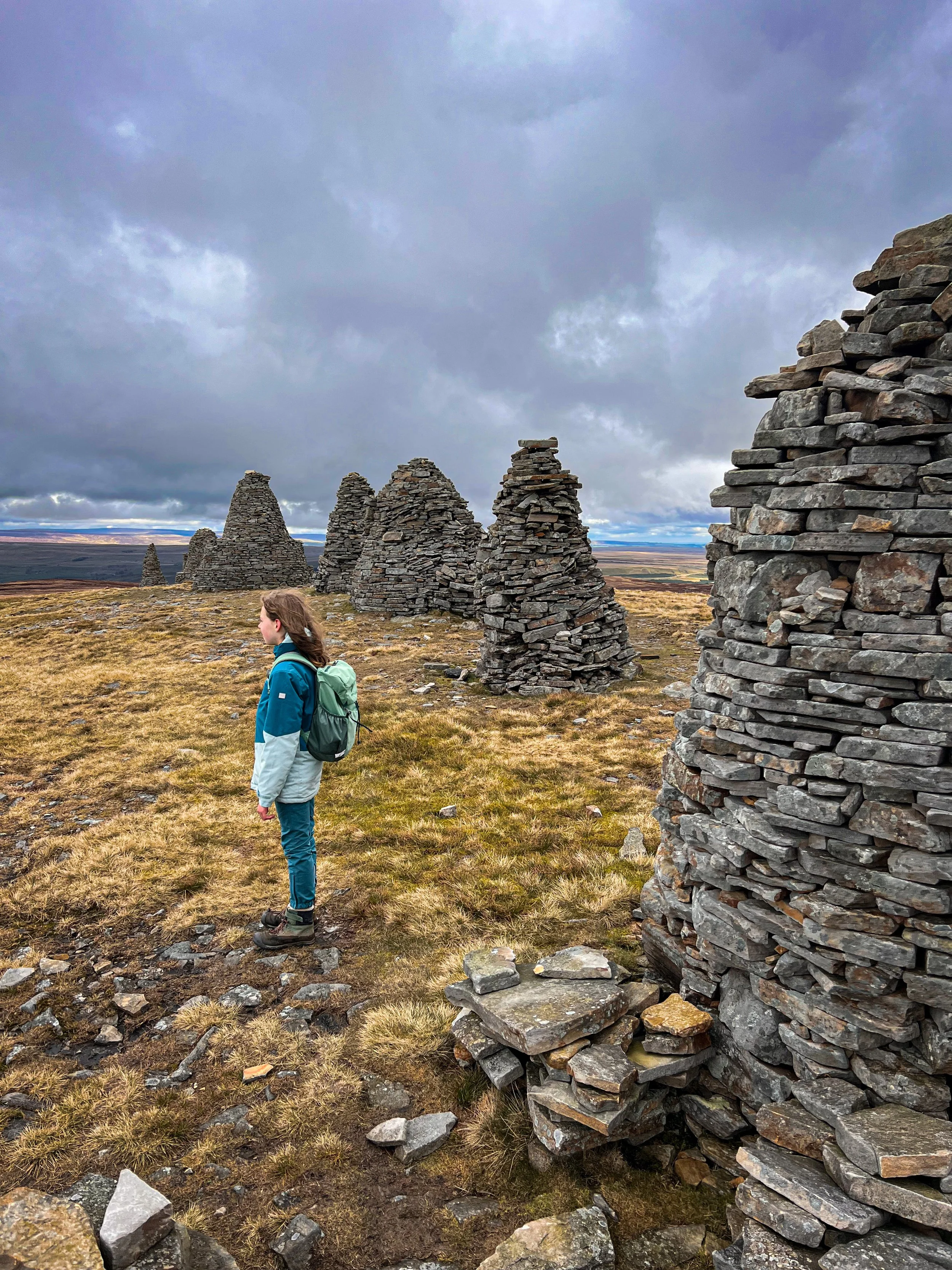
The Nine Standards are pretty legendary. I did a bit of geek-reading after doing this walk to find out more about the history of the gigantic cairns on the ridge line (not the summit I might add, an important point if you REALLY want to bag the top) and came up with… well nobody actually really knows.
What is a fact is that these cairns have held real significance over the nearby town of Kirkby Stephen for hundreds of years (some say 800). One view is that they were put there as protectors of the area. Others say they were built to try and intimidate the Scots who were partial to a good old invasion of the North of England back in’t day. Some say that they held some tribal significance from pre-history. What I can say is that they are MASSIVE, so massive that the route we took meant you could see them pretty much the whole way there.
Which of course made it feel like it was a REALLY long way.
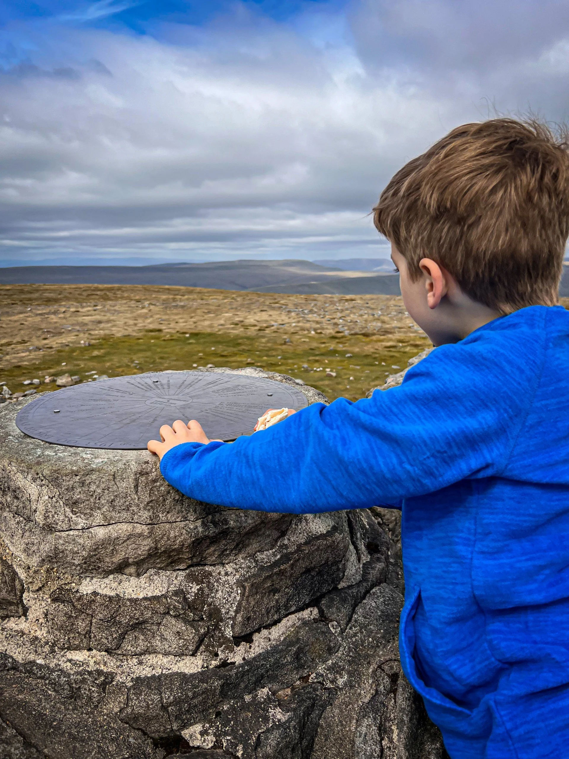
What is an extra bonus though, is that not only do you get the GIGANTIC historic and legendary cairns, you get a fancy viewpoint tower and then at the top (because that’s a little beyond the cairns) a trig too. So satisfying. A real top, top.
Nine Standards Rigg Route
This was a proper head scratcher in the planning. As with a lot of the far flung remote mountains, the summit is miles from anywhere on tricky terrain (i.e. bogs EVERYWHERE or on totally sketchy paths). We attempted this in Easter as well when the ground was still absolutely saturated from the previous year’s epic amount of rain. Part of this walk was on the Coast to Coast path too and we were tackling a stretch that was notoriously boggy.
Add in to the mix that there’s not a right lot of parking around there and you find a tough old nut to crack route wise.
My eternal walk goal is to plan for a satisfying circular, but it just wasn’t going to happen with this one. In an attempt to plan a circular, the end result was either way too long for the kids, or too risky on the bog front with some very dodgy paths to navigate (which is far from ideal). Nobody wanted to be waist deep in a bog in April.
So we took the advice of the owners of our holiday let, and parked up at the top of the Hartley Quarry road. There is a small amount of parking where the road ends and we tackled it as a there and back.
Since doing the walk though the Coast to Coast path across White Moss Hill (which is a little beyond the Nine Standards) has been completed.
Seeing as I right liked this one, I feel like a revisit is on the cards.
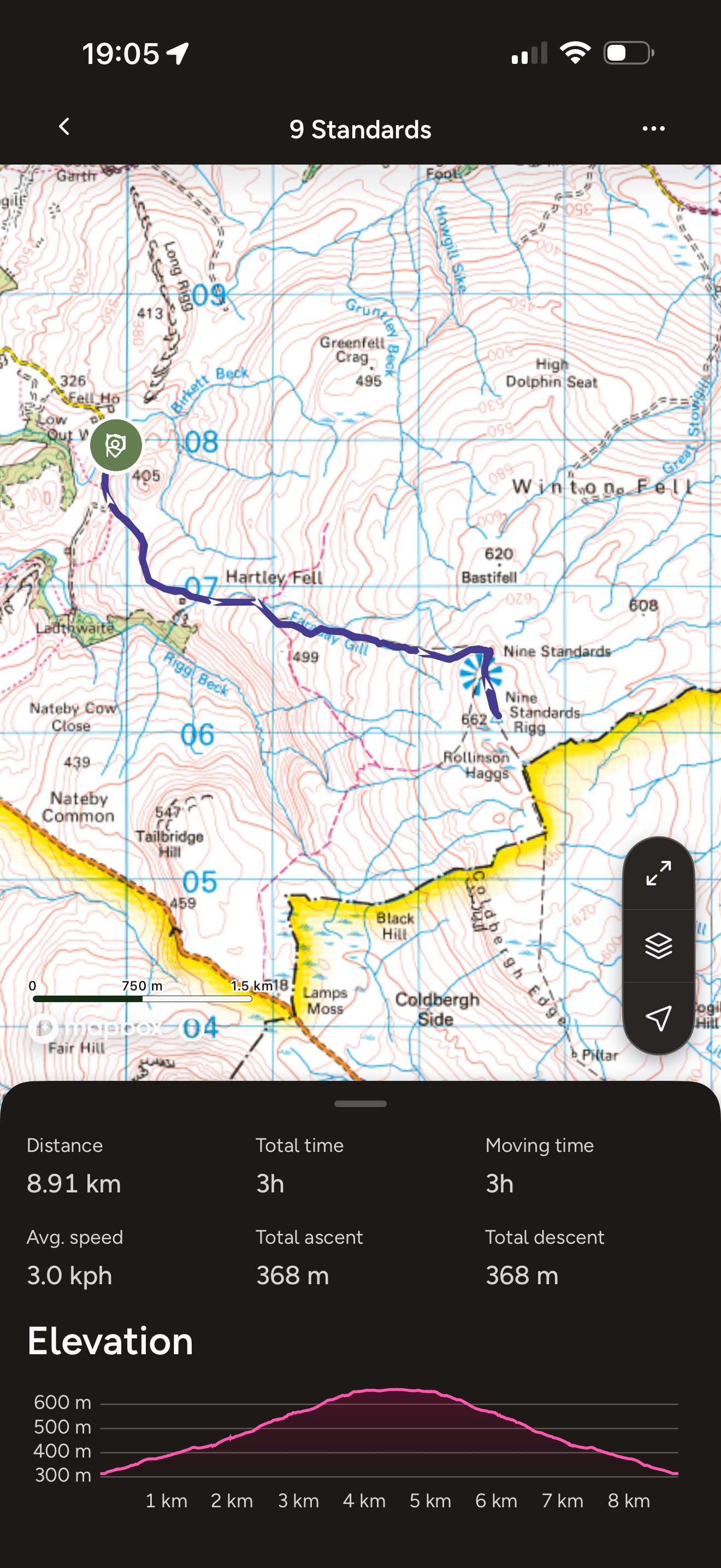
In the meantime, you can find our Nine Standards Rigg OS Route map by tapping the map pic (or link!)
Image is copyright of Ordnance Survey
The Nine Standards Rigg Facts
Distance Walked: 8.9km
Total time spent walking: 3 hours
Nine Standards Summit Height: 662m
Total Actual Ascent: 368m
Ranking: 28th Highest in the Yorkshire Dales
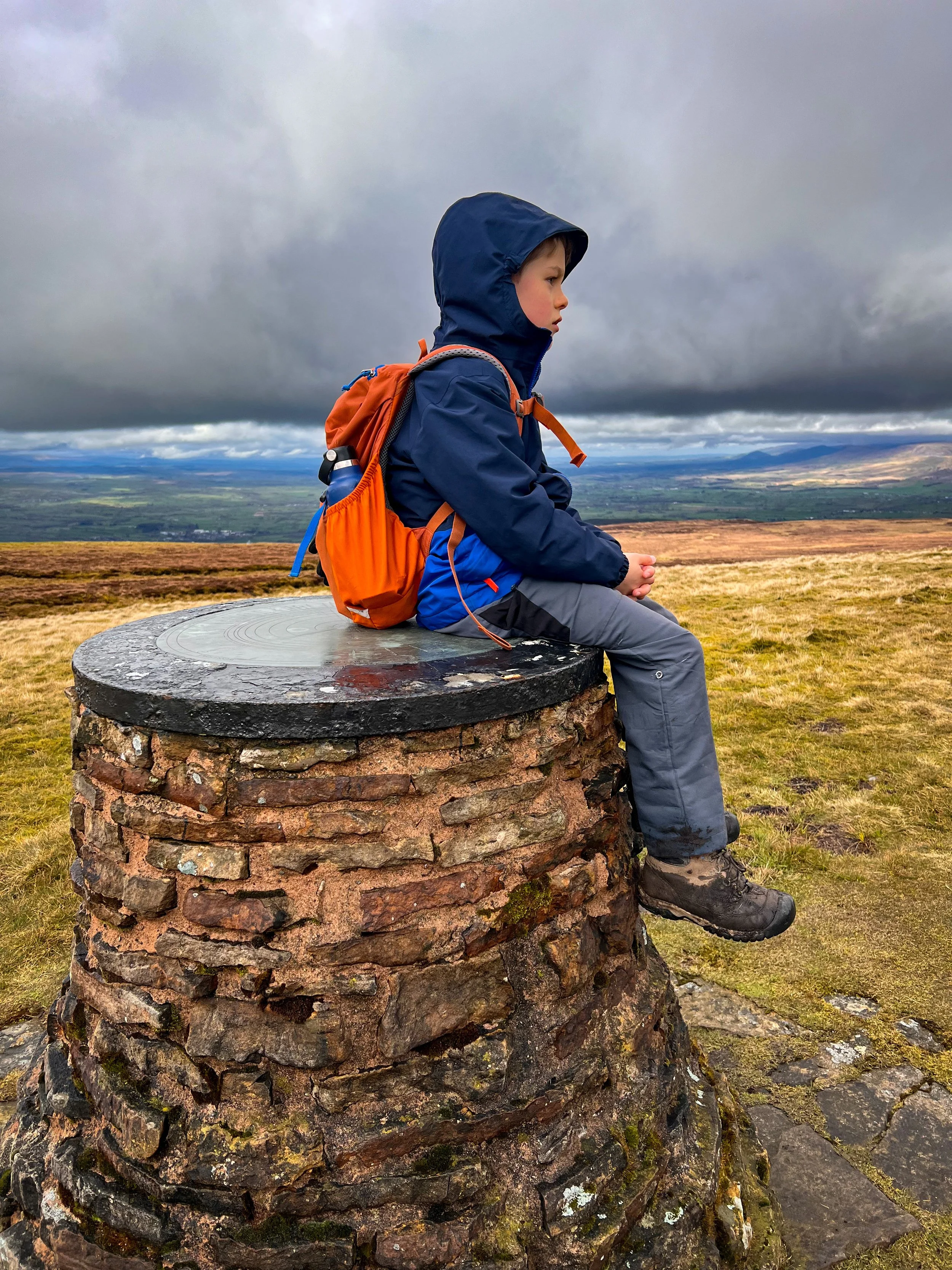
On the summit trig of Nine Standards Rigg
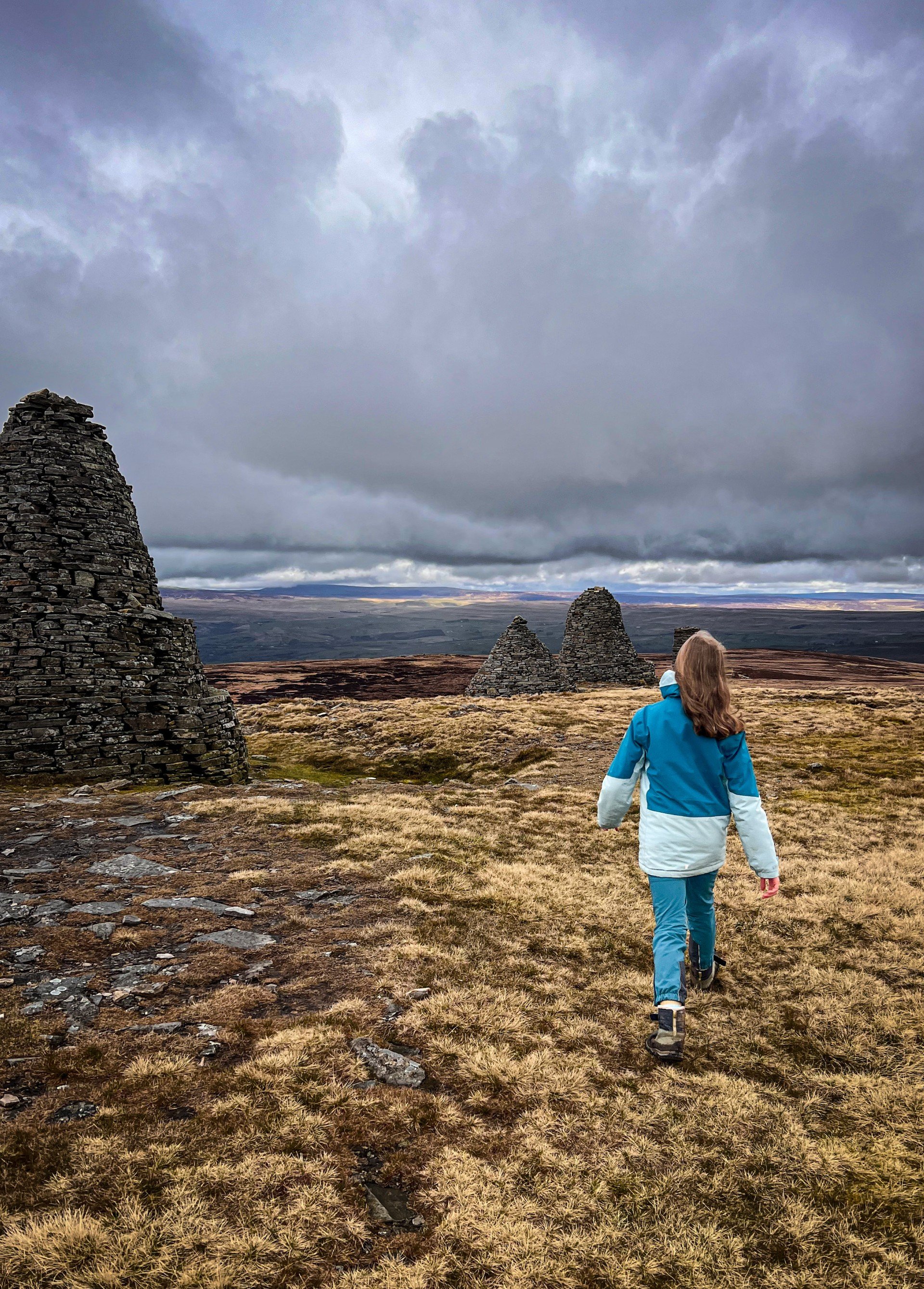
Some of the massive cairns. They are all different.
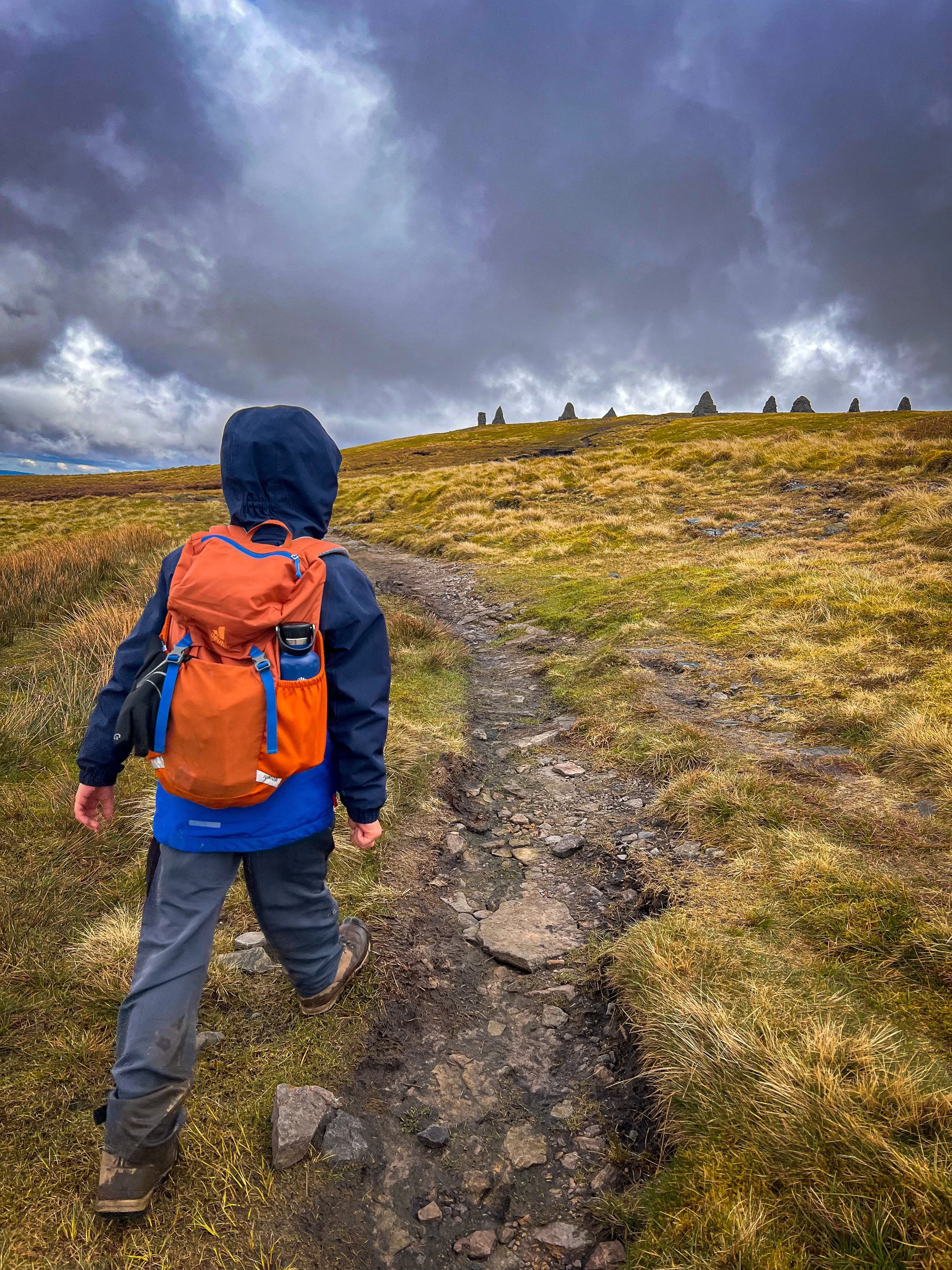
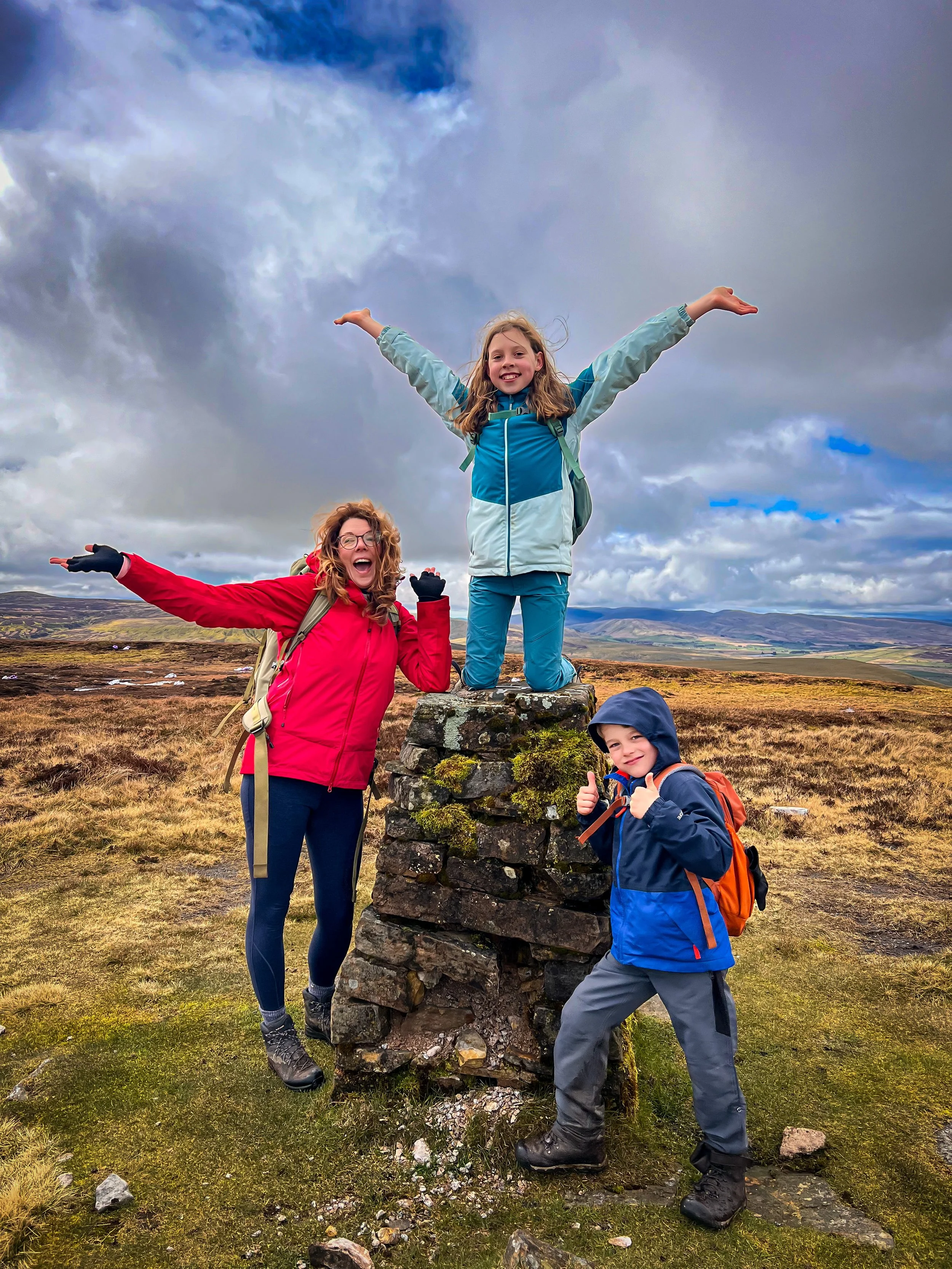
The nine on the horizon.
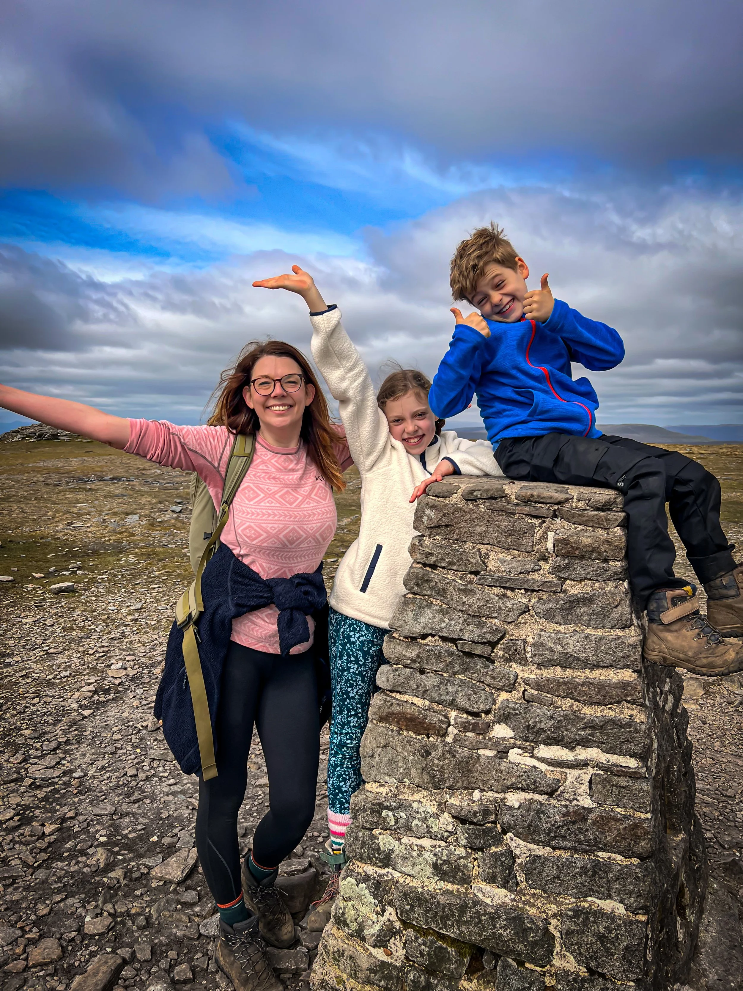
Ingleborough and Simon Fell
21 April 2024
‘The big one and the other one’
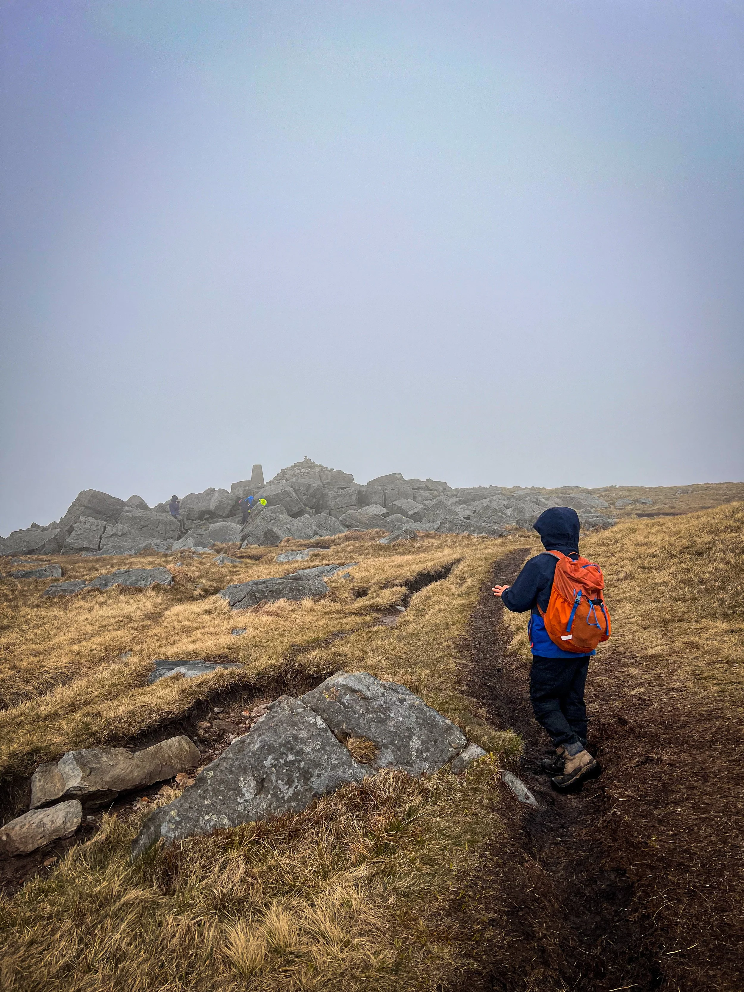
Ingleborough, Yes. Simon Fell, not so much.
Yes, the second highest mountain in the Yorkshire Dales is the one that we’ve climbed many times, from all different angles. But Simon Fell, nope.
You can find Ingleborough’s little brother Simon if you leave the summit walking in the direction of the Ingleborough ridge-line and I would love to say loads about it, but sorry Simon, you’re just not as mountain-y as your brother. A term we shall use quite frequently from this point onwards. I’ll be honest, it was one of those ‘really?’ moments.
But we bagged it, it had a few (at the time) balanced rocks to celebrate its slightly underwhelming summit and that was it really.
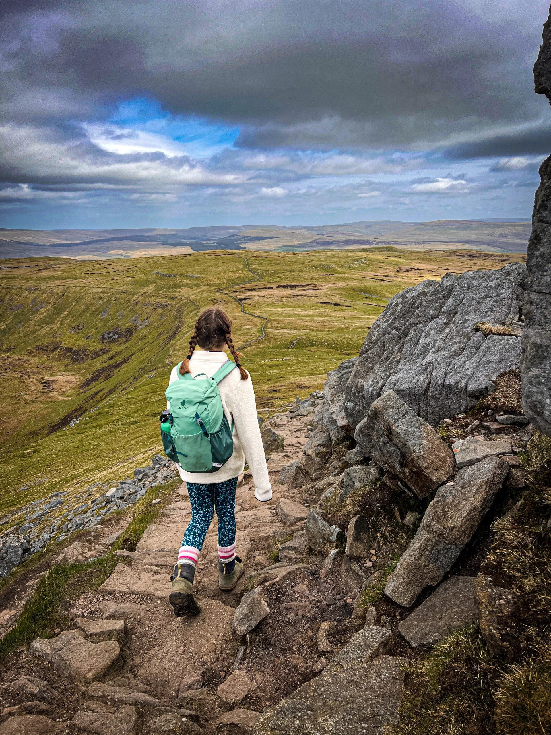
Although it did give us the opportunity to explore the ridge line of Ingleborough, which we haven’t done before and we also took a diversion to Park Fell, which does have a trig you can bag, and that does leave you with a pretty satisfying sense of completeness.
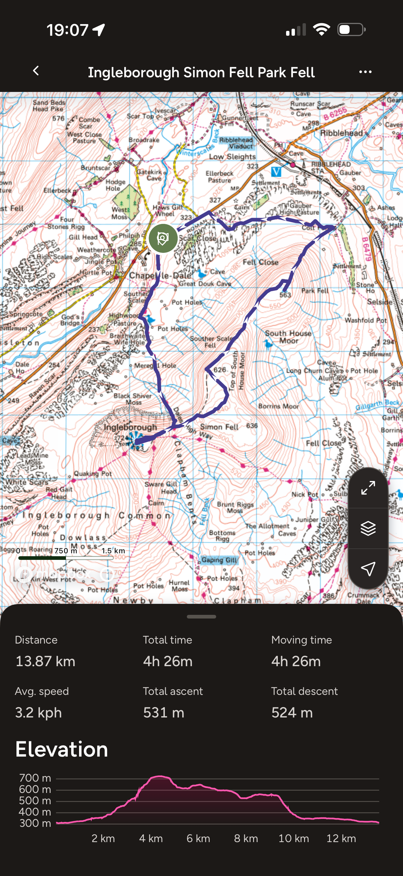
Ingleborough and Simon Fell Route
Having climbed Ingleborough by all available routes, the Yorkshire Three Peaks route from Chapel le Dale is short but steep, but whilst this circular is decent, the short stretch of road walking to the end is not ideal with the kids so one to be mindful of.
However, it’s probably your only option if you want to do this walk as a satisfying circular that’s a reasonable length for the kids to handle. I did consider tackling it from Clapham, but that route was 20km compared to 12km.
So my advice is, this is probably the best route (you can also bag the bonus trig on Park Fell at the end), but be aware that the road can be busy and fast, particularly on a sunny weekend.
If you just fancy tagging Simon Fell onto the classic circular from Clapham, that would be an option at 20km. That’s your call to make!
Image is copyright of Ordnance Survey
Ingleborough and Simon Fell Facts:
Ingleborough and Simon Fell Facts
Distance Walked: 13.9km
Total time spent walking: 4 hours 26 minutes
Ingleborough Summit 723m
Simon Fell Summit 650m
Total Actual Ascent: 531m
Ranking: 2nd Highest and 30th in the Yorkshire Dales
The approach to the final ascent from Chapel le Dale with the steep zig-zagged path ahead.
The view point marker on the summit seat of Ingleborough
The path that descends from the summit of Ingleborough with Simon Fell beyond.
Great Whernside
27 April 2024
The one that gave us all the seasons
Great Whernside, not to be confused with ACTUAL Whernside
No, they weren’t just lazy when they were coming up with names, the word Whernside actually means where the mill stones are. So perhaps Great Whernside just has really excellent millstones. I don’t know. But what I do know is this it’s another that we’ve climbed several times over the years, and there are two ways to do it.
The short way or the long way.
We did it the long way to reccy a lovely long circular, but having done this when the kids were younger, I also have a short version of the Great Whernside walk too.
Either way, it’s a super peak, with a satisfyingly large cairn on the top alongside a trig and there are STUNNING views across the national park and of neighbouring Nidderdale NL, because the summit fence line marks the border of the National Park and the National Landscape next door.
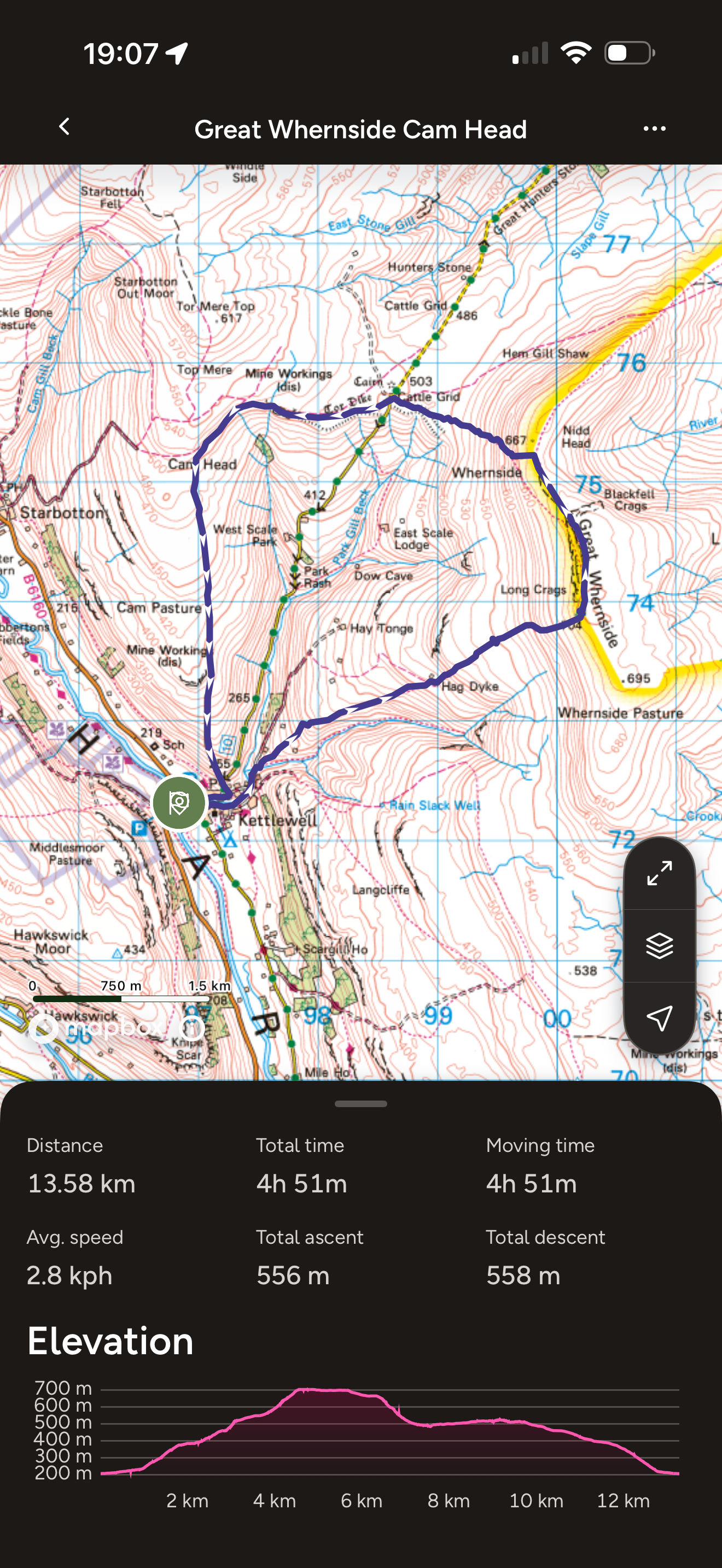
Great Whernside Route
In a deviation from the norm with the Dales mountains, this walk has options. The longer route will take you as far as Tor Dyke, which are the remains of a Brigantian Hill Fort and the shorter one takes you past the remains of an old Lead Smelting Mill which has a fun story about it being blown up by the army! Either way, the walk starts in Kettlewell at the pay and display and heads up past Hag Dyke Hostel which is a scout residence with the highest chapel in the country.
And yes, be prepared for bog. It’s a tad squelchy after the climb from Hag Dyke and the final ascent to the trig point be prepared to detour!
Image is copyright of Ordnance Survey
Great Whernside Facts:
Great Whernside Facts
Distance Walked: 13.6km
Total time spent walking: 4 hours 50 minutes.
Great Whernside Summit 704m
Total Actual Ascent: 556m
Ranking 6th highest in the Yorkshire Dales
The bridge before the beginning of the ascent (in sunshine, before we had hail… and then more sun!)
One of the rocks on the summit ridge.
The descent.
Birks Fell
5 May 2024
The one that has a right nice beer garden at the end.
I have unfinished business with Birks Fell
Not that it wasn’t a lovely walk, but there is a definite circular on the cards and we simply did not have the time on the day. So we will be back!
But other than that, Birks Fell isn’t the boggiest, the biggest, the most well known or the most popular peak in the Dales, so it’s unlikely you’ll see many folk about. That said, the views are very pretty across Wharfedale and Littondale, and it has a bonus trig too (which does NOT mark the top, I think that actually belongs to Firths Fell. Birks Fell has got a decent sized summit cairn which is also pretty satisfying).
It also has a wonderful pub at the end. One of our favourites in the Dales. So all in all, a very satisfying peak bagging day to be had folks!
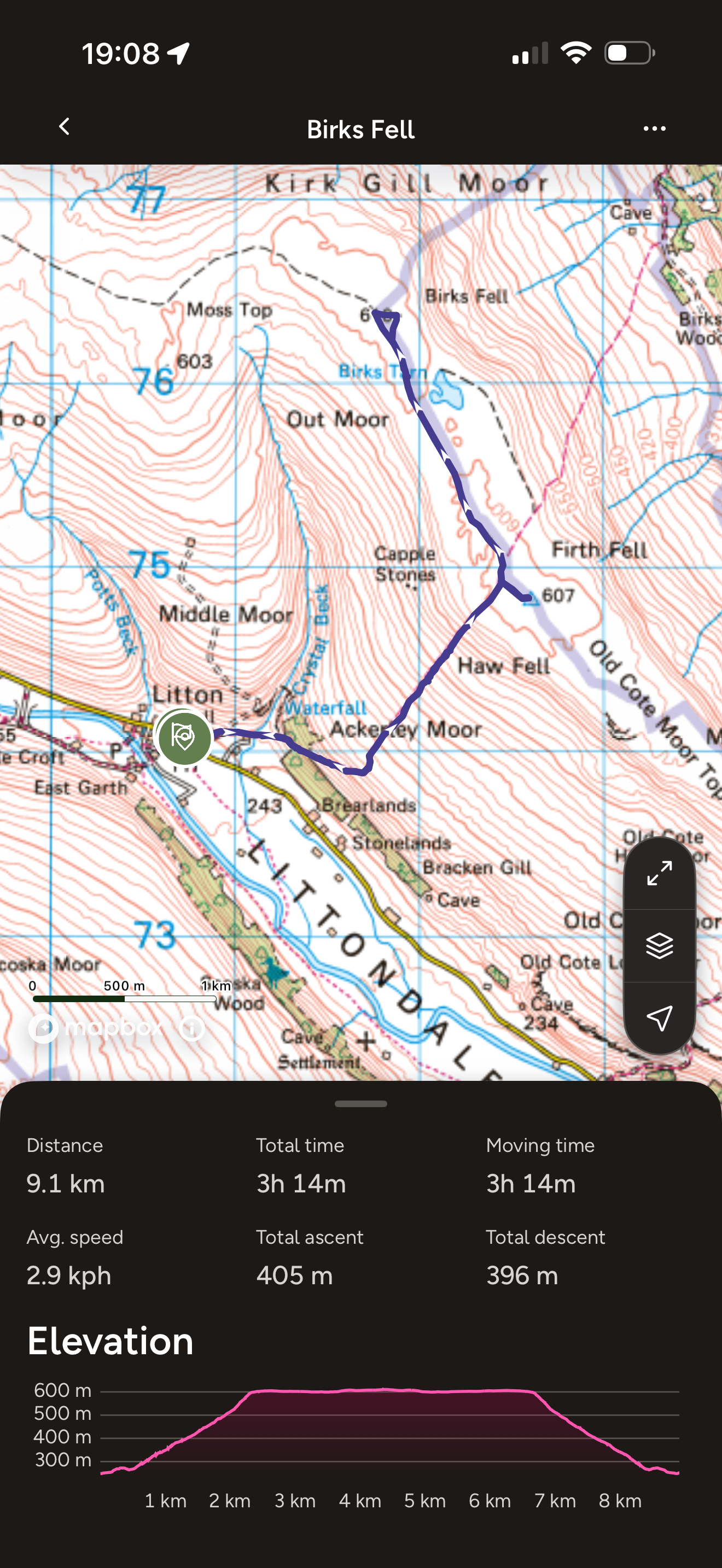
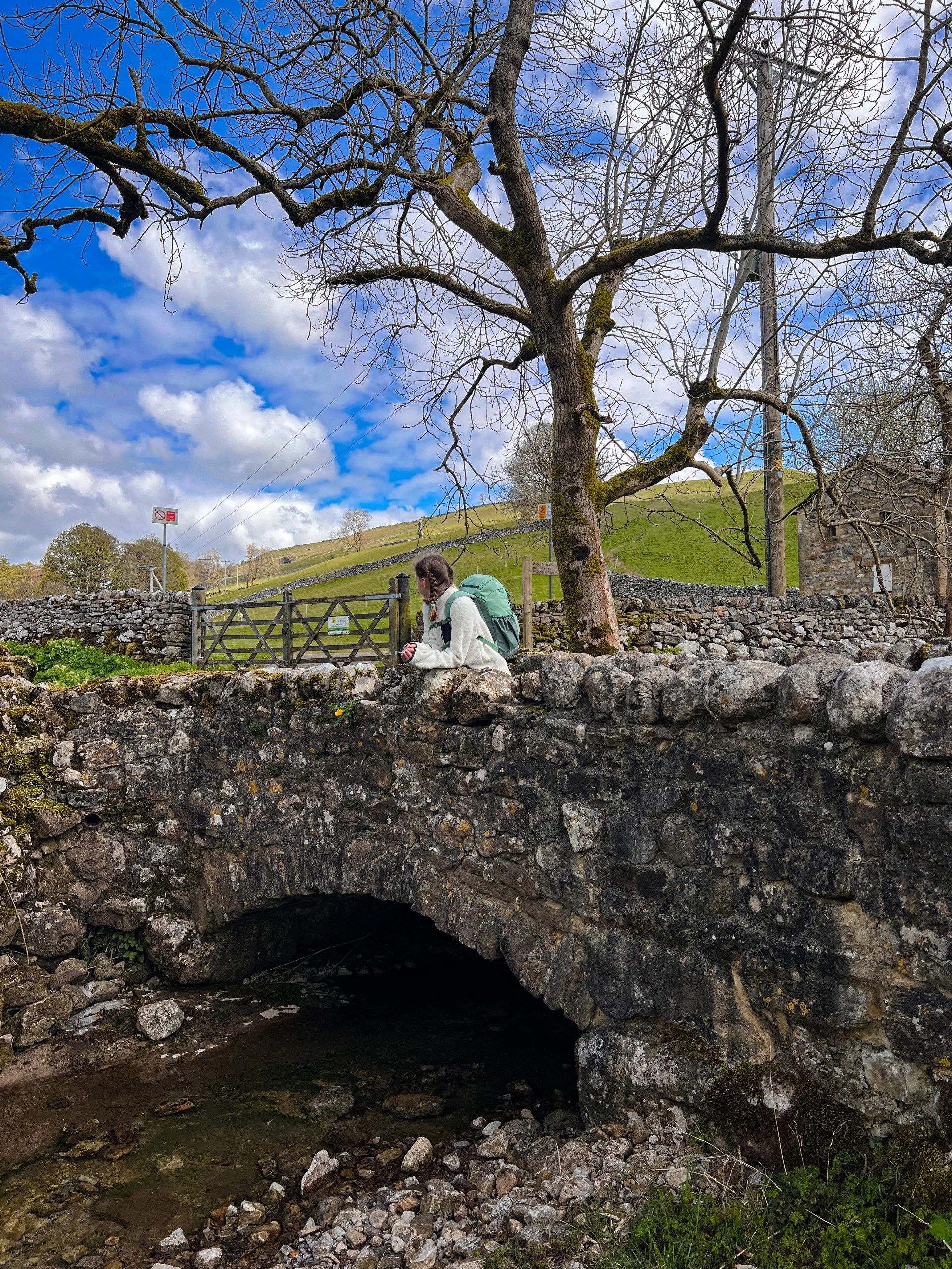
Birks Fell Route
We began from Litton at the Queens Arms pub which has a super beer garden in summer and an excellent cosy fire in winter. But less about the pub more about the route. From here you set off on the track that runs from the pub and climbs up and over the moor. This is the path that eventually takes you to Buckden.
When you hit the ridge, you’ll spot the trig to your right, but you need to head left along a well defined route until you see the summit cairn. We then headed back the same way!
Image is copyright of Ordnance Survey
Birks Fell Facts:
Distance Walked: 9.1km
Total time spent walking: 3 hours 14 minutes
Birks Fell Summit 610m
Total Actual Ascent 405m
Ranking 40th highest in the Yorkshire Dales
Replacing a rock on the summit cairn of Birks Fell
The beginning of the walk at Crystal Beck
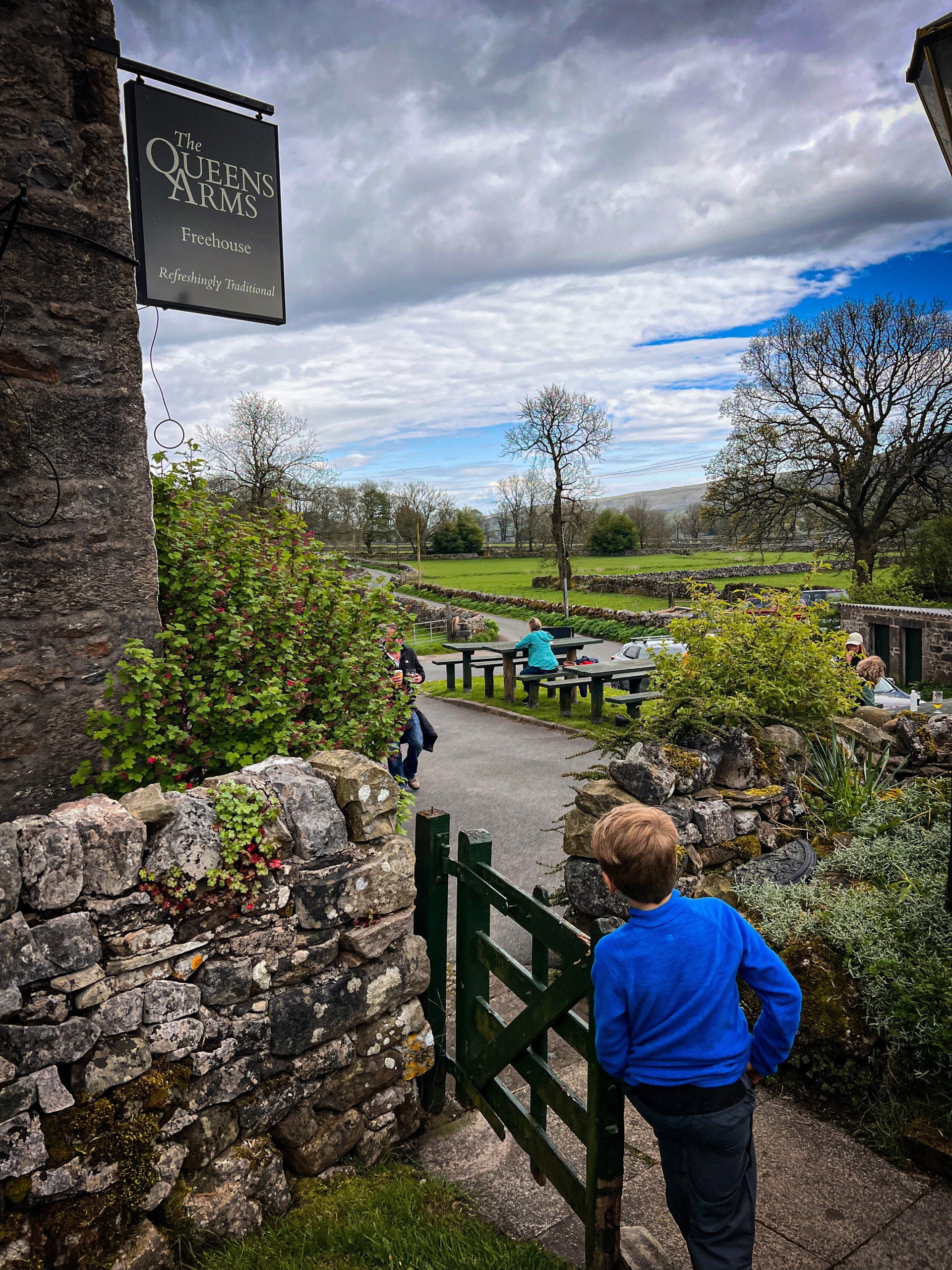
That beer garden! The Queens Arms at Litton.
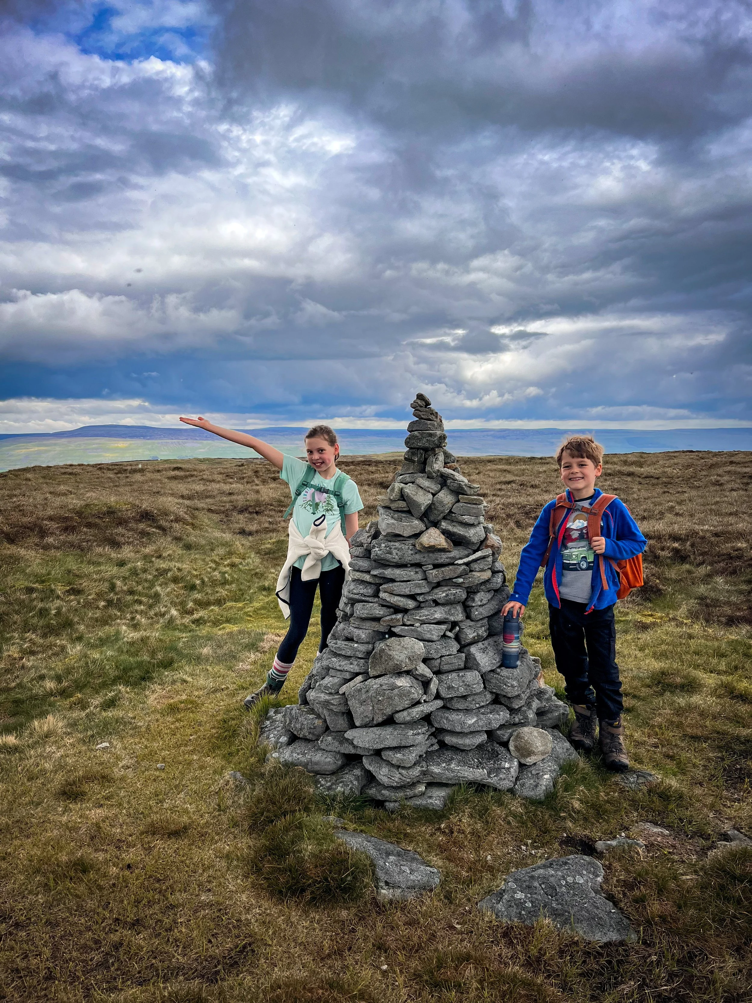
Drumaldrace
6th May 2024
The one with the surprise storm warning (and therefore not many pictures!)
Drumaldrace. Another with unfinished business!
What do you do when the Met Office decide to throw you a surprise thunderstorm warning en route to the mountain?
You go the quick way. Yes. This was an unwelcome yellow weather warning, which turned out to be for nothing, although this was a walk where the heavens opened as soon as we got to the summit cairn and it RAINED SO HARD! And I mean torrential.
So look how far we walked.
I am so annoyed, because I feel like we cheated! But we will return, because the circular that I had planned looked absolutely lush! So you’ll just have to head back when I have had chance to do it! (That’s the best bit about a website, you can update it!)
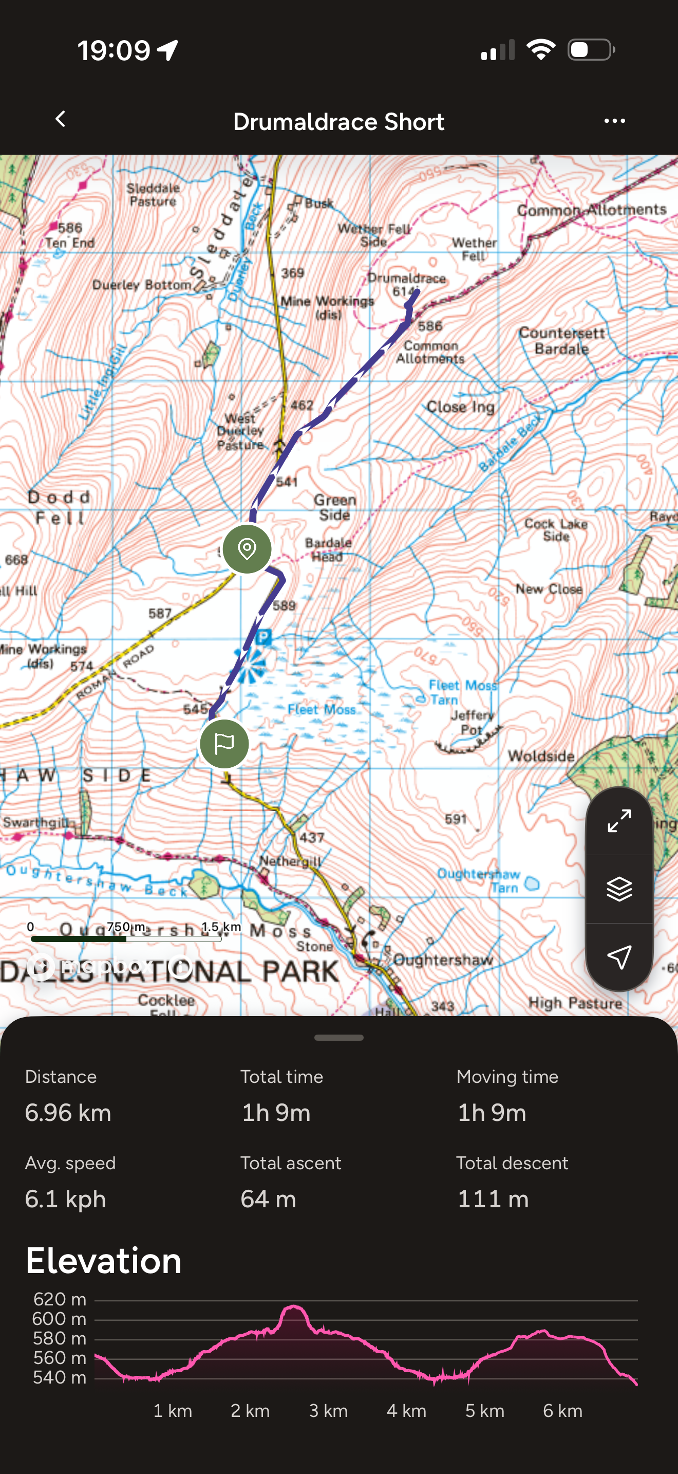
Drumaldrace Route
The intended route and the one we shall do when we go back was taking in Bardale Beck above Semerwater, but what we actually ended up doing was parking in the layby above Hawes and virtually sprinting to the top and back in what was by then torrential rain!
So another one with options. The walk to the top from the roadside feels VERY much like cheating, but bag the top we did!
(NOTE: in all the excitement of the deluge of rain, I forgot to stop the tracker on the map! The end point was the same as the start point, not Fleet Moss!)
Image is copyright of Ordnance Survey
Drumaldrace Facts:
Distance Walked: 5km
Total time spent walking: 1 hour 10 minutes.
Drumaldrace Summit 614m
Total Actual Ascent 64m
Ranking 39th highest in the Yorkshire Dales
Above: The summit cairn with the clouds looking pretty ominous.
Left: The view from the beginning of the walk.

The Next Twelve
Continue the Dales Mountains with the next series of walks… (coming soon!)
Buy Me a Coffee
Make a Donation
Thank you for taking the time to have a look at my website and for reading this now!
I set up the Reluctant Explorers and maintain the website and attached social media accounts in my spare time, around mum-life and two jobs. It was designed to provide access for parents to free resources to help get more families outside and exploring in nature. These walks have all been created by myself and the kids and we have walked each one ourselves (and re-walk them regularly to keep the information as up to date as we can).
If you would like to support us and can afford a few pennies, you can make a donation to our ‘Buy Me a Coffee’ page. Simply tap the button below to head there!