
Buckden Pike
Buckden Pike is the 7th highest peak in the Yorkshire Dales, so this family walk is not for the faint hearted, that’s for sure!
BUT you’ll get an abandoned lead mine, a top trig point and summit cairn with a view to die for and weird rocks on the way down. Feeling brave? This one can be extended to waterfalls too!
Want to climb Buckden Pike?
Well, I’m not going to lie. You will need a LOT of chocolate on this one! Located in Buckden, Upper Wharfedale, this big hitter in the Yorkshire Dales top ten peaks is a massive achievement for a budding peak bagger!
But it’s not for the faint hearted. And I’m talking in the parental sense here, because yes. You will need your full arsenal of Walking Distractions at the ready to climb this bad boy! That and SNACKS. Many snacks. (Did I mention snacks?)
One of the questions I get asked the most over on our Facebook and Instagram pages is ‘how old do you think the kids should be before they climb….. XYZ’ and the answer is…. it depends on the capabilities of your own kids! We first climbed this when the kids were 5&7 and most recently aged 12 and 10. I’d say I got more complaining the older they got than I did when they were younger! But you do you. This one is a pretty short peak for the Yorkshire Dales, so it does make it a great one for younger explorers because the shorter distance gives you plenty of extra time to tackle the steep climb.
And yes, it’s a steep one…. check out the details for Buckden Pike below!
Follow us, @thereluctantexplorers on Instagram and Facebook for ALL things outdoors in the Yorkshire Dales!
Buy Me a Coffee
Make a Donation
Thank you for taking the time to have a look at my website and for reading this now!
I set up the Reluctant Explorers and maintain the website and attached social media accounts in my spare time, around mum-life and two jobs. It was designed to provide access for parents to free resources to help get more families outside and exploring in nature. These walks have all been created by myself and the kids and we have walked each one ourselves (and re-walk them regularly to keep the information as up to date as we can).
If you would like to support us and can afford a few pennies, you can make a donation to our ‘Buy Me a Coffee’ page. Simply tap the button below to head there!

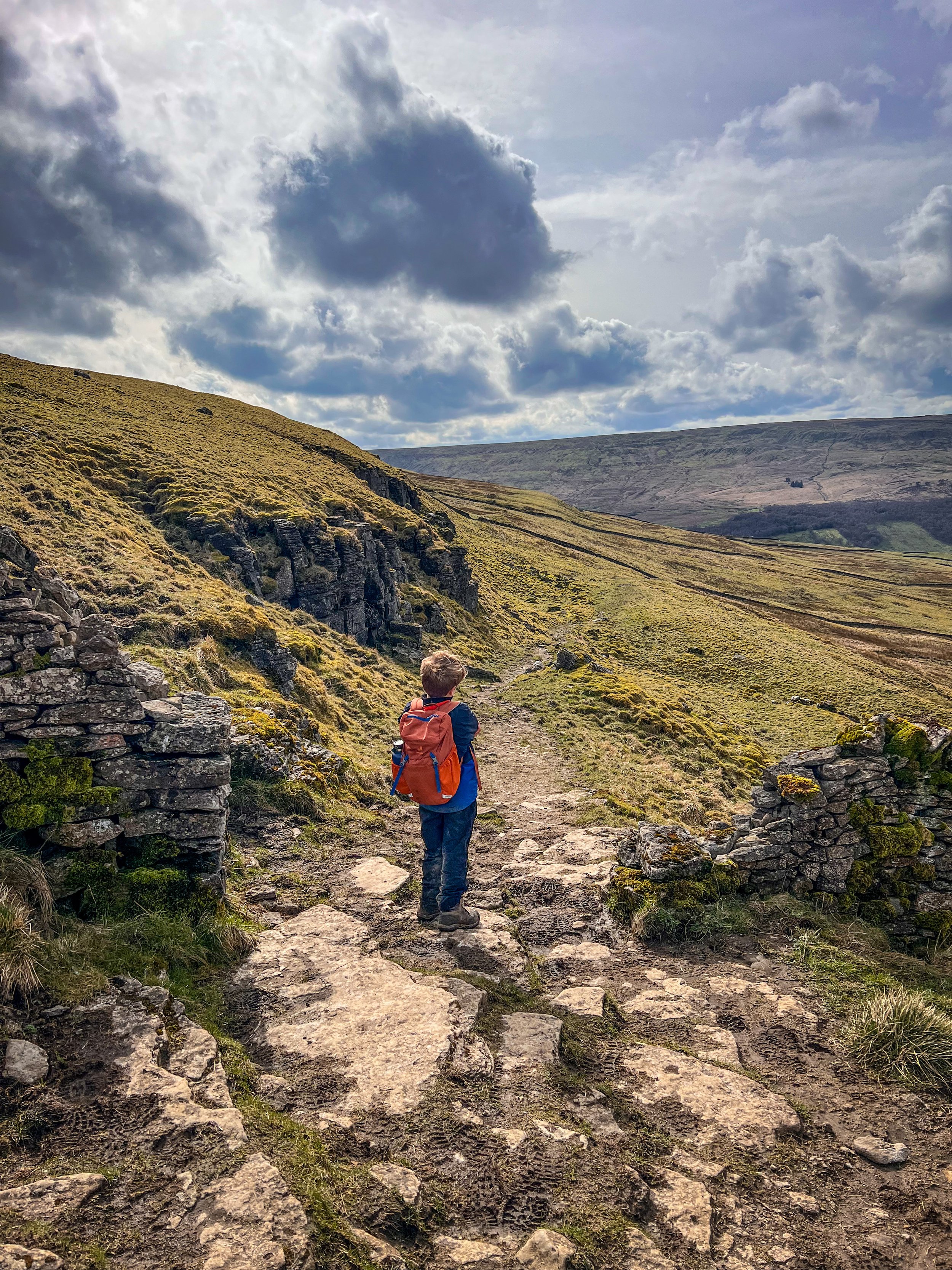
The path on the final ascent nearing the summit.
Walk details for Buckden Pike
Distance: Approximately 6.5 miles. Allow 4+ hours.
Terrain: Easily identifiable well walked paths with the exception of the steep section between the Lead Mine and the summit line. Uneven underfoot, muddy in places. Ascent is 502 metres, the summit being 702 metres high.
Parking: Buckden pay and display car park which has plenty of parking. If the car park is full, please try somewhere else. Do not block access, or disregard the requests of the national park. There are wildflower areas that should not be parked on. If you’re stuck, try nearby Kettlewell for Great Whernside, the stepping stone walk or the circular to Starbotton.
Public Transport: Yes! There are buses that service Buckden and you can find out more details about frequency on the Dales Bus website.
Dog Friendly? Yes although there are plenty of grazing cattle on this walk.
Location: Buckden, Upper Wharfedale, Yorkshire Dales
Map:OL Explorer OL2 Affiliate Link as Ordnance Survey Champion
What 3 Words: greeting.wallet.cashiers
Toilets/ Baby Change: Buckden Pay and Display car park has toilets
Nearest Cafe/ Amenities: Buckden village store and Buck Inn. Kettlewell is down the road for more.

The Buckden Lead Mine
How to hike Buckden Pike
Starting from Buckden Car Park, head to the gate leading from the Northern point of the car park (with the toilet block behind you and the entrance/exit of the car park to your left) Head out the gate in the wall, and immediately turn right, following the line of the dry stone wall. You will steeply head up and then right again continuing along the path until it reaches the beck. When you reach the water turn right. There is a little crossing point downstream.
Cross the beck and turn left to begin the climb up the bank on the otherside. The path steadily rises upwards in a southerly direction, leading away from Buckden and in the direction of Starbotton. It is a gradual climb for around 1.5km until it then sharply turns left, so you virtually double back on yourself. There is a signpost pointing in the direction of the Lead Mine.
The path will take you towards a perimeter dry stone wall which it then follows (the wall is on your left) until you reach a corner. Here, continue right (again, almost doubling back on yourself) before, sharply turning left when the path. The path here is well walked and clear but is certainly muddy in places! It continues through and over several perimeter walls, before once again meeting up with that dry stone wall, which you will again closely follow!
Upon the approach to the lead mine, there is a stile in the dry stone wall, directly ahead of you, cross that and continue following the clear path until you reach the remains of the Buckden Pike Lead Mine. It’s clear because of the huge spoil heaps and you will see the opening to one of the levels in the hillside up ahead. This is a stupidly dramatic part of the walk. you’ve got to pause and take it in, there are ruins of the old lead mines, the buildings and then you see the beginnings of Buckden Beck as it heads down towards the village (a word here, there is a path marked on the OS map but it’s been devastated by landslips and is sketchy at best. Don’t use this as a potential get out route, it’s not suitable for kids, it’s barely suitable for adults!)
Here is a great place for a snack stop, before you tackle the steep ascent to the summit of Buckden Pike and also here, the path isn’t quite as easy to follow. If you look up the hill from the lead mine, you will see a visible narrow path that takes you around the side of the hill, but this is quite narrow and steep with unguarded drops, so we’d recommend with kids avoiding that route where possible (that said, we have walked it with the kids and everyone survived!)
Instead, from the lead mine level opening, keep to the right of the stream and head west. Your direction will have the opening of the lead mine at your back and the broken down dry stone wall perimeter and gully to your left. Follow the edge of the dry stone wall straight on to the corner point where it then runs right, the path heads steeply uphill. Follow it upwards, handrailing the wall on your left. Once you hit the top of the ridge line there is a dry stone wall ahead of you, turn right and follow it.
This takes you to a corner point in the wall (that will be on your left) and the path takes you diagonally upwards and leftwards away from it. Keep heading uphill. There are two foot-worn paths uphill (you are on open access land so this is often the case) but use the drystone wall on your left as a guide and the steep uphill as your assurance you are headed in the correct direction! Both paths will take you to a flagged path along the ridgeline. (Fun Fact, I learned on my Hill and Moorland Leader course that these flags are made from reused factory flagstones from demolished factories in Leeds!)
You will also see some curious looking bog dams. This is the National Trust restoring the upland peat bogs which are INCREDIBLY environmentally important. Did you know that peat bogs store TWICE as much carbon as all the world’s forests combined? These bad boys are literally helping to keep our planet healthy and what you’ll see are ‘leaky dams’ which help to keep the bogs wet and therefore healthy. Take a peek into the water and you’ll see Sphagnum moss and if you visit in Spring, a blummin’ TONNE of frogspawn!
Oooh, I went off on a tangent then didn’t I! Head LEFT when you hit the leaky dams and the flagged path. You’ll immediately find a ladder stile over the wall and you’ll see ….. BAH BAH BAHHHHH THE SUMMIT TRIG! And a BRAND NEW seat where the old summit cairn used to be. Yes. The super steep climb will give you double the summit rewards! AND views! From Buckden Pike summit seat, looking west and to the right you will see the Yorkshire Three Peaks in the distance, Pen y Ghent, Ingleborough and Whernside, but the views will take you much further afield even as far as Wild Boar fell in Mallerstang and the Westmorland Dales, with the angular profile of Wild Boar Fell in the distance to the North too.
Take a moment to appreciate the geek. And now let’s carry on with the route instructions…
Now this bit’s probably the easiest part…. head back to the trig point from the Summit cairn and turn left, heading downhill in the direction of Cray. The National Park are doing some restoration to the path at the time of writing (2026) and so the structure of the path could change, but the one thing is sure, it’s blummin clear and easy to follow!
Just keep following it. As you head away from the restoration work, the path is extremely muddy after wet weather, so prepare for a little bit of mud avoidance! There’s not much else to say! It crosses through several perimeters of fields (definitely a name for an indie band) until you reach a dry stone wall, at which point head right and follow it down until you hit the T-Junction with the Buckden Rake path. (If you’re feeling super keen now, head to point 14…..)
If you just want to head back to the car park (because you’ve run out of Haribo) turn left and head through the gate, continuing downhill along the same path until you hit the car park!
COW CLOSE WATERFALLS… be warned, they’re seasonal. Unless you’re doing this walk in a wet Winter, Spring or an insanely wet Summer and Autumn don’t bother. Not that I don’t love this place, it’s just rubbish if there’s no water! But if you love a little wander to a loverly waterfall. Then tag this one on. It’s about 3km extra to your walk.
At point 12 turn right and then follow the directions from our Cow Close Waterfall walk from point 2/3. Be aware this is on open access land, but the stile across the fence is more than a little dilapidated!
OH YES! MORE WATERFALLS! You can also spend some time paddling in the waterfalls of Buckden Beck, which are situated around 1km up from the start of this walk. Well worth the trip!
Last walked April 2026.

The signpost for Buckden Lead Mines next to Buckden Beck.

The new summit seat of Buckden Pike, replacing the cairn.
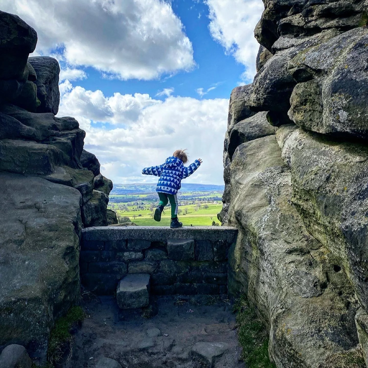
The descent from Buckden Pike
Helpful Information!
For more information, head to our safety information and tips page.
⭐ We hope you enjoy our walks, but please exercise common sense as routes can change with the weather conditions and seasons! The routes have been walked by our own two feet, but you know your own limits. Always take a back-up map, don’t rely on GPS alone, wear appropriate clothing for the weather and take adequate snacks and refreshments with you (although as a parent, I know you already know that bit!)
⭐ LEAVE NO TRACE! Take nothing away and leave nothing behind, take all rubbish home with you.
⭐ If you choose to paddle, be aware of bio security. Always wear clean dry water shoes (if worn) to avoid cross contamination of species between watercourses, this is a particular issue in the Yorkshire Dales, to help protect the white clawed crayfish.
⭐ If you decide to paddle, be aware that wild water can be dangerous, and water levels will vary season to season. Always supervise children around water. Check out the safety information on the Royal Life Saving Society website.


What’s cool for kids on this walk?
⭐ Buckden Pike is one the Yorkshire 30 highest peaks. Now THERE’S a little challenge for you! Can you bag all the top 30?!
💦 The waterfalls at Buckden Beck and stunning and great to splash in. Check out the description and pictures for Buckden Beck Waterfalls!
👻 The lead mines half way up Buckden Pike are a relic to the once thriving lead mining industry here. If you poke your head in the disused shaft, you’ll see a dark tunnel leading into the depths of the hill. Unsurprisingly, such an spooky looking shaft has given rise to reports of a ghostly presence here…. wish we’d seen it, might have helped us get that last climb over a bit quicker! Not only that, but the shaft pictured above was where the mystery of Buckden Bill began. Back in the 1960’s a group of students were exploring the abandoned shafts, when they chanced upon the skeleton of a man. Clearly having been there a long time, there was no clue to his identity, and for years the mystery has never been solved. It is presumed that he was an ex miner perhaps having returned to the place he knew so well, but in reality, we shall never know. His belongings are displayed in the Yorkshire Dales Mining Museum in Earby. Read more about the Dark History of the Dales on our blog!
🍻Head to the Buck Inn at Buckden if you fancy either a cosy log fire, or in the Summer, a sunny beer garden!
🌳 It’s a steep up so undoubtedly you will need to employ some serious walking distractions on the final push! Why not try one of our walking games? Or you can download a free scavenger sheet!

Want to grab the route?
Head to the Ordnance Survey Navigation App where you can download the route!
(Always carry a back up map and know how to use it)
Image is Copyright of Ordnance Survey

Want to bag another Yorkshire Dales peak?
All of our family friendly walks are arranged in loads of different categories including, waterfall walks, short walks and walks with play parks. So you can find exactly the kind of walk you are looking for!
But if you want to find all the kid friendly peak bagging walks in one place?
Then why not head to our Peak Bagging Walks section!
Scroll using the arrows for all our Family Friendly Walks
-
![Swimming in Janet's Foss Yorkshire Dales]()
Waterfall Walks
-
![Malham cove walk for kids]()
Pushchair Friendly
-
![Pinhaw Beacon trig point walk near Skipton]()
Peak Bagging Walks
-
![The Park at Greenhow Nidderdale]()
Walks with Play Parks
-
![Gordale Scar in Malham Yorkshire Dales]()
Organised by Location
-
![Walking in the woodland in Wensleydale]()
Woodland Walks
-
![Playing on the shore of Embsay Reservoir Yorkshire Dales]()
Reservoir Walks
-
![The ruins of Bolton Abbey]()
Bolton Abbey Estate Walks
-
![Leaping over the stile at Almscliffe Crag]()
Walks Under 2 Miles
-
![Child walking into a pub in Appletreewick]()
Walks with Pubs and Cafes


Follow us for up to date Outdoors Adventures!
We live and BREATHE the Yorkshire Dales outdoors life!
Come follow our journey over on Instagram and Facebook where you’ll find up to date walk info, breaking news on Yorkshire Events, new Yorkshire Dales wild swim spots, climbing, caves and more!


Follow us on Social Media for all the up to date info: @thereluctantexplorers
Leave No Trace
The Yorkshire Dales is our home, and the home of so many others who care deeply about this beautiful space.
Should you visit, make sure to:
Take home anything you bring, leave no rubbish behind.
Make the world a better place by picking up any rubbish you see, even if it isn’t yours.
Leave everything else as you found it.