

Greenhow And Prosperous Lead Mines
The Greenhow and Prosperous Lead Mines are oozing with history and are such a cool place to explore! This walk takes you not only to the Greenhow Lead Mining Trail, but also to the Provident and Prosperous Lead Mines.
And because it is family friendly, there is a short loop and a longer version too!
Ever heard of the Greenhow Lead Mining Trail?
Underneath the surface of Bewerley Moor and Greenhow Hill in Nidderdale lie an abandoned labyrinth of crumbling tunnels. A relic of the once prosperous lead mining industry which thrived in this little area of Yorkshire. Across the moors, you will find the remains of the Prosperous and Provident lead mines, that operated during the 1700’s and 1800’s.
On the surface, there are ruined buildings, towers, chimneys, mine shafts and all kinds of rusted and tangled metal work…. yes…. definitely a child friendly place I hear you cry….. BUT never fear. There are information boards. And information boards means it’s cool to go walk around and learn about the history of this beautiful area in Nidderdale.
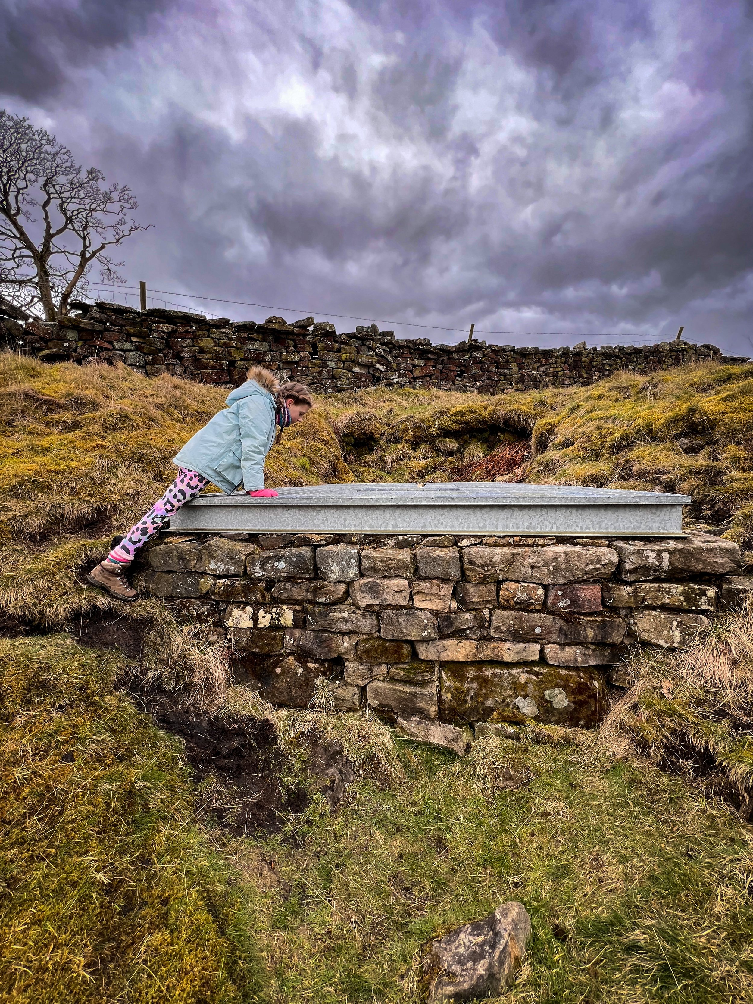
Plus, the walk has a park. A PARK! Yes, it’s a small one, but this village is tiny! Any who doesn’t love swings, a roundabout and a non-descript bouncy thing?!
Oh and now? We have done this walk so many times, that we have got a longer loop for older explorers and a shorter loop for the younger explorers. The longer loop will take you to all the mine workings, whereas the short loop sticks to around half of the ruins. Both still feature the park though!
UPDATE April 2026 - There have been reports of a bull and cows in the field at the start of this walk and that there have been encounters with a farmer. The route as described here is on public footpaths and both the Bewerley Moor and Providence lead mine trails are on open access land. I will be re-walking this to provide an alternative start point but in the meantime, I have amended the start point to avoid the field.

Buy Me a Coffee
Make a Donation
Thank you for taking the time to have a look at my website and for reading this now!
I set up the Reluctant Explorers and maintain the website and attached social media accounts in my spare time, around mum-life and two jobs. It was designed to provide access for parents to free resources to help get more families outside and exploring in nature. These walks have all been created by myself and the kids and we have walked each one ourselves (and re-walk them regularly to keep the information as up to date as we can).
If you would like to support us and can afford a few pennies, you can make a donation to our ‘Buy Me a Coffee’ page. Simply tap the button below to head there!

Walk details for the Greenhow Lead Mines
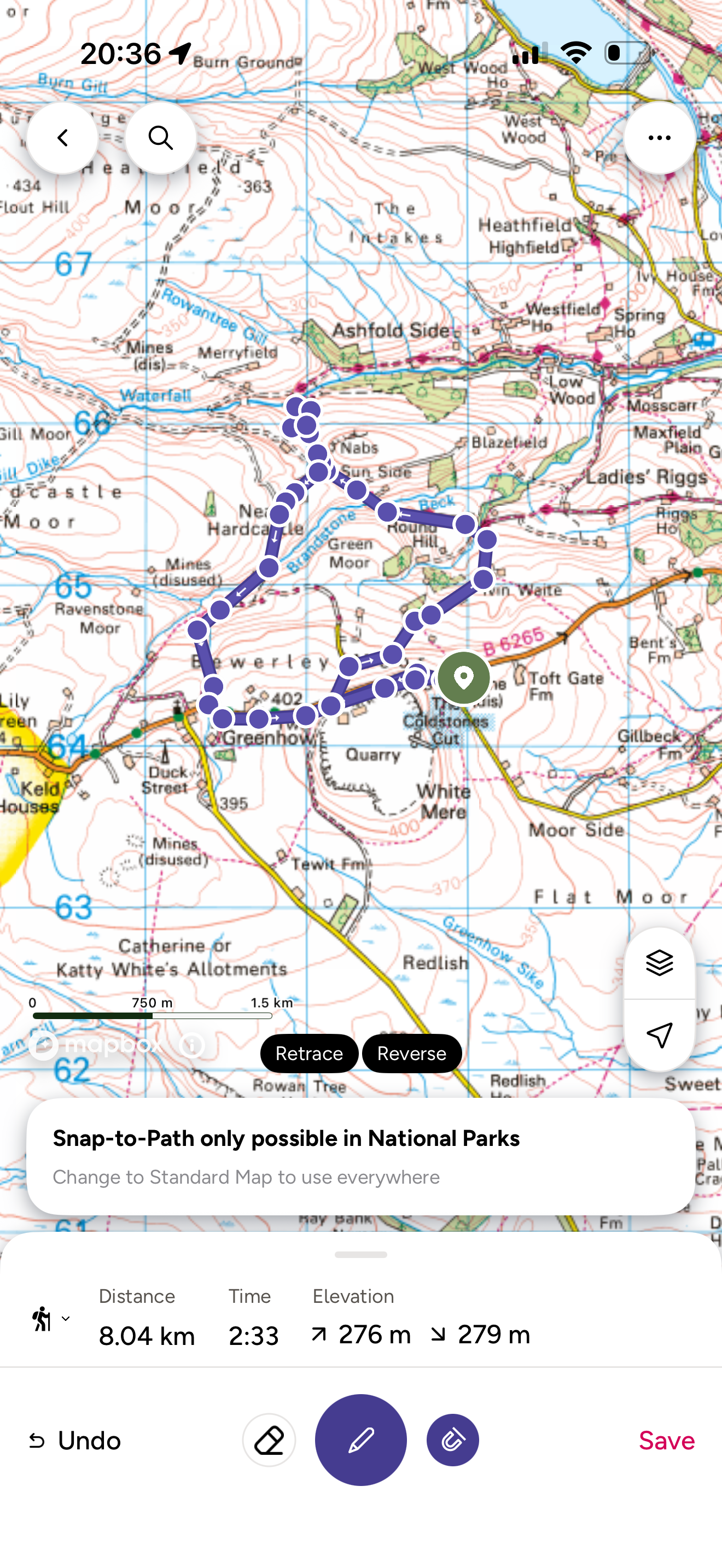
Distance: 4 miles (SHORT) 6 miles (LONG)
Terrain: Very well waymarked. The short route will follow the geology trail, the longer heads round both areas of ruins. There is some ascent, the terrain is often uneven underfoot, but the route is clearly signposted and well walked. Most of this walk is on open access land.
Parking: Coldstones Cut car park.
Public Transport: This walk is not easily accessible by public transport and the nearest bus stop is Pateley Bridge.
Dog Friendly? Yes
Location: Greenhow Hill, just outside Pateley Bridge.
What 3 Words: For the car park: safely.variety.headers
Map: Print off the map from nidderdaleaonb.org.uk or use OS Map OL Explorer 298
Toilets/ Baby Change: No - nearest in Pateley Bridge
Nearest Cafe/ Amenities: Pateley Bridge and Toft Gate Farm Cafe

The remains of the Providence Engine House
How to get to Provident and Prosperous Lead Mines
Directions:
Both the short and longer routes begin in the Coldstones Cut car park. (These are both worth a visit when you get back, check out the details for the Coldstones Cut and Lime Kiln here.) Head out the car park at the wooden Public Footpath signpost that points across the road and cross over to the other side.
EDIT previously, the route began in the field opposite the Coldstone Cuts car park, but now I have amended the route to start elsewhere after multiple reports of there being a bull and cows in the first field, which is a shame as it is the official start of the geology trail! I would instead recommend taking the footpath heading west alongside the edge of the Coldstones Cut quarry and the road until you see a smaller road on your right off of the main one (more or less directly opposite the entrance to the quarry, then walk down this until you reach the first fork to the right. Take this fork for the long route, continue straight on for the short route.
SHORT ROUTE If you want to do the short route, continue straight on along the track (don’t turn right) until you reach a further tarmacked access track. Now turn right and head downhill.
SHORT ROUTE Soon, you see a gate and a stile across the road. Take this, and continue to follow the road around to the left, until you see the mineworks in the distance. Take your time exploring all the waymarked points as they have a lot of information cunningly hidden away on them, and obviously the ruined buildings and shafts (although not inside! They are dangerous, crumbling and definitely haunted!) When you have explored head to point number 14.
LONG ROUTE After reaching the tarmacked track, turn immediately right to start heading downhill, it bends round to the right, so follow that until you reach a few houses. Here the access road turns into a wide grassy track, continuing to head downhill.
After a while, the track narrows and leads to a wooden gate by a wooded area. Head through the gate. The path is waymarked with a public bridleway sign. Continue straight on as the track widens again to an access track to the nearby properties. At the end of the access track, you will see a sign post at the junction. Take the track heading left, signposted Ashfold Side Public Bridleway. This is part of the Nidderdale Way.
Soon after turning, there is a further signpost, indicating the Nidderdale Way and pointing right, follow this sign and the lane as it heads upwards towards another property, passing it, and then continuing straight on. You need to stick on this lane (there are plenty of horse chestnut trees on this stretch!)
Eventually you will reach a bridge over the stream, with a pretty little waterfall on it. Here, cross the bridge and over the cattle grid, heading up the track on the other side and keep heading along the track, as it climbs on the other side. Keep straight on.
On your left in less than half a mile there is a wooden gate with a stile and public footpath signs. This is your return route, but to explore the Provident and Prosperous lead mines, you need to carry straight on. You will soon see a large information board with with the details of all the ruins there. You can take a little circular circuit around the ruins and spoil heaps to find out what’s there. Then head back to the wooden gate and signposts mentioned above.
Now, with the Prosperous and Providence lead mines to your back, turn right, head over the stile (or through the gate) and continue along another stony walled track. It continues up and round to the left before eventually descending to the ruins of another mining area.
You will pass a ruined building on your right, before heading across the ford. In wetter weather you might need to head upstream a bit to cross the beck, otherwise keep on the track and head across the ford.
This area contains more abandoned mine levels and loads more information boards, so explore! (be mindful that this area is dangerous, be aware of warning signs and do not enter the mining tunnels)
BOTH ROUTES Using the stone hut that can be found roughly in the centre of the area, walk down along the stony track, keeping the hut on your right. The track splits, take the left most track which heads more or less straight on.
You will see a yellow marked waymarker on your left. Here keep left on the stony track that begins to climb and bend round to the left. there’s a further information board ahead of you. On the post of the information board, there is a yellow waymarker, pointing up and left. Follow this. The stony track bends round and upwards, then appears to split into two again.
On the crest of the hill above there is another information post visible, The path here turns into a grassy one, and heads upwards and slightly left from the stony track. Head to this info board, there is another waymarker visible at the foot of this path.
At the next information post, continue up along the grassy path. There is another waymarked post up ahead visible on the horizon. This points to the left, so follow the grassy path round to the left and head across a dilapidated dry stone wall.
The path heads steeply up a moundy grassy hill to a stile. This takes into a little new(ish) tree plantation. Head through the trees, and through the grassy mounds ahead. The path here winds back into Greenhow, where after heading up a few steps and passing through a metal gate, you will end up back on the road again. Turn left here and stick to the footpath. The tiny park is a little way up the road on the left.
The path follows the edge of the road until just after the graveyard on the left. Be careful here, as the path follows the vergeside, which whilst is well maintained and off road, it does follow the side of the road closely, so be careful. You are only on the road for a short distance though until you reach the national speed limit signs.
At this point, you’ll see a metal gate on your right, which skirts around the bottom of the Hanson Quarry. You need to carefully cross this road, it is busy. On the opposite side, head through the gate and turn left. After crossing the entrance to the Hanson Quarry, this path leads you back to the car par
Last walked September 2023
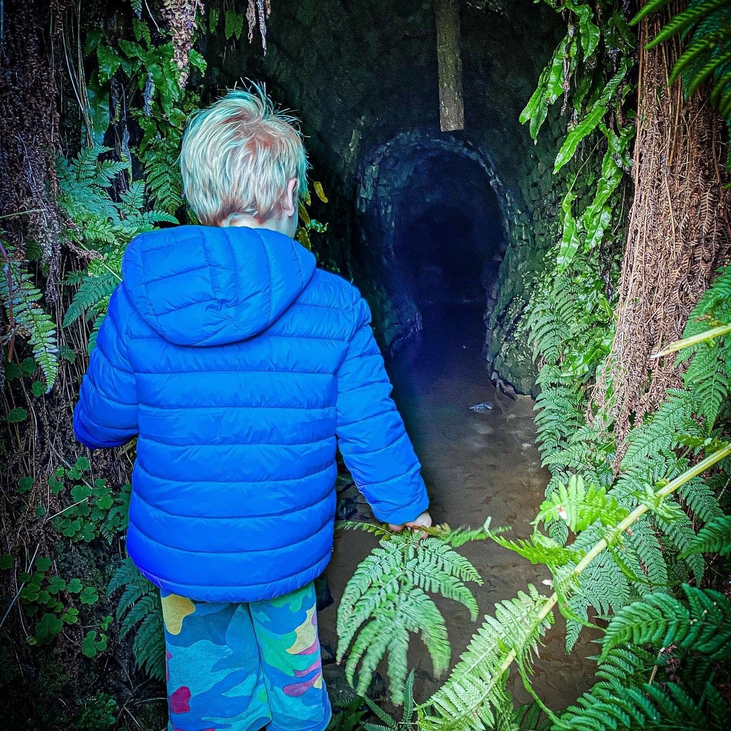
Peering into the entrance of the Cockhill level (do not enter, it is not safe and you’ll get ridiculously wet feet!)
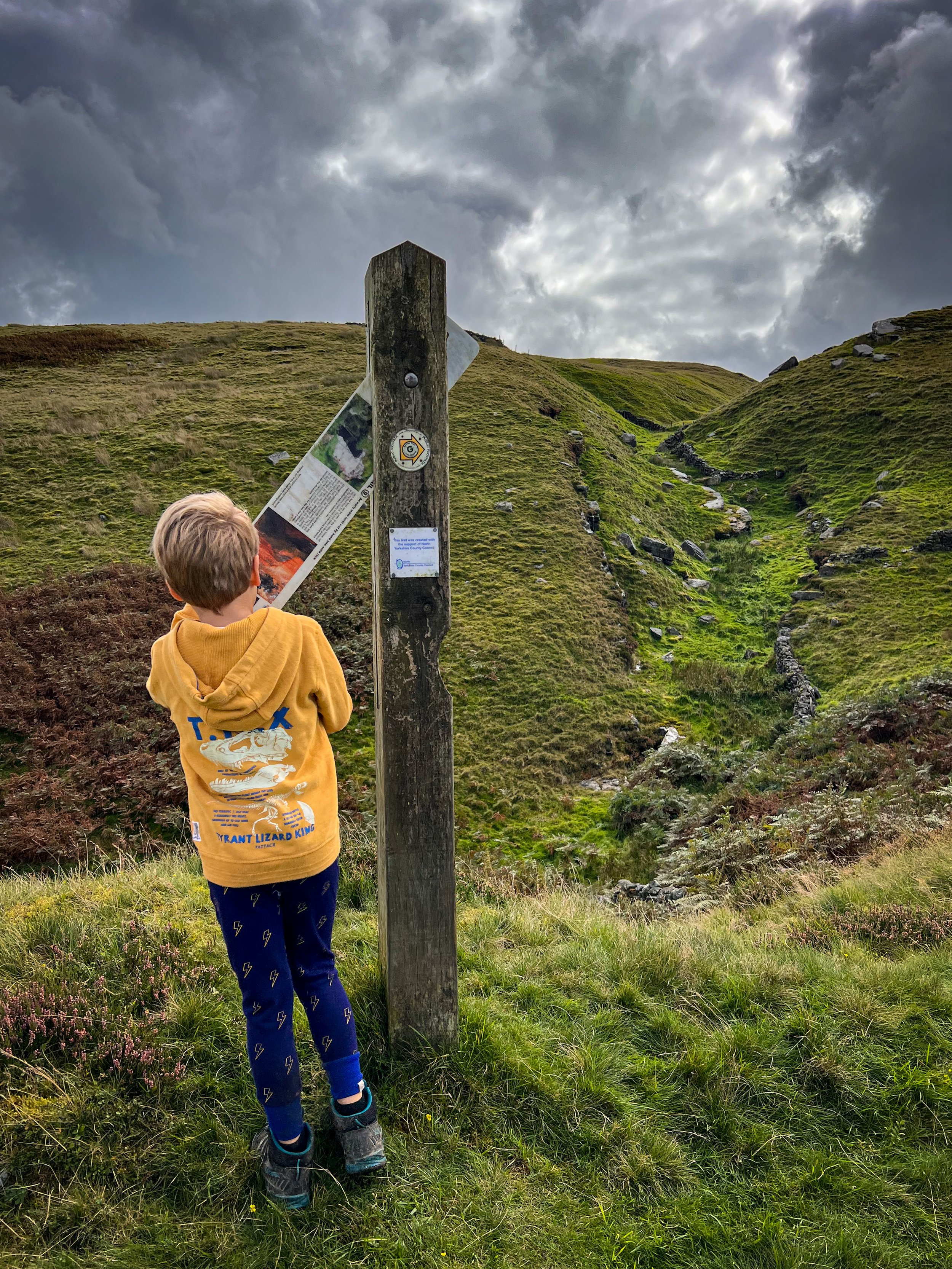
Checking out the information board at the Jack Ass Level.
Peering into the Providence Mine Shaft

Reading the information board at the Prosperous and Provident mines

Examining one of the ruins of the lead mining trail

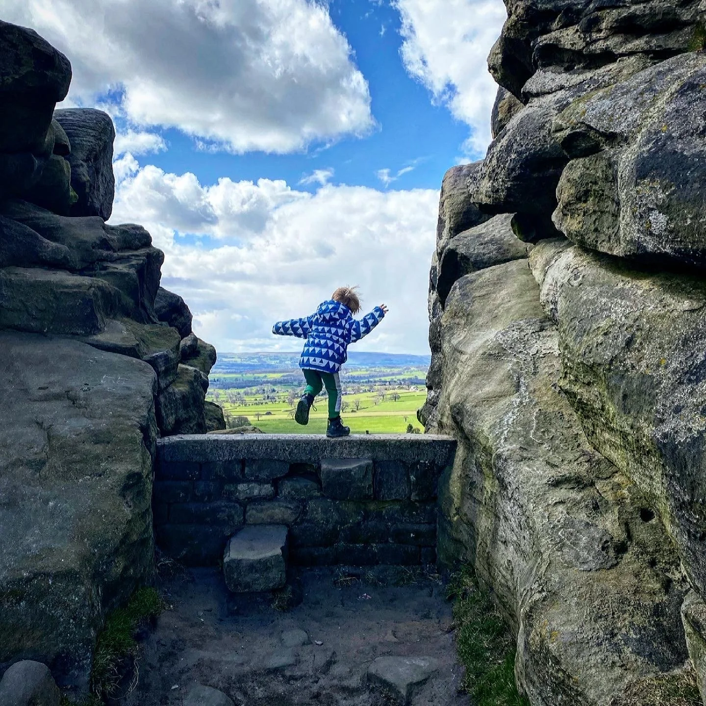
Jumping with views of Nidderdale behind

Crossing the beck at the mine trail
What’s cool for kids on this walk?
✨ This walk is oozing with history! The lead mining industry thrived in the Dales back in the 1800’s, and it is thought that the mining of Greenhow could have dated back to Roman times. If this kind of history really floats your boat, then head over to Grassington for the lead mining trail there, or to Buckden Pike, where you can find the remains of the lead mine there, before the industry collapsed in the late 1800’s. Check out the Buckden Pike route here. Journeying further north? Then check out Gunnerside in Swaledale…. see? Lots of mining!
⛏ Still want more Geological marvelry? Then Stump Cross Caverns is located just down the road from Greenhow village. The stunning show caves there were actually found by lead miners in the area, and were then opened up to the public. They are DEFINITELY worth a visit. Check out the details of our visit to Stump Cross Caverns here!
👻 Of COURSE there’s a ghost story about a labyrinth of abandoned Victorian mine shafts! It’d be rude not to! The story goes that the sounds of the lead mine come back to life after dark, the scraping of metal on rock, the dragging of the mining carts across the metal tracks, heard from deep from within the hill….. you can read more Yorkshire Dales Ghost Stories on the blog!
🌳 So many weird and wonderful things to see here but if you need a hand to boot out the walking whinges, then why not try one of our walking games?

Want to grab the route?
Head to the Ordnance Survey shop to grab an Ordnance Survey Explorer 298 map of Nidderdale.
Image is Copyright of Ordnance Survey
Affiliate link as an Ordnance Survey champion
Helpful Information!
Head to our dedicated safety and information page.
⭐ We hope you enjoy our walks, but please exercise common sense as routes can change with the weather conditions and seasons! The routes have been walked by our own two feet, but you know your own limits. Always take a back-up map, don’t rely on GPS alone, wear appropriate clothing for the weather and take adequate snacks and refreshments with you (although as a parent, I know you already know that bit!)
⭐ Leave no trace! Take nothing away and leave nothing behind, take all rubbish home with you.
❗ Obviously, mine shafts and abandoned levels are dangerous and should not be entered.


Heard of the Toft Gate Lime Kiln?
Well even the CAR PARK is cool on this walk! Because not only will you get the ruins of the Greenhow Lead Mines, the start point for this walk is the car park for the Toft Gate Lime Kiln and the Coldstones Cut modern art installation.
So why not tag these onto the end of the walk?
Scroll using the arrows for all our Family Friendly Walks
-
![Swimming in Janet's Foss Yorkshire Dales]()
Waterfall Walks
-
![Malham cove walk for kids]()
Pushchair Friendly
-
![Pinhaw Beacon trig point walk near Skipton]()
Peak Bagging Walks
-
![The Park at Greenhow Nidderdale]()
Walks with Play Parks
-
![Gordale Scar in Malham Yorkshire Dales]()
Organised by Location
-
![Walking in the woodland in Wensleydale]()
Woodland Walks
-
![Playing on the shore of Embsay Reservoir Yorkshire Dales]()
Reservoir Walks
-
![The ruins of Bolton Abbey]()
Bolton Abbey Estate Walks
-
![Leaping over the stile at Almscliffe Crag]()
Walks Under 2 Miles
-
![Child walking into a pub in Appletreewick]()
Walks with Pubs and Cafes


Follow us for up to date Outdoors Adventures!
We live and BREATHE the Yorkshire Dales outdoors life!
BEEN INSPIRED? Tag us @reluctantexplorers
Come follow our journey over on Instagram and Facebook where you’ll find up to date walk info, breaking news on Yorkshire Events, new Yorkshire Dales wild swim spots, climbing, caves and more!


Follow us on Social Media for all the up to date info: @thereluctantexplorers

Leave No Trace
The Yorkshire Dales is our home, and the home of so many others who care deeply about this beautiful space.
Should you visit, make sure to:
Take home anything you bring, leave no rubbish behind.
Make the world a better place by picking up any rubbish you see, even if it isn’t yours.
Leave everything else as you found it.