

Gunnerside Gill
Gunnerside Gill is located in Swaledale and is the home of the ruins of a once thriving lead mining area.
Now, you’ll find a ghost town of ruins reclaimed by nature, abandoned mine shafts, machinery and waterfalls.
An adventure of epic proportions!
Have you heard of Gunnerside Gill?
If you want to feel like a real explorer then this is the walk for you, but I am not going to beat about the bush, whilst this version is family friendly, it is long. It was the first longer walk that my two did, and it took us AGES. But they loved it! I KNOW! I was shocked too.
Gunnerside is a scheduled monument in the heart of Swaledale, one of the northernmost Dales in the Yorkshire Dales. It is essentially what remains of a huge mining operation, which was in full swing back in the late 1700’s early 1800s. Lead mining was BIG business around the Dales, which is why you’ll see the beautiful landscape strewn with abandoned mining tunnels, buildings and spoil heaps across the entirety of the national park.
But whilst nature slowly reclaims these abandoned places, what is left is a fascinating insight into what the Dales was like. Far from the peaceful and quiet countryside we are used to, Gunnerside will have been filled with the noises of industry. The walk will quite literally have you stepping into history.
So that’s you sorted, what about the kids?!
Well, pack up your full snack arsenal, the kids are going to need it to get around this one, although with abandoned ruins, waterfalls, paddle spots and more, this one has PLENTY to keep the family entertained!
Check out the details below!

Buy Me a Coffee
Make a Donation
Thank you for taking the time to have a look at my website and for reading this now!
I set up the Reluctant Explorers and maintain the website and attached social media accounts in my spare time, around mum-life and two jobs. It was designed to provide access for parents to free resources to help get more families outside and exploring in nature. These walks have all been created by myself and the kids and we have walked each one ourselves (and re-walk them regularly to keep the information as up to date as we can).
If you would like to support us and can afford a few pennies, you can make a donation to our ‘Buy Me a Coffee’ page. Simply tap the button below to head there!
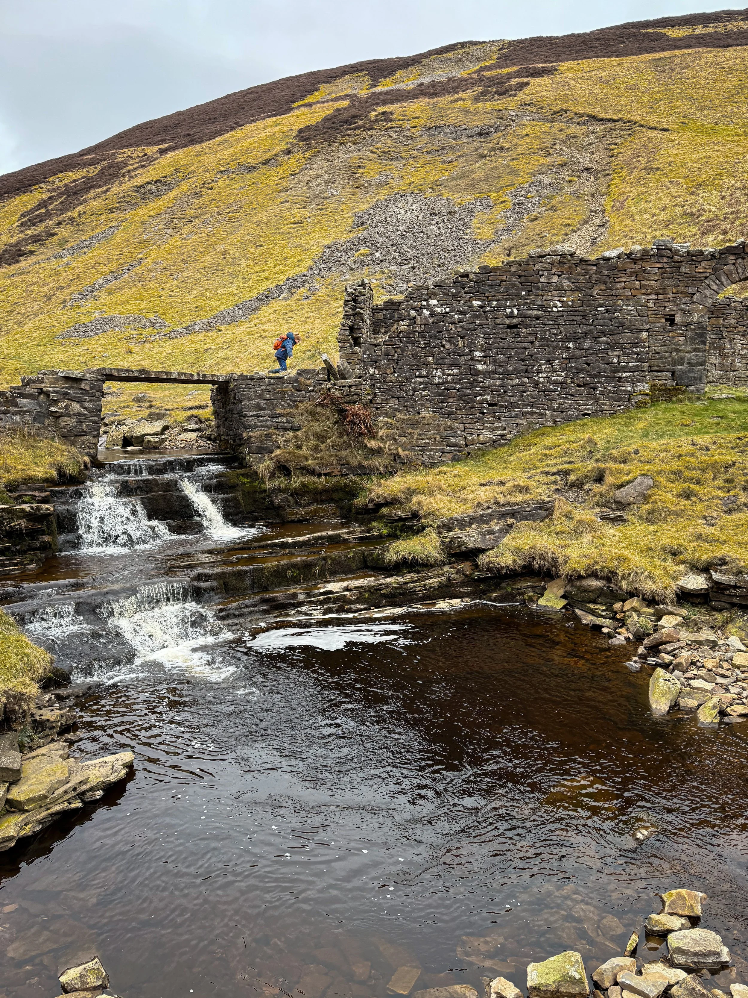
The stone bridge over the beck. This is the furthest point if you’d rather avoid the part with unguarded drops.
Walk Details for Gunnerside Gill
Distance: 6-8 miles upwards (this will vary dependant on how much exploring you end up doing)
Terrain: A varied terrain. Some steep ascent, mostly easily identifiable paths and tracks. There are some steep unguarded drops (but this can be avoided if desired). This walk is on access land where you have the right to roam.
Parking: Honesty box car park at Gunnerside - cash only.
Public Transport: there is a bus service that runs to Gunnerside, but this is subject to a seasonal timetable, so check out the Dales Bus website for more information.
Dog Friendly? Yes but be aware that this walk is full of abandoned tunnels, and ruins. We have encountered cows on this walk too.
Location: Gunnerside, Swaledale (North Eastern Yorkshire Dales)
Map: OL30 Northern and Central Yorkshire Dales affiliate link as an Ordnance Survey champion
What 3 Words: nicer.tenders.requests (main ruins)
Toilets/ Baby Change: There are no public toilets, but there is a pub located in Gunnerside.
Nearest Cafe/ Amenities: Gunnerside for pub/ cafe. Reeth and Muker are nearby too.

Walking into the ruins of Gunnerside Gill for the first time aged 6
How to walk the Gunnerside Gill circular
Directions to be used alongside a map
Beginning at the Gunnerside honesty box car park, use the village hall/ institution as your start point and head directly up the grassy hill opposite the front entrance. The Old Smithy (which dates back to 1795 - and is still working!) is on your right and there is a gate in the drystone wall ahead. Head through this and go straight on. You will be walking steeply up a grassy hill. The wall will be to your right for a short distance, then you will begin to bear left, moving further and further away from it. Continue to follow this path until it reaches the main stony track, at which point, bear right.
You will stay on this track for 1.5 miles (ignoring any offshoots down to the edge of Gunnerside Beck at this point). At Botcher Gill Gate, the road heads around to the left, following the contour of the gill. The track goes through a gate, and you will see a waterfall in the depths of the gill. It’s pretty, but sadly not accessible, so appreciate from a distance! The track continues over the beck, and up the other side. You will soon see a signpost on your right pointing ‘public footpath and public bridleway’. You need to follow the public bridleway sign.
The path continues around the edge of the gill and will slowly descend to the footbridge and a hub of lead mine ruins - pictured above. You will pass North Hush (hushing is an old lead mining technique of using flooding or torrential water to reveal the mineral veins, it has left scars on the landscape that are visible to this day) and as you head down to the footbridge and waterfall, here you have an option.
Option 1 (avoiding steep unguarded drops and narrow paths) You can cut the walk a little short here, and trim off half a mile off by simply jumping to step 6. Option 2 (better for more confident explorers) Or you can continue a little further up the gill for another waterfall and ruin. For the latter, you need to head on the path that continues along the left hand side of the gill. It is narrow, and it has steep drops to your right. Below you, you will see a waterfall and you need to cross the water above this after around a quarter of a mile. There are more ruins to explore on the far side of the gill, and when you have, head back along the eastern side of the gill, until the ruins and footbridge appear again. Now take the offshoot path, that winds steeply back down to the footbridge and waterfall, there are steep drops here too, so if in doubt, just stick to the main area.
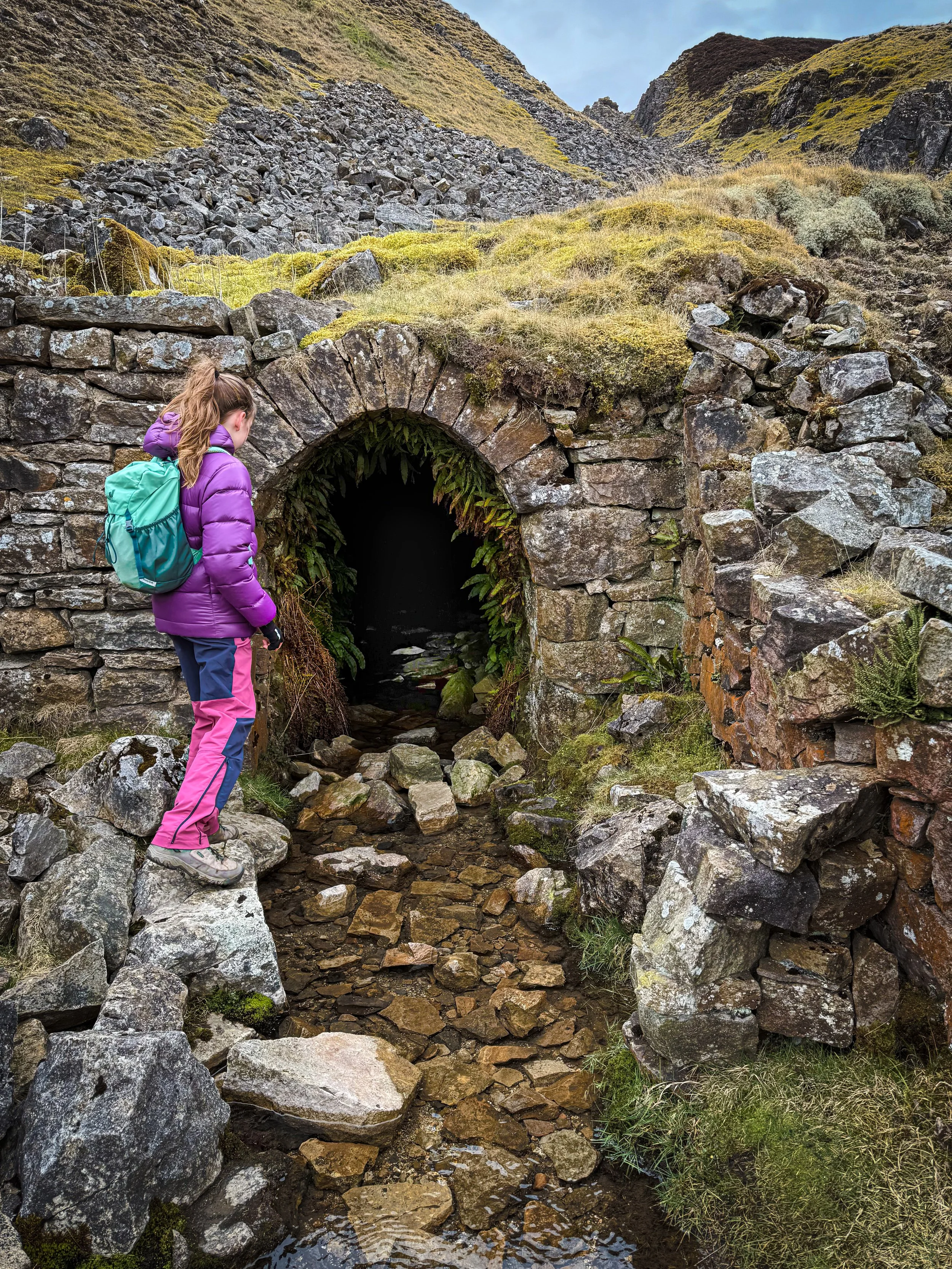
Head to the far end of the ruins of Blakethwaite Smelt Mill (you will be able to find this using the information board that’s attached to the side) and take the little stone steps that descend from there to a narrow footpath heading along the edge of the water of the beck. After about a quarter of a mile, the path ascends the scree of the Friarfold and Gorton Hushes, but you can take a detour briefly to the opposite side of the beck to go and explore the entrance to the Priscilla Level which has an abandoned mining cart outside it (this is fun to see!)
Back on the rising path, you will eventually see the cairns at the ruins of the Bunting Level, which was the main access to the workings on the east side of Gunnerside Gill. There is a signpost pointing to Gunnerside, along a wide stony track, and this is your route. Head south along the track until you reach another large stony cairn. Here, there is a waymarker. You need to take the right fork, labelled public footpath, which will take you downhill to more ruins. After passing through a stone stile in the wall, you will see the ruins of the old mine shop on your right. You need to cross the beck to reach this, and further up, to find the Sir Francis Level.
Once explored, head back across the beck to the path and continue along the eastern side of the Gill, keeping the water to your right.
You will shortly see the ruins of the Sir Francis Dressing Floor on your left and then continue along the path into Birkbeck Wood. At all times the path is clear and easy to follow and is well walked and way-marked. Keep the water to your right all the way back towards the village of Gunnerside. After around a mile, you will reach the buildings of the village. The path heads around the back of a building, then through a gate. At the end of that path, descend the steps, turn left along the track and head back into Gunnerside.
Last walked March 2025

The Priscilla Level

The cairn at the ruins of the Bunting level
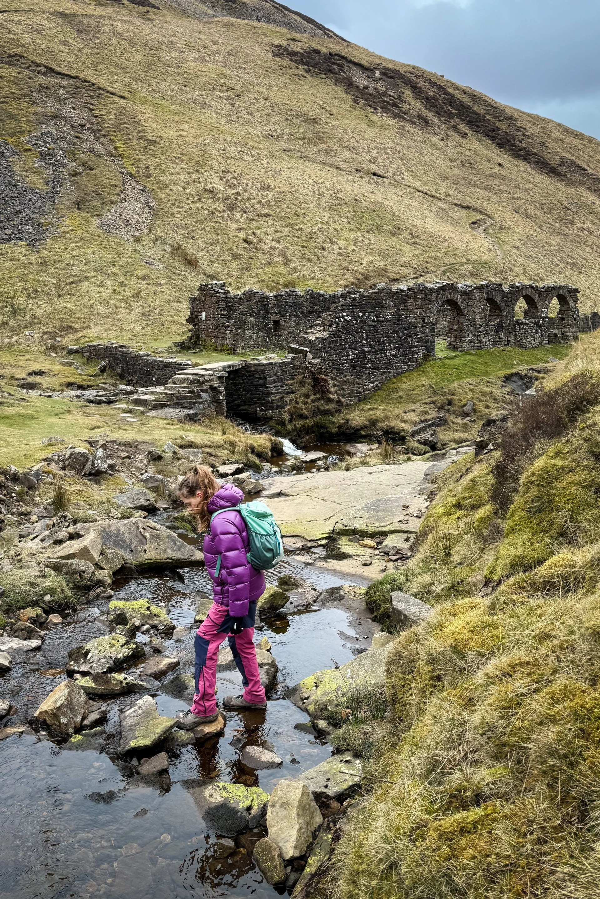
The ruins of the Blakethwaite Smelt Mill
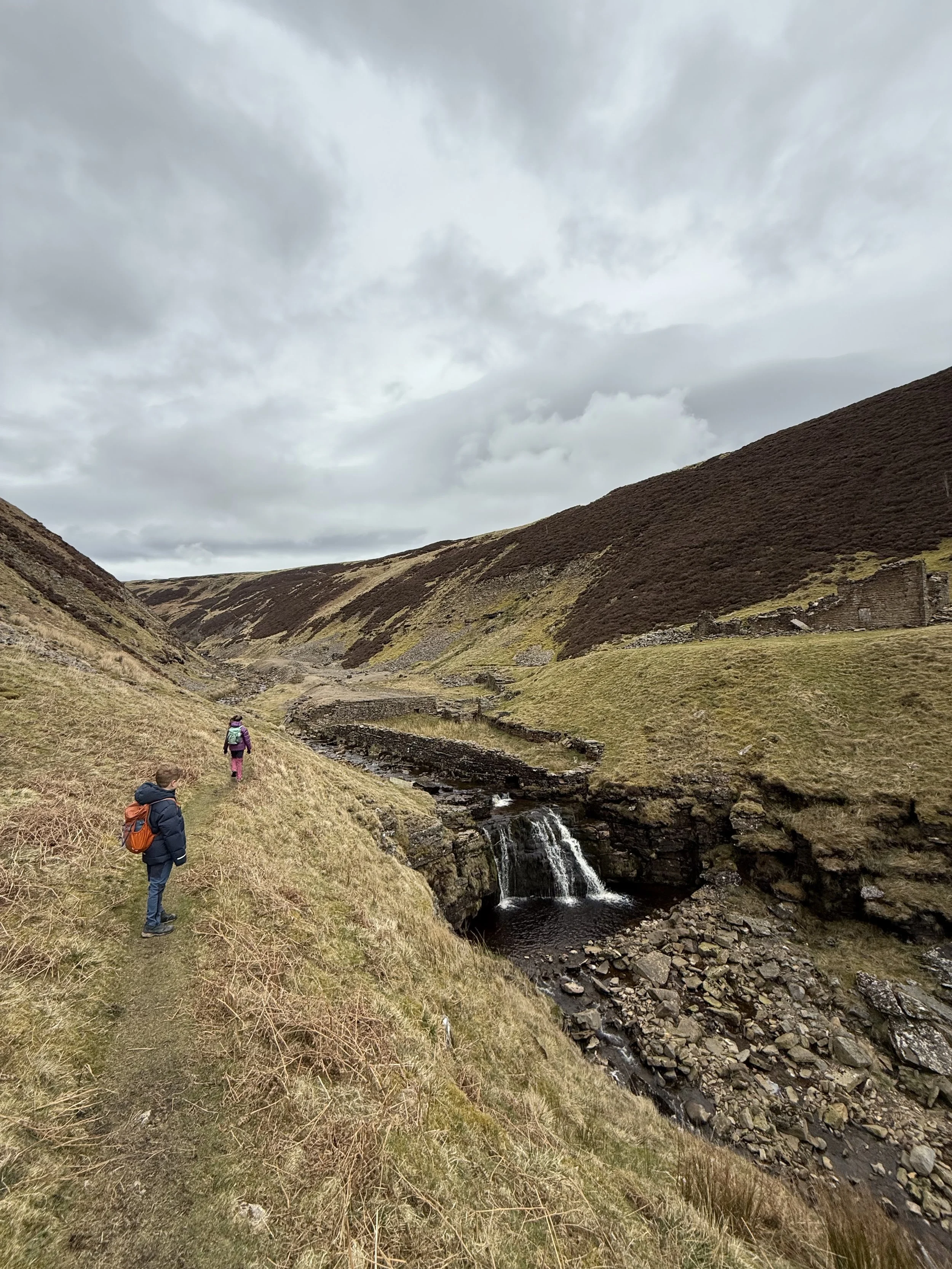
The waterfall on the upper part of the walk (that you can opt out of)
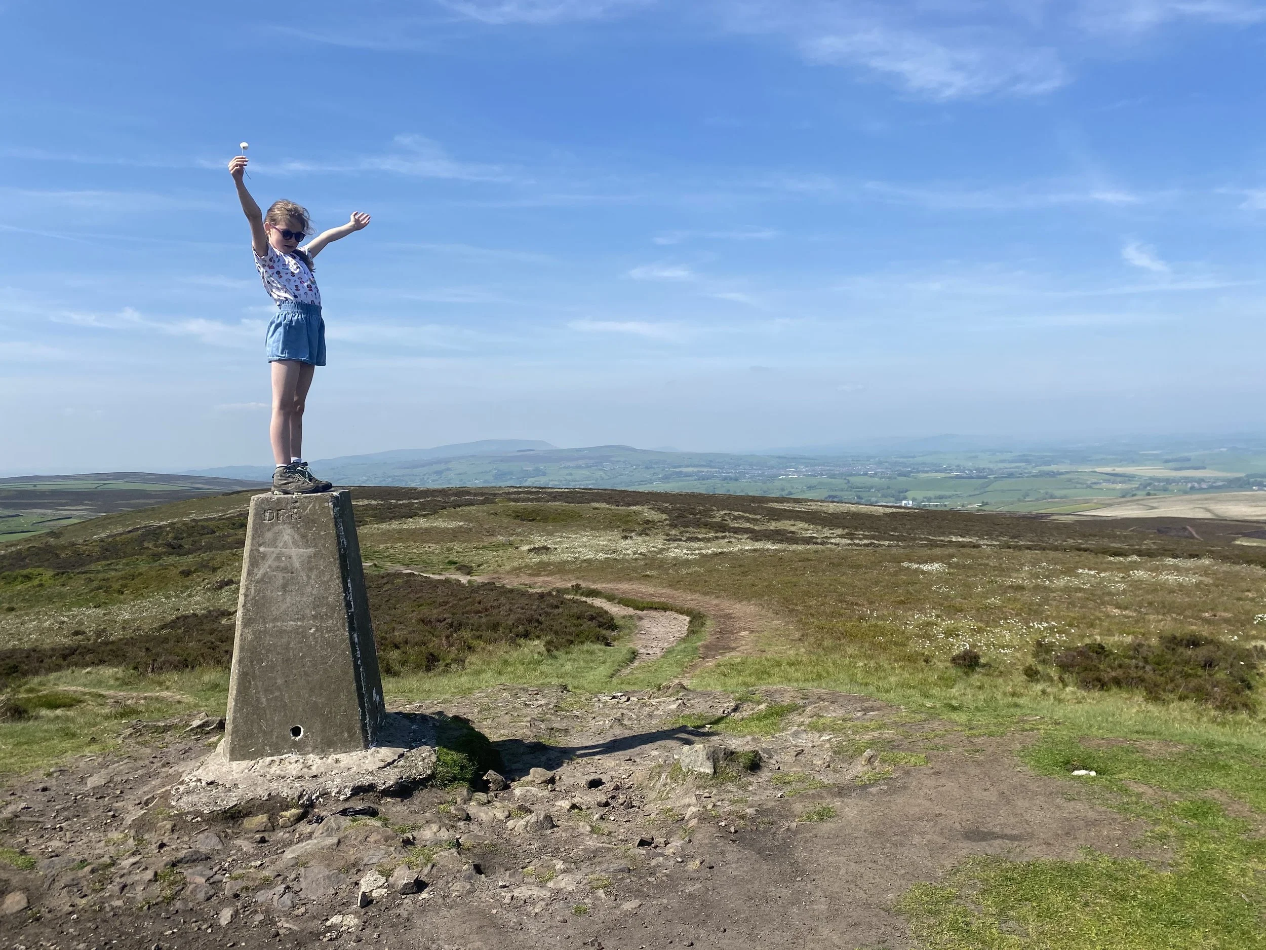
The Ilkley Moor trig point
What’s cool for kids at Gunnerside Gill?
💦 Waterfalls and paddle spots! At the footbridge there is an excellent waterfall with pool underneath it, which is easily accessible for little ones (and big ones who may prefer more of a dip!) This bit of the walk is a popular stop off spot for those walking the Gill (although, not nearly as busy as some of the other watery wonders in Swaledale, probably due to the 8 mile round trip to get to it!) Be aware that wild water can be dangerous, can be cold and can be fast flowing after heavy rain. Never EVER dive into a pool that you don’t know the depth of, and this one felt far too shallow for jumps. Dips and paddles at best! Check out our wild swimming with kids blog for more safety information and links to great resources to find out more.
🏰 Super cool ruins. There are loads of info boards up all around the ruins of Gunnerside Gill, so check those out, and check out the ruins! There are some tunnels to peer in (although we do not recommend entering without knowledge and specialist equipment), and loads to provoke the imagination. So cool, with history in spades!
📚 Speaking of history, here’s a brief potted history. The lead mining industry began working there in the 1700’s finishing in the late 1800’s when the industry declined in the area. The remains of the buildings are scheduled monuments, and represent some of the best preserved mining buildings in the area.
🍻 Enjoy a pint at the Kings Head pub, which is located right at the end of this walk.
🧒 If you need a little help with the walking whinge factor, why not try one of our whinge busting walking games! Like this little photography game that we played with toy llamas!
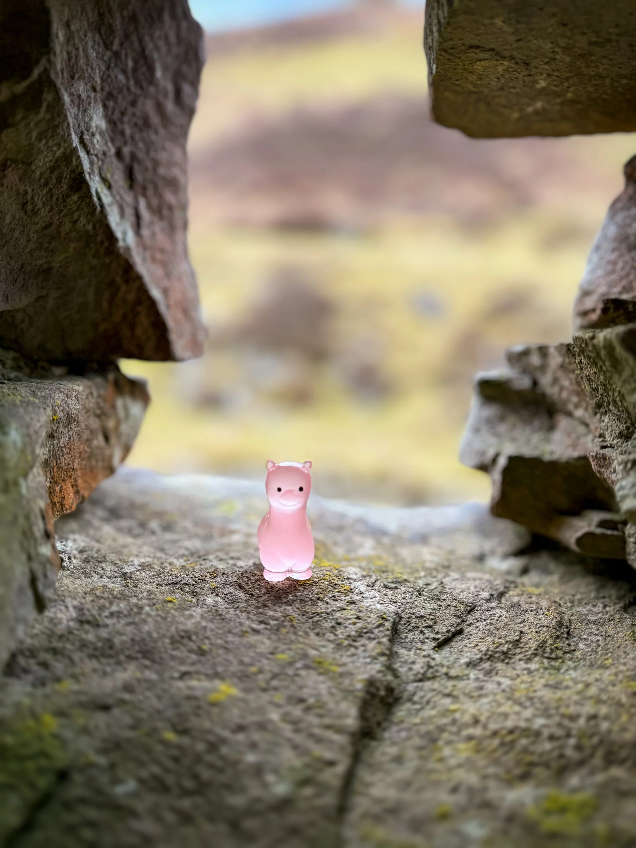
A cheeky little photography game with tiny toy llamas!
Helpful Information!
⭐ We hope you enjoy our walks, but please exercise common sense as routes can change with the weather conditions and seasons! The routes have been walked by our own two feet, but you know your own limits. Always take a back-up map, don’t rely on GPS alone, wear appropriate clothing for the weather and take adequate snacks and refreshments with you (although as a parent, I know you already know that bit!)
⭐ Leave no trace! Take nothing away and leave nothing behind, take all rubbish home with you.
⭐ If you choose to paddle, be aware of bio security. Always wear clean dry water shoes (if worn) to avoid cross contamination of species between watercourses, this is a particular issue in the Yorkshire Dales, to help protect the white clawed crayfish.
⭐ If you decide to paddle, be aware that wild water can be dangerous, and water levels will vary season to season. Always supervise children around water. Check out the safety information on the Royal Life Saving Society website.
⭐ Old mine shafts are dangerous and can be prone to collapse. Do not enter the tunnels.
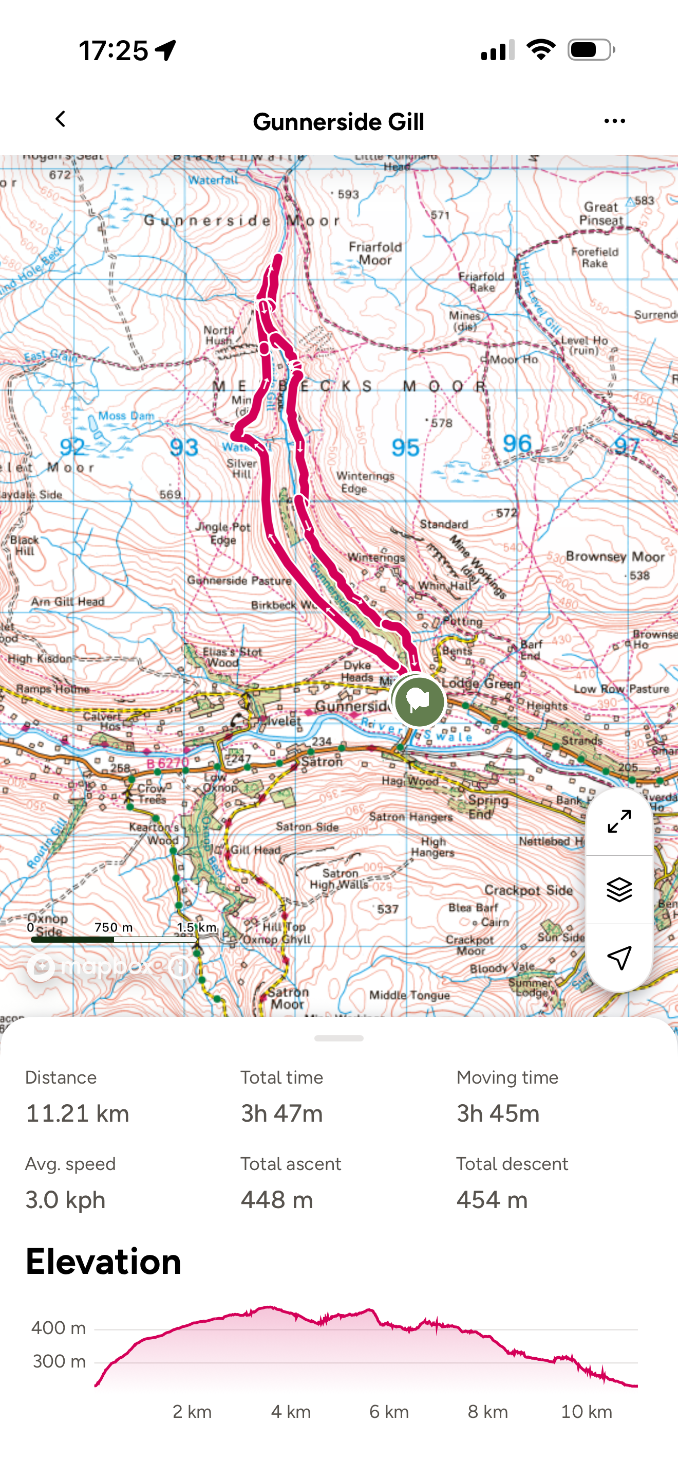
Want to grab the route?
You will need an Ordnance Survey OL30 Explorer map for this walk. Grab one from the Ordnance Survey online shop!
If you have the Ordnance Survey app, then download our route by tapping the button below! (If you don’t we thoroughly recommend you do!)
(Always carry a back up map and know how to use it)
Image is Copyright of Ordnance Survey
(Affiliate Link as an Ordnance Survey Champion)
Staying in the Swaledale area?
We have a Visit with Kids guide to provide you with all the family friendly inspiration you need! Think family friendly walks, local attractions and importantly, where to find the ice cream (and the play park!)
We have a dedicated guide for families staying in Hawes and Wensleydale, so why not check it out!
Scroll using the arrows for all our Family Friendly Walks
-
![Swimming in Janet's Foss Yorkshire Dales]()
Waterfall Walks
-
![Malham cove walk for kids]()
Pushchair Friendly
-
![Pinhaw Beacon trig point walk near Skipton]()
Peak Bagging Walks
-
![The Park at Greenhow Nidderdale]()
Walks with Play Parks
-
![Gordale Scar in Malham Yorkshire Dales]()
Organised by Location
-
![Walking in the woodland in Wensleydale]()
Woodland Walks
-
![Playing on the shore of Embsay Reservoir Yorkshire Dales]()
Reservoir Walks
-
![The ruins of Bolton Abbey]()
Bolton Abbey Estate Walks
-
![Leaping over the stile at Almscliffe Crag]()
Walks Under 2 Miles
-
![Child walking into a pub in Appletreewick]()
Walks with Pubs and Cafes





Follow us for up to date Outdoors Adventures!
We live and BREATHE the Yorkshire Dales outdoors life!
BEEN INSPIRED? Tag us @reluctantexplorers
Come follow our journey over on Instagram and Facebook where you’ll find up to date walk info, breaking news on Yorkshire Events, new Yorkshire Dales wild swim spots, climbing, caves and more!


Follow us on Social Media for all the up to date info: @thereluctantexplorers

Leave No Trace
The Yorkshire Dales is our home, and the home of so many others who care deeply about this beautiful space.
Should you visit, make sure to:
Take home anything you bring, leave no rubbish behind.
Make the world a better place by picking up any rubbish you see, even if it isn’t yours.
Leave everything else as you found it.