Malham Tarn Circular
Did you know that Malham Tarn is the highest limestone glacial lake in England?
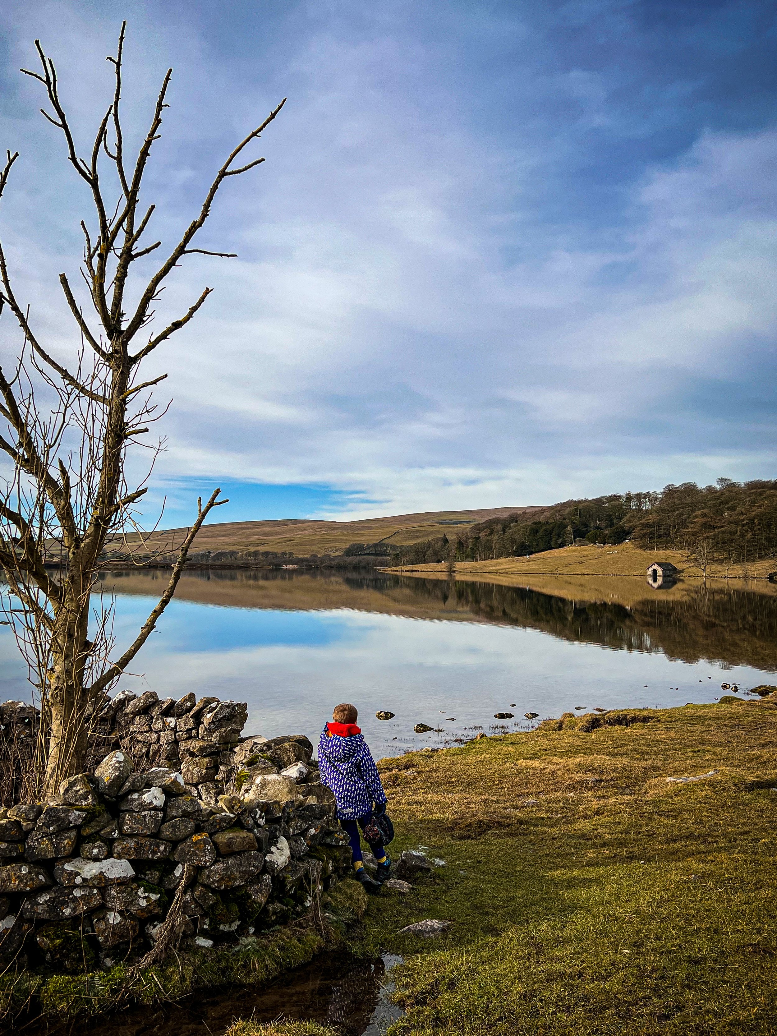
This circular walk is beautifully accessible and is flexible too. You will get outstanding views across the surrounding moorland and fells, a nature reserve, sculptures and more!
Can you walk all the way around Malham Tarn?
YES! Yes you can. This walk around Malham Tarn is one of our absolute favourite walks in the Malham area and is 100% suitable for all your walking desires! It’s one of the most adaptable walks there is, it can be shortened, it’s wheelchair accessible as part of the Yorkshire Dales miles without stiles scheme and pushchair accessible in parts, it has opportunities for bird watching, learning all about the seasonal changes to the landscape and wildlife in the nature reserve, sculptures and more!
There is a short loop accessible to the nature reserve on the boardwalk (also sturdy pushchair accessible), or a super long route that takes in the Smelt Mill Chimney and Water Sinks too. You could even make a middle sized version too, dependant on how you feel on the day!
See? I do love a walk that gives you OPTIONS!
Buy Me a Coffee
Make a Donation
Thank you for taking the time to have a look at my website and for reading this now!
I set up the Reluctant Explorers and maintain the website and attached social media accounts in my spare time, around mum-life and two jobs. It was designed to provide access for parents to free resources to help get more families outside and exploring in nature. These walks have all been created by myself and the kids and we have walked each one ourselves (and re-walk them regularly to keep the information as up to date as we can).
If you would like to support us and can afford a few pennies, you can make a donation to our ‘Buy Me a Coffee’ page. Simply tap the button below to head there!
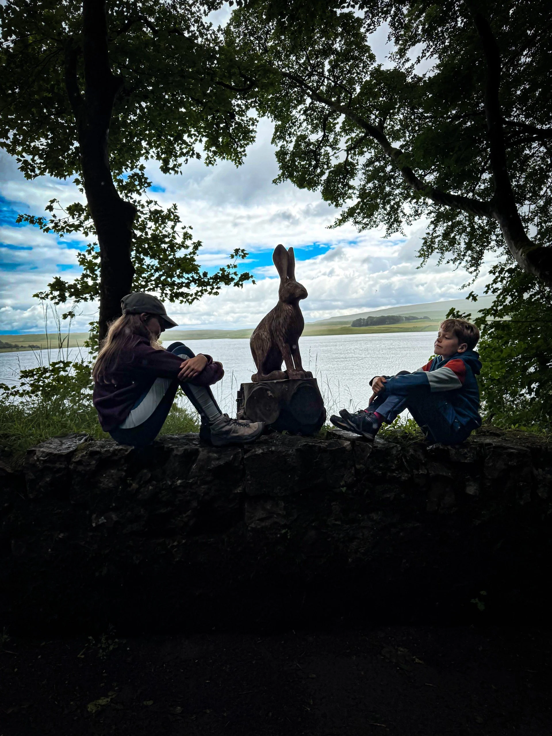
One of the nature sculptures at Malham Tarn
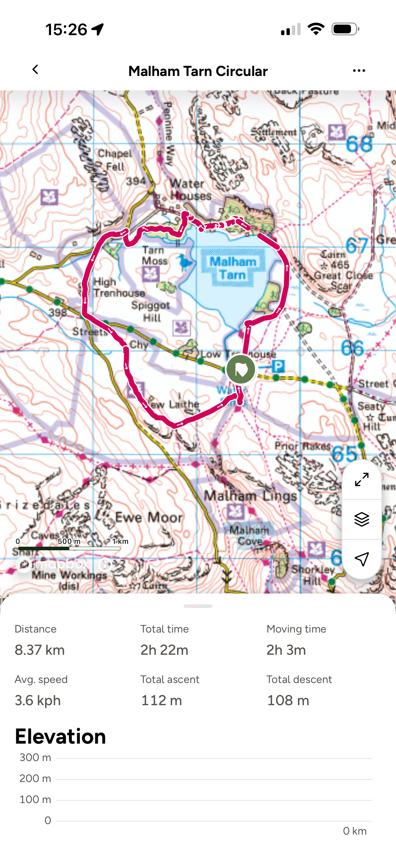
Walk details for Malham Tarn Circular
Distance: Full Distance: 5 miles Short Cut: 4 miles Nature Reserve less than 2 miles.
Terrain: A combination of well surfaced tracks, wide grassy paths, boardwalk, and some road walking (less if you do the full route) Mostly well walked and well signposted and maintained paths. The final section (on the longer version) is less easy to navigate and isn’t as well walked although way-markers are present.
Parking: National Trust Honesty Car Park at Water Sinks OR alternative parking is available at Water Houses (this is the car park for those wishing to do only the nature reserve or borrow an all terrain wheelchair from Malham Tarn House (National Trust Centre)
Public Transport: No. Malham is serviced by buses, but not the Tarn. Check out the bus timetable on the Dales Bus Website for more information as to where is bus accessible.
Dog friendly? Not entirely. Dogs are not allowed on the nature reserve, although it is possible to miss out this part by continuing on to Home Farm in Water Houses and then turning left along the track there. There are often grazing cows too on sections of this walk.
Wheelchair Access Info: This walk is a miles without stiles walk in part. For details about borrowing an all terrain wheelchair, check out Access the Dales. There is one availabe to borrow from the Malham Tarn field centre.
Location: Malhamdale, Yorkshire Dales National Park South
Map: OS OL02 Ordnance Survey Explorer Map affiliate link as an Ordnance Survey champion
What 3 Words: Water Sinks Car Park: startles.botanists.fellow Water Houses Car Park: cold.graduated.sundial
Toilets/ Baby Change: Nearest is Malham Yorkshire Dales Centre
Nearest Cafe/ Amenities: Malham for pubs and cafes.
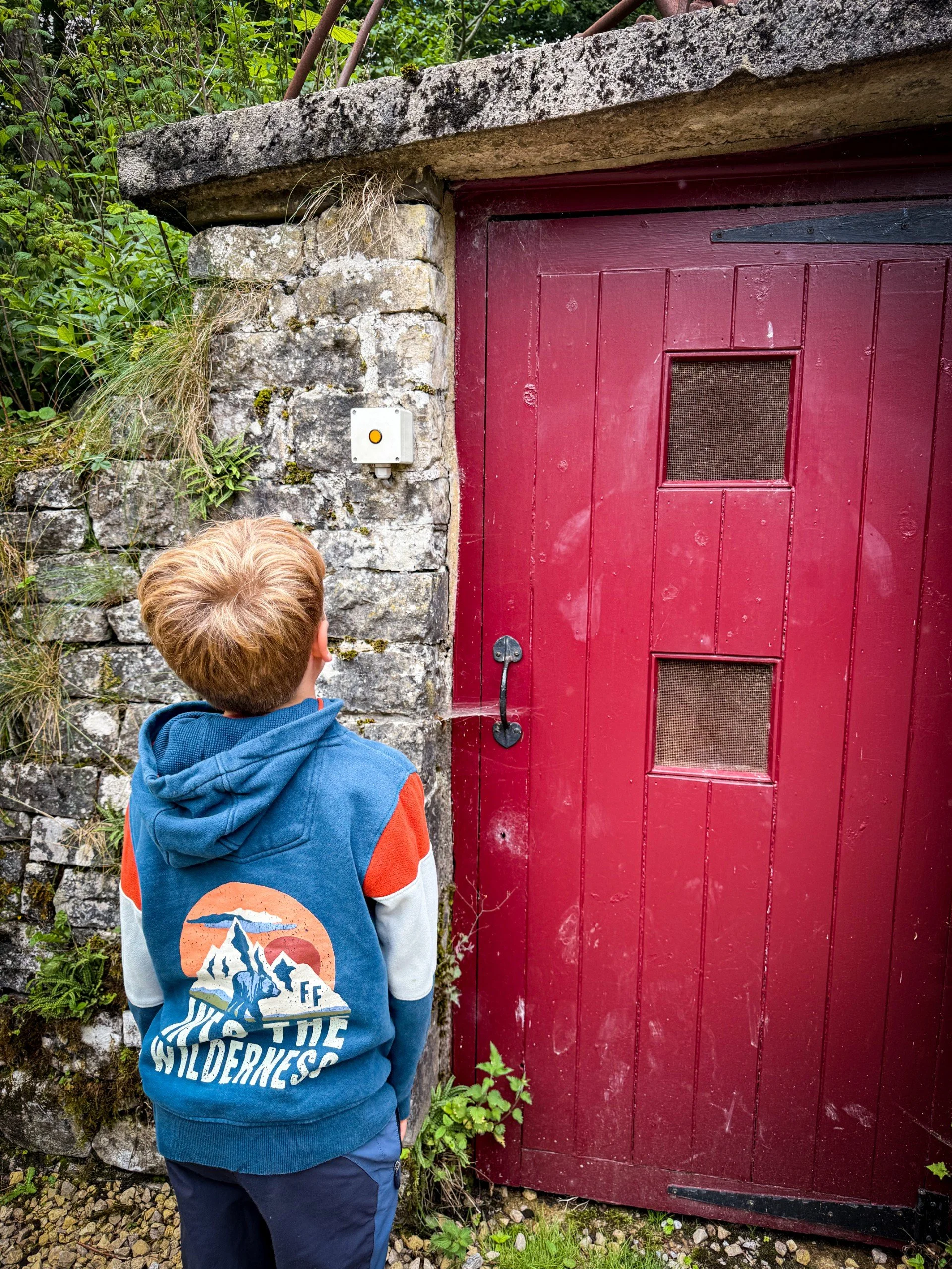
The Cave Spiders’ house at Malham Estate

The outflow at Malham Tarn
How to walk around Malham Tarn
Directions to be used alongside a map
Heading out of the Car Park there are two major grassy paths, the bridleway (that is the accessible one) and the one that heads down towards the edge of Malham Tarn. The bridleway heads diagonally rightwards, heading away from the car park (with it behind you). The other path heads down to the water’s edge and is a bit muddier.
Both paths eventually meet at the edge of the small tree plantation at the wide surfaced track that leads up to the Malham Tarn Estate Field Centre. There is a signpost here saying Pennine Way pointing left through the gate. Head through the wide access gate which has a National Trust sign next to it.
Continue along the track as it heads past the tarn (on your left). It will reach another set of gates, one wide that heads over a cattle grid, one narrow footpath gate. Head through these.
The track heads upwards towards the field centre and then heads rightwards around the back of the house. Follow the track around the back of the centre passing the cave spider house (pictured) and then keep on it as it bends to the left, then right, heading downhill on the access track with rocky gorge-like sides.
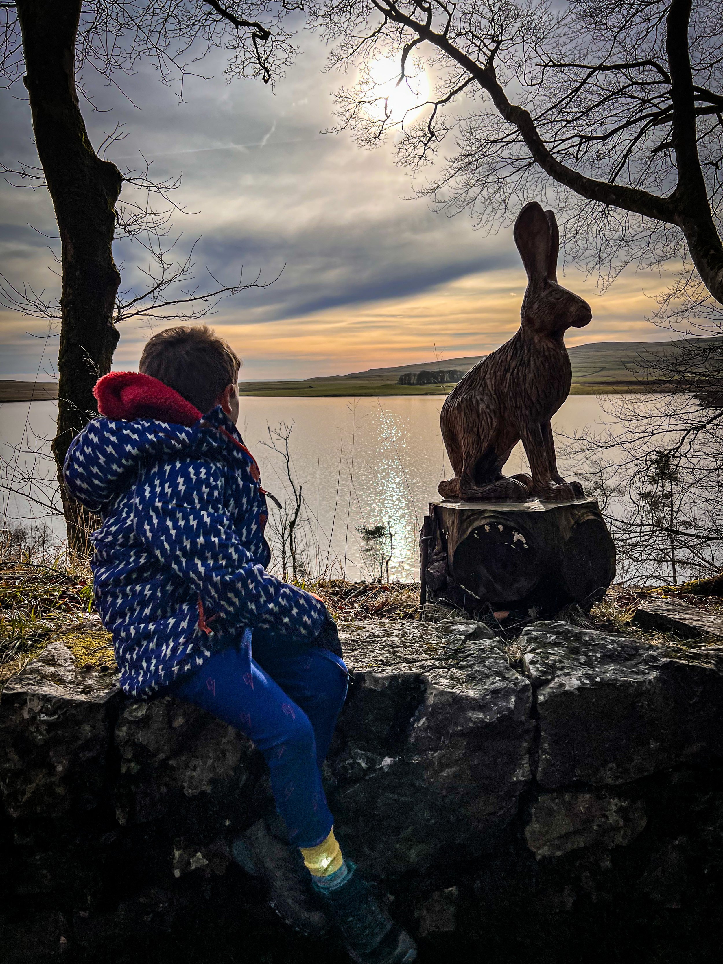
Here you will encounter nature themed chainsaw sculptures that line the road as it heads away from the field centre, there’s a viewing station, then later on a bird hide that you can go and birdwatch from.
Keep heading down the track until you reach the final sculpture, which is a hawk. Here, if you have a dog, continue straight on to Home Farm, then turn left on the permissive track heading back in the direction of Malham. Skip to point 8. If you do not have a dog, you can enter the nature reserve which is accessed through an iron gate on the left. It is signposted National Trust Malham Tarn National Nature Reserve.
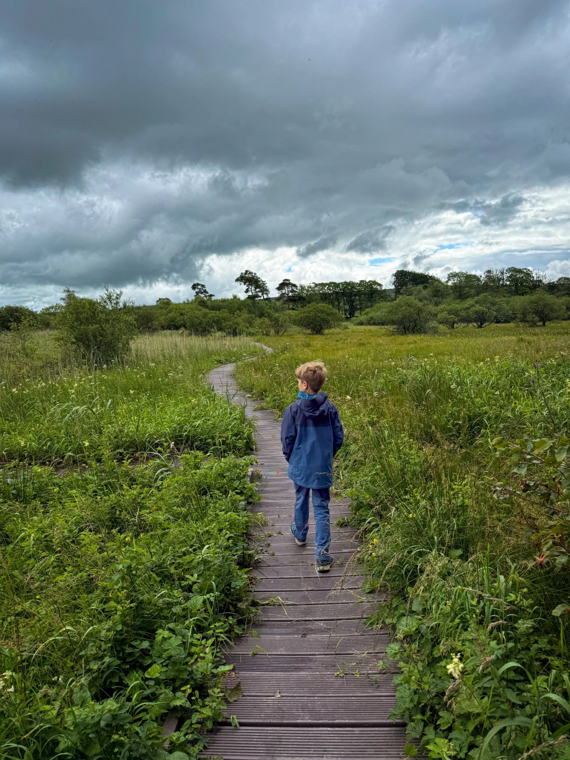
Here the path is a little narrower, but still well surfaced and it will lead you to the duckboards that wind their way around the nature reserve. There are plenty of information boards here to check out, so make sure you do!
Here the instructions are easy. Follow the duckboards! They will lead you eventually out of the reserve and back onto the permissive stony track that heads across from Water Houses. Head out the gate and turn left. Welcome back dog owners! You will pass the nature reserve gate on your left.
Hi those who just want to do the nature reserve bit! There is a car park here at Water Houses, you need to head out of the car park, turn right along the road, and then left onto the stony track. After a short distance you will see the information board and signpost for the nature reserve. Enjoy!
Back to those in it for the long haul! After turning left out of the nature reserve gate, continue on until the track meets the road and then keep heading straight on from here. This is your road walking section so be mindful of cars!
Soon, the road splits into two. You will want to take the left road, which is the quieter of the two in terms of traffic. Follow it up as it passes High Trenhouse and then joins the Stainforth/ Malham Road.
SHORT CUT! If you’re flagging a bit, here you can simply turn left and then walk along the road taking you past Low Trenhouse Farm and then eventually on to the car park you started at. This section is all road walking, so be mindful of the cars.
If you still have enough energy (and Haribo) to keep going, then this little extra bonus section will take you up to the Smelt Mill Chimney and then onto Water Sinks (check out more info about those places below) This adds about another 1 mile onto your walk and there is a little gentle ascent too. It follows one of the the Malham Tarn trails and is waymarked (although some were in need of repair when we went and this is certainly not as easy to navigate as the rest of the walk so far!)
At the cross roads, cross to the other side of the road, where there is a stile visible in the fence, with the smelt mill chimney in the field behind it.(There is livestock in the field so be aware if you have dogs). Continue on to the chimney where you can see the remains of the flue in the ground.
Pass the chimney, keeping it behind you and then continue across the grassy field towards the waymarker post ahead of you. The grassy path leads you gradually uphill towards the corner of the drystone wall. Where there is another waymarker.
Continue along the edge of the wall (keeping that to your left). It will reach a stone stile in the dry stone wall ahead. Cross this.
Continue straight on along a grassy lumpy bumpy path which has limestone embedded in it. You will have views towards Malham Tarn on your left as you head along. As a rough guide, the path runs roughly parallel with the direction of the road (which you will see at a distance) although admittedly it is not greatly clear! Never fear though, you are on open access land!
Keep your eyes peeled for another waymarker post ahead. It appears into sight when you are roughly in line with Low Trenhouse Farm at a distance on your left. It is ahead and a little to your left, continue towards this then down the hill to a large wide track, which heads left through a large gap in the wall. It is signposted Public Bridleway.
Follow this to the beck. If you want to, you can go and see what is essentially the giant plughole ‘Water Sinks’ which is where the water that flows out from Malham Tarn disappears completely into the cave systems below. To see this, turn right and follow the beck until it LITERALLY disappears. It depends on how much rain there has been previously as to how dramatic this is, so make a judgment call based on the whinge factor!
Continue along the clear path back to the road, turn right and head back to the car park!
Last walked Feb 2023- Part walked July 2025.

The duckboards around Malham Nature Reserve are pushchair and wheelchair friendly
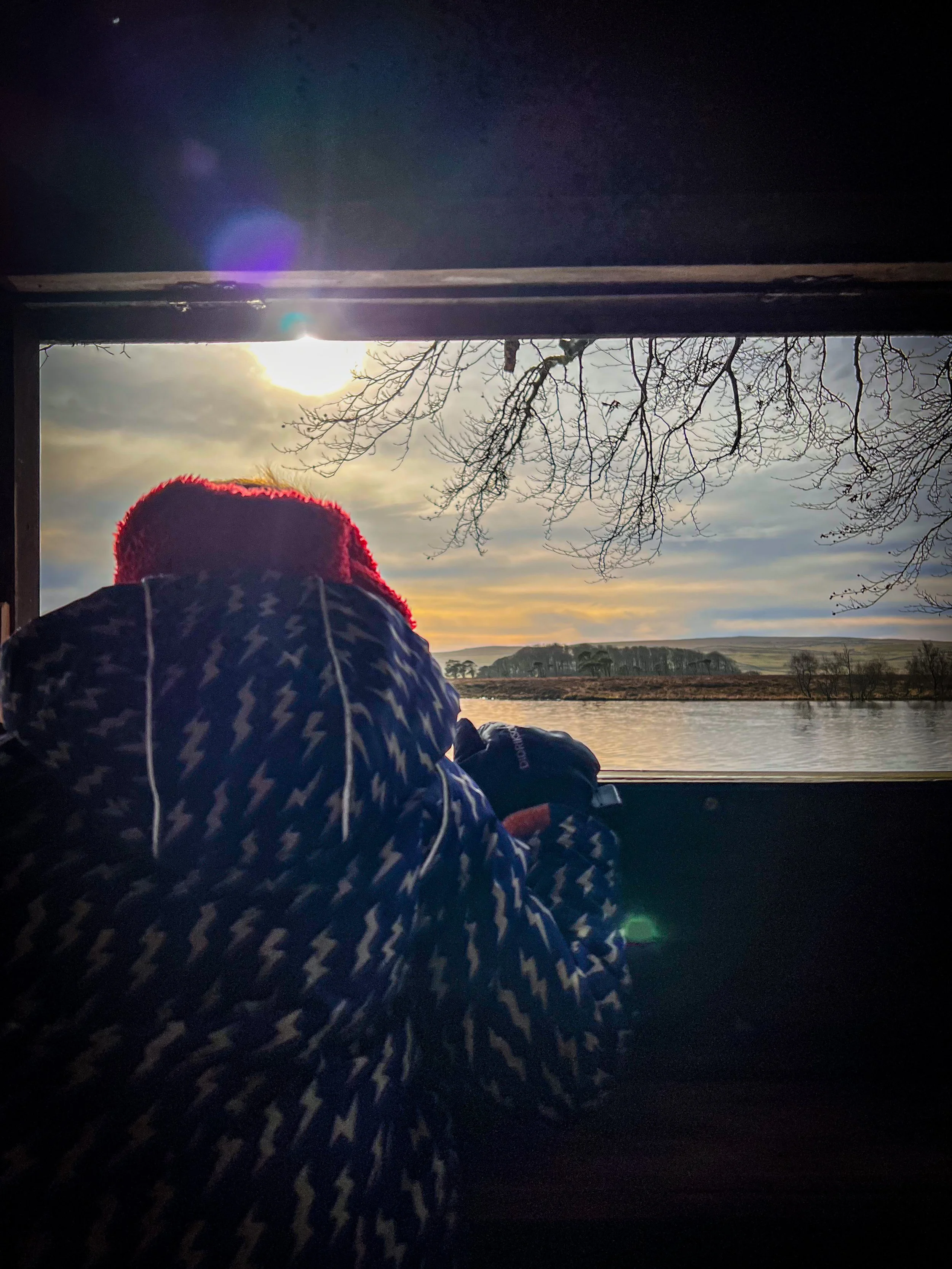
Looking out from the Bird Hide

The smelt mill chimney
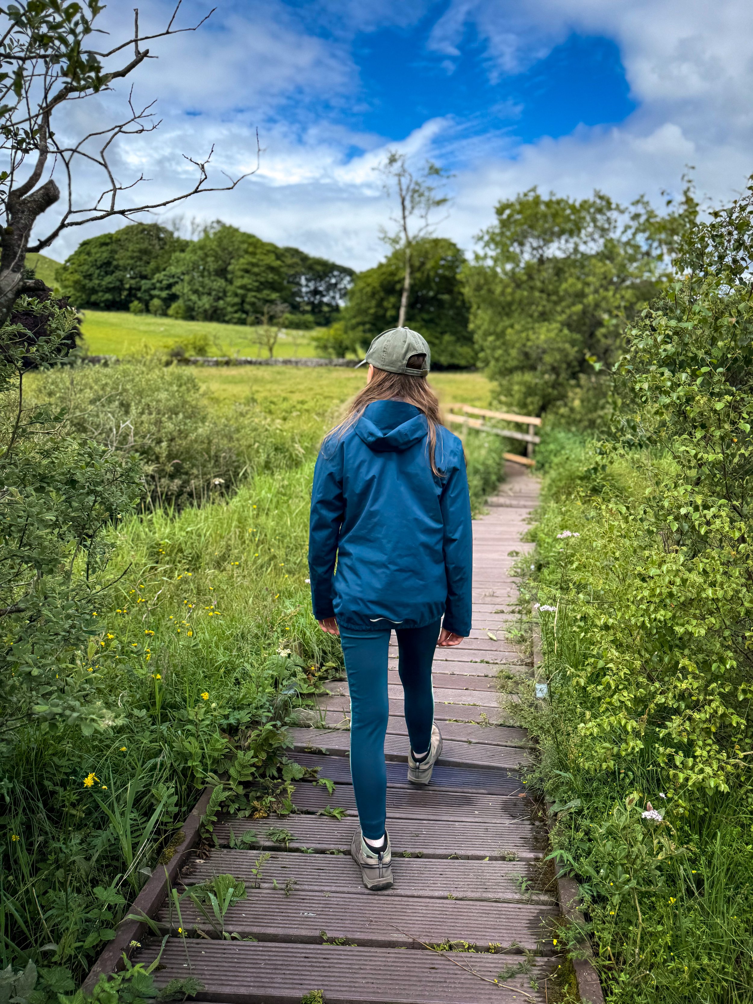
The nature reserve boardwalk in summer when it’s full of exciting stuff to explore!
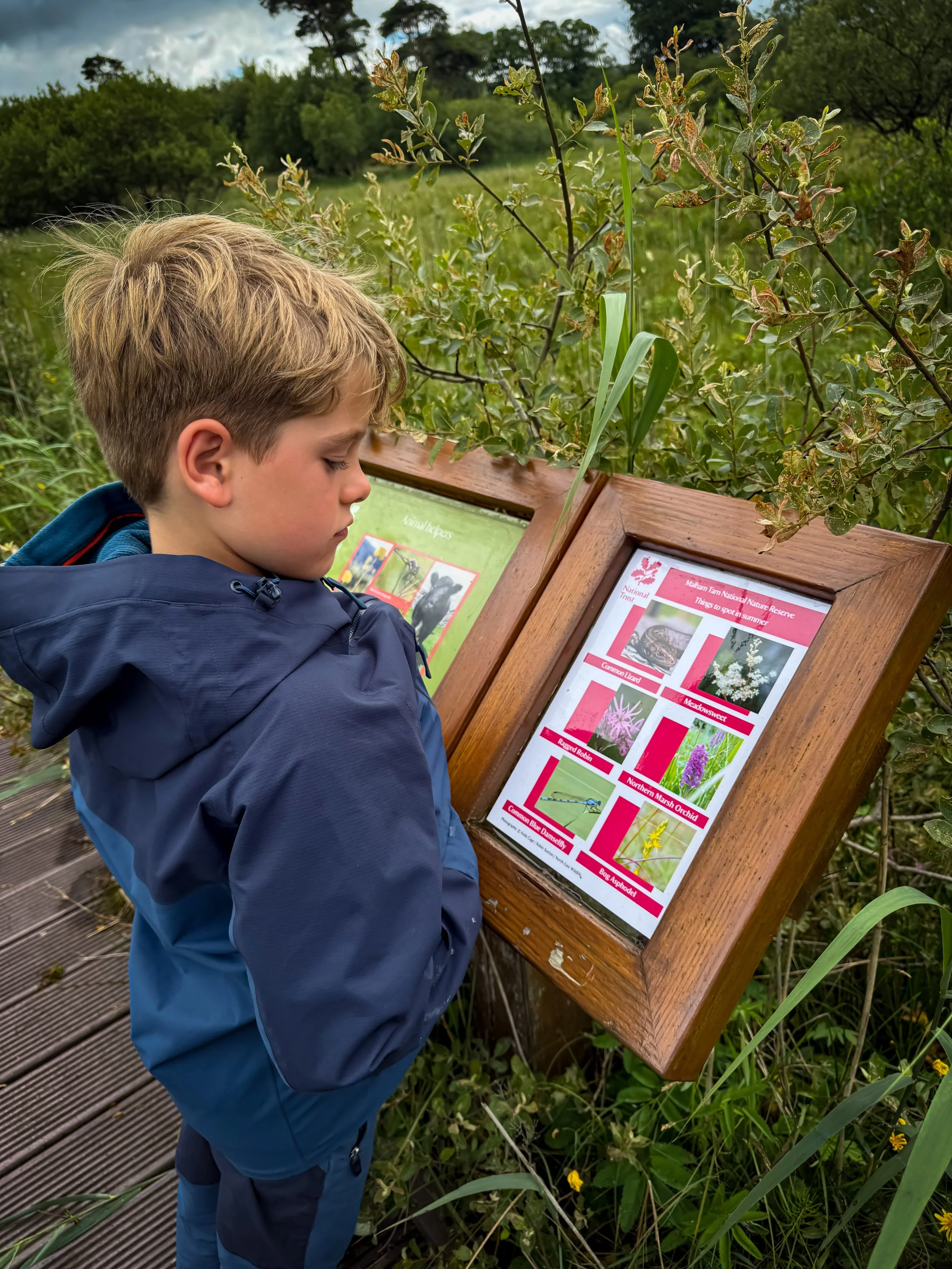
Looking at one of the seasonal information boards on the nature reserve.
The Malham tarn chainsaw sculptures in summer.
Want to grab the route?
You will need an Ordnance Survey OL02 Explorer map for this walk. Grab one from the Ordnance Survey online shop!
Or if you have the Ordnance Survey app, you can grab the route by hitting the button below!
(Always carry a back up map and know how to use it)
Image is Copyright of Ordnance Survey
(Affiliate Link as an Ordnance Survey Champion)
Helpful Information!
For more helpful information head to our safety tips and advice page.
⭐ We hope you enjoy our walks, but please exercise common sense as routes can change with the weather conditions and seasons! These walks are intended as a guide only and are undertaken at your own risk. The routes have been walked by our own two feet, but you know your own limits. If in doubt, turn back. Always take a back-up map, don’t rely on GPS or your phone alone, wear appropriate clothing for the weather and take adequate snacks and refreshments with you (although as a parent, I know you already know that bit!)
⭐ Leave no trace! Take nothing away and leave nothing behind, take all rubbish home with you.
⭐ Malham Tarn is a SSSI and is not a place for swimming or launching a paddleboard or kayak from.

What’s cool for kids on this walk?
✨ Want to know about Water Sinks? I like to think about it as a gigantic plughole! Essentially the water that flows out from Malham Tarn only heads a few hundred metres before it disappears into the complex cave systems that exist below. Contrary to popular (and logical!) belief, the water does not in fact reappear at the bottom of Malham Cove, but at Aire Head, which is south of Malham and in fact the origin of the River Aire.
🐞 Malham Tarn is a designated SSSI and conservation area and is a safe haven for the white clawed crayfish, which is a species under threat from alien invaders! The field centre is the home of biology and geology students who study the area. If you’re lucky you might be able to spot a whole array of birds and animals, perhaps even deer.
🏰 The Smelt Mill Chimney is hundreds of years old and is a relic of the smelt industry. Lead, Copper and Zinc Carbonate were mined on nearby Pike Daw and the metal was processed at the smelt mill. The flue led to this chimney (which you can still see today) and was emitted through the chimney (source: National Trust)
💦 NO SWIMMING OR PADDLING! Malham Tarn is protected and as I mentioned above is an SSSI. As such, the water is off limits in its entirety. Did you know that it is largest natural Lake in North Yorkshire and the highest limestone lake in England?
🌳 Do you want to beat the walking whinge? Well there are plenty of sculptures to spot, or you might fancy some bird spotting. But if not, why not try one of our walking games? Or you can download a free scavenger sheet!

More Malham walks please?
Malham is admittedly one of the busiest parts in the Yorkshire Dales, but it does have a lot of beautiful places, which is why we have a whole page dedicated to Malham walks.
TOP TIP: Malham gets extremely busy in the Summer months, if you want to avoid the crowds, pay a visit outside of peaks times and peak season. It is beautiful all year round.
Scroll using the arrows for all our Family Friendly Walks
-
![Swimming in Janet's Foss Yorkshire Dales]()
Waterfall Walks
-
![Malham cove walk for kids]()
Pushchair Friendly
-
![Pinhaw Beacon trig point walk near Skipton]()
Peak Bagging Walks
-
![The Park at Greenhow Nidderdale]()
Walks with Play Parks
-
![Gordale Scar in Malham Yorkshire Dales]()
Organised by Location
-
![Walking in the woodland in Wensleydale]()
Woodland Walks
-
![Playing on the shore of Embsay Reservoir Yorkshire Dales]()
Reservoir Walks
-
![The ruins of Bolton Abbey]()
Bolton Abbey Estate Walks
-
![Leaping over the stile at Almscliffe Crag]()
Walks Under 2 Miles
-
![Child walking into a pub in Appletreewick]()
Walks with Pubs and Cafes


Follow us for up to date Outdoors Adventures!
We live and BREATHE the Yorkshire Dales outdoors life!
BEEN INSPIRED? Tag us @reluctantexplorers
Come follow our journey over on Instagram and Facebook where you’ll find up to date walk info, breaking news on Yorkshire Events, new Yorkshire Dales wild swim spots, climbing, caves and more!


Follow us on Social Media for all the up to date info: @thereluctantexplorers
Leave No Trace
The Yorkshire Dales is our home, and the home of so many others who care deeply about this beautiful space.
Should you visit, make sure to:
Take home anything you bring, leave no rubbish behind.
Make the world a better place by picking up any rubbish you see, even if it isn’t yours.
Leave everything else as you found it.