
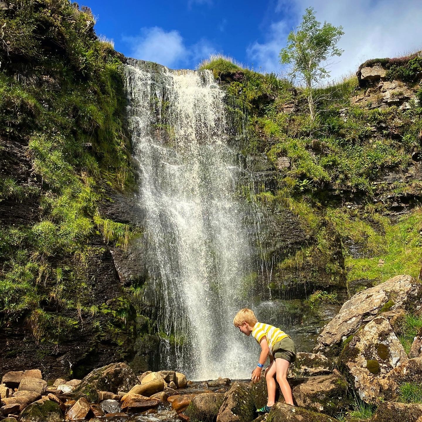
Force Gill, Whernside
Force Gill is a spectacular waterfall on the side on the highest of the Yorkshire Peaks, Whernside.
But don’t worry, to go and see this beauty of a waterfall, you don’t have to climb to the top of the peak, so it’s a great one for a budding explorer who’s ready to stretch their legs!
Where is Force Gill?
Well, Force Gill waterfall is located right on the side of the highest of the Yorkshire three peaks, Whernside! It is not only a classic climbable mountain, but it is home to this SPECTACULAR waterfall.
Visible from the main path up Whernside, there are thousands of folk on the three peaks route, who will simply walk right by this stunning waterfall. But we say it’s worth a trip in its own right!
When you’re there you’ll find a sheltered grassy spot, with a rocky path that leads down to the base of the waterfall.
BUT this is not all about the epic waterfall! Oh no. This walk takes you past the Ribblehead Viaduct, Blea Moor Tunnel and if you’re lucky you might get to see a steam train!

Buy Me a Coffee
Make a Donation
Thank you for taking the time to have a look at my website and for reading this now!
I set up the Reluctant Explorers and maintain the website and attached social media accounts in my spare time, around mum-life and two jobs. It was designed to provide access for parents to free resources to help get more families outside and exploring in nature. These walks have all been created by myself and the kids and we have walked each one ourselves (and re-walk them regularly to keep the information as up to date as we can).
If you would like to support us and can afford a few pennies, you can make a donation to our ‘Buy Me a Coffee’ page. Simply tap the button below to head there!
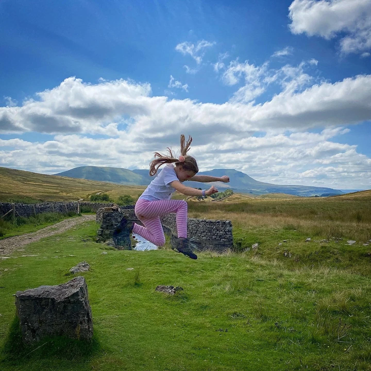
The view from the Aqueduct to Ingleborough.
What are the walk details for Force Gill?
Distance: 5-6 miles. This is a there and back again, linear walk. For a circular, head to our Whernside circular walk.
Terrain: Wide, easily identifiable and well walked paths in the main. The offshoot to the waterfall, is smaller, but still clear.
Parking: Ribblehead viaduct. There is plenty of layby parking here. That said it can get busy, particularly in the Summer, so if you find it too busy to park, why not try nearby Horton in Ribblesdale for Pen y ghent or Settle to try the Settle Caves walk or Ingleton for the waterfalls trail. Always have a plan B is your plan A is too busy!
Public Transport: An awesome alternative to taking the car! The Ribblehead train station is located right next to the start point of this walk. There are also buses that run to the area, but they are subject to seasonal timetables so check out the Dales Bus website for further information.
Location: Ribblehead, Yorkshire Dales. The falls are located on Open Access Land and so you can exercise your right to roam.
Map: Yorkshire Dales Southern and Western OL02 OS Explorer
What 3 Words: conducted.engine.recline
Toilets/ Baby Change: Station Pub and Ribblehead Station (toilets for customers only)
Nearest Cafe/ Amenities: The Station Pub. There are also usually ice cream vans and sometimes a bacon sandwich van at the parking area (although from our experience the van isn’t the finest….) We recommend the pub! The beer garden has a cracking view and plenty of kid friendly options there on the menu too.
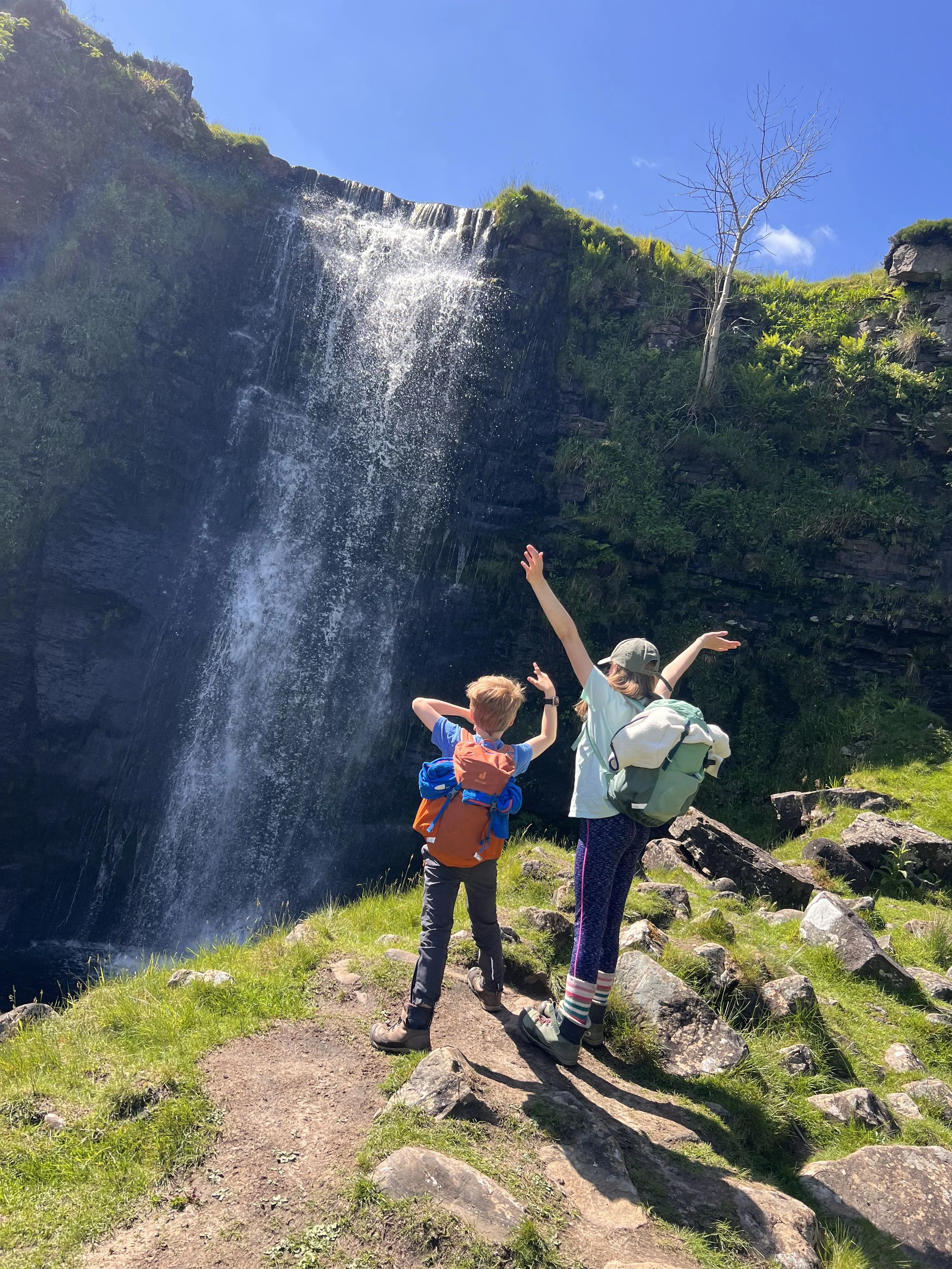
How to walk to Force Gill
Directions to be used alongside a map:
Starting from the parking area at Ribblehead Viaduct, take one of the many paths that leads you to the great arches, and take a moment to soak in this incredible piece of architecture and engineering!
Don’t cross under the arches, the path you need heads along the right hand side, and heads upwards towards Blea Moor sidings and the signal box. Keep heading straight on, keeping the railway tracks to your left, and ignoring any offshoots to the left or right. You will pass the Blea Moor signal box and its dilapidated cottage - which seems to be after years of neglect, finally being looked after…
After approximately 2 miles, you will reach the Aqueduct, which takes the water of Force Gill over the railway tracks, here you can see the entrance to Blea Moor tunnel, where the railway heads underground before it reappears in Dentdale.
Cross over the railway lines at the Aqueduct, and continue along the path which begins to climb the Eastern slopes of Whernside. It is the main Yorkshire Three Peaks path and is virtually unmissable. Force Gill will become visible after around 200m, on your left. The little path offshoot begins at the gate on Smithy Hill. Don’t go through the gate, but skirt round the wall on the left, walking in the direction of the waterfalls. The path here is clear, but almost always boggy in the middle, so be prepared. After about another 200m you will reach the waterfall.
Once you have taken in all the waterfall’s glory, head back the way you came and enjoy the insane views across to Ingleborough, another of the Yorkshire 3 Peaks.
Last walked May 2026
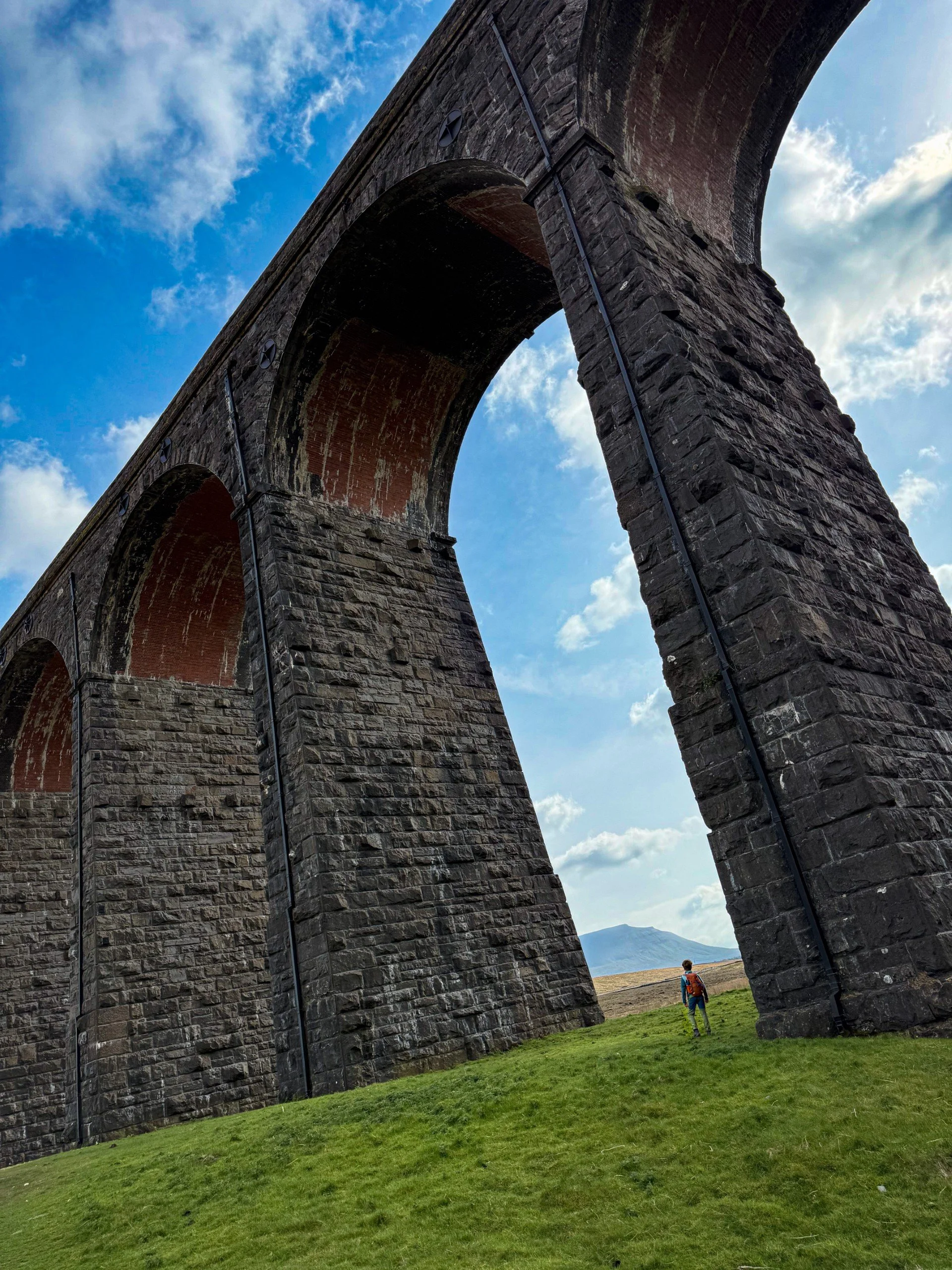
The Ribblehead Viaduct
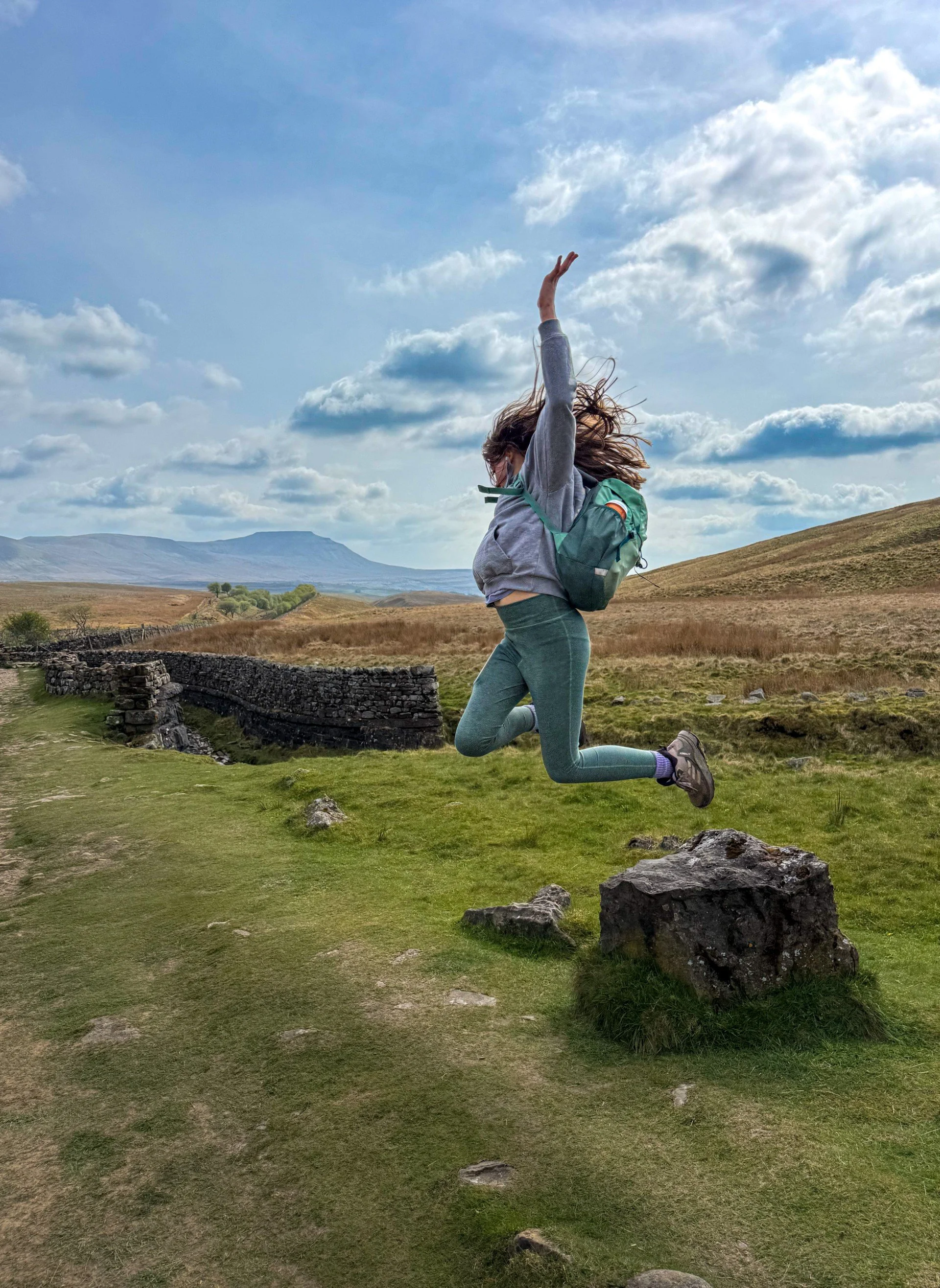
The aqueduct which takes water over the railway
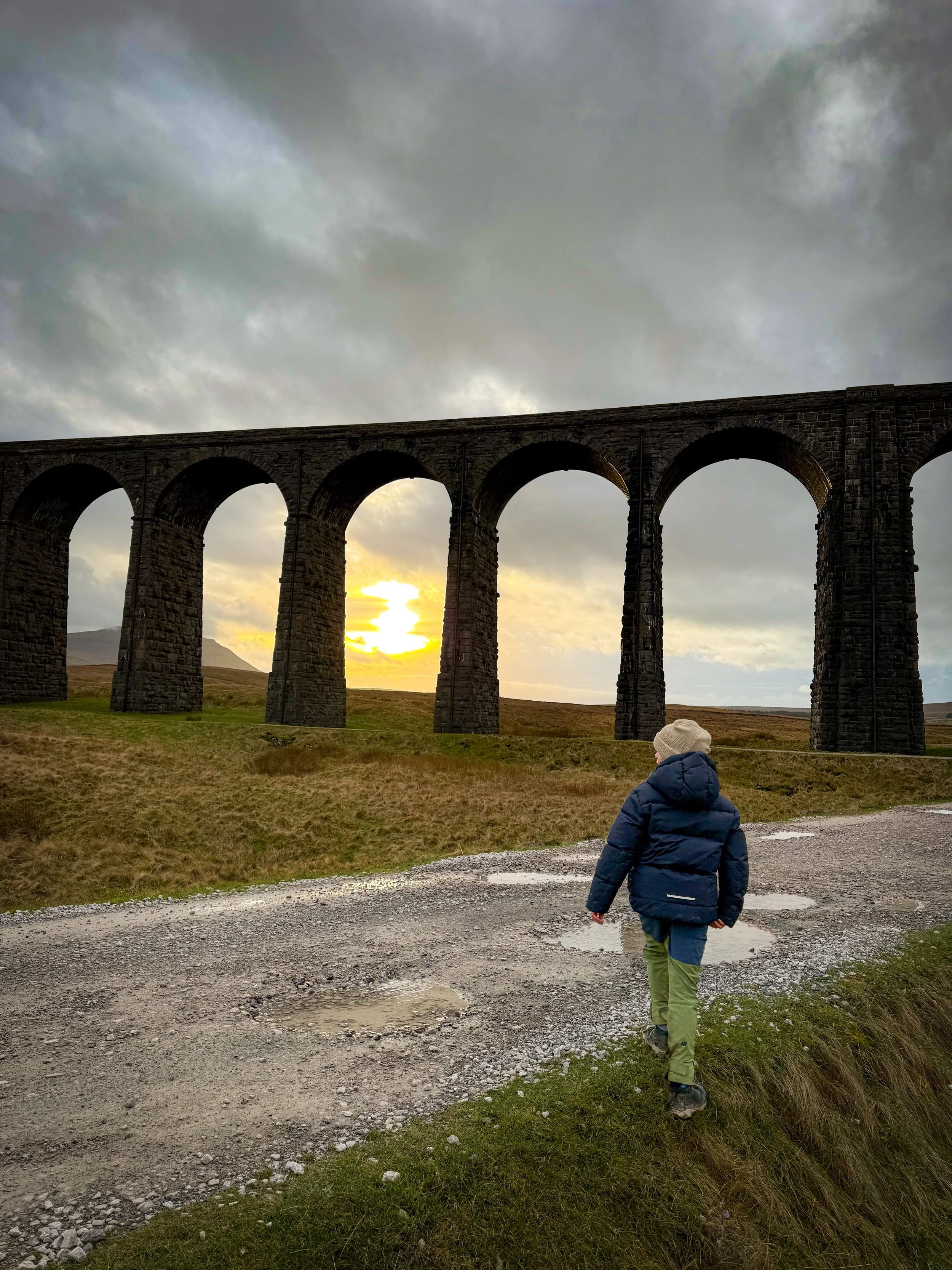
The viaduct in winter
What’s Cool for kids on this walk?
💦 It is possible to paddle in the water of the falls but be careful of the pool directly surrounding the drop, it takes a steep dip in depth and this one isn’t called Force Gill for nothing, it definitely is a force! So expect a face full of spray! Always supervise children around water. Please be aware that water levels can change rapidly, and this fall will be very different after periods of prolonged heavy rain.
🚂 This one is a train lovers dream! The Ribblehead viaduct is on the Settle to Carlisle railway and is fully open. If you’re lucky an occasional steam train can be seen too! (We’ve been lucky only once, but you can check out the Settle to Carlisle website to see the times of the steam excursions if you’re keen!)
👻 I do love a ghost story, and there are plenty about Blea Moor and Ribblehead! Built back in the 19th Century, the construction of the Ribblehead Viaduct was not only a monumental achievement in terms of engineering, but also in terms of man power. The workers set up camps across the moors surrounding the building site, but the conditions were bleak, hard and an endurance test in themselves. Sadly, many lost their lives to smallpox, brawling and in the construction process, which has led to stories of several hauntings in the area.
One at the Blea Moor Signal Box, where ghostly phone calls were heard. One at Blea Moor Tunnel where an oppressive atmosphere is felt in the train carriages as they pass through, and many more from the moorland around. This walk takes in all of them! Read more about the Ghost Stories of the Yorkshire Dales or the Dark History of the Dales by heading to the blog!
🌳 After some distractions to keep those whinges at bay? Why not try some of our whinge busting walking games, or a scavenger sheet?
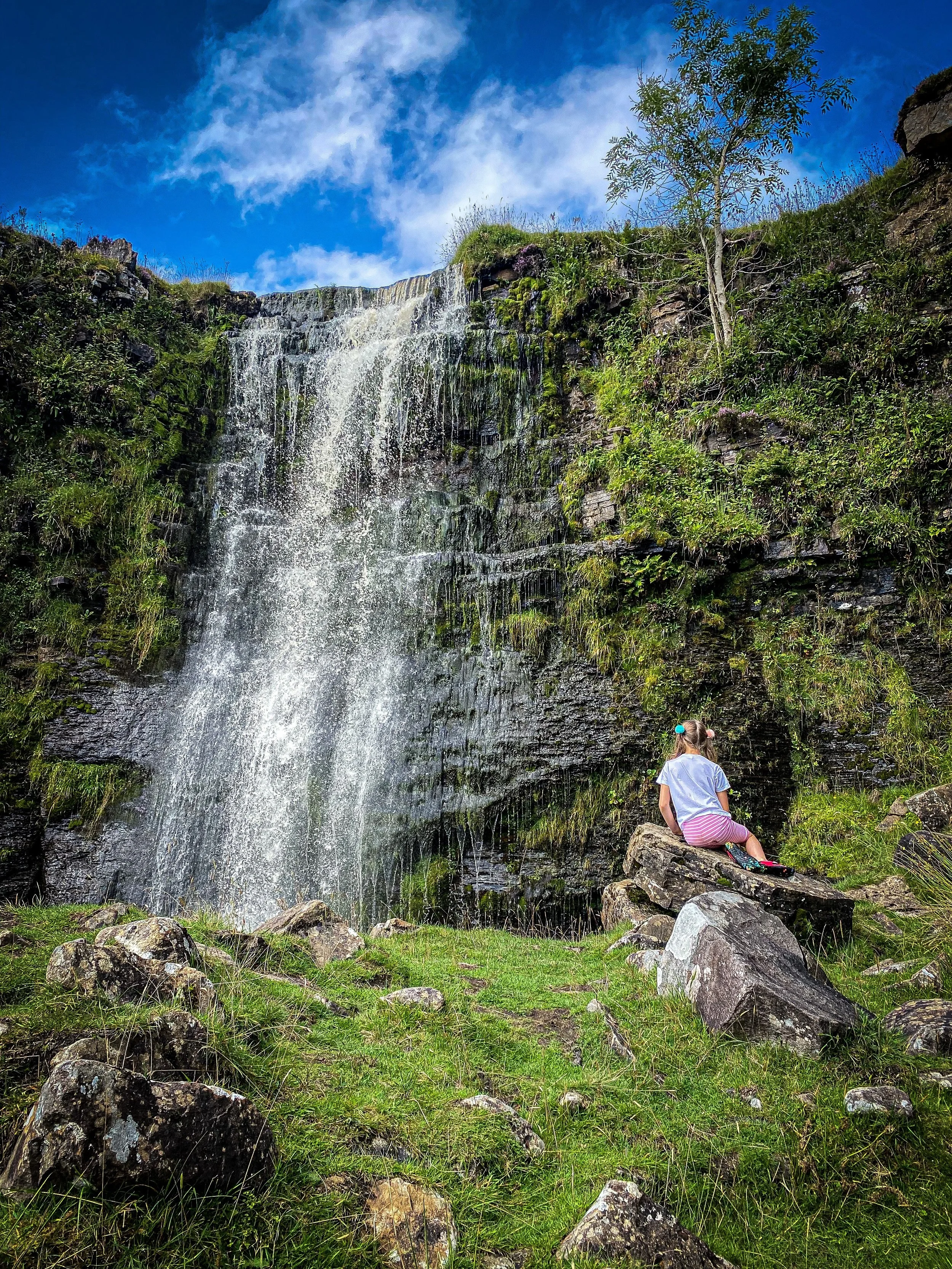
Sitting next to Force Gill in the Summer
Helpful Information!
Head to our dedicated page for helpful information and safety for more!
⭐ We hope you enjoy our walks, but please exercise common sense as routes can change with the weather conditions and seasons! The routes have been walked by our own two feet, but you know your own limits. Always take a back-up map, don’t rely on GPS alone, wear appropriate clothing for the weather and take adequate snacks and refreshments with you (although as a parent, I know you already know that bit!)
⭐ Leave no trace! Take nothing away and leave nothing behind, take all rubbish home with you.
⭐ If you choose to paddle, be aware of bio security. Always wear clean dry water shoes (if worn) to avoid cross contamination of species between watercourses, this is a particular issue in the Yorkshire Dales, to help protect the white clawed crayfish.
⭐ If you decide to paddle, be aware that wild water can be dangerous, and water levels will vary season to season. Always supervise children around water. Check out the safety information on the Royal Life Saving Society website.

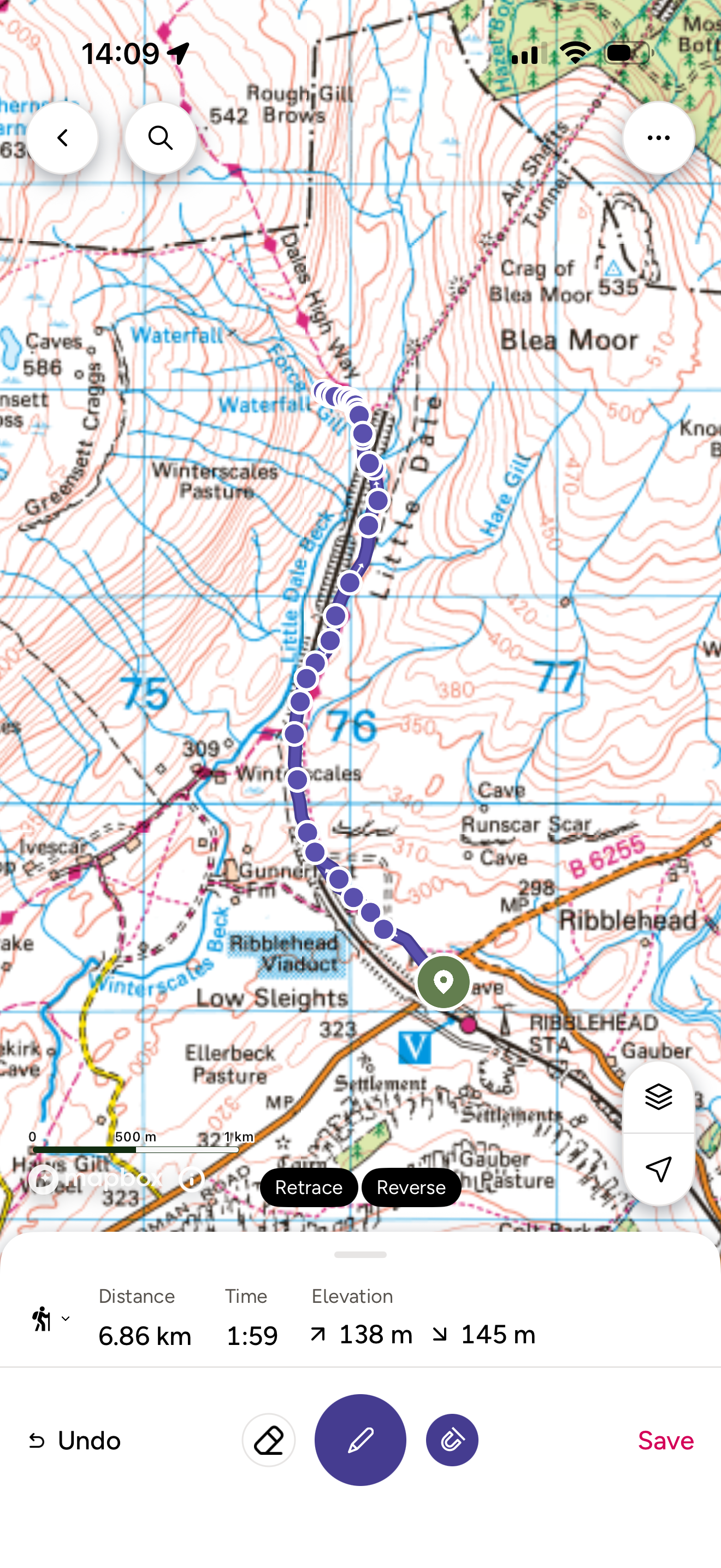
Want to grab the route?
You’ll need to grab yourself an Ordnance Survey Explorer OL2 map for this route. Maps are available on the Ordnance Survey online shop.
(Always carry a back up map and know how to use it)
Image is Copyright of Ordnance Survey
Affiliate link as an Ordnance Survey champion

Want to climb Whernside itself?
You can head to our walk page for Whernside, where you’ll find the full route description and all the kid friendly details of the walk!
We do this a different way to the norm for many reasons, but we think that we’ve found the best family friendly option!
Scroll using the arrows for all our Family Friendly Walks
-
![Swimming in Janet's Foss Yorkshire Dales]()
Waterfall Walks
-
![Malham cove walk for kids]()
Pushchair Friendly
-
![Pinhaw Beacon trig point walk near Skipton]()
Peak Bagging Walks
-
![The Park at Greenhow Nidderdale]()
Walks with Play Parks
-
![Gordale Scar in Malham Yorkshire Dales]()
Organised by Location
-
![Walking in the woodland in Wensleydale]()
Woodland Walks
-
![Playing on the shore of Embsay Reservoir Yorkshire Dales]()
Reservoir Walks
-
![The ruins of Bolton Abbey]()
Bolton Abbey Estate Walks
-
![Leaping over the stile at Almscliffe Crag]()
Walks Under 2 Miles
-
![Child walking into a pub in Appletreewick]()
Walks with Pubs and Cafes





Follow us for up to date Outdoors Adventures!
We live and BREATHE the Yorkshire Dales outdoors life!
BEEN INSPIRED? Tag us @reluctantexplorers
Come follow our journey over on Instagram and Facebook where you’ll find up to date walk info, breaking news on Yorkshire Events, new Yorkshire Dales wild swim spots, climbing, caves and more!


Follow us on Social Media for all the up to date info: @thereluctantexplorers

Leave No Trace
The Yorkshire Dales is our home, and the home of so many others who care deeply about this beautiful space.
Should you visit, make sure to:
Take home anything you bring, leave no rubbish behind.
Make the world a better place by picking up any rubbish you see, even if it isn’t yours.
Leave everything else as you found it.