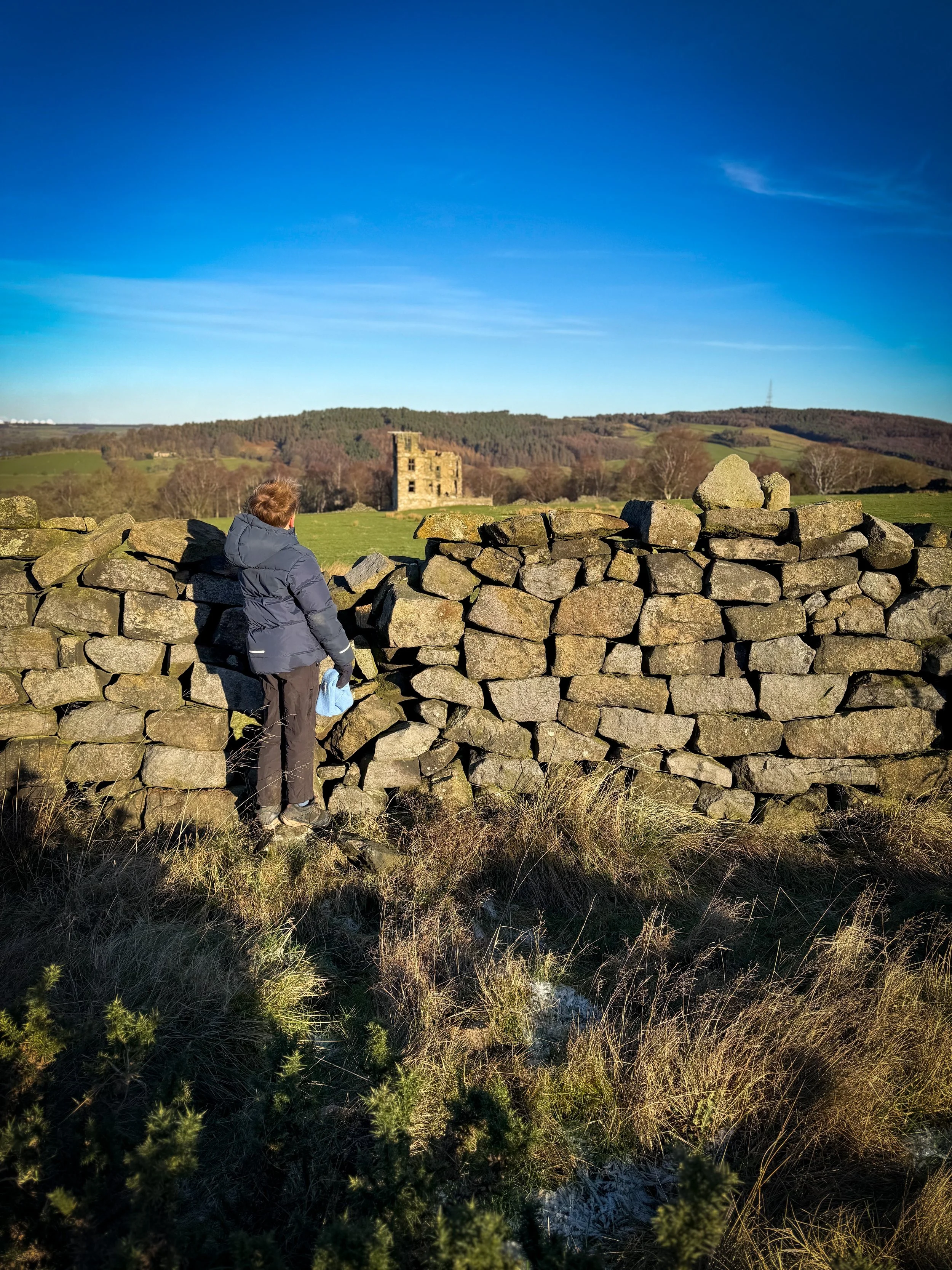
Dob Park Lodge
This walk will take you past the ruins of Dob Park, the Grade II listed ruin of the 16th Century Hunting Lodge! Plus it has excellent stone throwing opportunities as well as woods to explore!
Bet you didn’t know this existed right?
Where is Dob Park?
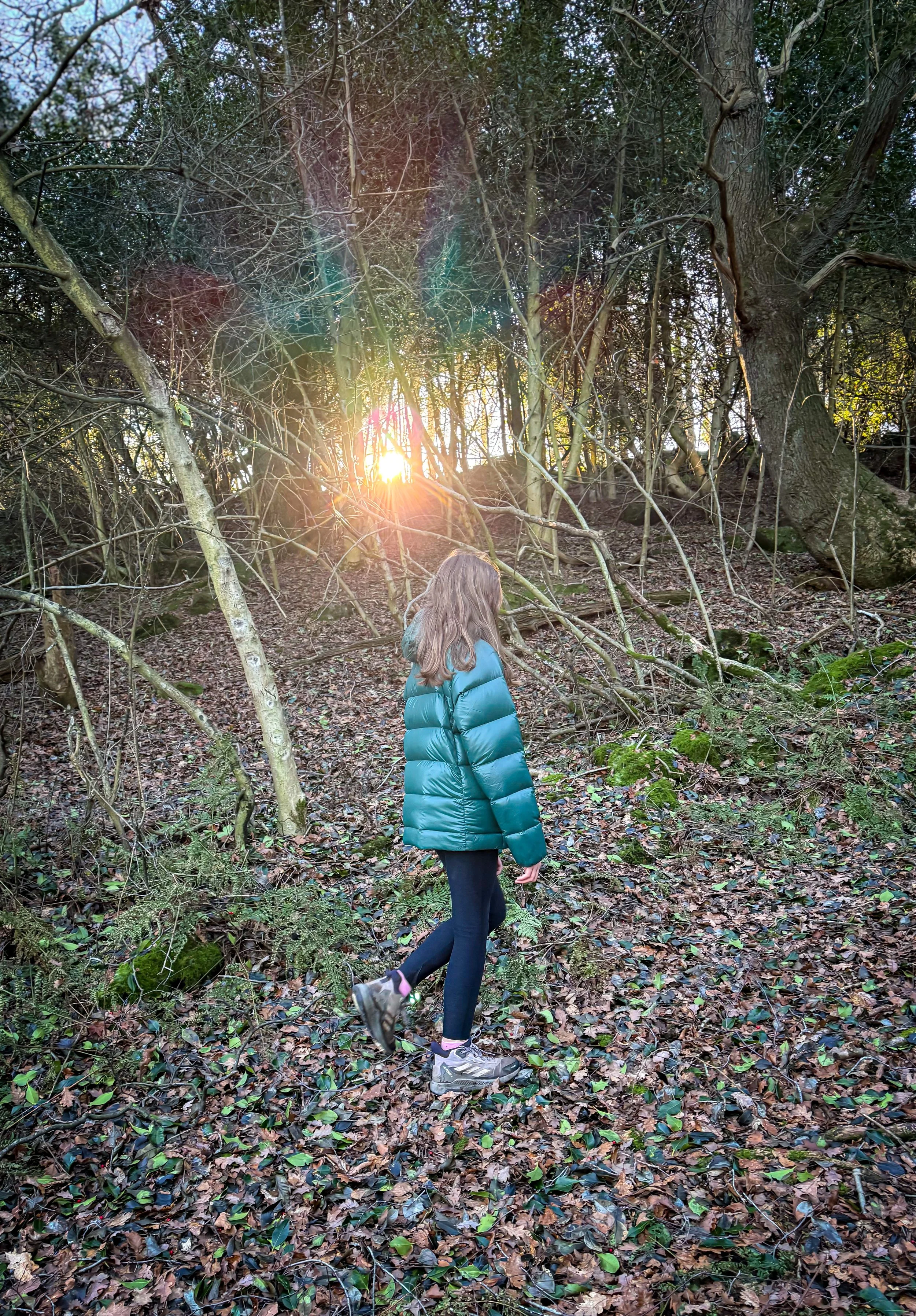
Dob Park is an area in Nidderdale, just outside of Otley and is super for a short walk! This walk heads down to the 17th Century packhorse bridge, which spans the River Washburn where there are plenty of places to throw stones. After that it’s on to Dobpark Woods, which are great to explore before heading out onto the moor.
On the way back, you’ll spot Dob Park Lodge, which is a Grade II listed ruin of an old 16th Century hunting lodge.
Visible from the path, the ruins of Dob Park Lodge are pretty cool to see and the 19th Century British artist JM Turner featured Dob Park in one of his paintings.
Alright, we’re not stupid, this little bit of history may not spark as much enthusiasm in the little ones as we’d hope, but you know… there’s plenty more than that going on with this walk!

Buy Me a Coffee
Make a Donation
Thank you for taking the time to have a look at my website and for reading this now!
I set up the Reluctant Explorers and maintain the website and attached social media accounts in my spare time, around mum-life and two jobs. It was designed to provide access for parents to free resources to help get more families outside and exploring in nature. These walks have all been created by myself and the kids and we have walked each one ourselves (and re-walk them regularly to keep the information as up to date as we can).
If you would like to support us and can afford a few pennies, you can make a donation to our ‘Buy Me a Coffee’ page. Simply tap the button below to head there!
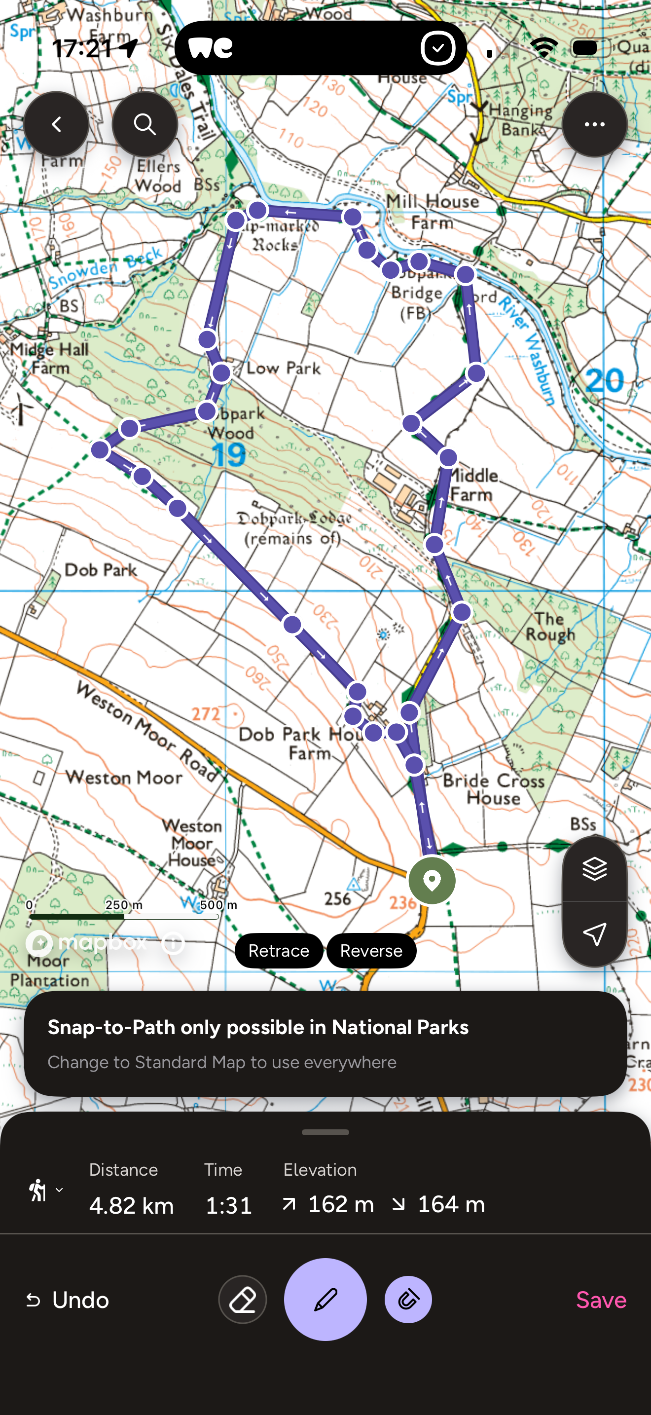
The Walk details for Dob Park
Distance: 3.5 miles circular
Terrain: Farm tracks, some rough under foot. Some woodland trails can be muddy underfoot. Approx. 170m of ascent. 🛑 A note as to the terrain. When first walked, the pathway at Low Park was extremely overgrown and brambly and we were forced to take a diversion through the trees to the right of this path, which ran parallel to the actual path. It was only for around 50m and it joined the path again at the top end. Upon our most recent visit, the path had been cleared, but in places it was still a little overgrown. The detour is still present if you’d prefer, albeit it’s a bit muddy!
Parking: On street parking at Dob Park Road. This is a residential access road and farm track. There is some layby parking, but please adhere to parking regulations and do not block any access tracks or roadways. Farm vehicle access is required at all times.
Public Transport: No direct public transport.
Dog Friendly: Yes. Some farmland, be respectful of landowner requests.
Location: Weston, North Yorkshire. Just north of Otley.
Map: OS Explorer 297 Lower Wharfedale and Washburn Valley.
What 3 Words: freely.gadgets.grandson (verge parking - be respectful)
Toilets/ Baby Change: No
Nearest Cafe/ Amenities: Otley
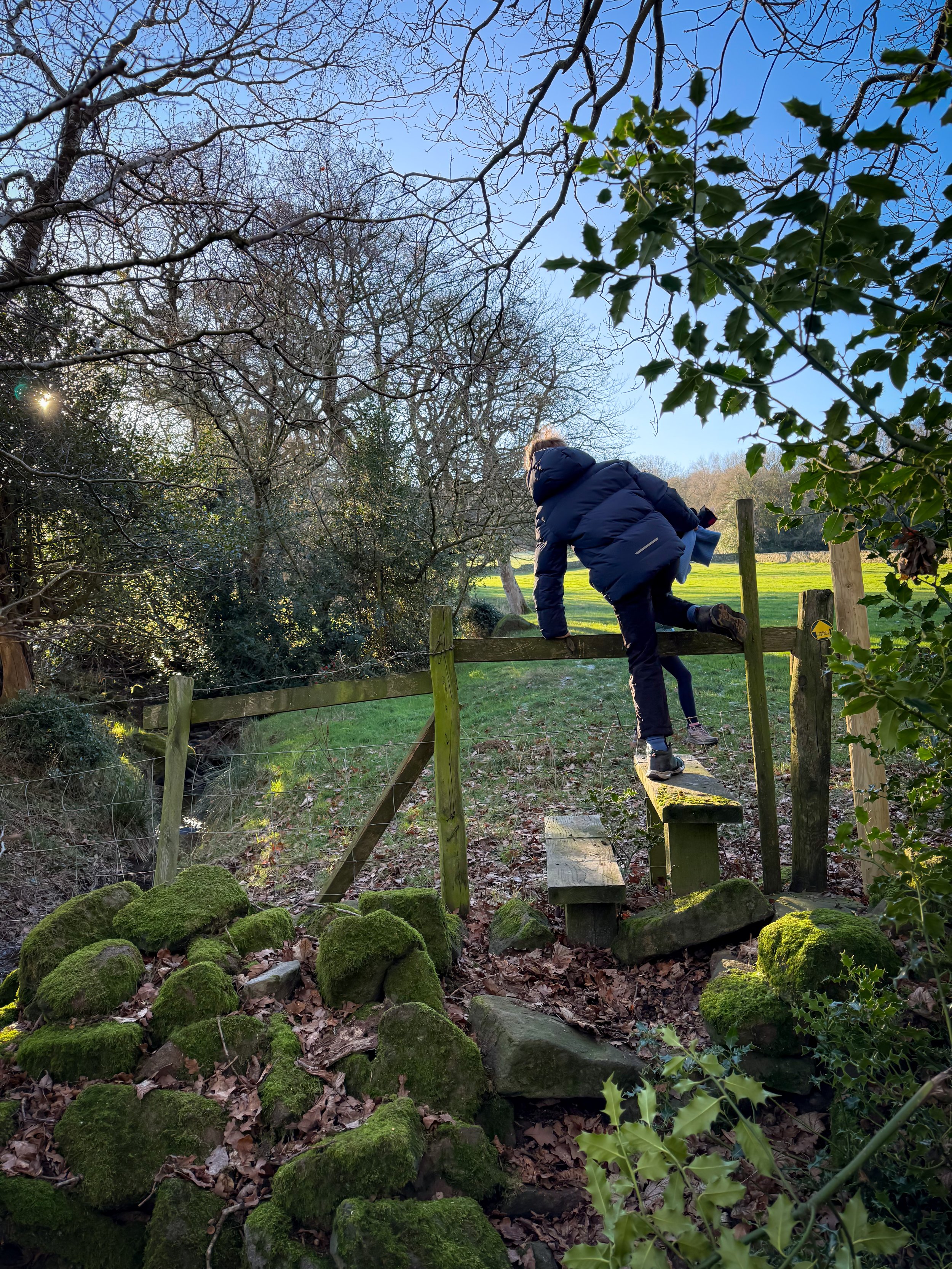
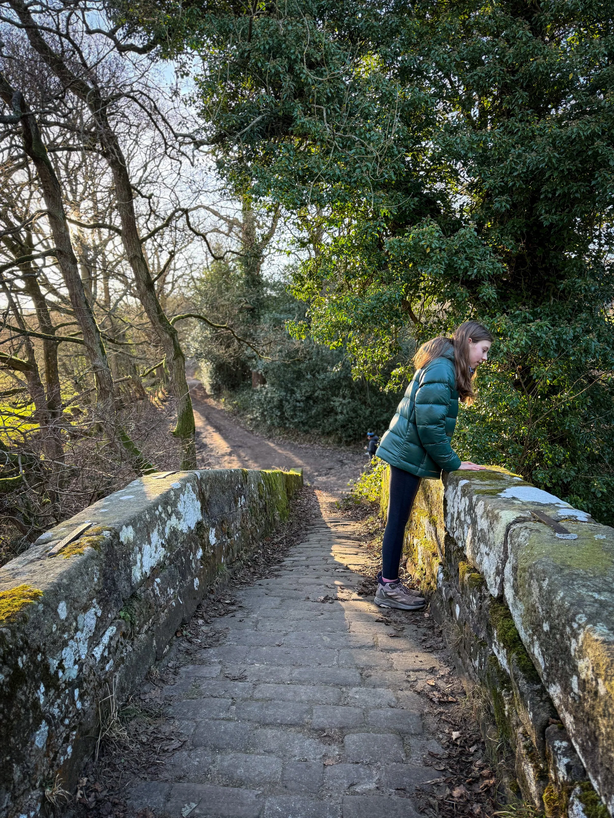
The stile out of the woodland before Low Park.
Directions to Dob Park
Route instructions to be used alongside a map.
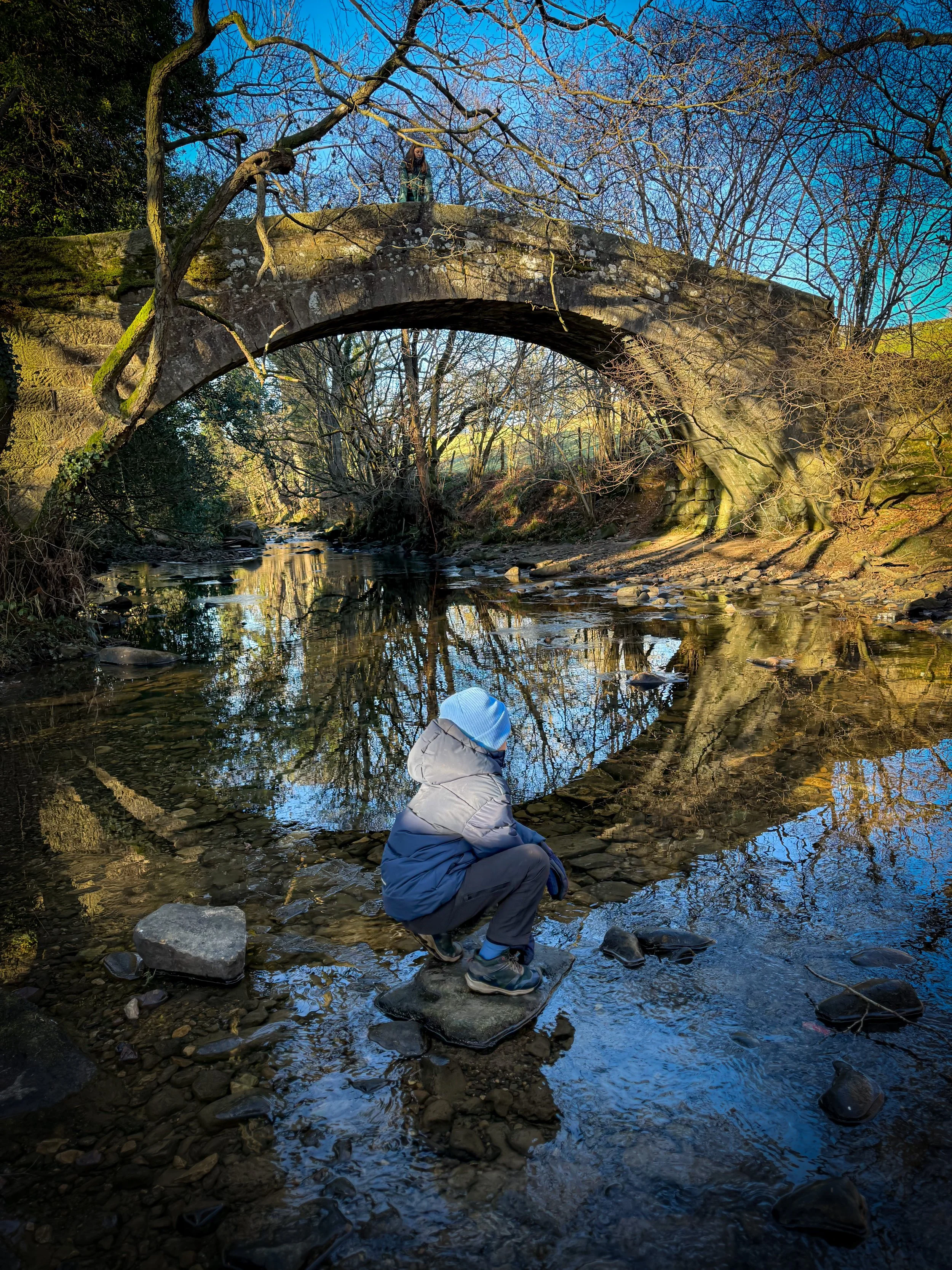
Beginning on Dob Park Road, walk down, with your back to Newall Carr Road, the main road. You will follow this quiet tarmacked track passing the signs to the two houses on your left until it become a rough track. Follow this downwards as it bends right and left, passing Middle Farm and heading down towards Dob Park Bridge. There is a little point here where you can throw stones in the River Washburn.
Don’t cross the bridge. You need to take the path to the left of it, before you reach the bridge, which follows the river. It is signposted Public Footpath, the Six Dales Trail. Continue straight on and after a short distance, the path forks into two. Take the left fork and head uphill to a gate. Go through this, and then turn right. Continue to follow the edge of the field, keeping the fence to your right and passing through two further gates before reaching a small metal gate into a small area of woodland. Head through this gate, crossing a very small stream. Then turn left.
You will see a pointless gate (the fence has fallen down, but it still has a yellow waymarker on it to follow!) Follow that arrow, you are heading through the trees to a stile over the fence, keeping left.
Cross the stile over the fence and then follow the line of the water heading upstream. Keep this on your left and pass over another stone stile and mini bridge into the next field, still keeping the stream to your left until you reach Low Park.
Here there is a stile over a fence and a yellow arrow waymarker. Historically this path was pretty overgrown and we had to detour to the right through the woods (but this can be quite muddy). On the most recent walk, the path was cleared, but still a little bit overgrown in places. Just be aware, you can still take the detour if needed. Head along the path to the end, as it enters the wood.
The path from here heads upwards through the middle of the woods, bearing slightly to the right. Follow it up through the woods, until you reach the perimeter wall. Exit the woodland perimeter, and keep heading upwards, past a rocky outcrop. Here the terrain is open, and your view (if you turn backwards) will be across the Washburn Valley.
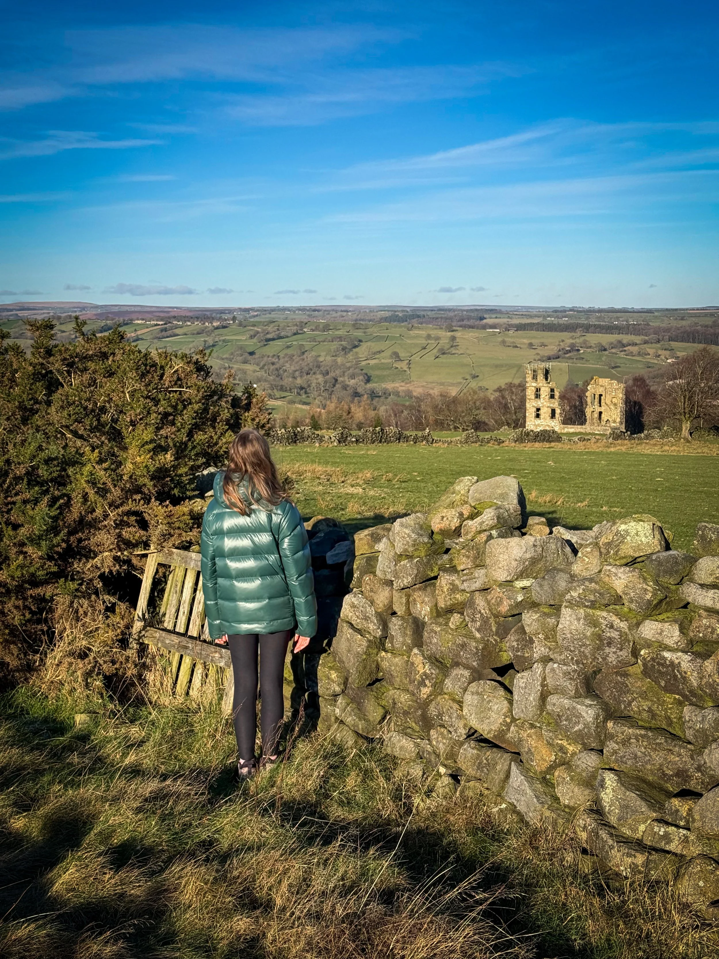
To your left, you will see the perimeter wall of the woodland and the corner of it. Aim for the corner in the wall to your left and then follow that wall line roughly until you see a metal gate into a walled track ahead of you. Head through this and you will see the ruins of Dob Park on your left.
Once crossed into the walled track, the remains of the early 17th Century hunting lodge is clearly visible to your left You cannot gain access directly to it, but the views of it are pretty epic Follow the walled track straight on until you get to Dob Park House Farm. Here you will see the access point to the property ahead, but the path circumvents the property, through a small gate in the wall to your right. Follow this round to the left, through the stile through the wall, and continue back down to the concrete road heading right and leading away from the Farm.
This will join the track you started the walk on. Turn right, and head upwards back to where you started.
Last walked December 2025.
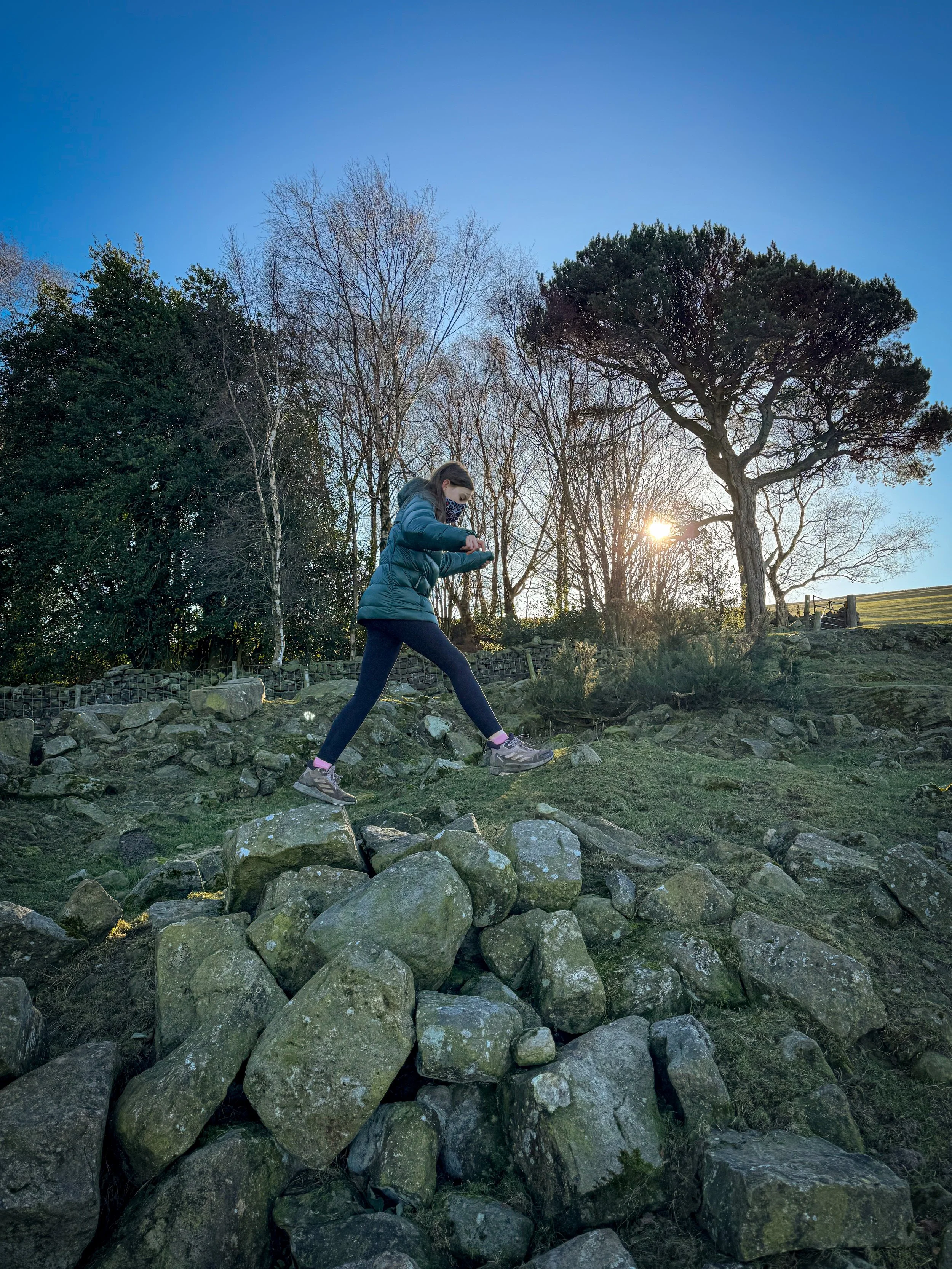
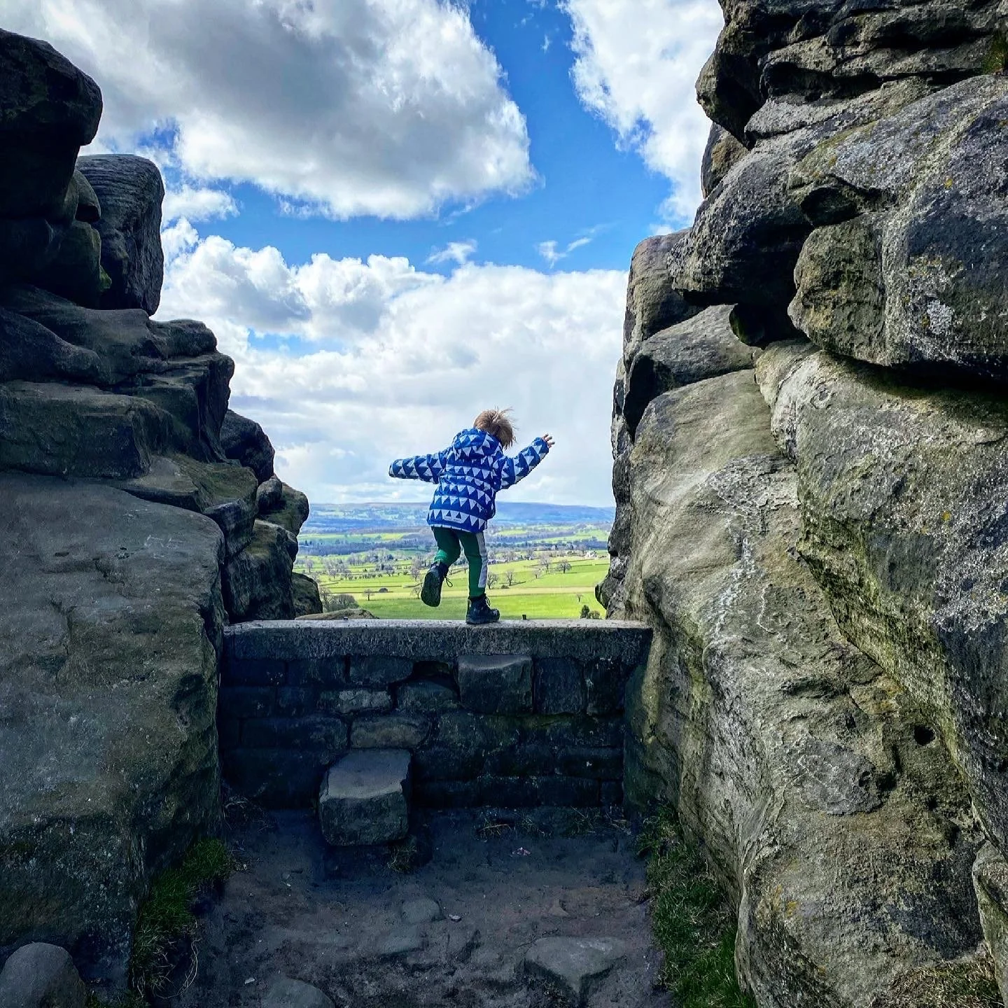
Some excellent leaping rocks as you head out of Dobpark Woods
Helpful Information!
For more helpful information head to our safety tips and advice page.
⭐ We hope you enjoy our walks, but please exercise common sense as routes can change with the weather conditions and seasons! These walks are intended as a guide only and are undertaken at your own risk. The routes have been walked by our own two feet, but you know your own limits. If in doubt, turn back. Always take a back-up map, don’t rely on GPS or your phone alone, wear appropriate clothing for the weather and take adequate snacks and refreshments with you (although as a parent, I know you already know that bit!)
⭐ Leave no trace! Take nothing away and leave nothing behind, take all rubbish home with you.
⭐ If you choose to paddle, be aware of bio security. Always wear clean dry water shoes (if worn) to avoid cross contamination of species between watercourses, this is a particular issue in the Yorkshire Dales, to help protect the white clawed crayfish.
⭐ If you decide to paddle, be aware that wild water can be dangerous, and water levels will vary season to season. Always supervise children around water. Check out the safety information on the Royal Life Saving Society website.
What’s cool for kids on this walk?
💦 Next to Dob Park Bridge, is an area where you can reach the side of the river for stone throwing and welly dipping!
✨ If you’ve had a good look through the website, you might come to the conclusion that I’m a bit of a history geek. AND YOU’D BE RIGHT!! Whilst I appreciate that the remains of a Grade II listed, early 17th Century hunting lodge, which was occupied by the Vavasour family of nearby Weston Hall, was reportedly shelled by the forces of Oliver Cromwell and which featured in an early 19th century painting by Turner MIGHT not really excite the very little ones, it is very cool to see. Get your imaginations working and make up stories about the people who lived there, or maybe you could have a think about what animals occupy the remains now…….
🌳 Well this walk is great for a farm lover, as there are plenty to spot! You could also find some geocaches along the way! Need some more to beat the walking whinge? Why not try one of our walking games? Or you can download a free scavenger sheet!
Want to grab the route?
Ok, admittedly, SOMEBODY may have left the tracker on when we drove home and so this was not the tracked route, but it is the route we took, so enjoy!
Head to the Ordnance Survey Navigation App where you can download the route!
(Always carry a back up map and know how to use it)
Image is Copyright of Ordnance Survey
Check out our most recent trip to Bolton Abbey by watching our reel!
To keep up to date with all our walks and adventures, you can head over to our Instagram and Facebook pages for daily updates, ideas and Yorkshire Dales with kids inspiration!
Our most recent trip to Dob Park was in December 2025. You can see what the walk looks like in real life by watching the reel!
Either tap the link or scan the QR code to see the reel!


NIDDERDALE BABY! We have a whole page dedicated to the National Landscape, so why not take a look?
We have loads of walks in the Nidderdale area, so why not check them out by tapping the link below?
We have over 100 family friendly walks on our website in and around the Yorkshire Dales National Park, so if waterfalls, or woodland, or maybe even a walk with a play park is your kind of thing, then had up to the menu and find out what there is to offer!
Scroll using the arrows for all our Family Friendly Walks
-
![Swimming in Janet's Foss Yorkshire Dales]()
Waterfall Walks
-
![Malham cove walk for kids]()
Pushchair Friendly
-
![Pinhaw Beacon trig point walk near Skipton]()
Peak Bagging Walks
-
![The Park at Greenhow Nidderdale]()
Walks with Play Parks
-
![Gordale Scar in Malham Yorkshire Dales]()
Organised by Location
-
![Walking in the woodland in Wensleydale]()
Woodland Walks
-
![Playing on the shore of Embsay Reservoir Yorkshire Dales]()
Reservoir Walks
-
![The ruins of Bolton Abbey]()
Bolton Abbey Estate Walks
-
![Leaping over the stile at Almscliffe Crag]()
Walks Under 2 Miles
-
![Child walking into a pub in Appletreewick]()
Walks with Pubs and Cafes


Follow us for up to date Outdoors Adventures!
We live and BREATHE the Yorkshire Dales outdoors life!
Come follow our journey over on Instagram, Facebook, Twitter and TikTok, where you’ll find up to date walk info, breaking news on Yorkshire Events, new Yorkshire Dales wild swim spots, climbing, caves and more!


Follow us on Social Media for all the up to date info: @thereluctantexplorers