
Cray Gill Waterfalls
Cray is a tiny hamlet in Upper Wharfedale in the Yorkshire Dales National Park.
And….. well… IT IS WATERFALL CENTRAL! I mean you’re simply falling over them there are so many (not literally I might add, sounds painful!)
So if you’re a family of waterfall lovers? Then this walk is an absolute MUST!
Cray Gill is the home of so many waterfalls!
Cray is a tiny little hamlet in the upper reaches of Wharfedale in the Yorkshire Dales National Park. In fact it’s so tiny, it’s probably got a total of around four or five houses altogether! Compare that to what seems like hundreds of waterfalls, that’s a strong waterfall to house ratio! So you see, Cray really is THE place to be if you want to hunt waterfalls.
There are many dotted along the beck, some are even visible from the road if you drive through to Wensleydale. But these stunning waterfalls are just a little bit more secret, with all of them being set a little off the path, but still easy to find with the kids!
So splash-some are these waterfalls, that you’ll want to set aside a whole day to fully appreciate this walk, because there are perfect picnic spots, paddle spots and also pubs galore!
My idea of a brilliant family waterfall walk!
Follow us, @thereluctantexplorers on Instagram and Facebook for ALL things outdoors in the Yorkshire Dales!
Buy Me a Coffee
Make a Donation
Thank you for taking the time to have a look at my website and for reading this now!
I set up the Reluctant Explorers and maintain the website and attached social media accounts in my spare time, around mum-life and two jobs. It was designed to provide access for parents to free resources to help get more families outside and exploring in nature. These walks have all been created by myself and the kids and we have walked each one ourselves (and re-walk them regularly to keep the information as up to date as we can).
If you would like to support us and can afford a few pennies, you can make a donation to our ‘Buy Me a Coffee’ page. Simply tap the button below to head there!

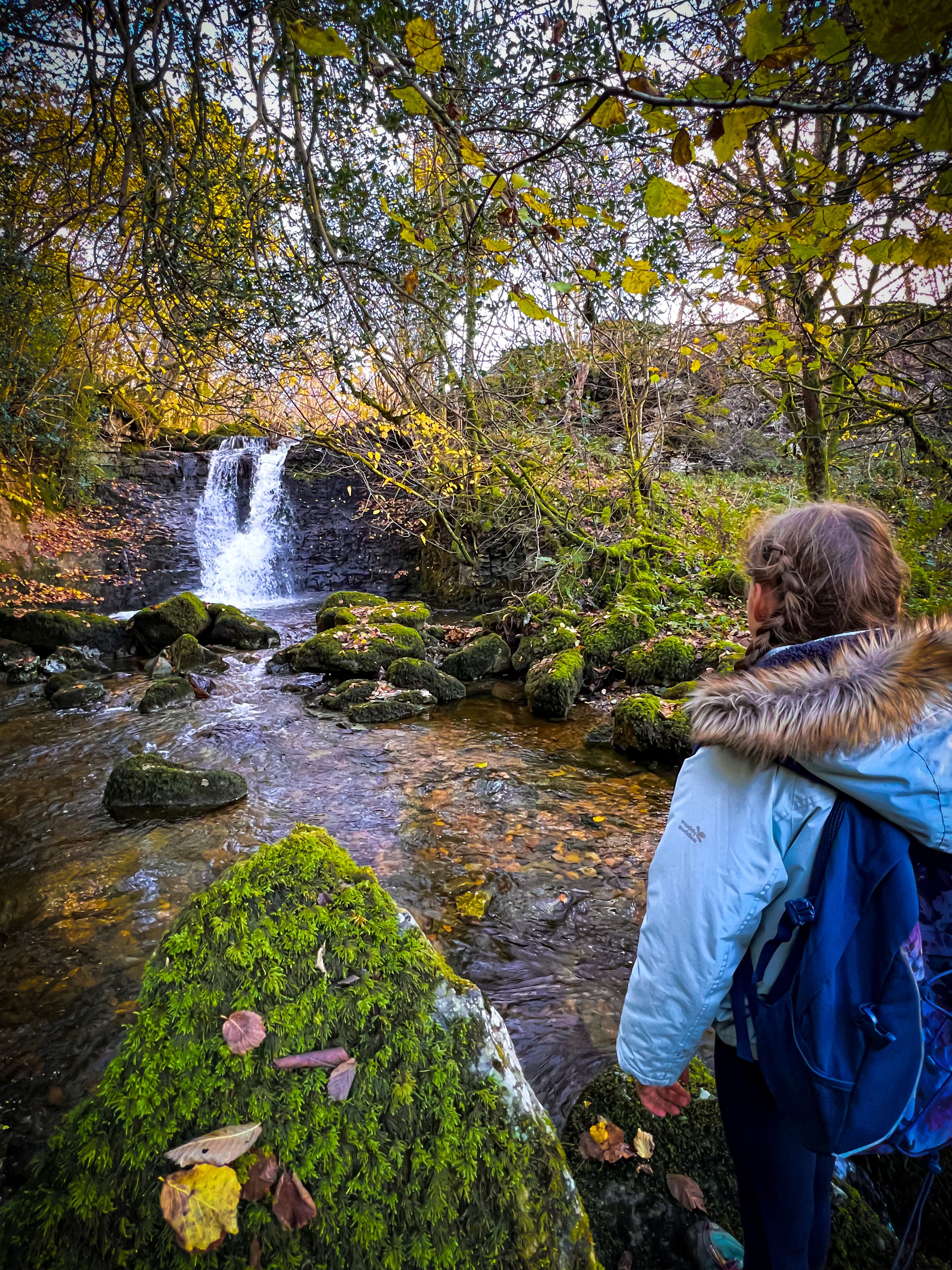
The stepping stones across the beck in Cray
Walk details for Cray Gill Waterfalls
Distance: 4-5 miles
Terrain: Easily identifiable paths. Some quiet country road walking. Some rough terrain. To reach some of the falls, there is some walking off path. The only ascent is at the beginning of this walk, the rest is flat.
Parking: Buckden Pay and Display
Public Transport: Yes! Buckden has a bus service, where this walk begins. Check the Dales Bus website to find out times and frequency as this varies by season.
Dog Friendly: Yes. Be warned that there is often grazing cattle on this walk.
Location: Buckden and Cray, Upper Wharfedale, Yorkshire Dales
Map: OL30 Yorkshire Dales Central and Northern affiliate link as an Ordnance Survey Champion
What 3 Words: start point: apple.playoffs.dozens
Toilets/ Baby Change: Buckden Pay and Display
Nearest Cafe/ Amenities: Buckden for shop and pub. Aaaaaand Hubberholme also has a pub. Yes folks. it’s a 2 pub walk!

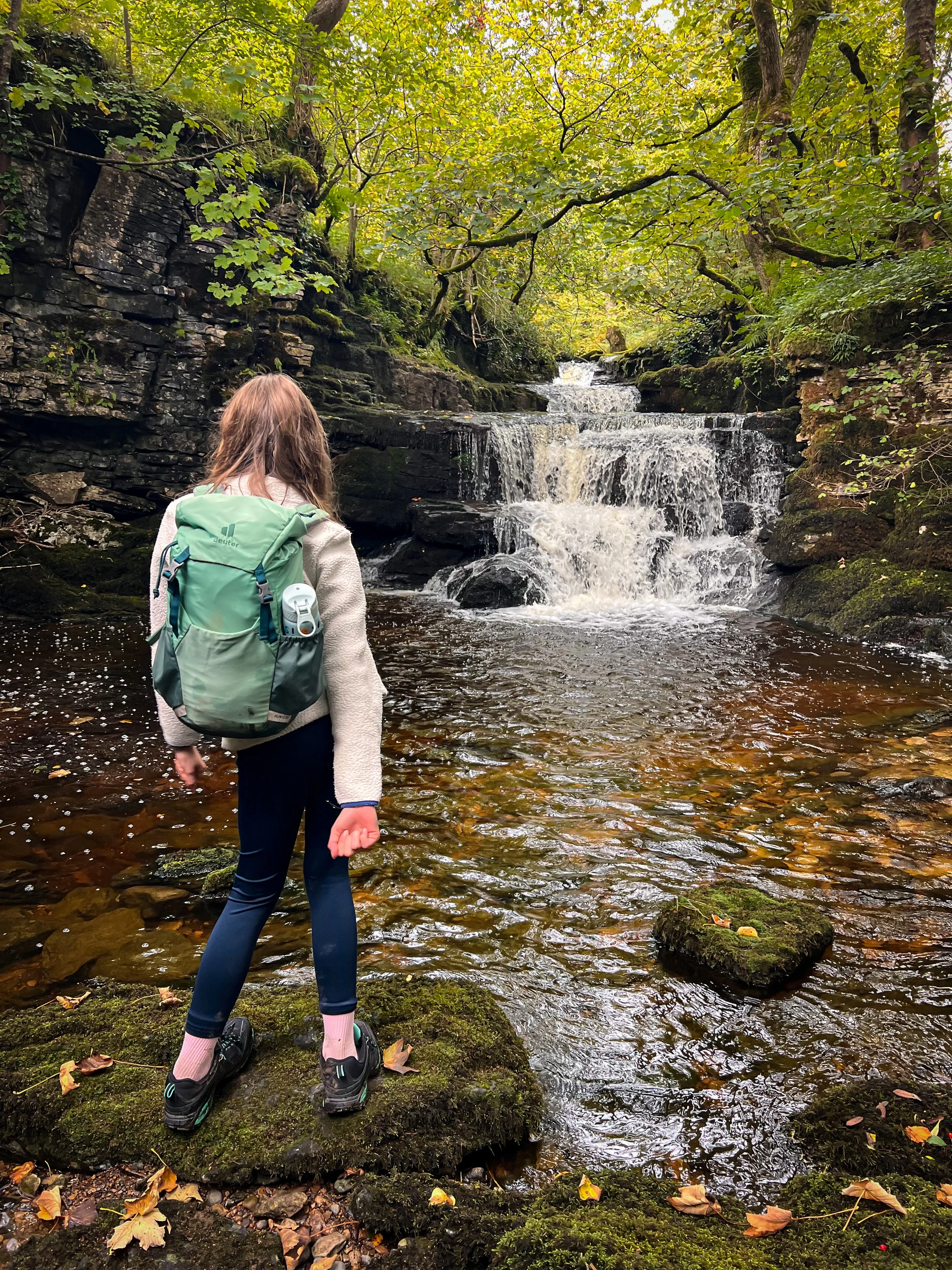
Taking a little splash in the water of the second waterfall. This was pictured after a reasonable amount of rain.
Directions to Cray Gill Waterfalls
Directions to be used alongside a map.
Beginning at Buckden Car Park, take that gate out of the car park, which leads in the direction of Cray. The path is a wide stony bridleway, which heads gradually upwards towards Buckden Rake. Keep on this path after it levels out, passing through several gates, until after approximately 2km from the car park, you reach a gate in the wall to your left, leading downhill in the direction of the hamlet of Cray. The signpost says ‘public footpath Cray’.
Go through this gate, which heads steeply downwards through the field, roughly heading to the wall, then following that down. It can get a little bit boggy here after wet weather. Towards the bottom of the field bear right and head through a gate to the stepping stones.
Cross these and then on the other side, carefully cross the road. Head up the track to the right hand side of the White Lion, it bears left, going behind the pub building. Sadly, the White Lion pub is currently closed - 2026 update.
Keep right on this track as it continues to pass several properties to your left. There is a yellow way marker pointing you in the direction of the path so you don’t inadvertently end up in a farmyard! Continue until the path forks into two.
Here, there is a footpath sign. You need to bear left heading on the lower left hand fork, it looks like you are going to head into the driveway of one of the properties, but there is a sign pointing towards a narrow path through the wall that leads between the edge of the garden to the property and a dry stone wall. This then heads through a wooden gate into a open hillside. The path is clear here and you need to follow it round and down.
For those not keen on cows, we’ve encountered some very friendly ones in this field. In general Belted Galloways do regularly graze the area.
Continue along the path as it heads down the hill and then towards a small amount of woodland. Ahead, there is a gate with a National Trust sign on it, go through this. You will soon hear the sound of the first waterfall down a gorge to your left, but you cannot access it from here.
If you walk a bit further along to where the beck is at the same level as you, there is a small path that offshoots through the grass to your left. Double back on yourself and walk along the edge of the beck heading upstream (much easier after dryer weather!) We’ve been after varying levels of rain, and you can only get close to the falls when there hasn’t been heavy rain. On our most recent visit in January 2026, there were fallen trees blocking the waterfall plunge pool (pictured below).
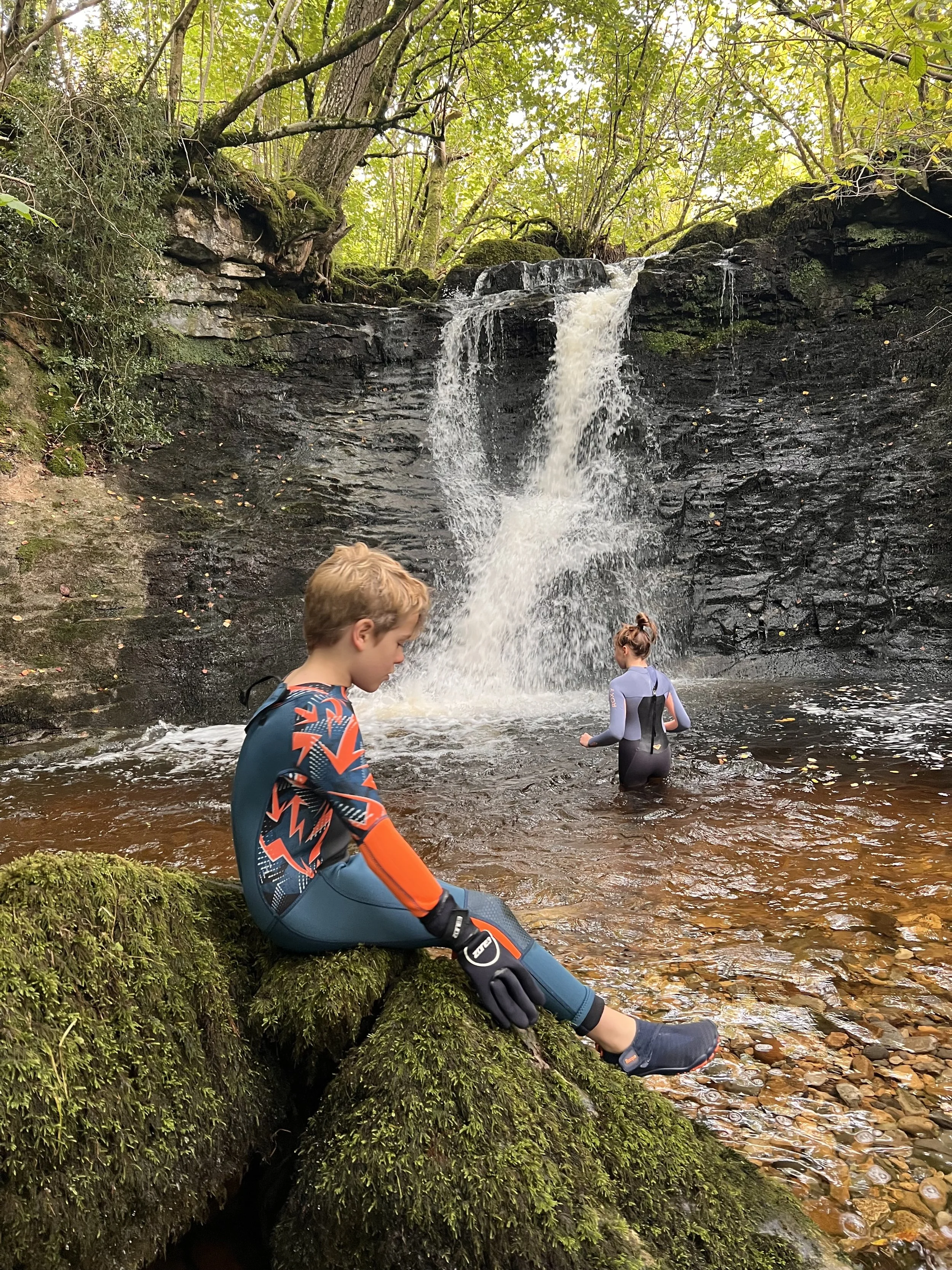
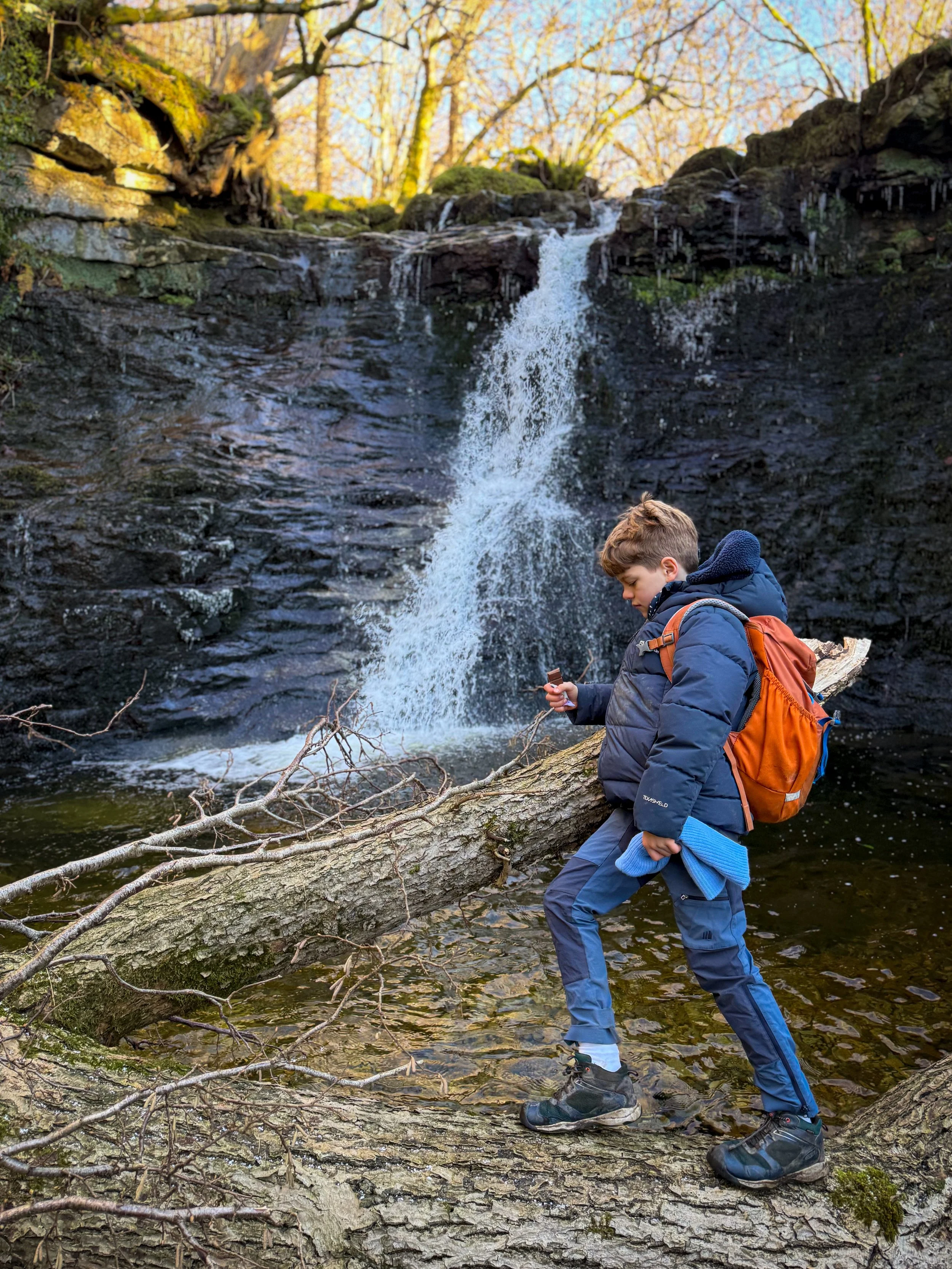
Once you have taken in the beauty of the first falls, head back to the path. Almost immediately after re-joining the main path, there is another offshoot to the right, just before you reach the little packhorse bridge. This will take you to another waterfall, again hidden just off the path. This is the waterfall with the biggest drop at around 10 feet and is best seen when there has been a decent amount of rain. Head back to the path, once you have visited it.
Now cross the bridge, keeping the beck to your left. There’s a lovely spot to get down to the water’s edge at the bridge to have a splash and paddle if you fancy it and there hasn’t been too much rain!
Continue along the path keeping the beck to your left side. You will encounter lots of small drop waterfalls along the route, some of which are accessible from the path, some less so. It all depends on how wet it’s been and how confident you are at clambering down the bank. Luckily, you can see them all from the path anyway without getting down to them if you are at all in any doubt!
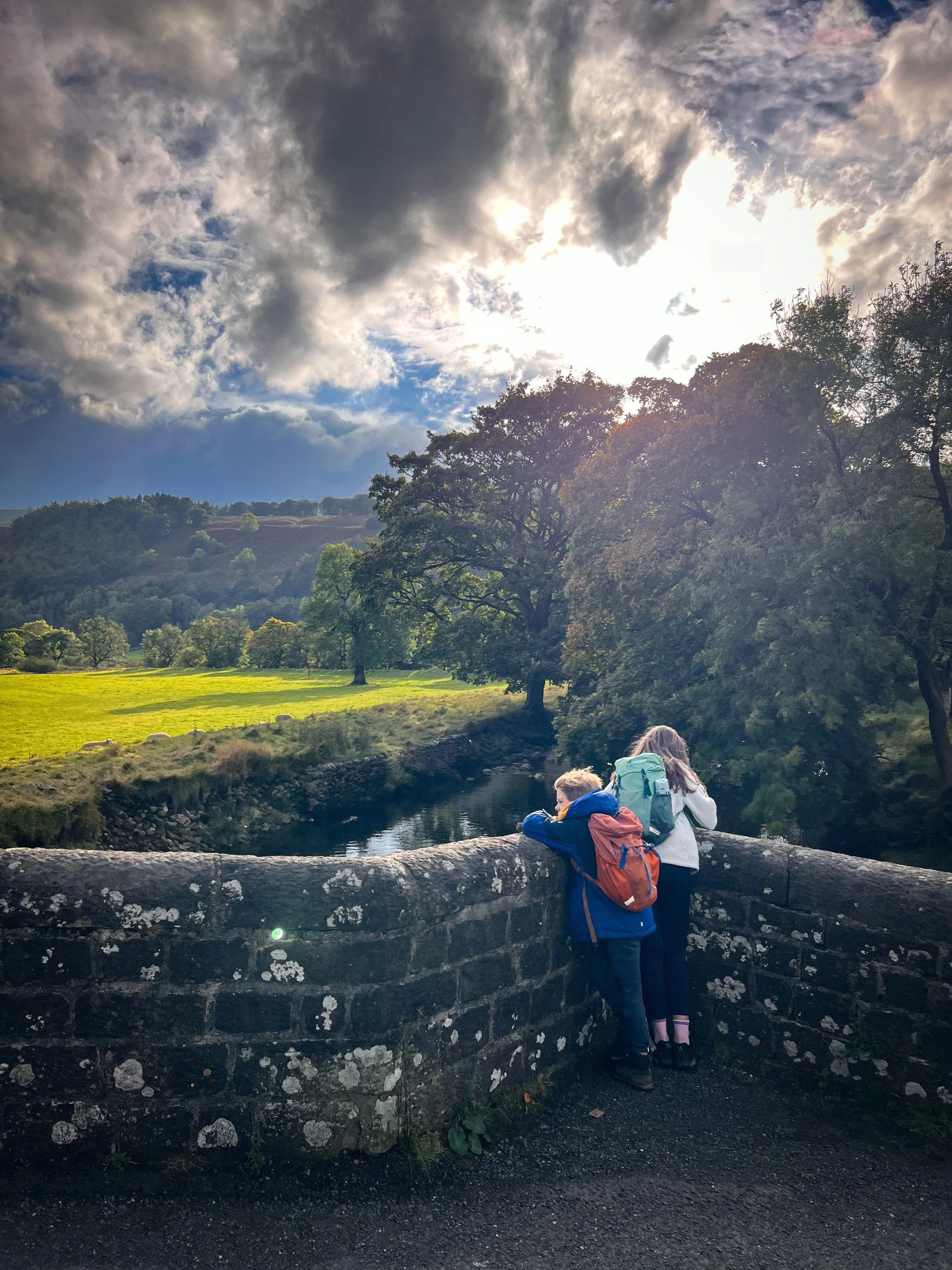
The rushing beck, soon broadens out, and you will exit the little woodland to wide open fields and soon thereafter reach a gate in the wall to the road. Turn right and follow it along until you reach the bridge at Hubberholme. It is a quiet lane, but on occasion you will encounter cars, so be aware.
Cross the bridge towards the George Inn (stop if you fancy, it’s a beautiful traditional Dales pub!) then turn left along the other country lane leading out of Hubberholme (you have now joined the Dales Way path)
The path continues for a short distance along the road, until you see a brand new (as of 2025) Permissive Footpath sign on your left. This is the newly diverted Dales Way footpath, which removes a large chunk of what was road walking. Head through the gate (which has a National Trust sign on it) and follow it. It will head straight on until you reach the river, then turn right. Follow this footpath alongside the river until you reach Buckden Old Bridge. Here, turn left and head back into the village!
Last walked January 2026.

One of the smaller cascades on the beck. You can only really get this close to it after dry weather, when the rocks aren’t slippery.
The first set of falls you reach, but this time after heavy rain. To get any closer than this would have meant getting wet feet!
The first set of falls in early autumn, here water shoes meant we could reach the waterfall!
The last spectacular falls, these are by the far the hardest to get down to, with a clamber down the bank required. They can be viewed from above.
Winter 2026, trees have fallen at the first set of falls.
Buckden Old bridge in early autumn

The walk back from Hubberholme to Buckden
For more helpful safety information and advice, head to our dedicated page.
⭐ We hope you enjoy our walks, but please exercise common sense as routes can change with the weather conditions and seasons! The routes have been walked by our own two feet, but you know your own limits. Always take a back-up map, don’t rely on GPS alone, wear appropriate clothing for the weather and take adequate snacks and refreshments with you (although as a parent, I know you already know that bit!)
⭐ Leave no trace! Take nothing away and leave nothing behind, take all rubbish home with you.
⭐ If you choose to paddle, be aware of bio security. Always wear clean dry water shoes (if worn) to avoid cross contamination of species between watercourses, this is a particular issue in the Yorkshire Dales, to help protect the white clawed crayfish.
⭐ If you decide to paddle, be aware that wild water can be dangerous, and water levels will vary season to season. Always supervise children around water. Check out the safety information on the Royal Life Saving Society website.

Want to grab the route?
Head to the Ordnance Survey Navigation App where you can download the route!
Don’t have the paper map? You’ll need Ordnance Survey, OL30 Yorkshire Dales Northern and Central.
(Always carry a back up map and know how to use it)
Image is Copyright of Ordnance Survey
Affiliate link as an Ordnance Survey champion

What’s cool for kids on this walk?
💦 Oh yes. This is a water walk that JUST. KEEPS. GIVING! But… I’ve said it before, but please exercise caution when paddling. There are plenty of places to safely paddle on this walk, but be aware that pools around waterfalls can have a steep gradient and get deep FAST. With running water, always check depths and currents before allowing children to paddle, steer clear of the white aerated water at the bottom of waterfalls and be aware that water levels can change vastly with wet weather conditions. If in doubt, don’t risk it.
🍻 Admittedly, this is one for the grown ups, but there are two pubs on this walk, The George Inn and the Buck Inn, both are super cosy in the winter and have beer gardens for the summer. Both are family friendly.
🛝 Whilst there is no park at Buckden, there is one nearby in Kettlewell, where you can also find an ice cream kiosk too. Find out where all the nearest parks are by heading to our play park directory!
🌳 Walking distractions…… well splashing and throwing stones will sort half of this walk for you, but what about the rest?! Well the meadows and fields of Upper Wharfedale have some of the finest wild flowers, so go check out which bees you can spot! Or, the smooth rounded stones found at the river banks of Hubberholme are the kind that are great for painting! Or try one of our whinge busting walking games? Or you can download a free scavenger sheet!
Scroll using the arrows for all our Family Friendly Walks
-
![Swimming in Janet's Foss Yorkshire Dales]()
Waterfall Walks
-
![Malham cove walk for kids]()
Pushchair Friendly
-
![Pinhaw Beacon trig point walk near Skipton]()
Peak Bagging Walks
-
![The Park at Greenhow Nidderdale]()
Walks with Play Parks
-
![Gordale Scar in Malham Yorkshire Dales]()
Organised by Location
-
![Walking in the woodland in Wensleydale]()
Woodland Walks
-
![Playing on the shore of Embsay Reservoir Yorkshire Dales]()
Reservoir Walks
-
![The ruins of Bolton Abbey]()
Bolton Abbey Estate Walks
-
![Leaping over the stile at Almscliffe Crag]()
Walks Under 2 Miles
-
![Child walking into a pub in Appletreewick]()
Walks with Pubs and Cafes


Follow us for up to date Outdoors Adventures!
We live and BREATHE the Yorkshire Dales outdoors life!
Come follow our journey over on Instagram and Facebook, where you’ll find up to date walk info, breaking news on Yorkshire Events, new Yorkshire Dales wild swim spots, climbing, caves and more!


Follow us on Social Media for all the up to date info: @thereluctantexplorers
Leave No Trace
The Yorkshire Dales is our home, and the home of so many others who care deeply about this beautiful space.
Should you visit, make sure to:
Take home anything you bring, leave no rubbish behind.
Make the world a better place by picking up any rubbish you see, even if it isn’t yours.
Leave everything else as you found it.