Ingleborough
Ingleborough is the second highest peak in the Yorkshire Dales National Park and is one of the famous Yorkshire Three Peaks.
Having now climbed this mountain a grand total of five times, using each of the three major routes, I have come up with two options for you!
An easier and shorter family friendly there and back again.
And a more challenging longer circular, which is still family friendly, but more of a challenge for older kids.
Fancy climbing Ingleborough with the kids?
Well here is what we consider to be the most family friendly route up and down the second highest peak in the Yorkshire Dales, as well as the more challenging circular route from Clapham. Because in the end, I couldn’t decide and you know what? The circular hike from Clapham is too beautiful to not include.
Researching the most family friendly route up Ingleborough took well over a year, and after now climbing the mountain FIVE times, I’ve come up with two routes! You can read more about doing the Yorkshire Three Peaks with the kids (both separately and as the 12 hour challenge) over on the blog, but these routes I feel are the most family friendly of all the major routes going up and and down Ingleborough.
Below, you’ll find a shorter and easier linear route from Ingleton and also a more challenging and longer route from Clapham. The great news is, both routes end with a park and a range of options for pubs and cafes too!

Buy Me a Coffee
Make a Donation
Thank you for taking the time to have a look at my website and for reading this now!
I set up the Reluctant Explorers and maintain the website and attached social media accounts in my spare time, around mum-life and two jobs. It was designed to provide access for parents to free resources to help get more families outside and exploring in nature. These walks have all been created by myself and the kids and we have walked each one ourselves (and re-walk them regularly to keep the information as up to date as we can).
If you would like to support us and can afford a few pennies, you can make a donation to our ‘Buy Me a Coffee’ page. Simply tap the button below to head there!

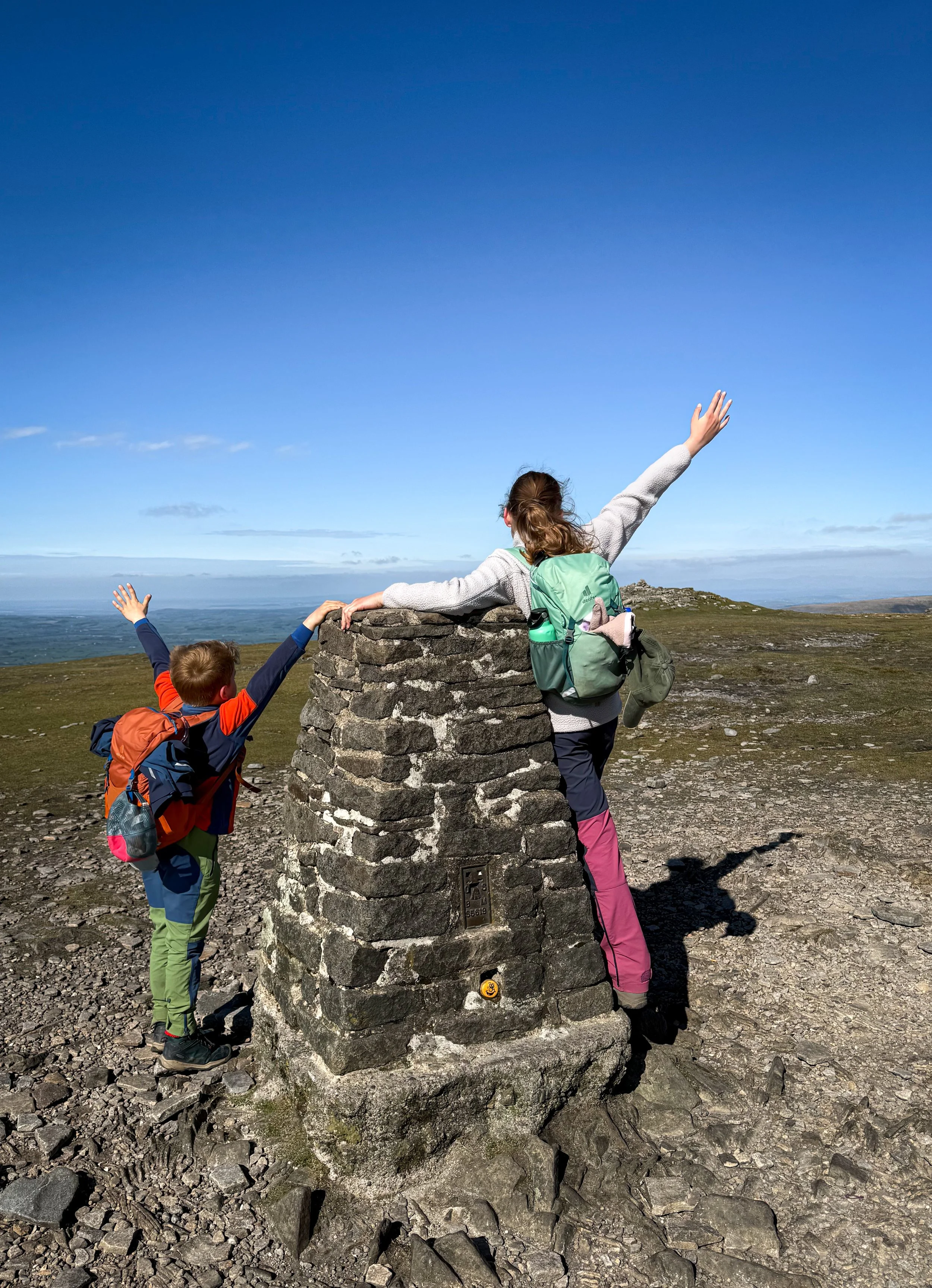
Standing at the viewpoint which is set into the summit shelter on the Ingleborough Plateau.
Walk Details for Climbing Ingleborough
Distance: Ingleton: 7 miles linear walk Clapham: 10 miles.
Terrain: Ingleton and Clapham: Very well walked and signposted paths. In good visibility, this walk is very easy to navigate. In poor visibility, the summit of Ingleborough is a challenge, as it is a relatively flat and featureless plateau surrounded by steep drops, therefore navigation skills and a map are required (see pictures for poor visibility)
Parking: Ingleton: One of the many pay and display car parks in Ingleton. This route starts from the bus stop in the Community Centre pay and display.
Clapham: The pay and display car park in Clapham.
Both are large pay and display car parks and you shouldn’t face a problem getting parked. In case you are, do have a plan B. Why not try parking at Ribblehead and climbing Whernside instead.
Public Transport: Yes. Traveline buses are in operation between the areas of Skipton, Settle, Kirkby Lonsdale, Hawes and Lancaster. Check the bus timetables for more in depth information.
Map: OS Explorer map OL02 which covers the Yorkshire Three Peaks area.
Dog friendly? Yes, dogs to be kept under close control
Location: Ingleton, North Yorkshire. Clapham, North Yorkshire.
What 3 Words: tint.chins.machine
Toilets/ Baby Change: Can be found at the car park next to the community centre or in the car park of Clapham.
Nearest Cafe/ Amenities: Ingleton/ Clapham. Loads of options for cafes and pubs at both.

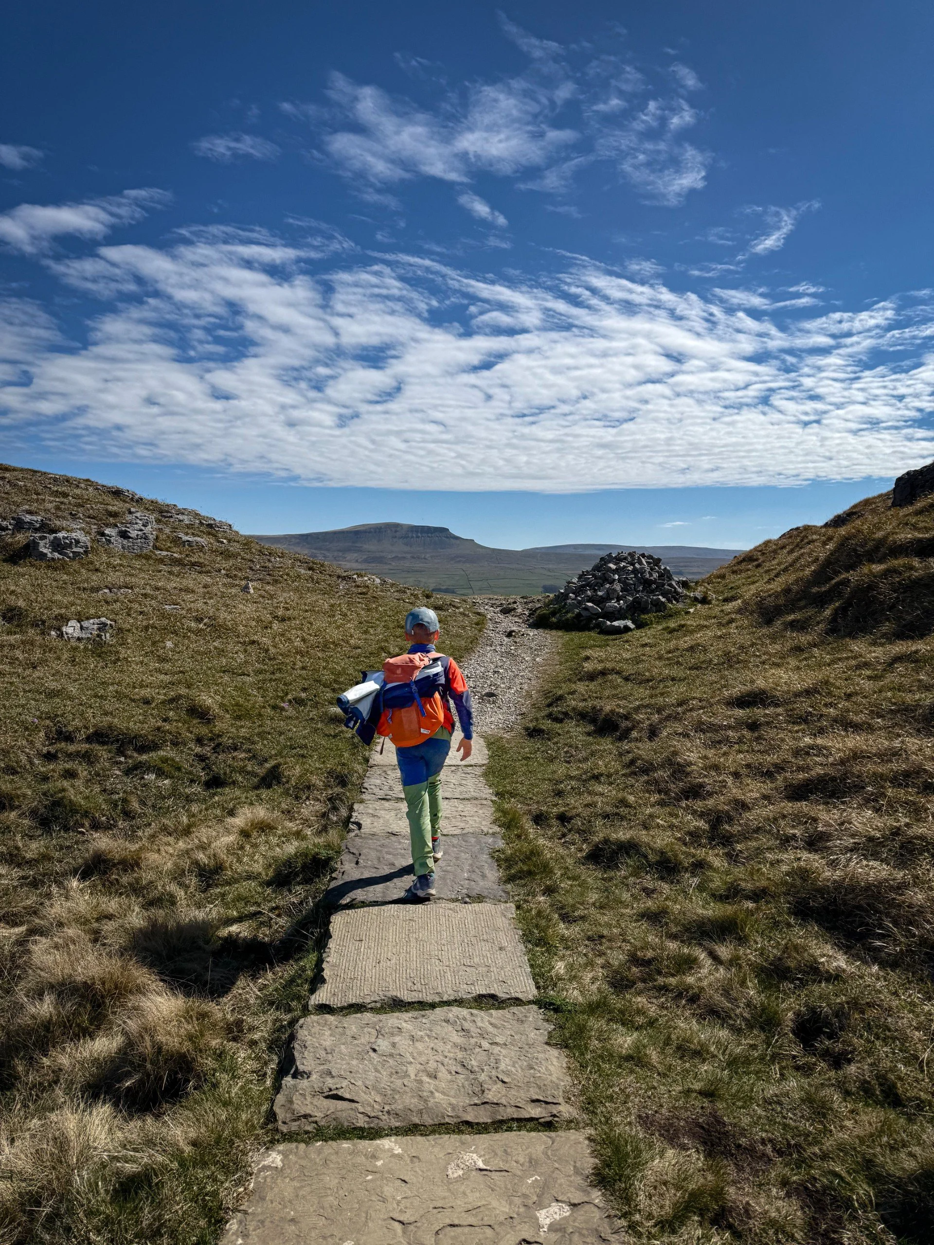
The path up Ingleborough beyond Crina Bottom.
How to walk Ingleborough
Directions to be used alongside a map and compass.
Ingleton
Beginning from the Ingleton Community Centre Car Park, head out the eastern exit, heading onto Back Gate. As you walk past the community centre, it will be to your left as you leave the car park. Turn left onto Back Gate.
Continue along this road until you see a fork ahead, High Street. Turn right here, heading in the direction of White Scar Cave (signposted). Continue along High Street, until there is another fork. This time take the left fork, which continues upwards in the direction of White Scar Cave.
To your right, you will notice a signpost that’s signposted Ingleborough 2 1/2 miles. This is your path! It heads up a wide access track, that’s rocky. Look to your right, you will see the post box to one of the most remote houses EVER. Crina Bottom. It’s located completely off-grid 1.5 miles away from the road. You will be walking along the access track, which is also the Pennine Journey national trail.
Head up the hill, then follow this rocky track as it continues uphill. After around 1km, the track heads at a right angle to the right, continue until you reach a gate through to the open fell (open access land). At this point, you will see Crina Bottom up ahead on your left. Here, you will continue, passing the property to your left, then continuing up the path as it heads up the side of Ingleborough. It is visible in the distance.
The path is relatively steady until you reach the final ascent where the path steepens to the summit. After just over 2km, you will be at the top and see the trig point, large cairn and seating area to the left.
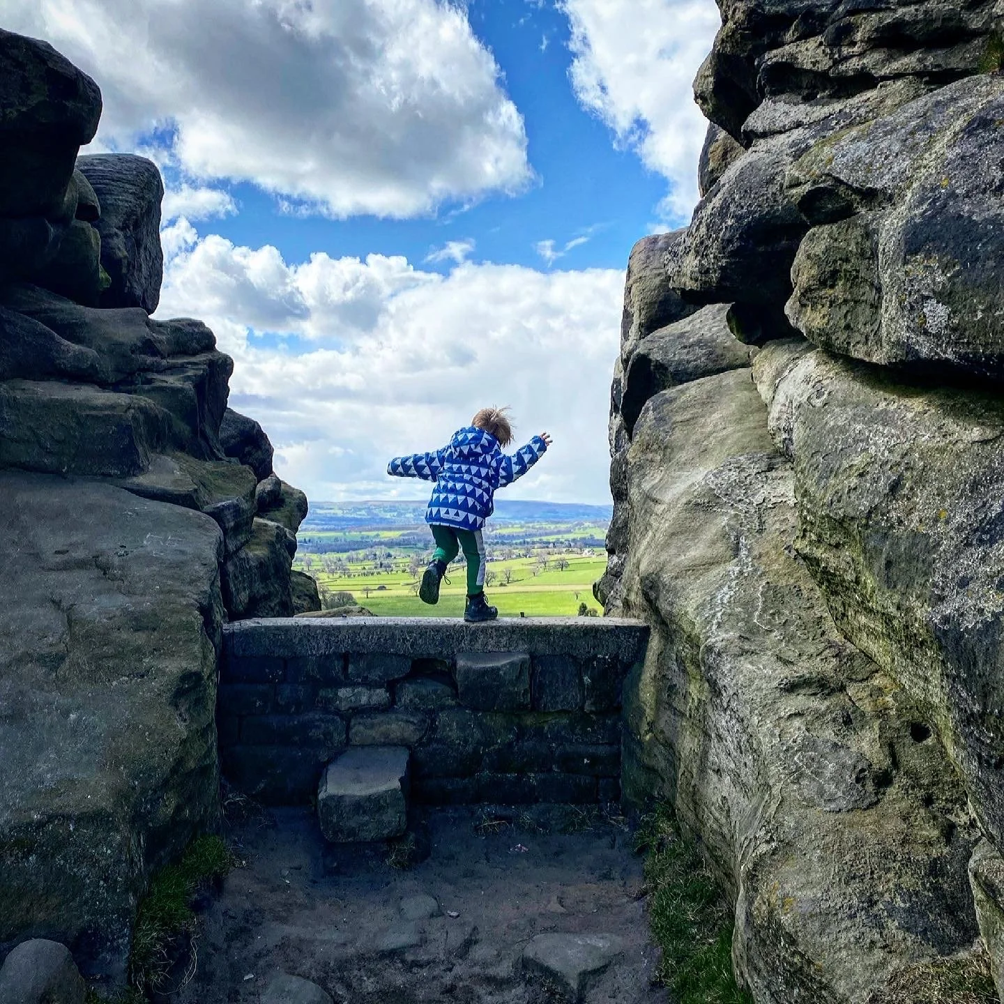
If you want to visit the true summit of Ingleborough, it’s not the trig, cairn or viewpoint seat, but it is the far less conspicuous moundy bit, obvious only by the topography, it being higher than the rest of the plateau around it. Ingleborough is like an vast rocky football pitch. Flat, rocky and virtually featureless. Very tricky to navigate in the cloud (as it often is) and can be particularly disorientating!
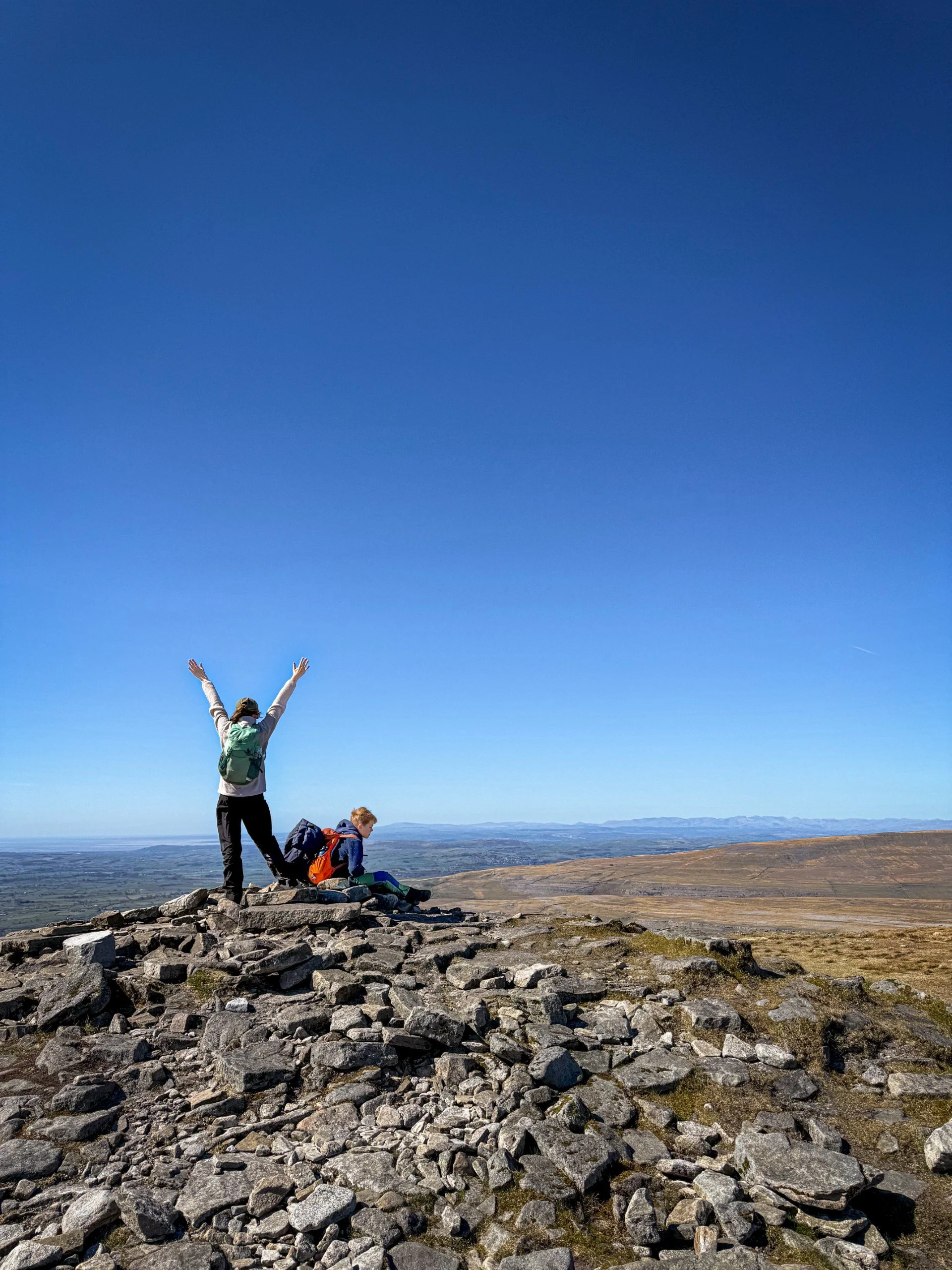
Once you have admired the views (you can see all the way to the Lake District, Morecambe Bay, the rest of the fells of the Yorkshire Dales and beyond!) then head back the way you came, taking care to use the cairn to find the top of the path you arrived on, which is pretty tricky to see from the top!
Head back the way you came because having attempted two more circular walks, the final consensus is that the linear route is the best for kids!
Route last walked July 2024
Clapham
Please make sure you bring your map! We also recommend the OS Maps app.
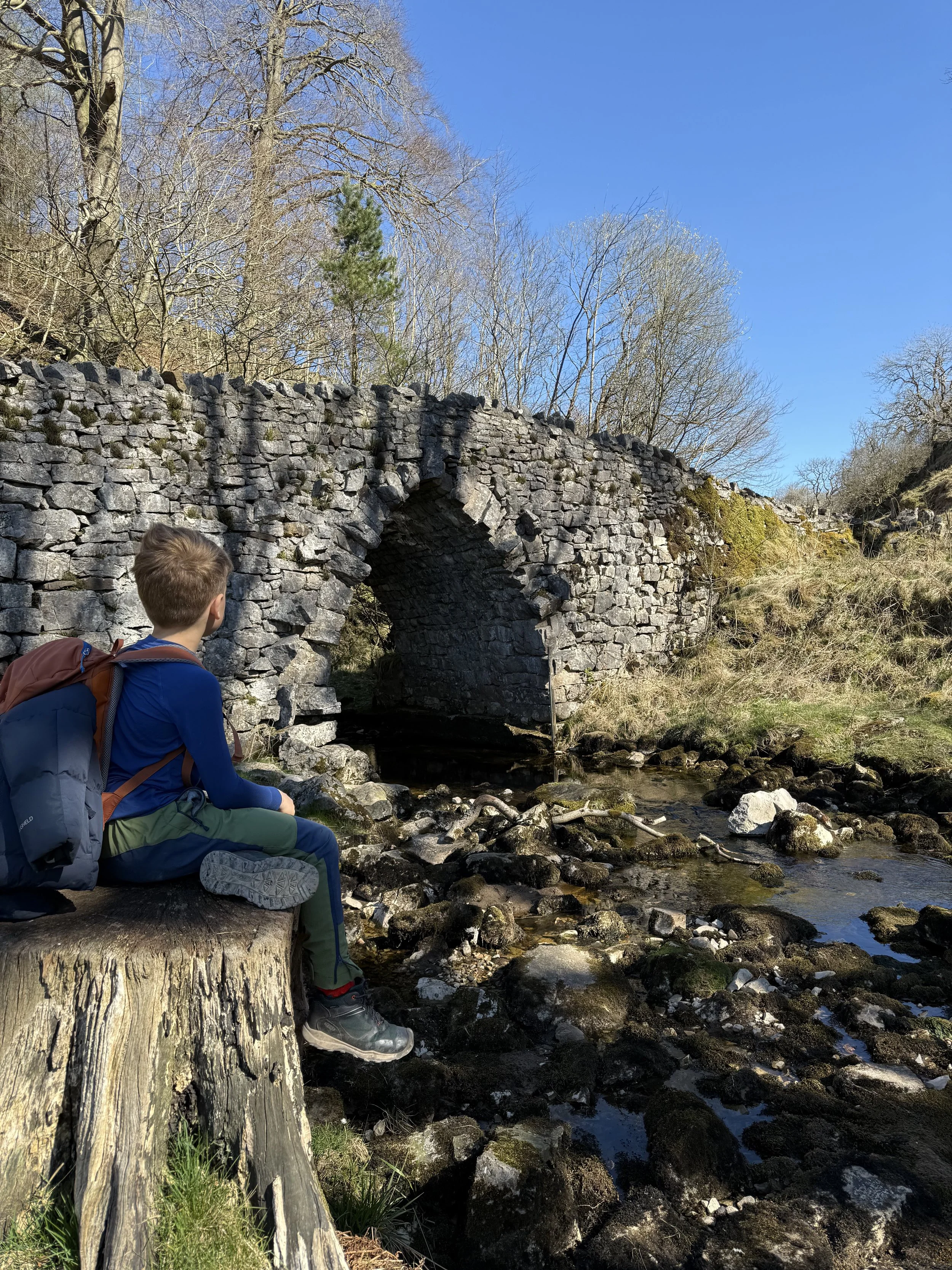
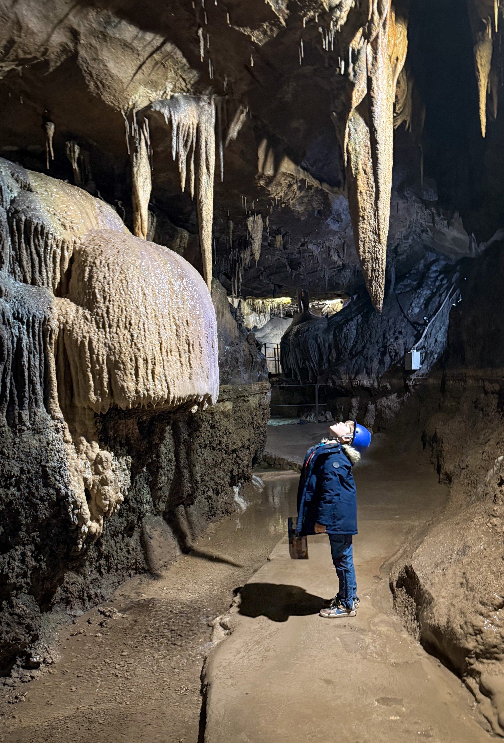
Beginning from Clapham pay and display, head out of the car park and take one of the many bridges to cross to the far side of the beck. Turn right and walk up towards the Sawmill Cafe and the beginning of the Ingleborough Estate Nature Trail. Here you can either head into the trail (an admission charge applies) and walk through the grounds of the estate, or you can continue past the cafe, on the road (passing a farm on your right), to find the public bridleway/ footpath behind it. It is signposted Ingleborough Cave/ Gaping Gill/ Ingleborough. Follow the sign along the clear track.
Whichever route you choose will take you to Ingleborough Cave (show cave, there is an entry charge which you can pay at the Sawmill Cafe). Continue past the cave, crossing the bridge and then head along the wide track taking you to Trow Gill. The path bends round to the left before heading over a stile into the gorge. You will regularly see climbers here!
Continue through the gorge, as the rocky path rises and then narrows as it leaves Trow Gill. The path continues to roughly follow the line of the wall as you continue upwards.
When you reach the double stile in the wall, then head through this and continue to follow the wide path as it heads towards Ingleborough. After a short distance, you will see an offshoot to the right. This path takes you to Gaping Gill. If you fancy a peek at the opening to the pothole, then go and take a look (you can only go down Gaping Gill on winch day)
Once you have checked out Gaping Gill, head back to the main path. This is clear and well walked, as it heads up to Little Ingleborough.
Continue to follow the path as it heads up to the summit of Ingleborough.
The summit is wide, flat and covered with rocks! It can be very disorientating on the plateau in cloud, so be prepared (as Ingleborough is often shrouded in cloud, when the others are cloud free!) To head back from the trig point to the return route, retrace your steps and look for the cairns. Be aware that a lot of these cairns mark the sheer drop on one side of Ingleborough, you are looking for the clear route down, heading in an east-north-east direction (16 point compass) The path is well walked and obvious - anything else, and you may be heading in the wrong direction! In good visibility, what you will be doing is retracing your steps to the point where you reached the plateau and then heading back down.
Follow the path as it reaches the clearly flagged route down until you reach a waymarked path split. You don’t want to take the route you came up on, so ignore that. Of the remaining two options, the left takes you on the descent to Chapel le Dale or along the ridge walk, the right will take you in the direction of Horton in Ribblesdale and Pen y ghent. It is the Y3P trail and it’s very well walked. You need to head right here.
The path continues to descend towards Horton, until there is a split just after the ruin of an old farm building. Here you need to head right. The path will bend in the direction of Clapham (the left hand route is the Y3P route that takes you to Horton)
Follow the obvious and wide path. You will head through limestone pavement a plenty here until you reach another crossroads.
Here you need to follow the Pennine Way waymarker. the path is wide, clear and grassy and you will see a huge cairn ahead on the rise of a hill.
Come down through the gate, following the Pennine Way waymarkers until you hit a stony track. Follow this until it reaches a plantation, turn right, then head downhill under the dark tunnels until you reach Clapham again!
Last walked April 2025
The top-most top bit!

The view from the top of Inglebourough on the northern edge looking at Whernside which is in the foreground, then in the distance you can just about make out the Howgills
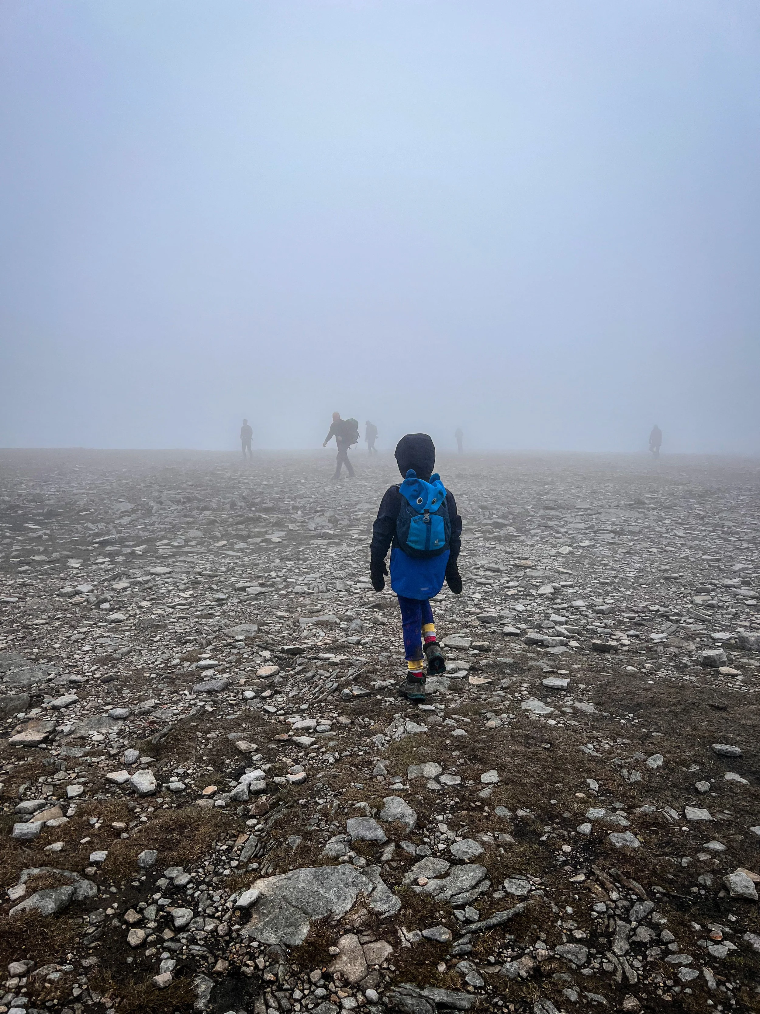
The summit when the cloud came down. Believe it or not a minute earlier, this had been completely clear. We lost the views within seconds and then it didn’t shift for the rest of the day. This is where the importance of being able to navigate using a compass really comes into its own. The plateau has some sheer drops to the side and is virtually featureless in these conditions.
The Route from Clapham
The bridge at Ingleborough Cave
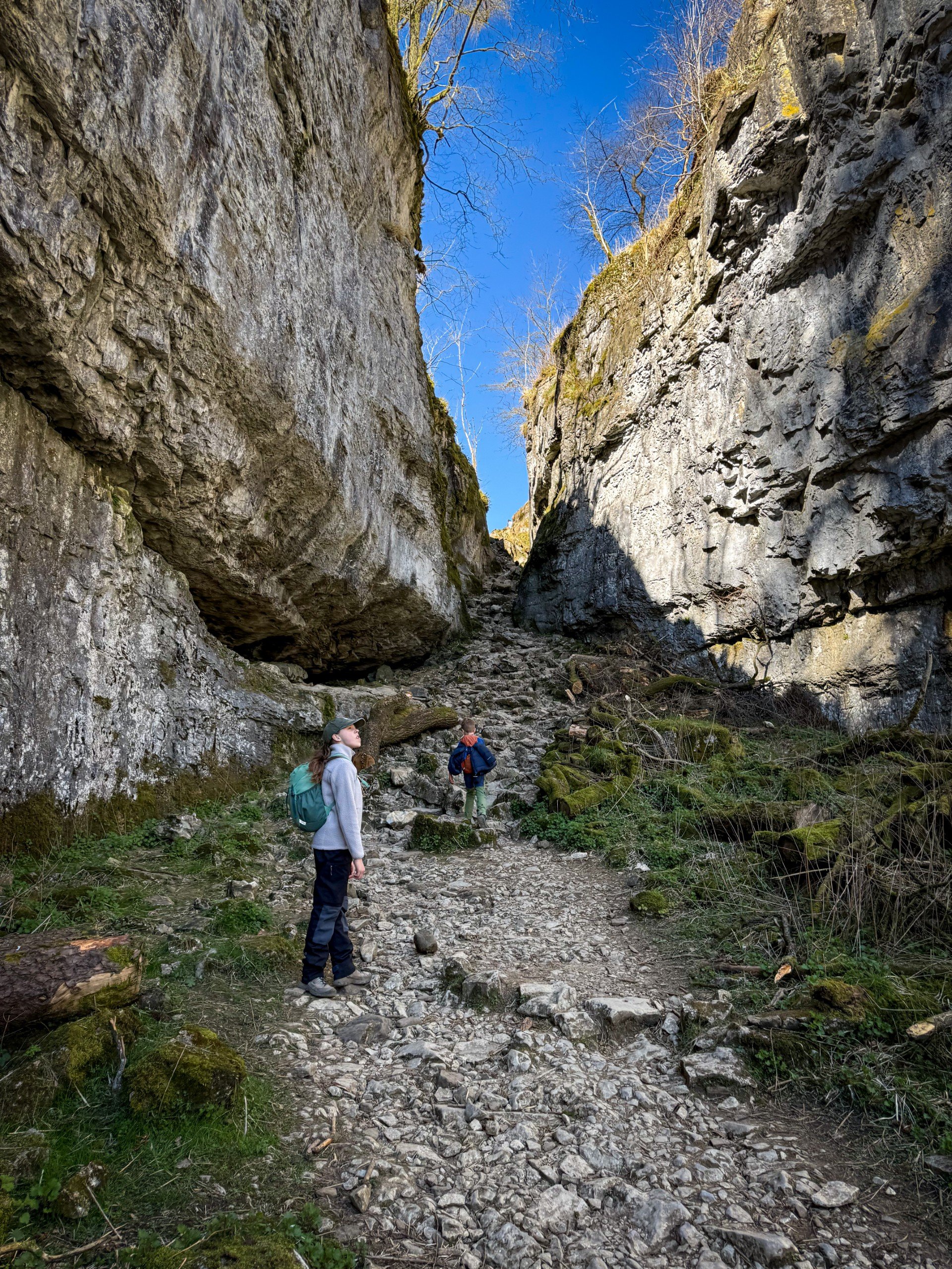
Trow Gill
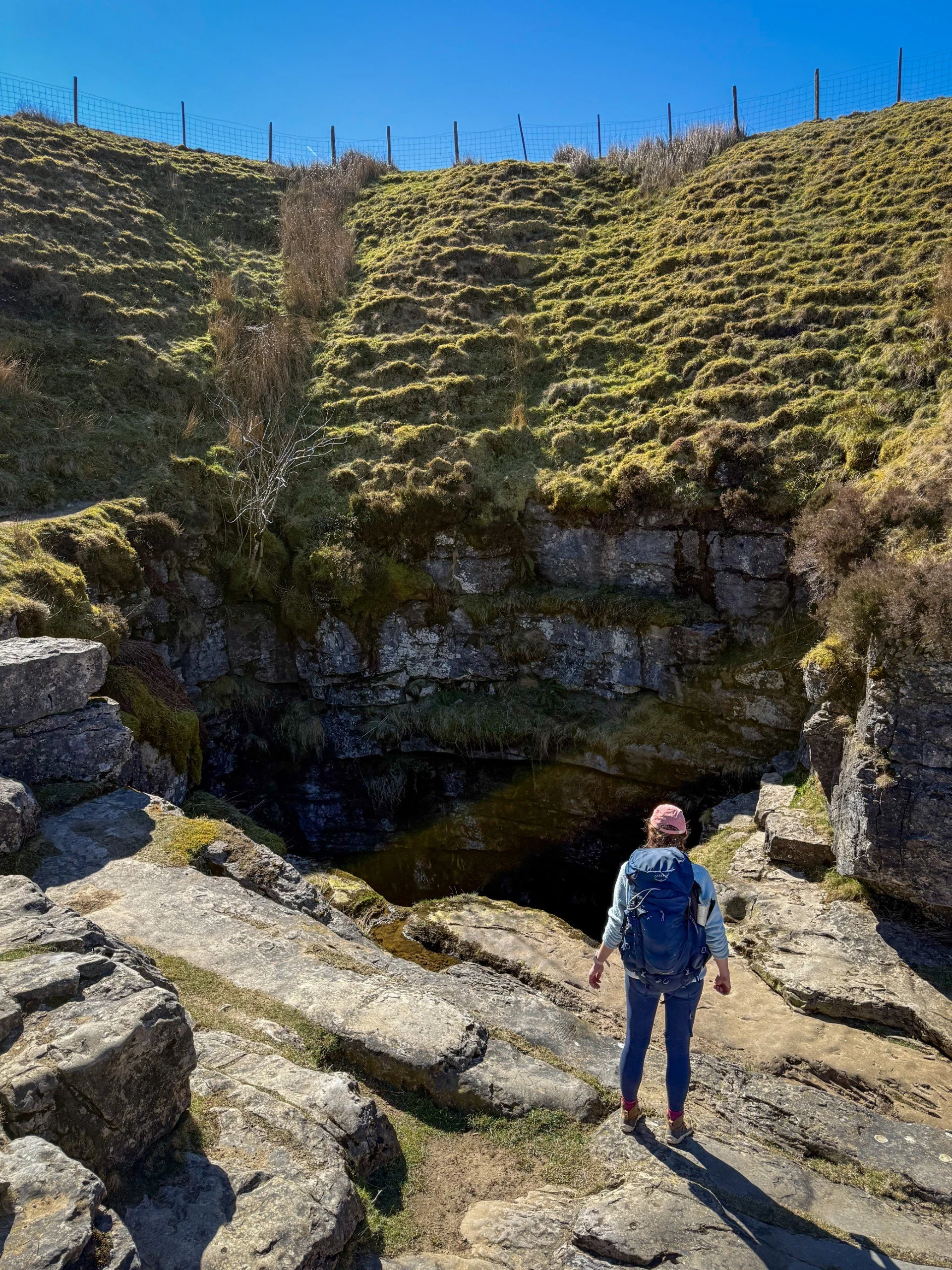
The massive black hole that is Gaping Gill
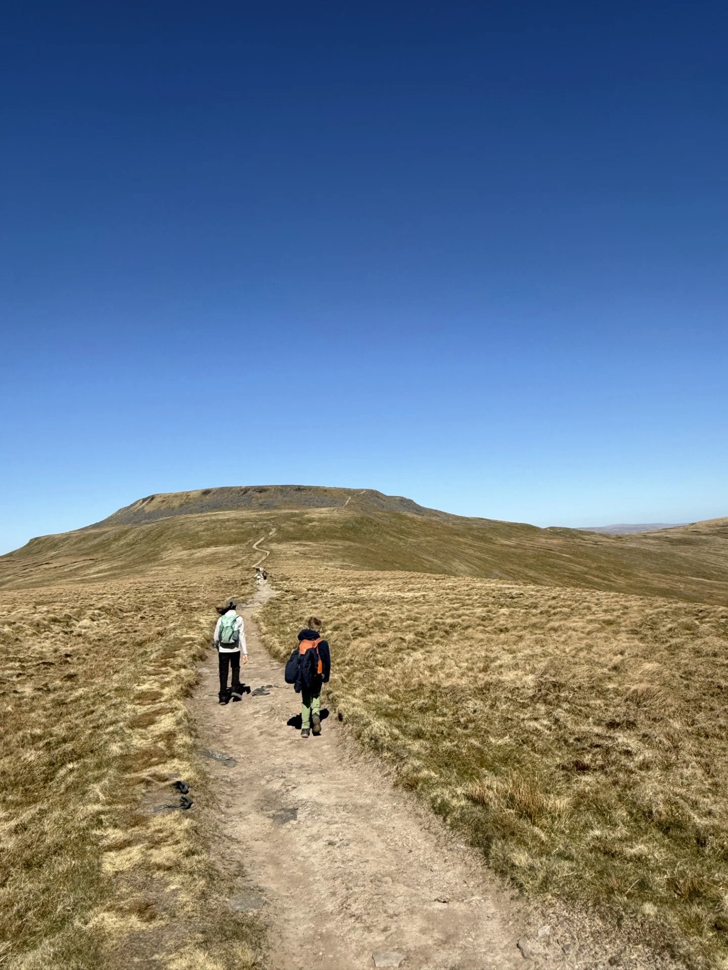
Walking towards the final ascent from Little Ingleborough
The path towards Horton with Pen y ghent beyond
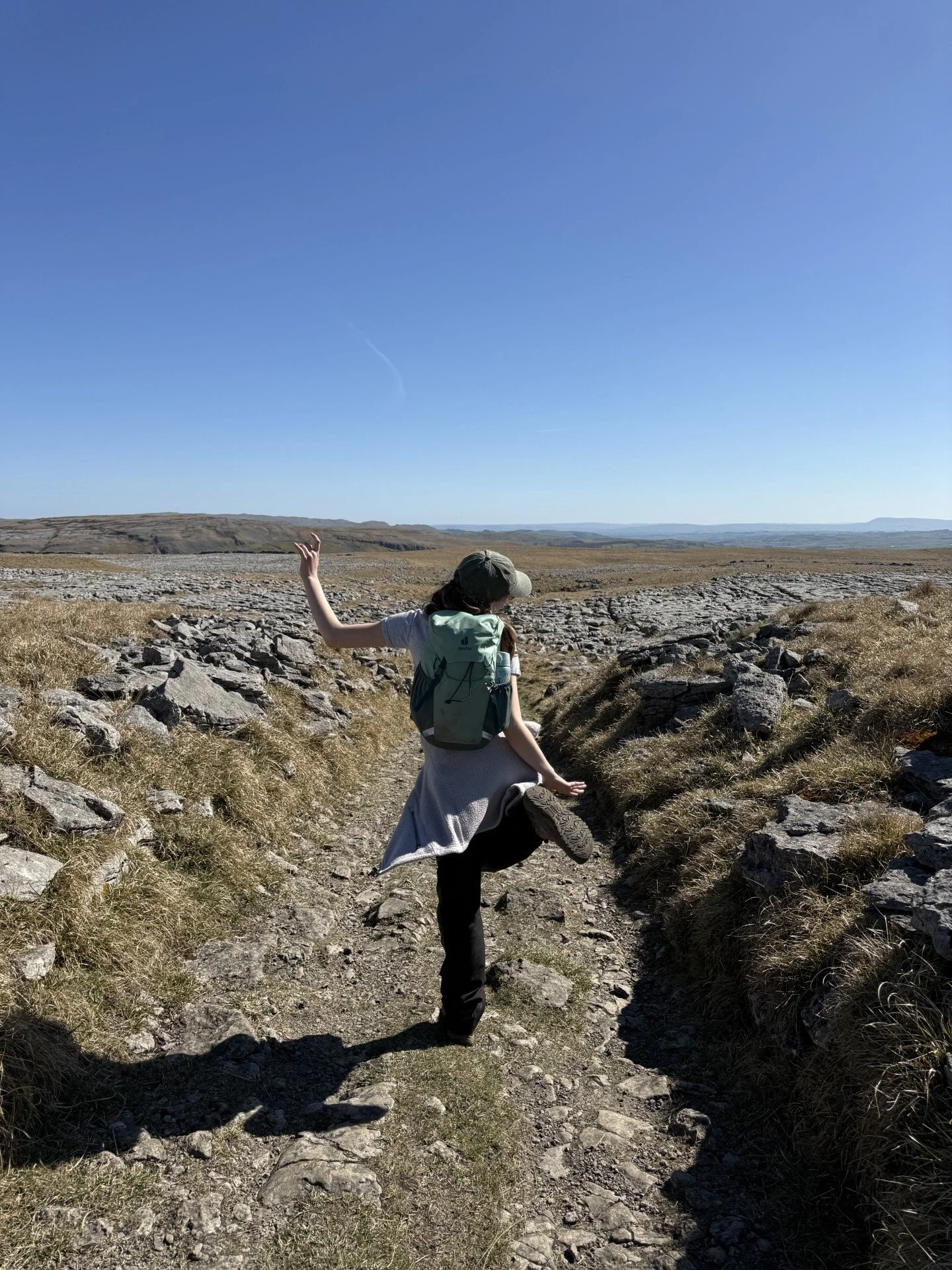
The return route to Clapham through the limestone pavements of the Ingleborough Nature Reserve

Just before the final ascent to Ingleborough.
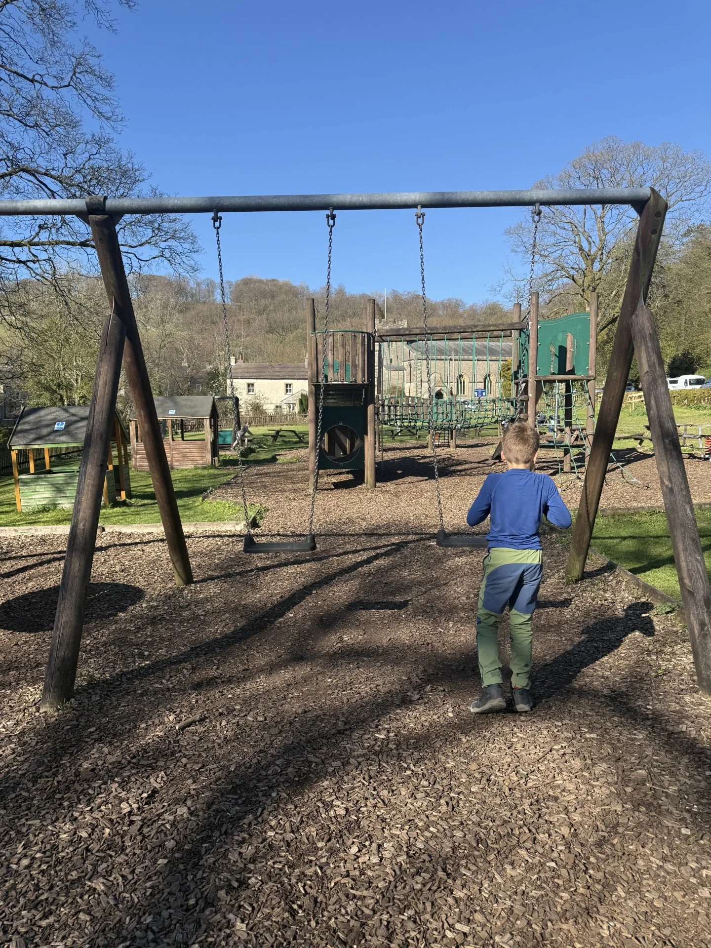
The play park at Clapham
What’s cool for kids on Ingleborough?
✨ Ingleborough has quite a lot of awesome history associated with it! It was once a Brigantian hillfort, and is a site of archaeological significance which is why it is important not to remove or move any rocks on the summit. There were around 20 roundhouses situated on top of the summit and the ramparts were around 3,000 feet long. It is the highest hillfort in England (source: Historic England)
Not only that, but there was once a hunting tower built on top of the mountain too, created to shelter for grouse shooting. On the day of celebration back in 1830, a horse race was held on the summit plateau, but during the day of celebrations it was pulled down by angry locals and never replaced. Such a weird little bit of history!
👻 But not only is there some quirky history on top of the mountain, there are countless tales of folklore and spirits, as well as a pretty fascinating bit of dark history. This mountain really is the stuff of legends!
It is said that there once were giants that sat on top of Ingleborough, who would hurl rocks to try and create a pathway for them to use across the mountains. This was the explanation given to all the rocks strewn across the valley. Ghostly horses were reported to silently gallop across the plateau, and corpsie lights shone in the gloom leading travellers to their doom. With rumours of the valley being cursed by druids, it’s not wonder that this led to the rumour that the land around Ingleborough was bad luck.
Head up from Clapham and you’ll pass Gaping Gill, which was thought to be the entrance to the underworld (which, technically, it is!) But beneath the surface there were fairies and dark spirits, not brave cavers exploring the systems! Gaping Gill is said to be haunted by a monk, who presumably met a grim end by stumbling into the big black hole which you can see above ground. (Source Brigantes Nation)
🥸 I’m not stopping there! On the route up from Clapham you pass Trow Gill. On the land above this huge chasm of limestone is an unassuming cave, where they discovered the body of a world war two German spy, who was found with an empty vial of poison, walled up inside.
🧙 If that’s STILL not enough, in Clapham there was the witch, Alice Ketyll, who has been immortalised in the village millennium stone after she performed a ritual to try and aid the Lancastrian cause in the War of the Roses! PHEW.
A little whistlestop tour of the legends and stories of Ingleborough. If you want to read more, head to the full details of our Tales of the Dales.
🧒 There is a park in Ingleton, simply head into the centre of the village and towards the swimming pool. It is next door, in Clapham, you’ll find it in the middle of the village.
🍦For the Clapham route, stop off for ice cream at Ingleborough Cave (you’ll have plenty of options at the end in Ingleton!)
🧚If you start from Clapham, you will head along the Mimpish Squimbies trail, which is a fairy trail through the Ingleborough Estate (charges apply - you can avoid this to not incur the charge)
🌳 why not try one of our walking games? Or you can download a free scavenger sheet!

Want to grab the route from Ingleton?
Head to the Ordnance Survey Navigation App where you can download the route!
(Always carry a back up map and know how to use it)
Image is Copyright of Ordnance Survey
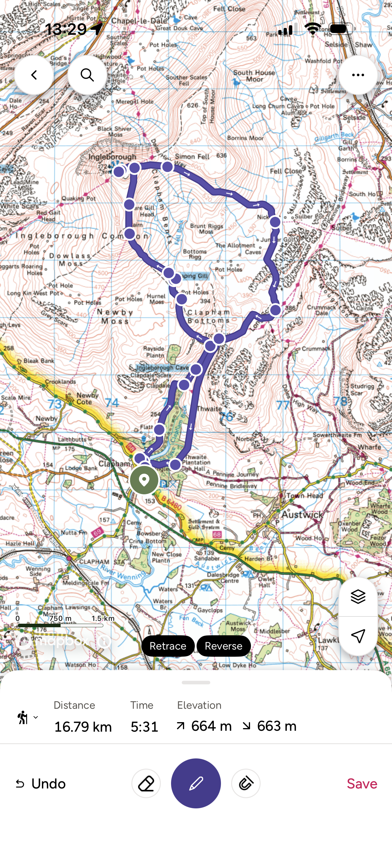
Want to grab the route from Clapham?
For this walk you will need an OS Explorer map OL02 which covers the Yorkshire Three Peaks area. Grab one from the OS shop.
(Always carry a back up map and know how to use it)
Image is Copyright of Ordnance Survey
Affiliate link as an Ordnance Survey Champion
Helpful Information!
For more helpful information head to our safety tips and advice page.
⭐ We hope you enjoy our walks, but please exercise common sense as routes can change with the weather conditions and seasons! These walks are intended as a guide only and are undertaken at your own risk. The routes have been walked by our own two feet, but you know your own limits. If in doubt, turn back. Always take a back-up map, don’t rely on GPS or your phone alone, wear appropriate clothing for the weather and take adequate snacks and refreshments with you (although as a parent, I know you already know that bit!)
⭐ Leave no trace! Take nothing away and leave nothing behind, take all rubbish home with you.
⭐ Be adventure smart. Do you have the skills to navigate yourself on this mountain in the conditions you are presented with? If the answer is no, save it for another day. Check out Mountain Rescue’s advice on mountain safety.

Staying in the Ingleton area?
We have a Visit with Kids guide to provide you with all the family friendly inspiration you need! Think family friendly walks, local attractions and importantly, where to find the ice cream (and the play park!)
There are two guides covering this area and the nearby areas so why not check out our…
Visit Settle and Ribblesdale with the Kids Guide
Visit Sedbergh, Dentdale and the Westmorland Dales with the Kids Guide
Scroll using the arrows for all our Family Friendly Walks
-
![Swimming in Janet's Foss Yorkshire Dales]()
Waterfall Walks
-
![Malham cove walk for kids]()
Pushchair Friendly
-
![Pinhaw Beacon trig point walk near Skipton]()
Peak Bagging Walks
-
![The Park at Greenhow Nidderdale]()
Walks with Play Parks
-
![Gordale Scar in Malham Yorkshire Dales]()
Organised by Location
-
![Walking in the woodland in Wensleydale]()
Woodland Walks
-
![Playing on the shore of Embsay Reservoir Yorkshire Dales]()
Reservoir Walks
-
![The ruins of Bolton Abbey]()
Bolton Abbey Estate Walks
-
![Leaping over the stile at Almscliffe Crag]()
Walks Under 2 Miles
-
![Child walking into a pub in Appletreewick]()
Walks with Pubs and Cafes


Follow us for up to date Outdoors Adventures!
We live and BREATHE the Yorkshire Dales outdoors life!
BEEN INSPIRED? Tag us @reluctantexplorers
Come follow our journey over on Instagram and Facebook where you’ll find up to date walk info, breaking news on Yorkshire Events, new Yorkshire Dales wild swim spots, climbing, caves and more!


Follow us on Social Media for all the up to date info: @thereluctantexplorers
Leave No Trace
The Yorkshire Dales is our home, and the home of so many others who care deeply about this beautiful space.
Should you visit, make sure to:
Take home anything you bring, leave no rubbish behind.
Make the world a better place by picking up any rubbish you see, even if it isn’t yours.
Leave everything else as you found it.