
Semerwater
Semerwater is the only named Lake in the Yorkshire Dales. Sure, there are some tarn, but this lake is so lake-y they named it thrice! (Intrigued, read on!)
Located in the breathtakingly remote Raydale, just up from Wensleydale, Semerwater is great for hiking, water sports, wild swimming and has a fair share of its very own Yorkshire Dales Legends too!
Looking for a circular walk around Semerwater?
This family friendly circular is a great wander for those who love a lakeside adventure! It starts and ends at the edge of this stunning lake, and it really delivers in terms of views! (OK the kids may not be as keen on that)
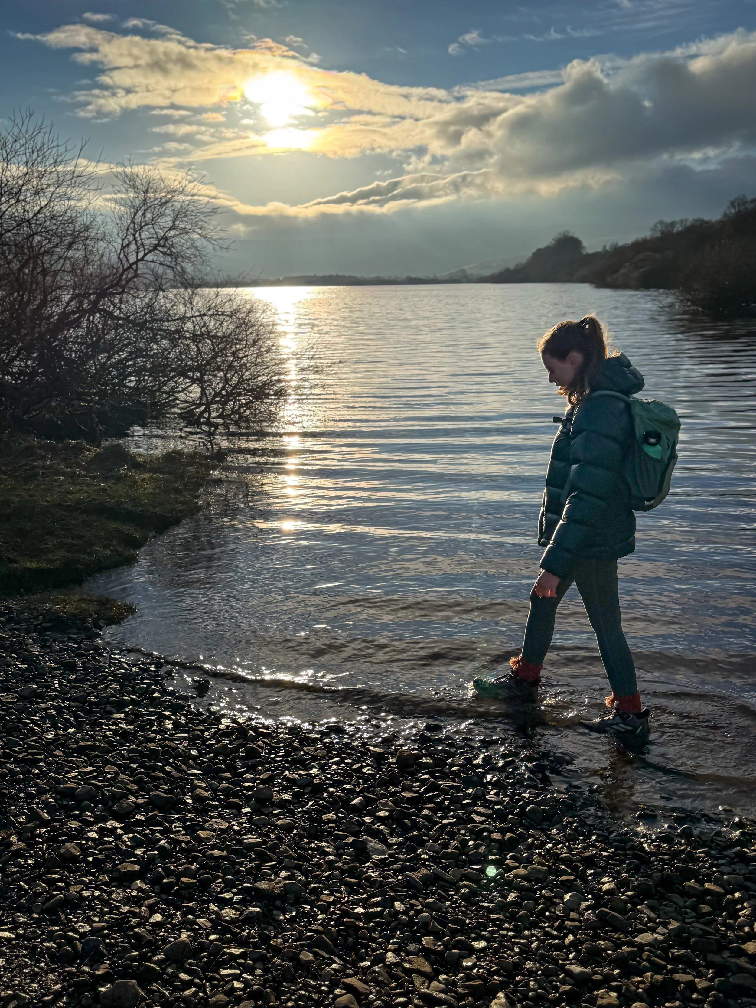
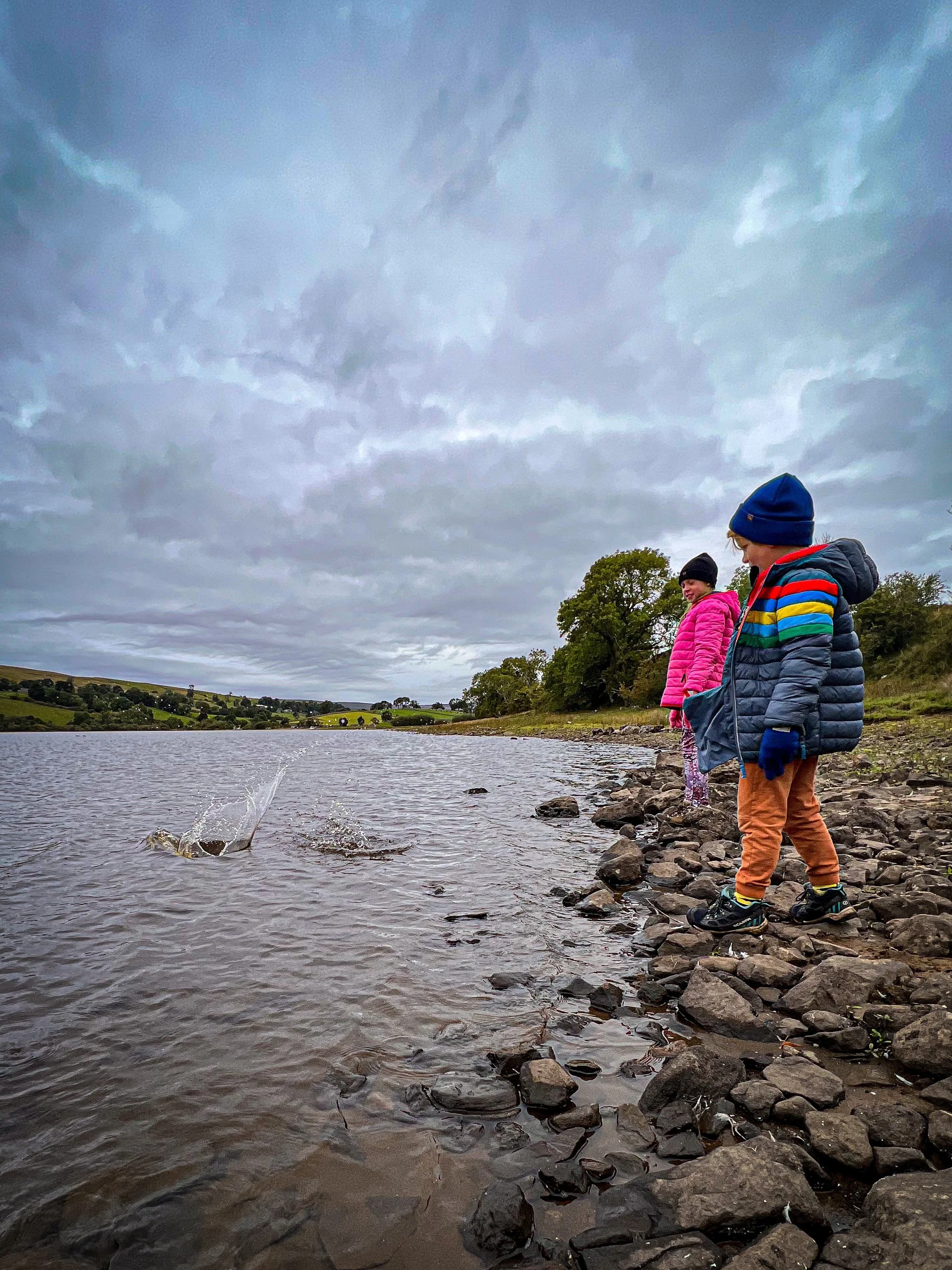
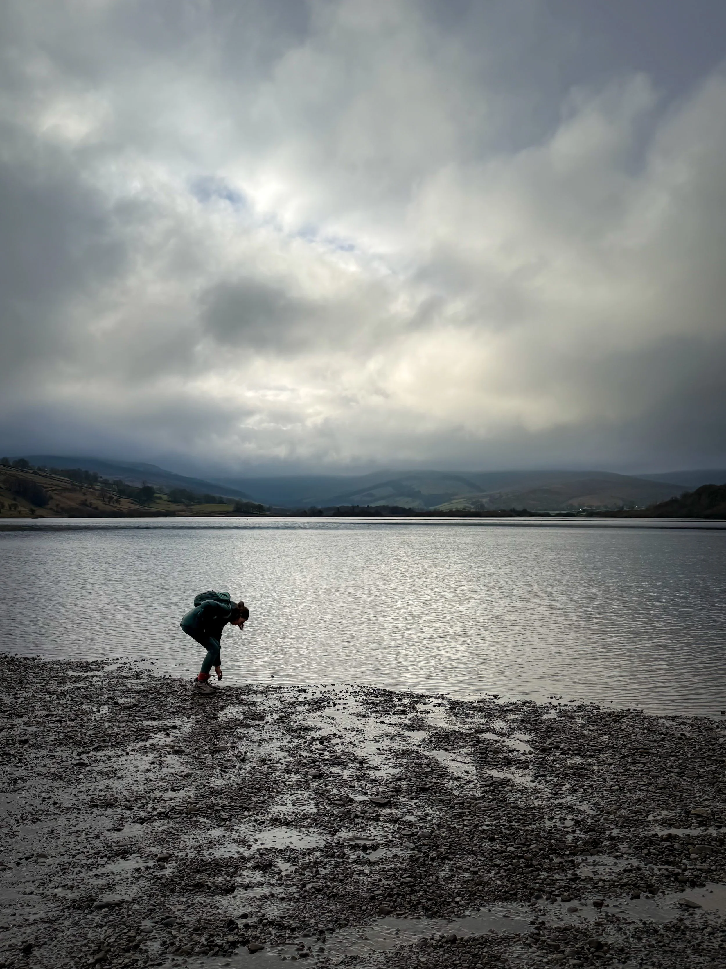
But the good news is, it’s EXCELLENT for a paddle and a stone throw, as the owner of the Lake allows wild swimming and water sports on the Lake (small charges apply) and it also has a great legend and ruins to explore too!
What can I say? We love this walk!
Buy Me a Coffee
Make a Donation
Thank you for taking the time to have a look at my website and for reading this now!
I set up the Reluctant Explorers and maintain the website and attached social media accounts in my spare time, around mum-life and two jobs. It was designed to provide access for parents to free resources to help get more families outside and exploring in nature. These walks have all been created by myself and the kids and we have walked each one ourselves (and re-walk them regularly to keep the information as up to date as we can).
If you would like to support us and can afford a few pennies, you can make a donation to our ‘Buy Me a Coffee’ page. Simply tap the button below to head there!
The first time we attempted this walk in 2022 (aged 8&6)
Walk details for Semerwater
Distance: just over 5 miles
Terrain: Some uneven underfoot, muddy in places, particularly on the first and last stretch. There is a short section of road walking, which takes place on a quiet country road. On our most recent visit on a sunny Saturday, we encountered no cars. Be aware that the ford will flood after wet weather, so an alternative route will need to be taken, but details about that are below!
Parking: Shoreside at Semerwater. Make sure you pay for parking at the Low Blean farm, which is a short walk up the road, and is well signposted. At the time of writing, it was £3 for the day.
Public Transport: There are no public transport links for this walk.
Dog Friendly? Yes - but be aware there are cows on this walk.
Location: Raydale, which is an offshoot from Wensleydale
Map: OS Explorer OL30 affiliate link as an Ordnance Survey champion
What 3 Words: dusted.goal.spindles (parking)
Toilets/ Baby Change: None.
Nearest Cafe/ Amenities: Bainbridge which has a pub and play area.
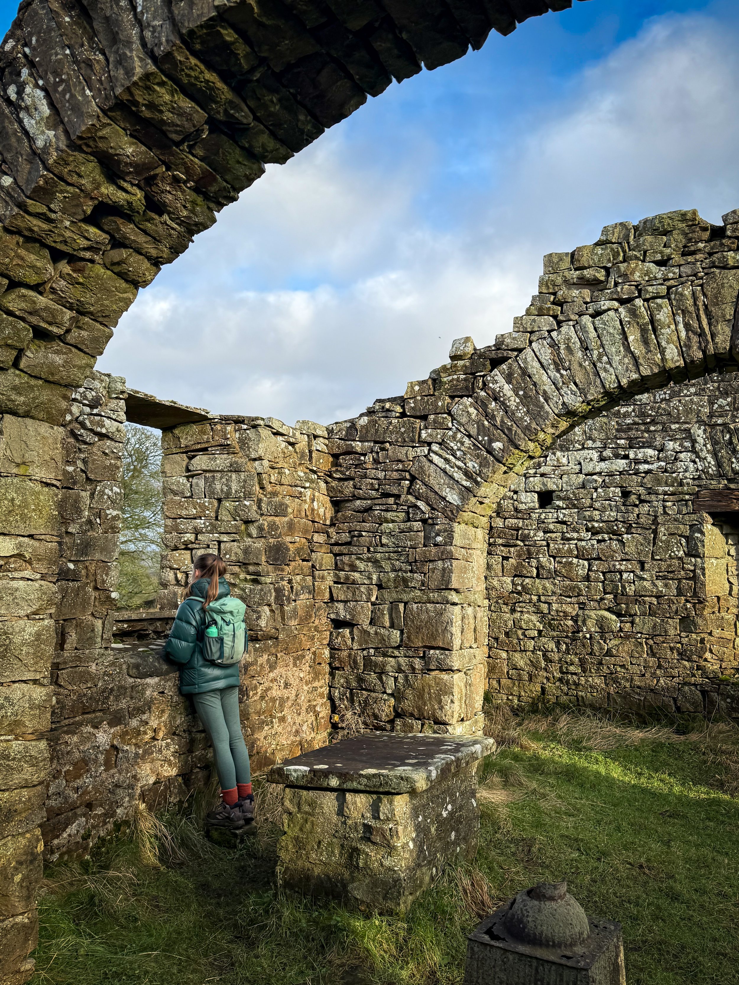
You are able to take a look at the ruins of Stalling Busk church. There is an information board there to tell you more.
How to walk around Semerwater
Directions to be used alongside a map
From the car park head east along the road, walking towards Low Blean Farm where you pay for parking. The lake is on your right hand side. Opposite the driveway on the edge of the road is a metal gate and public footpath sign for Stalling Busk, head through this and across the next field, roughly parallel to the line of the wall on your right. In the wall opposite is a wooden gate. Head through that and across the next field.
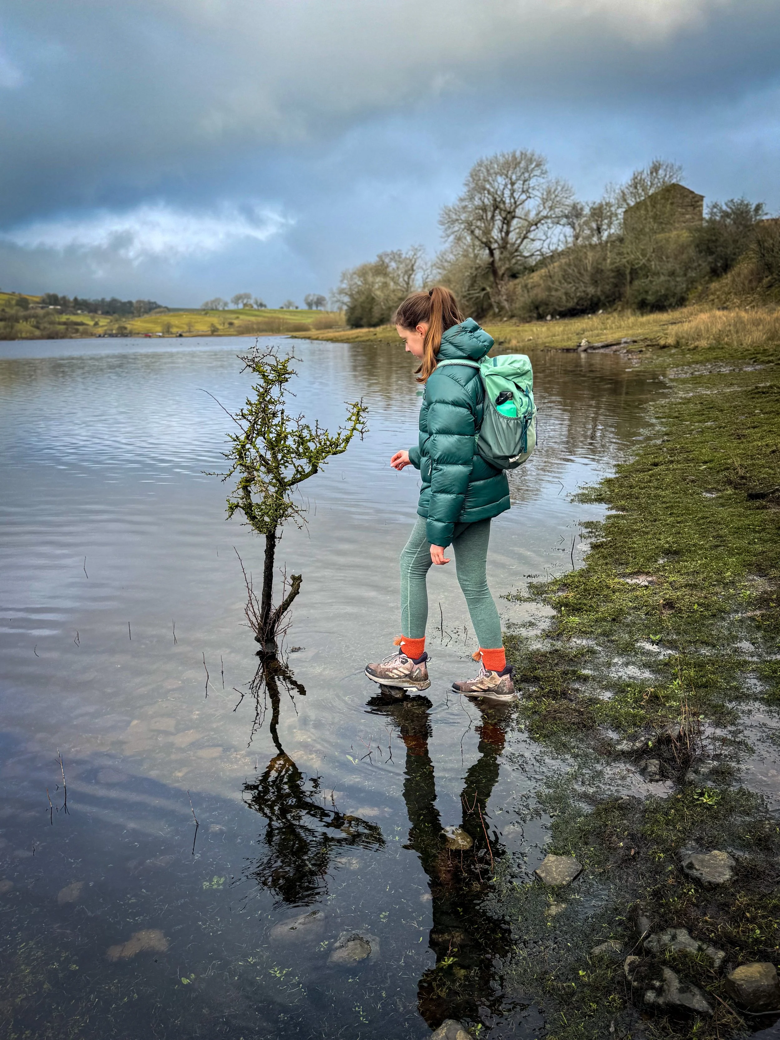
Next, head through a stone gap in the wall, then over a stone stile next to a farm building. On your right you will soon see you can get down to the waters edge for a stone throwing opportunity!
After this, continue to follow the footpath through another gate in the wall, keeping the lake to your right and heading straight on. The path is clear to see and reaches a stile over the fence as it enters the Semerwater nature reserve.
There is a gate in the wall to exit the nature reserve, and the path continues straight on, heading slightly uphill to meet a stream and a drystone wall. Keep the wall to your right and you will soon see the ruins of Stalling Busk Church ahead and on your right. You can access the ruins, where there is an information board to find out more about its history (see below!) but after exploring, head back to the path.
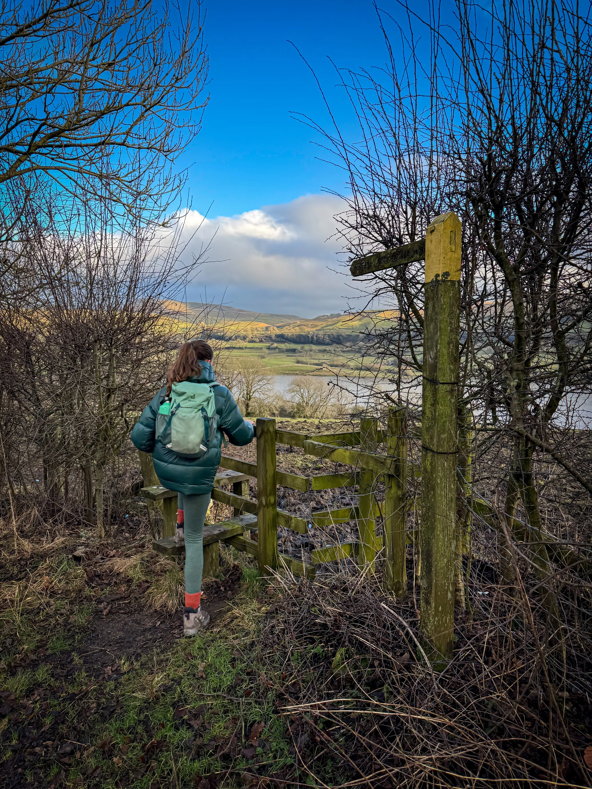
The path heads straight on through a wooden gate directly ahead (don’t be misled by the farm building with the metal gate next to it, there isn’t a path there). There is a small gate on the right of the five bar gate, head through that..
On the other side, there is a signpost pointing to Stalling Busk and Marsett. UPDATE 2026: Here you need to make a choice based on your conditions. The walk into Stalling Busk is lovely and well worth it, BUT if you have had heavy rain the path to Marsett from there may be flooded. NEVER FEAR! Here, you can head in the direction of Marsett and this path will take you to a footbridge over the beck. As you enter the final field, make sure you head right to the footbridge, not straight on to Busk Lane. or you will be faced with the same problem.
Conditions good? Head in the direction of Stalling Busk. The path heads upwards and into the tiny settlement, passing Keld Scar waterfalls. You will only catch a glimpse, but they are pretty! Head through a further five bar gate, and you will reach the stream, roughly follow the line of the stream heading upstream. You will be going uphill to a gate in the wall up ahead.
You will now be on a grassy and stony track, which heads round to the right, between a pretty farmhouse on your right and an outbuilding on your left. The path goes between the two and then heads towards a wide stone track. At the junction, there is a perfectly positioned stone bench. Turn right onto Busk Lane.
Follow the track downwards. You will reach a ford with the beck and this was where we found it flooded on our most recent visit (nothing some wet feet couldn’t handle) but if you DO find yourself in a pickle, then there is a footpath a little further up the lane, if you retrace your steps. Cross the ford (normally at splash depth!)
The path heads right, and follows the line of the water, before bending round to the left. There is a footbridge up ahead to cross the water.
Cross it, then continue to head along the stony track until you reach the village of Marsett. At the village green, keep right, following the line of the beck until you see the road bridge into Marsett. Turn right onto the bridge and cross this. Then follow the quiet country road. The most traffic we have encountered included a tractor and a farmers quad, so it is super quiet. Nevertheless, keep your eyes peeled particularly in the Summer (there’s a campsite/ glamping/ holiday lets at Marsett).
After just over a mile, you will see a footpath sign to your right. Cross the stile and take this footpath, which heads down and diagonally leftwards across the field heading back towards Semerwater that will be ahead of you and right. (We have encountered cows in this field before, friendly ones, but just in case you prefer to avoid our bovine friends!)
The path heads downhill and edges closer and closer to the Lake. You will soon reach the path back out onto the road. Turn right over Semerwater bridge and head back to the car park where you started.
Last walked January 2026.
Standing at the edge of the water
The path back to Semerwater
What’s cool for kids at Semerwater?
💦 The water. The walk starts and ends at the lakeside, which you are able to enjoy! You can paddle, it’s lovely and shallow for a long way, so great for younger kids. It’s also swimmable, and wild swimming is allowed there. If you own a SUP, canoe, kayak you can launch from there. You have to pay an additional fee (paddleboarding was £5) and you must have paddleboarding insurance in place. You can check out more info on the website. Campervans and Motorhomes are permitted to stay overnight too.
📚 Fun fact…. did you know that Lake Semerwater is in fact Lake Lake Lake Water? If you look at the origin of each word used in the name, Lake Sae (Old English, meaning Lake) Mere (Also Old English meaning Lake) and Water…. You get… Lake Lake Lake Water…. Tautology my friends. Tautology!
👻 Semerwater is FULL of legends. Literally. There is an old tale that Semerwater hasn’t always been a Lake, but was once in fact a town. The story goes that one night, a beggar (or witch, or angel dependant on which version you read) once visited the disappeared town, looking for shelter. Having been turned away by every residence there, she eventually found shelter in a farmhouse on the side of the hill. To punish the town for their lack of assistance, it was submerged under water. The story goes that you can still hear the bells of the old church ringing from underneath the water… read more Witch Tales on the blog.
But not only that, Semerwater has so many ghostly goings on! This walk takes you past Stalling Busk Church, the area around which is haunted by a Grey Lady, Countersett Hall is haunted, as is Raydale House and Semerwater Hall. There are tales of ghosts wandering the countryside, galloping horsemen and noisily knocking furniture. YOu can read more ghost stories on the blog!
A place that can’t be missed by a fan of a ghost story!
🌳 If you are looking for a few walking games to try on the way around, why not check out our walking games?
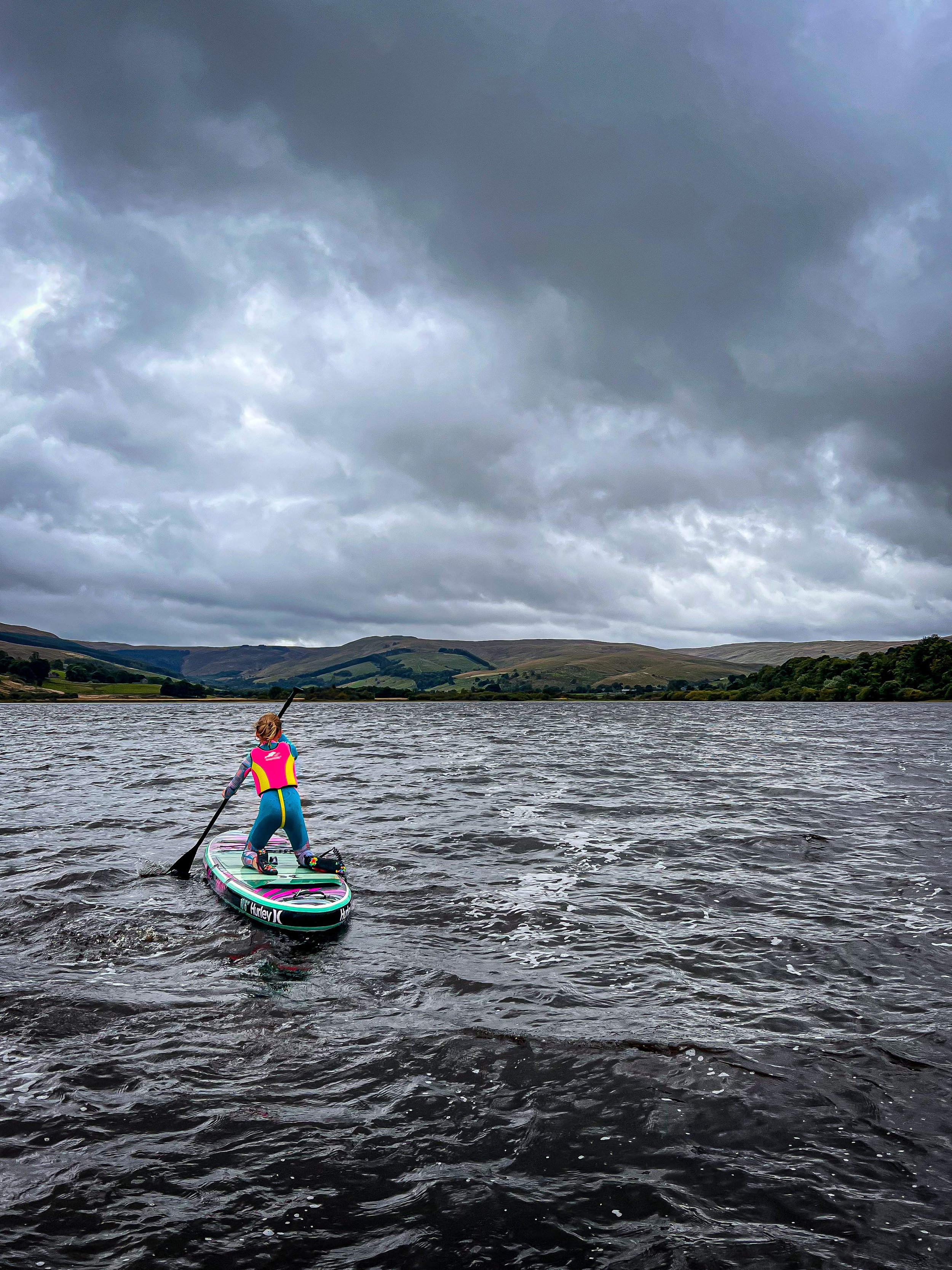
Paddleboarding on Semerwater
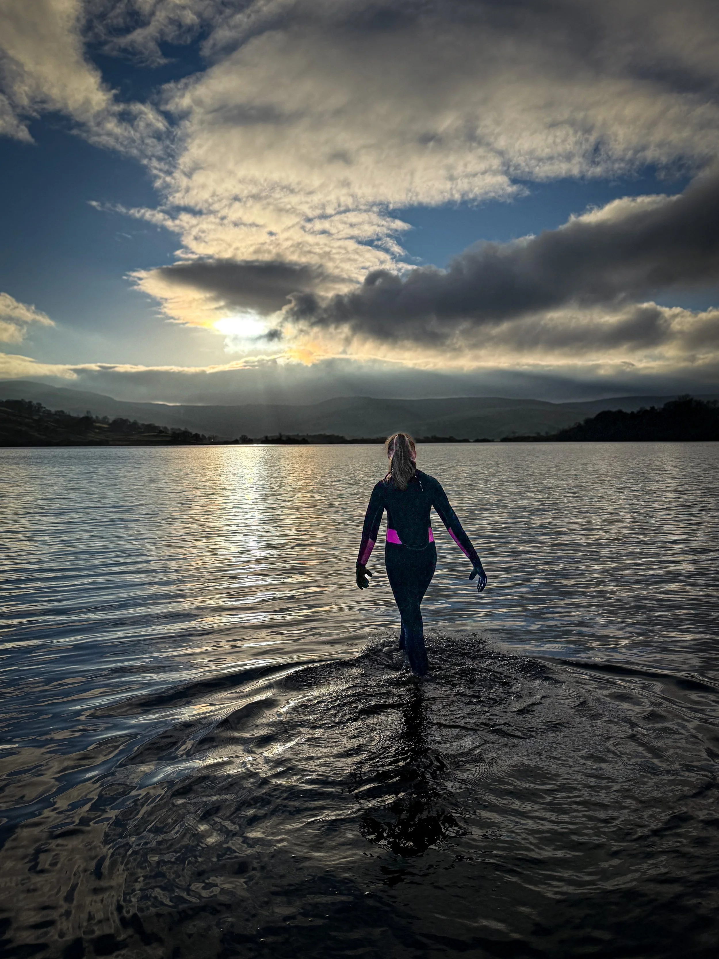
Wild swimming in Semerwater is permitted by the landowner
Helpful Information!
For more helpful information head to our safety tips and advice page.
⭐ We hope you enjoy our walks, but please exercise common sense as routes can change with the weather conditions and seasons! These walks are intended as a guide only and are undertaken at your own risk. The routes have been walked by our own two feet, but you know your own limits. If in doubt, turn back. Always take a back-up map, don’t rely on GPS or your phone alone, wear appropriate clothing for the weather and take adequate snacks and refreshments with you (although as a parent, I know you already know that bit!)
⭐ Leave no trace! Take nothing away and leave nothing behind, take all rubbish home with you.
⭐ If you choose to paddle, be aware of bio security. Always wear clean dry water shoes (if worn) to avoid cross contamination of species between watercourses, this is a particular issue in the Yorkshire Dales, to help protect the white clawed crayfish.
⭐ If you decide to paddle, be aware that wild water can be dangerous, and water levels will vary season to season. Always supervise children around water. Check out the safety information on the Royal Life Saving Society website.
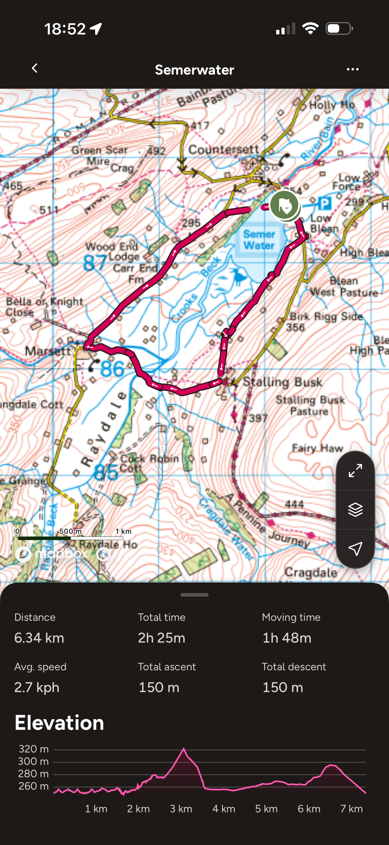
Want to grab the route?
Just don’t follow the last bit through the lake! No, we didn’t swim back to the car park, the tracker decided to pause!
Head to the Ordnance Survey Navigation App where you can download the route!
(Always carry a back up map and know how to use it)
Image is Copyright of Ordnance Survey

Staying in the Wensleydale area?
We have a Visit with Kids guide to provide you with all the family friendly inspiration you need! Think family friendly walks, local attractions and importantly, where to find the ice cream (and the play park!)
We have a dedicated guide for families staying in Hawes and Wensleydale, so why not check it out!
Scroll using the arrows for all our Family Friendly Walks
-
![Swimming in Janet's Foss Yorkshire Dales]()
Waterfall Walks
-
![Malham cove walk for kids]()
Pushchair Friendly
-
![Pinhaw Beacon trig point walk near Skipton]()
Peak Bagging Walks
-
![The Park at Greenhow Nidderdale]()
Walks with Play Parks
-
![Gordale Scar in Malham Yorkshire Dales]()
Organised by Location
-
![Walking in the woodland in Wensleydale]()
Woodland Walks
-
![Playing on the shore of Embsay Reservoir Yorkshire Dales]()
Reservoir Walks
-
![The ruins of Bolton Abbey]()
Bolton Abbey Estate Walks
-
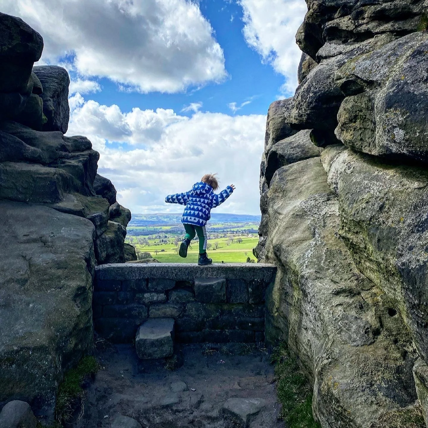
![Leaping over the stile at Almscliffe Crag]()
Walks Under 2 Miles
-
![Child walking into a pub in Appletreewick]()
Walks with Pubs and Cafes


Follow us for up to date Outdoors Adventures!
We live and BREATHE the Yorkshire Dales outdoors life!
Come follow our journey over on Instagram, Facebook, Twitter and TikTok, where you’ll find up to date walk info, breaking news on Yorkshire Events, new Yorkshire Dales wild swim spots, climbing, caves and more!


Follow us on Social Media for all the up to date info: @thereluctantexplorers
Leave No Trace
The Yorkshire Dales is our home, and the home of so many others who care deeply about this beautiful space.
Should you visit, make sure to:
Take home anything you bring, leave no rubbish behind.
Make the world a better place by picking up any rubbish you see, even if it isn’t yours.
Leave everything else as you found it.