
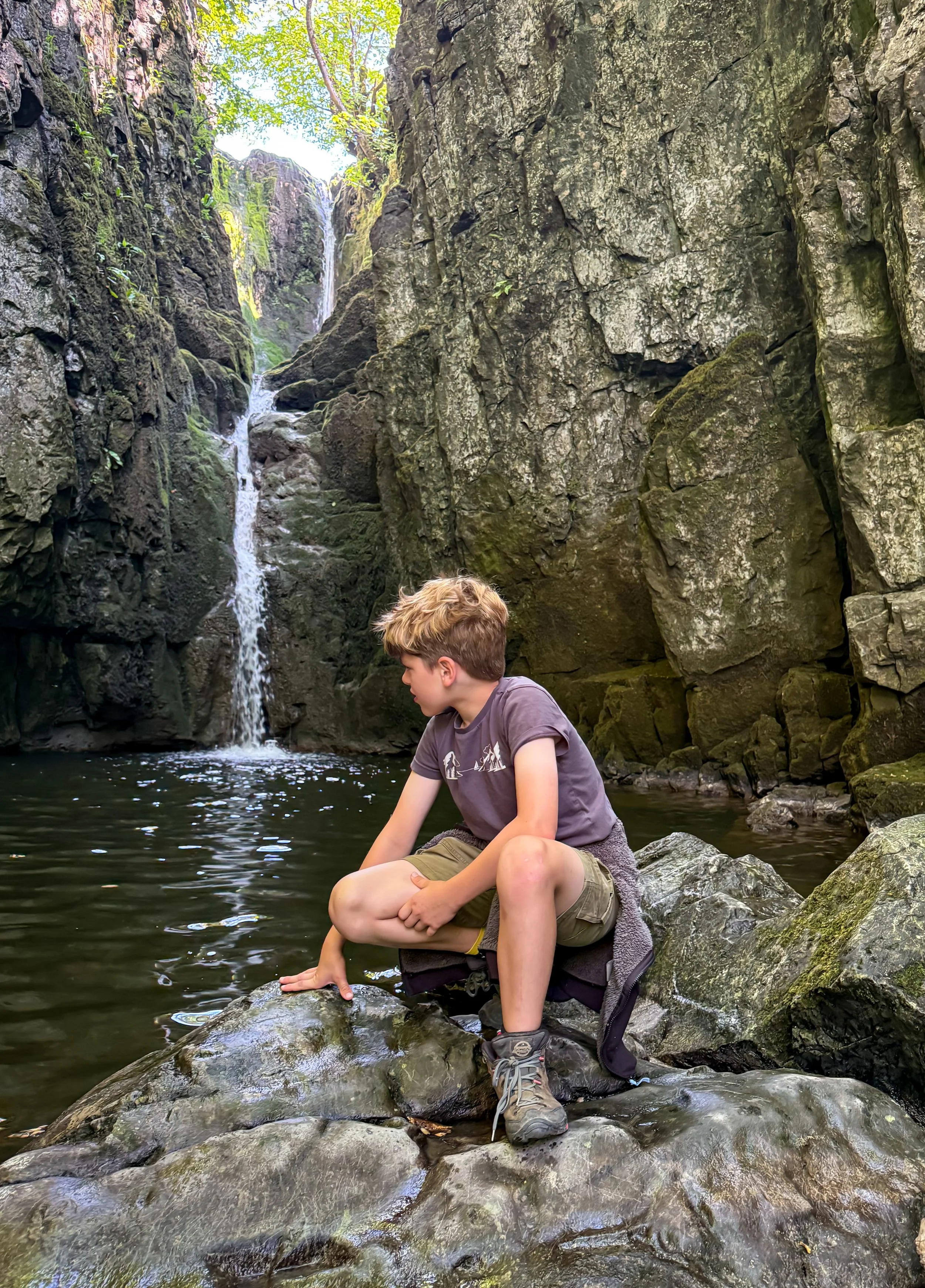
Catrigg Force
Catrigg Force is a stunning waterfall located just outside of Stainforth near Settle in the Yorkshire Dales.
It’s a top shady spot on a Summers day and a popular wild swim spot too! Here, you’ll find two family friendly walks to Catrigg Force suitable for different abilities.
Have you ever visited Catrigg Force?
This stunning waterfall is a short walk from Stainforth, the home of the super famous Stainforth Force, just outside of Settle in the Yorkshire Dales. But whilst Stainforth Force gets particularly busy with visiting campers from the neighbouring site on a Summer’s Day, Catrigg Force is relatively peaceful in comparison. So why not try out one of our walks to it?
The short linear walk gives you stepping stones, waterfalls and a pub at the end (if you fancy it!)
The circular walk also takes in the Winskill Stones Nature Reserve and in April, you’ll spot beautiful bluebells in the woodland up on Stainforth Scar. Both are pretty bite-sized and are perfect for a short adventure or for younger explorers. Ah who am I kidding, ALL explorers, because I love this one!
If you are feeling brave it’s also a very popular wild swim spot too, but be careful of the super slippery stones surrounding the falls!

Buy Me a Coffee
Make a Donation
Thank you for taking the time to have a look at my website and for reading this now!
I set up the Reluctant Explorers and maintain the website and attached social media accounts in my spare time, around mum-life and two jobs. It was designed to provide access for parents to free resources to help get more families outside and exploring in nature. These walks have all been created by myself and the kids and we have walked each one ourselves (and re-walk them regularly to keep the information as up to date as we can).
If you would like to support us and can afford a few pennies, you can make a donation to our ‘Buy Me a Coffee’ page. Simply tap the button below to head there!

The steps up Stainforth Scar in April when the bluebells are out.
Walk details for Catrigg Force
Distance: Linear Walk: Less than 1 mile. There and back again. Circular Walk: Just over 2.5 miles circular.
Terrain - BOTH ROUTES: Easily identifiable paths, that are well signposted. Some ascent, and the path down into the woodland of Catrigg Force is a little steep. Be wary that the stones around Catrigg Force can get very slippery underfoot.
Parking: Stainforth Pay and Display. If the car park is full, try a different walk nearby, perhaps the Ribblehead Viaduct or the Settle Caves
Public Transport: There is a bus stop at Stainforth where this walk begins. Check out the Dales bus service website for more information about seasonal timetables.
Dog Friendly? Yes - there is often grazing cattle on this walk.
Location: Stainforth, Ribblesdale. Yorkshire Dales National Park.
Map: Ordnance Survey OL02 Explorer Yorkshire Dales Southern and Western
What 3 Words: Initiates.flashback.drift
Toilets/ Baby Change: Stainforth Pay and Display
Nearest Cafe/ Amenities: Stainforth and then Settle

Wild swimming in the Summer
How to walk to Catrigg Force: Linear Route
Directions from Stainforth. Always use a map.
Starting from Stainforth Pay and Display head into the village on the Pennine Bridleway. Then bear left onto Goat Lane. After a short distance, you will see a grassy open area on your right, with some stepping stones across Stainforth Beck. Cross these (provided you can of course - if they aren’t passable, head over the bridge over the beck towards the pub, then take an immediate left, continuing on until you see a grassy triangle surrounded by houses. That will get you to the same spot).
Head straight on and upwards, keeping the houses to the left and the triangle of grass on your right. You will see a lane emerging ahead, which leads upwards. It is signposted as the Pennine Bridleway. Head up here and follow it for just over half a mile until you see a signpost pointing left, to Catrigg Force.
Turn left, and head down towards the wooded area, turning left through a gate into the woodland. You will find the waterfall down the hill. The last section of steps is fairly steep. Once you have splashed to your heart’s content, then head back up and the way you came from!
Last walked December 2025

The Winskill Stones: limestone pavement and nature reserve
How to walk to Catrigg Force: Circular Route via Winskill Stones
Directions to be used alongside a map.
Beginning at the same start point as the linear route, Stainforth Car Park, head out of the vehicular exit and turn right heading into the village of Stainforth on the Pennine Bridleway. Get as far as Main Road, then turn right, heading across the bridge over Stainforth Beck.
Directly opposite the Craven Heifer pub, you will see a small access road on your left with the acorn National Trail signpost. Turn left down this road until the end where you will see a gravelled track opposite and diagonally on your right. There is a footpath sign marked Winskill, head up this access track, which then bends round to the right through the houses to a wooden gate and a stone stepped stile with a further footpath signpost.
Head up the grassy path that’s wide and very obvious heading diagonally up and left to the metal gate at the top end of the field. There is a signpost here that says please keep to the footpath on the left next to the fence. The path broadly follows the fence, getting closer and closer to it as you go.
You will reach a wooden kissing gate in the fence on your left, and beyond you will see rough stone steps heading upwards. Head up them!
The steps take you steeply up Stainforth Scar, and when you reach the top, you will see a wooden ladder stile, head over this then take the grassy path that follows the top edge of the scar until it splits into two. Here take the right hand fork, that takes you to a gap in the wall.
The path heads towards Lower Winskill farm, where you will see yet another ladder stile over the perimeter wall. The path heads directly through the middle of the farmyard towards the farmhouse, through a metal gate and along the access track, where you will another footpath sign pointing up the walled stony track. Head up the track.
At the top, you will find a cattle grid and multiple signposts. On your right at this point in the distance you will see the Winskill Stones. If you want to explore them, head right here along the stony track and a little further up you will reach the limestone pavement (check out more about those below). After exploring, head back the way you came back to the cattle grid, and then continue along the Pennine Bridleway, signposted Stainforth.
The stony track will lead you to a wooden gate signposted again with Pennine Bridleway, Stainforth. Head through the gate and down towards the wooded gorge of Catrigg Force. Ahead of you, you will see the top of Pen y Ghent in the distance. The stone track bends round to the left meeting another gate in the wall, and immediately afterwards on your right, you will see the gate to Catrigg Force.
Head through the signposted gate that leads you downwards to the woodland. There is a further gate in the wall on your left that takes you into the woodland to the path that leads steeply down to the waterfall. Take care on the stones at Catrigg, they are slippery ALL the time!
Once you have seen the waterfall head back up to the gate on the stony track and turn right. Follow the walled path all the way back down into Stainforth.
As you reach the houses of the village, continue straight on to the stepping stones that cross Stainforth Beck, cross them and head straight on down the road until you meet the Pennine Bridleway again. Turn right, and head back to the car park! If you can’t cross the stepping stones, then turn left at the grassy triangle and take the road leading back to the Craven Heifer. Here, turn right over the bridge, the left again to return to the car park.
Last walked December 2025.

Catrigg Force in the winter months
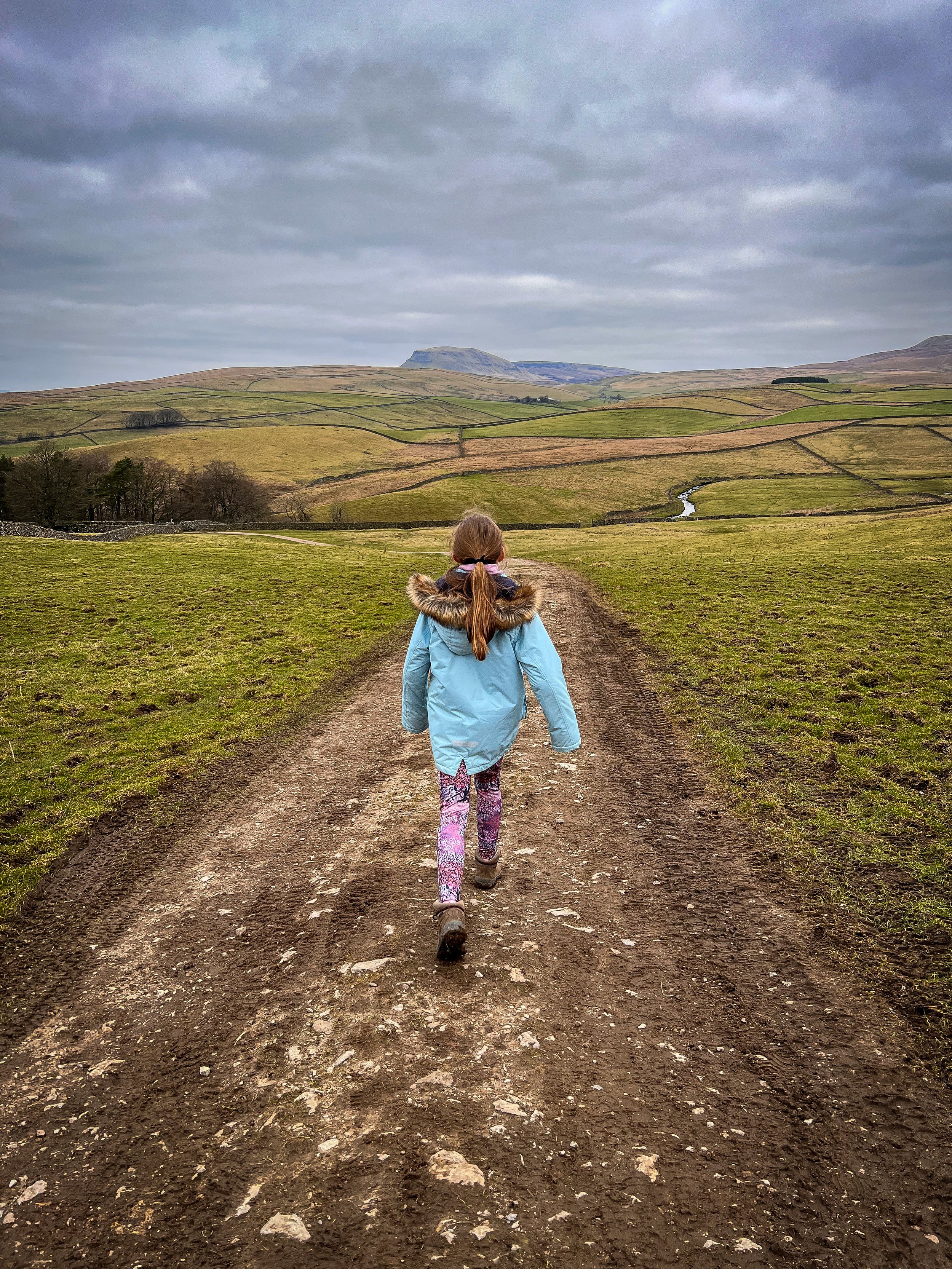
Walking down to Catrigg Force with Pen y Ghent in the background. The waterfall is in the little wooded area to the left of this picture.
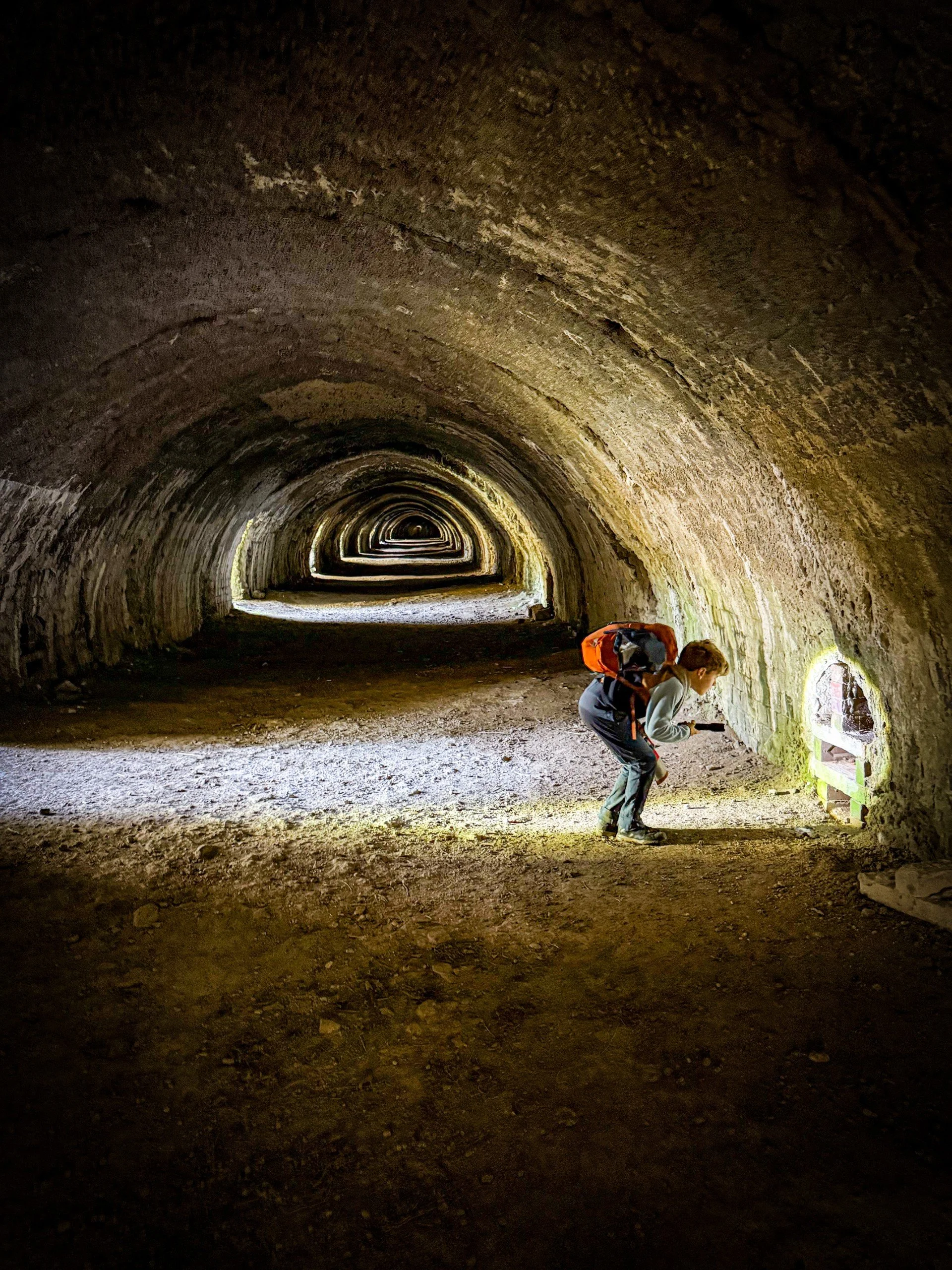
The Hoffman Kiln
How to walk to Catrigg Force: Circular Route with the Hoffman Kiln.
Directions to be used alongside a map.
Beginning from Stainforth Pay and Display, head out of the car park entrance and turn left. You need to turn left again, and head down the B6479 in the direction of Settle. This part of the walk is on a pavement, running alongside the road on the left hand side. After crossing a minor road, and after 500 yards, there is a stone stepped stile crossing a dry stone wall to your left. You need to take this, and head into the field. It’s signposted Langcliffe.
This is a grassy field, and the path heads diagonally rightwards, over a small hillock and then down across a stream after which you will see a ladder stile. Head across the next field - in the distance, you will begin to see some of the buildings of the trail come into view. There is a stile into the trail and on your right, an information board all about it.
EXPLORE! There is so much to be seen here. The remains of several incredibly impressive stone kilns, train tracks, tramlines, and the crowning glory… The Hoffman Kiln. It’s a protected site with loads of information boards dotted around it, so take it all in and enjoy! (IF you really want to just pick out the best bits, then immediately after the stile, turn right. This path takes you straight to the triple draw kilns and from there, head on to the Hoffman Kiln.)
Once you have enjoyed the trail, head out to the far end of the quarry trail beyond the Hoffman Kiln. Back in 2025, renovations were completed to the site and the buildings next to the kiln. There is now a large car park along with some office buildings right next to the old quarry. You can use this as an alternative start point. Since originally writing this walk, more of the trail has opened up, so it is possible to now from the Hoffman Kiln, turn left up the woodend steps to the car park (now signposted craven lime works trail ) and then follow the car park access road. There is a path leading up into the woodland from here, where you’ll find more of the trail to explore. It will lead you back down onto Hoffman Kiln Road, and you need to make you way to the access road, at the point where it heads under the railway bridge.
Turn left onto a wide stony track, passing between some stables and keeping the railway to your right. The footpath is signposted Langcliffe. It’s a wide stony track, and you can’t miss it! Soon after, it heads through a gate and turns grassy (and if it’s wet, a tad muddy!) keep heading on until you reach a ladder stile and cross that, following the grassy path on the other side then through a fence.
After passing through a little gate in a wire fence, you will reach another ladder stile (feels familiar right?!) Here you will get amazing views across towards Warrendale Knotts, and in the next field you’ll reach a stone stepped stile. Cross this and turn left. There is a signpost pointing in the direction of Winskill ¾ miles.
Follow this, it’s a stony track that heads through a gate into a field and then uphill, passing a bench on the right, then a tree on the left, until you head through another gate at the top. The path will be going uphill now. Head through the gate at the top and follow the clear path until it heads through a gate on the left. Follow the path along the next field and cross a stile onto another track. Here, turn right.
At the top, you will find a cattle grid and multiple signposts. On your right at this point in the distance you will see the Winskill Stones. If you want to explore them, head right here along the stony track and a little further up you will reach the limestone pavement (check out more about those below). After exploring, head back the way you came back to the cattle grid, and then continue along the Pennine Bridleway, signposted Stainforth.
The stony track will lead you to a wooden gate signposted again with Pennine Bridleway, Stainforth. Head through the gate and down towards the wooded gorge of Catrigg Force. Ahead of you, you will see the top of Pen y Ghent in the distance. The stone track bends round to the left meeting another gate in the wall, and immediately afterwards on your right, you will see the gate to Catrigg Force.
Head through the signposted gate that leads you downwards to the woodland. There is a further gate in the wall on your left that takes you into the woodland to the path that leads steeply down to the waterfall. Take care on the stones at Catrigg, they are slippery ALL the time!
Once you have seen the waterfall head back up to the gate on the stony track and turn right. Follow the walled path all the way back down into Stainforth.
As you reach the houses of the village, continue straight on to the stepping stones that cross Stainforth Beck, cross them and head straight on down the road until you meet the Pennine Bridleway again. Turn right, and head back to the car park! If you can’t cross the stepping stones, then turn left at the grassy triangle and take the road leading back to the Craven Heifer. Here, turn right over the bridge, the left again to return to the car park.
Last walked July 2026.
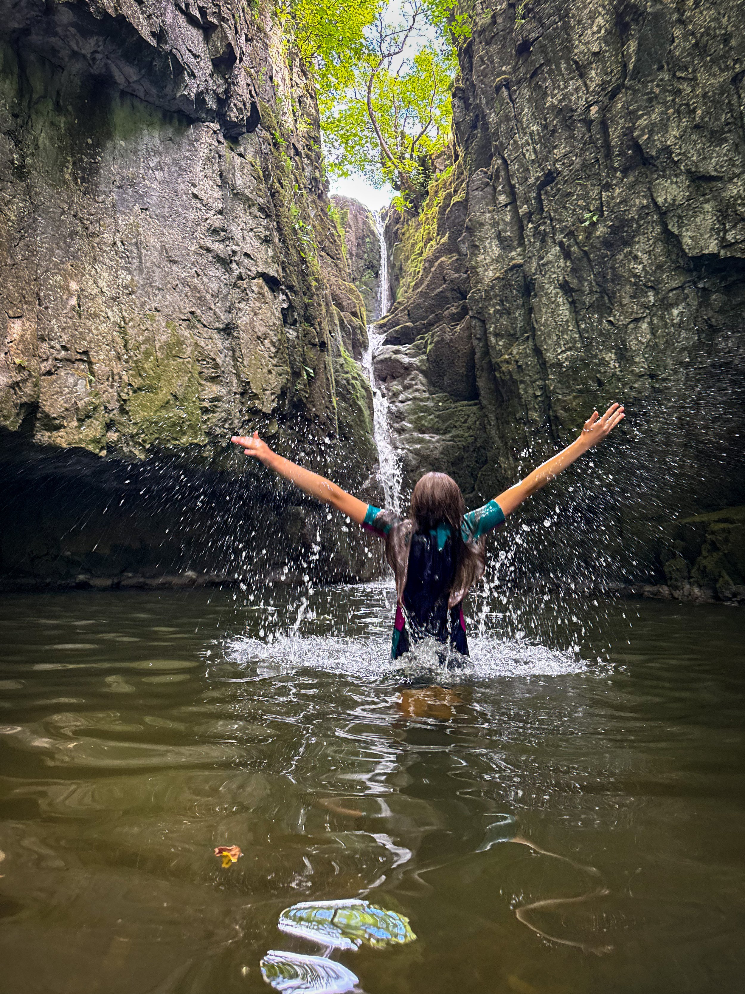
Catrigg Force in the summer
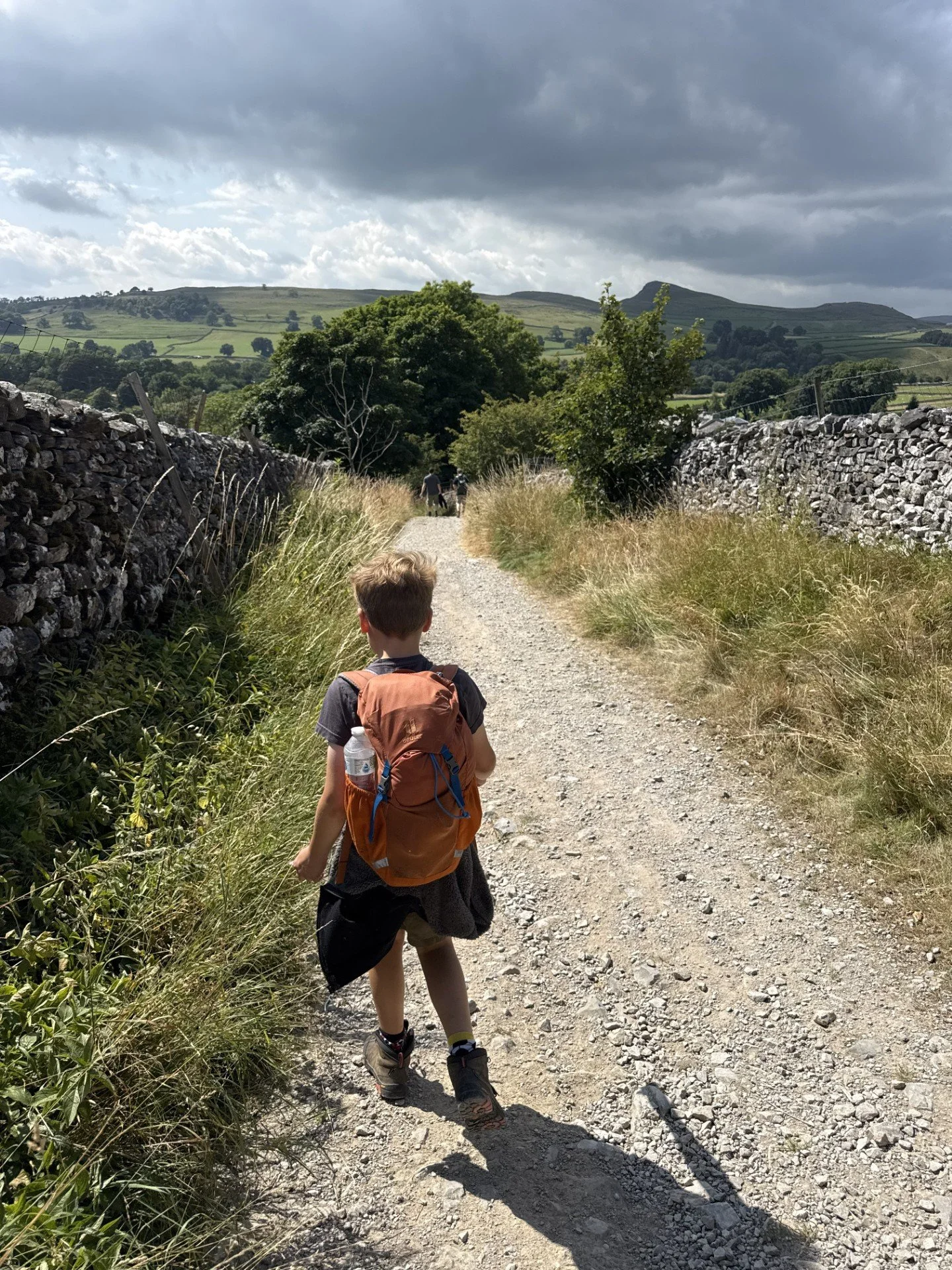
The path back to Stainforth

What’s cool for kids on this walk?
💦 This is a walk with a splash! Catrigg Force is a popular waterfall swim spot. Although it is much quieter than it’s cousin, Stainforth Force, you will probably be sharing the plunge pool with others on a hot sunny day. Do take a look at the safety advice and links below if you do choose to paddle or swim. The depth of the water is deep by the drop of the waterfall, always supervise children around water and check out the RLSS Summer safety advice.
🍻 There is pub in the centre of Stainforth, the Craven Heifer, which has a beck-side beer terrace. Ok, that’s more for the adults!
📚 The Craven Limeworks trail, including the Hoffman Kiln is a pretty special place. The main event itself is one of only a few remaining in the whole country and dates back to 1873 when it was built. It operated as a kiln until its closure in the 1930’s! The information boards dotted around the trail will be able to fill you in with all of the history bits, but in terms of kids, the kiln itself is a MEGA place to explore. Plus with it being essentially a preserved industrial heritage site, there are nooks, tunnels, and all sorts to get the imaginations going!
REMEMBER YOUR TORCH! Or you won’t see much at all!
✨ The Winskill Stones nature reserve is the home of a section of limestone pavement. There are campaigns against the practice of digging up limestone pavements for creating rockeries and this land was purchased by a conservation charity to create a reserve for the diverse range of wild plants that thrive in the limestone habitat. It is dedicated to the memory of Geoff Hamilton, a gardener who championed the campaigns.
🌳 In need of some strategies to beat the walking whinge? Why not try some walking games or download one of our scavenger hunt sheets? There is plenty of wildlife to spot in the Winskill Stones Nature Reserve.
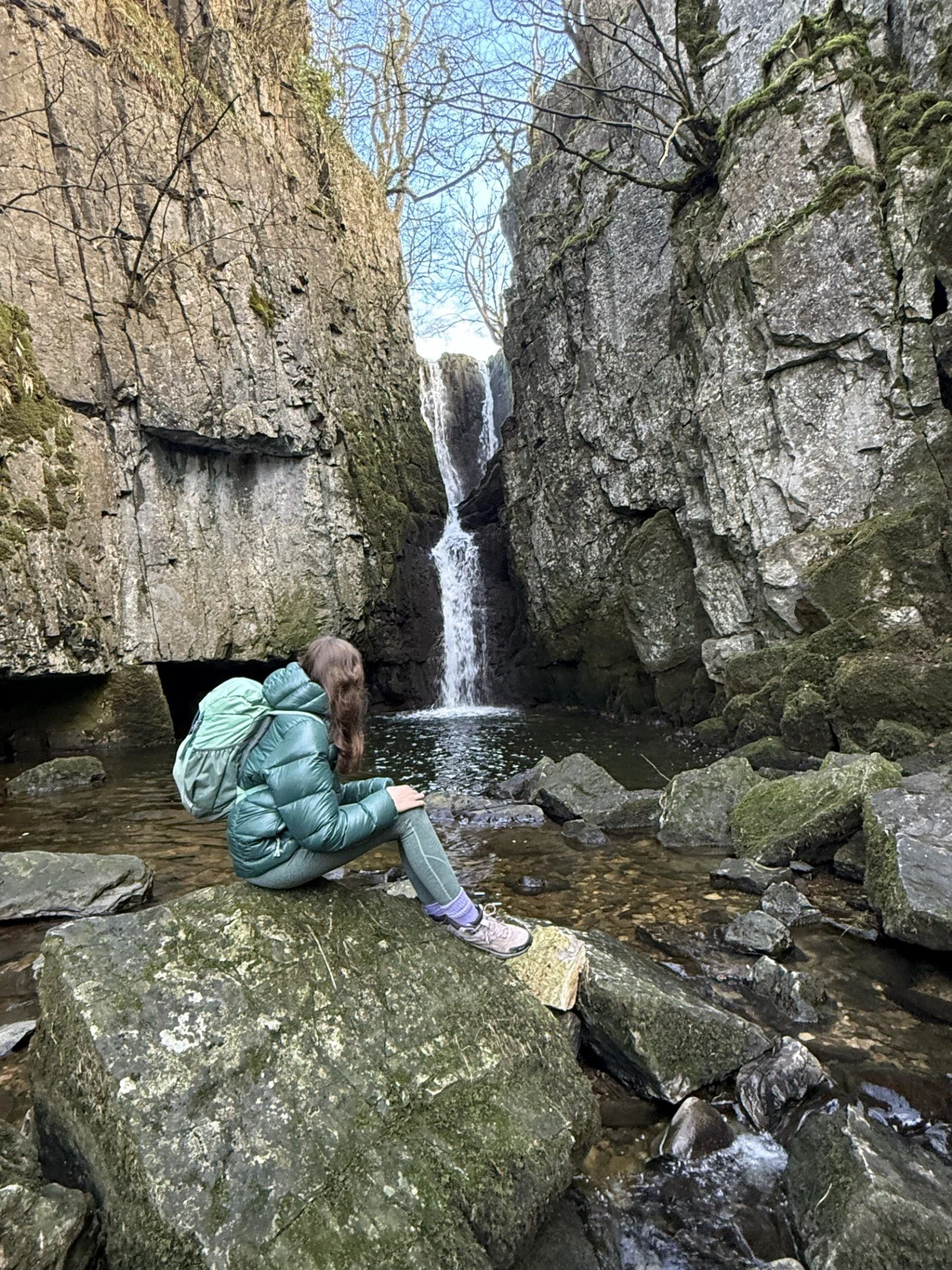

The waterfall in December
Views across to Ingleborough from the top of Stainforth Scar.
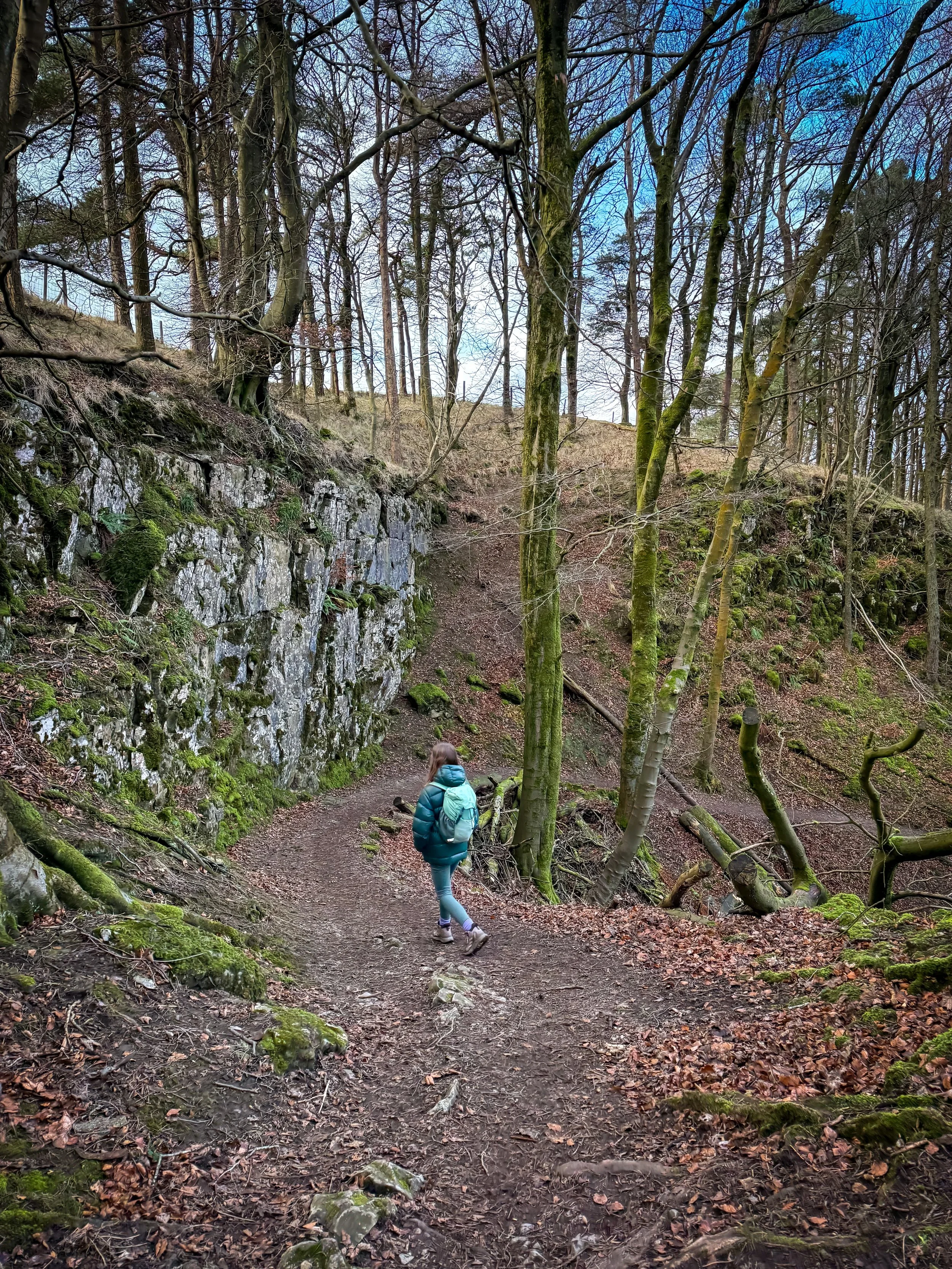
The descent to the waterfall.
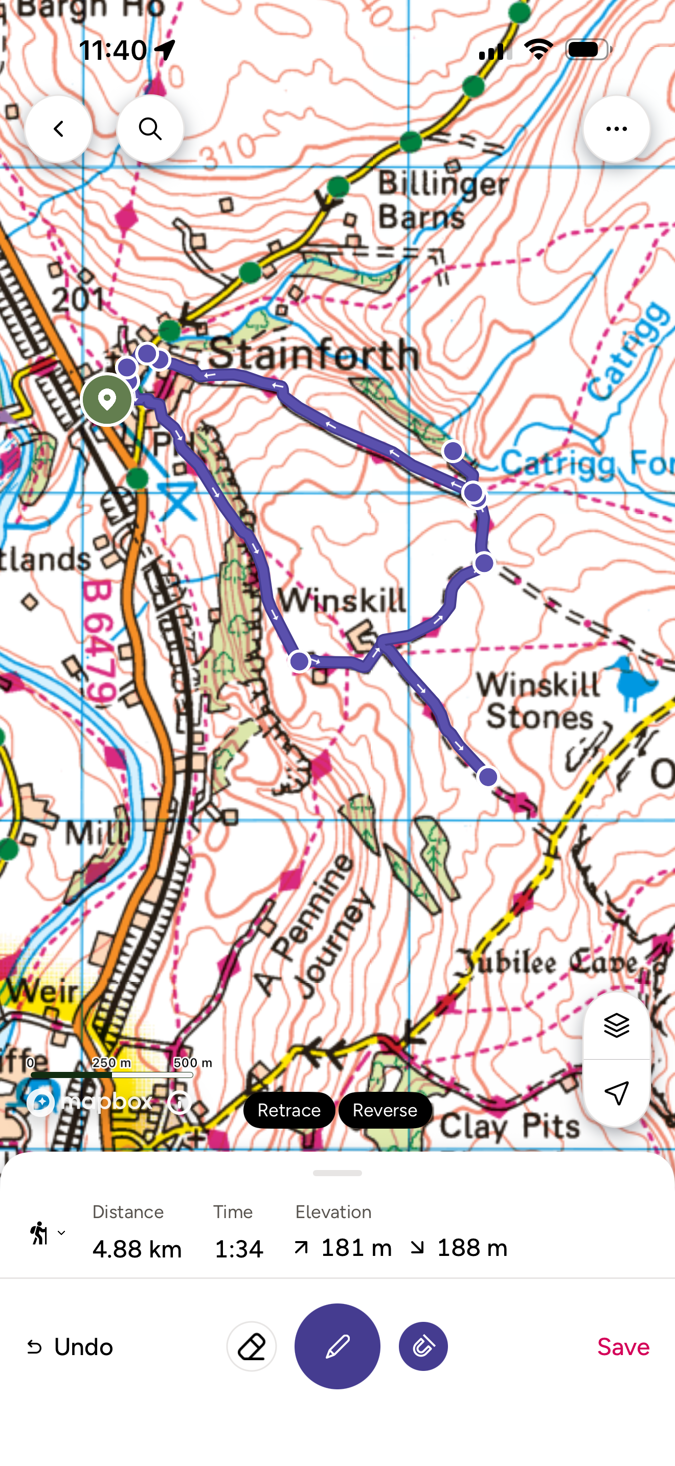
Want to grab the route?
This is a guide to the longer circular.
You will need to use Ordnance Survey map OL02 Yorkshire Dales Southern and Western you can also use the OS Map App.
Image is Copyright of Ordnance Survey
Affiliate Link as an Ordnance Survey Champion
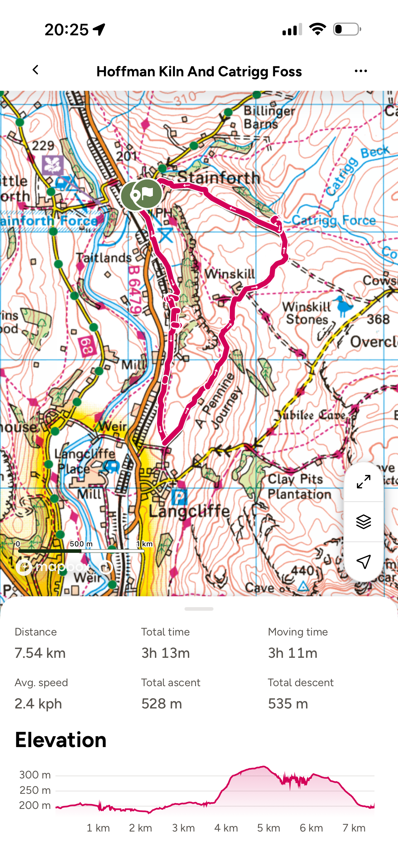
Want to grab the route to the Hoffman Kiln?
This is a guide to the Hoffman Kiln circular.
You will need to use Ordnance Survey map OL02 Yorkshire Dales Southern and Western you can also use the OS Map App.
Image is Copyright of Ordnance Survey
Affiliate Link as an Ordnance Survey Champion

Helpful Information!
For all our safety advice head to our dedicated page.
⭐ We hope you enjoy our walks, but please exercise common sense as routes can change with the weather conditions and seasons! The routes have been walked by our own two feet, but you know your own limits. Always take a back-up map, don’t rely on GPS alone, wear appropriate clothing for the weather and take adequate snacks and refreshments with you (although as a parent, I know you already know that bit!)
⭐ Leave no trace! Take nothing away and leave nothing behind, take all rubbish home with you.
⭐ If you choose to paddle, be aware of bio security. Always wear clean dry water shoes (if worn) to avoid cross contamination of species between watercourses, this is a particular issue in the Yorkshire Dales, to help protect the white clawed crayfish.
⭐ If you decide to paddle, be aware that wild water can be dangerous, and water levels will vary season to season. Always supervise children around water. Check out the safety information on the Royal Life Saving Society website.
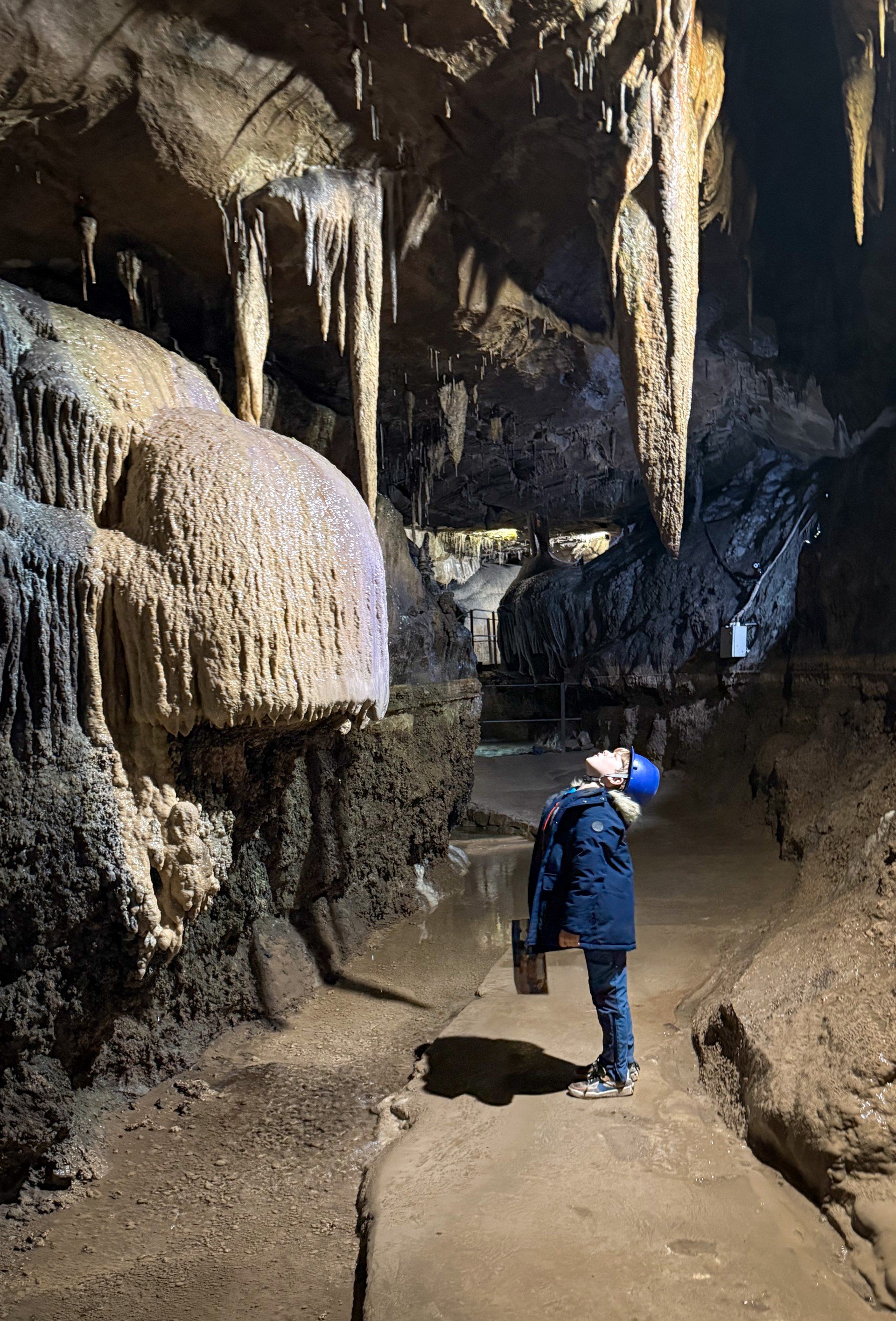
Staying in the Settle area or are you just looking for some inspiration?
Check out our Visit with Kids Guides!
We have a Visit with Kids guide to provide you with all the family friendly inspiration you need! Think family friendly walks, local attractions and importantly, where to find the ice cream (and the play park!)
There is a dedicated guide covering this area and the nearby areas so why not check out our…
Scroll using the arrows for all our Family Friendly Walks
-
![Swimming in Janet's Foss Yorkshire Dales]()
Waterfall Walks
-
![Malham cove walk for kids]()
Pushchair Friendly
-
![Pinhaw Beacon trig point walk near Skipton]()
Peak Bagging Walks
-
![The Park at Greenhow Nidderdale]()
Walks with Play Parks
-
![Gordale Scar in Malham Yorkshire Dales]()
Organised by Location
-
![Walking in the woodland in Wensleydale]()
Woodland Walks
-
![Playing on the shore of Embsay Reservoir Yorkshire Dales]()
Reservoir Walks
-
![The ruins of Bolton Abbey]()
Bolton Abbey Estate Walks
-
![Leaping over the stile at Almscliffe Crag]()
Walks Under 2 Miles
-
![Child walking into a pub in Appletreewick]()
Walks with Pubs and Cafes





Follow us for up to date Outdoors Adventures!
We live and BREATHE the Yorkshire Dales outdoors life!
Come follow our journey over on Instagram, Facebook, where you’ll find up to date walk info, breaking news on Yorkshire Events, new Yorkshire Dales wild swim spots, climbing, caves and more!


Follow us on Social Media for all the up to date info: @thereluctantexplorers

Leave No Trace
The Yorkshire Dales is our home, and the home of so many others who care deeply about this beautiful space.
Should you visit, make sure to:
Take home anything you bring, leave no rubbish behind.
Make the world a better place by picking up any rubbish you see, even if it isn’t yours.
Leave everything else as you found it.